Mississippi Counties. List Alphabetically (and by Population)
How many counties are there in Mississippi? As of 2024, there are a total of 82 counties in the state of Mississippi. Among them, Adams County is the oldest one (established in 1799) while Humphreys County is the youngest (established in 1918). With population of 245,285, Hinds County is the most populated. The biggest county by land area is Yazoo County (1823 km²) and the smallest is Alcorn County (1,036 km²).
Largest Counties in Mississippi
1. Hinds County
County Seat: Jackson and Raymond
- Area: 877 square miles
- Population: Approximately 231,840
- Area Codes: 601, 769
- Latitude and Longitude: 32.3246° N, 90.2125° W
Location and History
Hinds County, located in central Mississippi, is the most populous county in the state and home to Jackson, the state capital. Established in 1821, the county was named after General Thomas Hinds, a hero of the Battle of New Orleans during the War of 1812. Jackson, founded in 1822 and named after Andrew Jackson, became the state capital due to its central location. Hinds County has played a pivotal role in Mississippi’s political and economic life, serving as a hub for government, education, and commerce. The county also has a rich civil rights history, with Jackson being a focal point of the movement during the 1960s.
Major Highways and Landmarks
Hinds County is crisscrossed by several major highways, including Interstate 20, which runs east-west through Jackson, and Interstate 55, which runs north-south, connecting the county to Memphis and New Orleans. U.S. Route 49 and U.S. Route 80 are also significant routes within the county. Notable landmarks include the Mississippi State Capitol, a historic building that houses the state legislature, and the Mississippi Civil Rights Museum, which documents the struggle for civil rights in the state. The county is also home to Jackson State University, a historically black university with a rich history of activism and academic excellence, and the historic Raymond Courthouse, a well-preserved antebellum courthouse in the county’s second seat, Raymond.
2. Harrison County
County Seat: Gulfport and Biloxi
- Area: 976 square miles
- Population: Approximately 206,650
- Area Codes: 228
- Latitude and Longitude: 30.4158° N, 89.0686° W
Location and History
Harrison County is located on the Gulf Coast of Mississippi and is one of the most populous counties in the state. The county was established in 1841 and named after U.S. President William Henry Harrison. Gulfport and Biloxi, the county’s co-seats, are the largest cities and serve as major economic and cultural centers along the Gulf Coast. The county’s history is deeply tied to its coastal location, with fishing, shipbuilding, and tourism being key industries. Harrison County has a rich cultural heritage, influenced by French, Spanish, and African American traditions, and it has long been a popular destination for tourists, drawn to its beaches and casinos.
Major Highways and Landmarks
Harrison County is served by major highways, including Interstate 10, which runs east-west along the Gulf Coast, and U.S. Route 90, known as the “Beach Boulevard,” which parallels the coastline. U.S. Route 49 connects the county to the interior of Mississippi. Notable landmarks include the Biloxi Lighthouse, one of the most photographed sites on the Gulf Coast, and the Beau Rivage Resort & Casino in Biloxi, a major tourist destination. The county is also home to the Mississippi Coast Coliseum, which hosts concerts, conventions, and sporting events, and the Lynn Meadows Discovery Center in Gulfport, a children’s museum offering interactive exhibits and educational programs.
3. DeSoto County
County Seat: Hernando
- Area: 497 square miles
- Population: Approximately 184,945
- Area Codes: 662
- Latitude and Longitude: 34.8826° N, 89.9886° W
Location and History
DeSoto County is located in the northwestern corner of Mississippi, bordering Tennessee. The county was established in 1836 and named after the Spanish explorer Hernando de Soto, who is believed to have explored the area in the 16th century. DeSoto County has experienced rapid growth in recent decades, largely due to its proximity to Memphis, Tennessee. This growth has transformed the county from a rural, agricultural area into a suburban extension of the Memphis metropolitan area. Hernando, the county seat, retains its small-town charm while serving as the administrative and cultural center of the county.
Major Highways and Landmarks
DeSoto County is well-connected by major highways, including Interstate 55, which runs north-south through the county, providing easy access to Memphis and Jackson, and Interstate 269, a beltway that encircles the Memphis metropolitan area. U.S. Route 51 and U.S. Route 78 are also significant routes in the county. Notable landmarks include the historic Hernando Courthouse, an iconic building in the heart of the county seat, and the DeSoto County Museum, which offers exhibits on local history. The county is also home to the Snowden Grove Park in Southaven, a large sports complex that hosts baseball tournaments and other events, and the Tanger Outlets Southaven, a popular shopping destination.
4. Rankin County
County Seat: Brandon
- Area: 806 square miles
- Population: Approximately 157,031
- Area Codes: 601, 769
- Latitude and Longitude: 32.2746° N, 89.9851° W
Location and History
Rankin County is located in central Mississippi, just east of the state capital, Jackson. The county was established in 1828 and named after Christopher Rankin, a U.S. Congressman from Mississippi. Rankin County has grown significantly in recent decades, becoming one of the fastest-growing counties in the state. The county’s proximity to Jackson has made it a popular suburban area, with a mix of residential, commercial, and industrial development. Brandon, the county seat, has a rich history and serves as the administrative and cultural center of the county, known for its charming downtown and strong community spirit.
Major Highways and Landmarks
Rankin County is served by several major highways, including Interstate 20, which runs east-west through the county, connecting it to Jackson and Meridian, and U.S. Route 49, which runs north-south. Mississippi State Highway 25 also provides a key route to the northeastern part of the state. Notable landmarks include the Ross Barnett Reservoir, a large man-made lake that offers boating, fishing, and recreational activities, and the Brandon Amphitheater, a state-of-the-art outdoor concert venue. The county is also home to the Mississippi State Fire Academy, a premier training facility for firefighters, and the historic City of Brandon, with its well-preserved antebellum architecture and vibrant community events.
5. Madison County
County Seat: Canton
- Area: 742 square miles
- Population: Approximately 108,729
- Area Codes: 601, 769
- Latitude and Longitude: 32.6120° N, 90.0353° W
Location and History
Madison County is located in central Mississippi, north of Jackson. The county was established in 1828 and named after James Madison, the fourth President of the United States. Madison County has a rich history, with Canton, the county seat, serving as a key center of commerce and agriculture in the 19th century. The county has experienced significant growth in recent years, particularly in the cities of Madison and Ridgeland, which have become affluent suburban communities within the Jackson metropolitan area. Madison County is known for its high quality of life, strong schools, and beautiful natural landscapes.
Major Highways and Landmarks
Madison County is well-connected by major highways, including Interstate 55, which runs north-south through the county, and U.S. Route 51, which parallels I-55. Mississippi State Highway 16 provides an east-west route across the northern part of the county. Notable landmarks include the historic Canton Square, known for its antebellum architecture and annual Canton Flea Market, one of the largest arts and crafts shows in the South. The county is also home to the Ross Barnett Reservoir, which offers a range of recreational activities, and the Natchez Trace Parkway, a scenic road that follows the historic Natchez Trace and provides access to hiking, biking, and historic sites.
6. Lauderdale County
County Seat: Meridian
- Area: 715 square miles
- Population: Approximately 72,984
- Area Codes: 601, 769
- Latitude and Longitude: 32.3643° N, 88.7037° W
Location and History
Lauderdale County is located in eastern Mississippi, along the Alabama border. The county was established in 1833 and named after Colonel James Lauderdale, who was killed in the Battle of New Orleans during the War of 1812. Meridian, the county seat, developed as a key railroad center in the 19th century, earning the nickname “Queen City of the East.” The city’s strategic location at the intersection of several major rail lines made it a vital transportation and commercial hub. Today, Lauderdale County continues to play an important role in the state’s economy, with a diverse mix of industries, including manufacturing, healthcare, and education.
Major Highways and Landmarks
Lauderdale County is served by major highways such as Interstate 20, which runs east-west through Meridian, and Interstate 59, which connects the county to New Orleans and Birmingham. U.S. Route 45 also runs north-south through the county. Notable landmarks include the Mississippi Industrial Heritage Museum, located in the historic Soule Steam Feed Works building, and the Riley Center for Education and Performing Arts, a restored opera house in downtown Meridian. The county is also home to Bonita Lakes Park, a large recreational area with hiking trails, fishing, and boating, and the Meridian Naval Air Station, a key military installation in the region.
7. Jones County
County Seat: Laurel and Ellisville
- Area: 700 square miles
- Population: Approximately 68,613
- Area Codes: 601, 769
- Latitude and Longitude: 31.6040° N, 89.1706° W
Location and History
Jones County is located in southeastern Mississippi and is known for its rich history and vibrant cultural heritage. The county was established in 1826 and named after John Paul Jones, a Revolutionary War hero. Jones County has a unique history, particularly during the Civil War, when it was home to the “Free State of Jones,” a region where many residents opposed secession and resisted Confederate authority. Laurel, one of the county’s seats, developed as a major center for the timber industry in the late 19th and early 20th centuries, becoming known as the “Yellow Pine Capital of the World.” Today, the county is a mix of industrial, agricultural, and cultural activities.
Major Highways and Landmarks
Jones County is accessible via major highways such as Interstate 59, which runs north-south through the county, connecting it to Meridian and New Orleans. U.S. Route 84 runs east-west and connects Laurel to Hattiesburg and other parts of the state. Notable landmarks include the Lauren Rogers Museum of Art in Laurel, Mississippi’s first art museum, which houses a diverse collection of American and European art. The county is also home to the Landrum’s Homestead & Village, a living history museum that recreates life in the 19th century, and the historic Ellisville Courthouse, an iconic building that played a significant role in the county’s history.
8. Lee County
County Seat: Tupelo
- Area: 453 square miles
- Population: Approximately 85,436
- Area Codes: 662
- Latitude and Longitude: 34.2617° N, 88.7033° W
Location and History
Lee County is located in northeastern Mississippi and is best known as the birthplace of Elvis Presley. The county was established in 1866 and named after Confederate General Robert E. Lee. Tupelo, the county seat, developed as a key center for commerce and transportation in the region, particularly with the arrival of the railroad in the 19th century. Tupelo is also famous for its role in the Civil Rights Movement, particularly the Tupelo Tornado of 1936, which led to significant changes in emergency response and disaster management. Today, Lee County is a vibrant community with a strong economy based on manufacturing, healthcare, and tourism.
Major Highways and Landmarks
Lee County is well-connected by major highways, including U.S. Route 45, which runs north-south through the county, and U.S. Route 78, which runs east-west and is part of the future Interstate 22 corridor. The Natchez Trace Parkway also passes through the county, providing a scenic route that follows the historic Natchez Trace. Notable landmarks include the Elvis Presley Birthplace in Tupelo, a museum and park dedicated to the life of the King of Rock ‘n’ Roll. The county is also home to the Tupelo Automobile Museum, which houses an extensive collection of classic and antique cars, and the Tupelo National Battlefield, a historic site commemorating a Civil War battle.
9. Forrest County
County Seat: Hattiesburg
- Area: 470 square miles
- Population: Approximately 74,439
- Area Codes: 601, 769
- Latitude and Longitude: 31.1794° N, 89.3063° W
Location and History
Forrest County is located in southern Mississippi and is named after Confederate General Nathan Bedford Forrest. The county was established in 1908 and has Hattiesburg as its county seat. Hattiesburg, also known as the “Hub City,” developed as a key center for the lumber and railroad industries in the late 19th and early 20th centuries. The city’s strategic location at the intersection of several major rail lines facilitated its growth as an economic and cultural center in southern Mississippi. Today, Forrest County is known for its strong educational institutions, healthcare facilities, and vibrant arts scene.
Major Highways and Landmarks
Forrest County is served by major highways such as Interstate 59, which runs north-south through the county, and U.S. Route 49, which runs north-south through Hattiesburg and connects it to Jackson and the Gulf Coast. U.S. Route 98 is another key route that runs east-west through the county. Notable landmarks include the University of Southern Mississippi in Hattiesburg, a major research university with a beautiful campus and a strong athletic program. The county is also home to the African American Military History Museum, which highlights the contributions of African American soldiers, and the Hattiesburg Zoo, a popular attraction for families and visitors.
10. Lowndes County
County Seat: Columbus
- Area: 516 square miles
- Population: Approximately 59,779
- Area Codes: 662
- Latitude and Longitude: 33.4957° N, 88.4273° W
Location and History
Lowndes County is located in eastern Mississippi, along the Alabama border. The county was established in 1830 and named after William Jones Lowndes, a prominent South Carolina statesman. Columbus, the county seat, is one of the oldest cities in Mississippi and played a significant role in the state’s early history. The city developed as a key center for agriculture and trade in the 19th century, with the Tombigbee River providing a vital transportation route. During the Civil War, Columbus was an important hospital town and avoided destruction, leading to its preservation of many antebellum homes. Today, Lowndes County is a blend of historical charm and modern industry, with a strong emphasis on education and military presence.
Major Highways and Landmarks
Lowndes County is accessible via major highways such as U.S. Route 45, which runs north-south through the county, and U.S. Route 82, which runs east-west and connects Columbus to other parts of the state. Mississippi State Highway 12 is also a key route within the county. Notable landmarks include the Mississippi University for Women in Columbus, the first public college for women in the United States, and the Tennessee-Tombigbee Waterway, a major transportation route that also offers recreational opportunities. The county is also home to the historic Columbus Air Force Base, a key training facility for U.S. Air Force pilots, and the annual Columbus Spring Pilgrimage, a popular event that showcases the city’s historic homes and gardens.
List of All Counties in Mississippi Alphabetically
Below please see all Mississippi counties which are listed in alphabetical order.
- Adams County, MS
- Alcorn County, MS
- Amite County, MS
- Attala County, MS
- Benton County, MS
- Bolivar County, MS
- Calhoun County, MS
- Carroll County, MS
- Chickasaw County, MS
- Choctaw County, MS
- Claiborne County, MS
- Clarke County, MS
- Clay County, MS
- Coahoma County, MS
- Copiah County, MS
- Covington County, MS
- DeSoto County, MS
- Forrest County, MS
- Franklin County, MS
- George County, MS
- Greene County, MS
- Grenada County, MS
- Hancock County, MS
- Harrison County, MS
- Hinds County, MS
- Holmes County, MS
- Humphreys County, MS
- Issaquena County, MS
- Itawamba County, MS
- Jackson County, MS
- Jasper County, MS
- Jefferson County, MS
- Jefferson Davis County, MS
- Jones County, MS
- Kemper County, MS
- Lafayette County, MS
- Lamar County, MS
- Lauderdale County, MS
- Lawrence County, MS
- Leake County, MS
- Lee County, MS
- Leflore County, MS
- Lincoln County, MS
- Lowndes County, MS
- Madison County, MS
- Marion County, MS
- Marshall County, MS
- Monroe County, MS
- Montgomery County, MS
- Neshoba County, MS
- Newton County, MS
- Noxubee County, MS
- Oktibbeha County, MS
- Panola County, MS
- Pearl River County, MS
- Perry County, MS
- Pike County, MS
- Pontotoc County, MS
- Prentiss County, MS
- Quitman County, MS
- Rankin County, MS
- Scott County, MS
- Sharkey County, MS
- Simpson County, MS
- Smith County, MS
- Stone County, MS
- Sunflower County, MS
- Tallahatchie County, MS
- Tate County, MS
- Tippah County, MS
- Tishomingo County, MS
- Tunica County, MS
- Union County, MS
- Walthall County, MS
- Warren County, MS
- Washington County, MS
- Wayne County, MS
- Webster County, MS
- Wilkinson County, MS
- Winston County, MS
- Yalobusha County, MS
- Yazoo County, MS
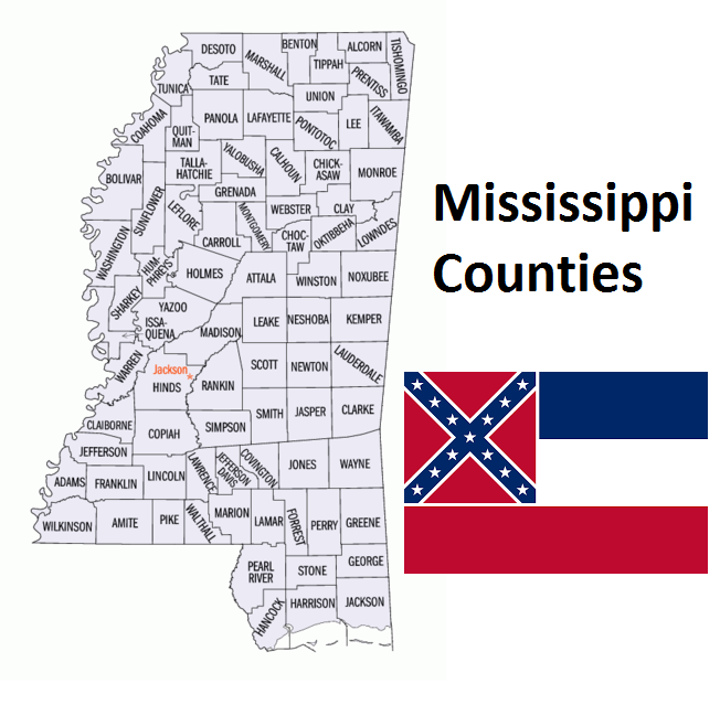
Map of Mississippi Counties