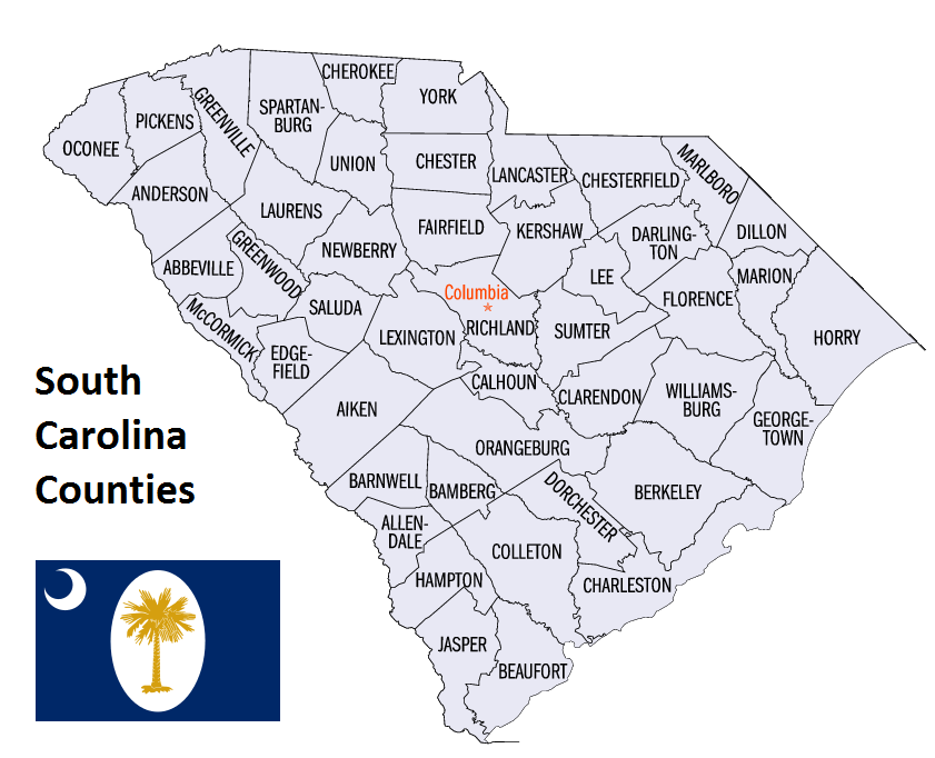
South Carolina Counties. List Alphabetically (and by Population)
How many counties are there in South Carolina? As of 2024, there are a total of 46 counties in the state of South Carolina. Among them, Beaufort County is the oldest one (established in 1769) while Allendale County is the youngest (established in 1919). With population of 498,766, Greenville County is the most populated. The biggest county by land area is Charleston County (3,517 km²) and the smallest is Calhoun County (1,015 km²).
Largest Counties in South Carolina
1. Horry County
County Overview
- County Seat: Conway
- Area: 1,255 square miles
- Population: 351,029 (2020 Census)
- Area Codes: 843, 854
- Latitude: 33.8413° N
- Longitude: 78.9924° W
Location and History
Horry County is located in the northeastern corner of South Carolina, along the Atlantic coast. It is the largest county in South Carolina by area. Established in 1801, the county was named after Peter Horry, a Revolutionary War hero and a brigadier general in the South Carolina militia. The county seat, Conway, is a historic town known for its beautiful oak-lined streets and early 20th-century architecture. Horry County’s history is closely tied to its coastal location, with the development of Myrtle Beach as a major tourist destination playing a significant role in the county’s growth and economy. The area has evolved from a largely agrarian society into a booming center of tourism, real estate, and retail.
Major Highways and Landmarks
U.S. Route 17, U.S. Route 501, and State Route 31 are the major highways that traverse Horry County, providing crucial connections to Myrtle Beach, Georgetown, and other parts of South Carolina. Major landmarks include Myrtle Beach, which is one of the most popular vacation spots on the East Coast, known for its sandy beaches, golf courses, and family-friendly attractions. The county is also home to the Myrtle Beach Boardwalk and SkyWheel, a 200-foot-tall observation wheel that offers stunning views of the Atlantic Ocean. Additionally, the Waccamaw National Wildlife Refuge, located along the Waccamaw River, provides a habitat for diverse wildlife and offers opportunities for hiking, birdwatching, and kayaking.
2. Anderson County
County Overview
- County Seat: Anderson
- Area: 757 square miles
- Population: 203,718 (2020 Census)
- Area Codes: 864
- Latitude: 34.5034° N
- Longitude: 82.6501° W
Location and History
Anderson County is located in the northwestern part of South Carolina, in the foothills of the Blue Ridge Mountains. The county was established in 1826 and named after Revolutionary War leader Robert Anderson. The county seat, Anderson, is known as “The Electric City” due to its early adoption of hydroelectric power, which spurred its growth and development in the late 19th and early 20th centuries. Anderson County’s history is marked by its role in the textile industry, which dominated the region’s economy for much of the 20th century. Today, Anderson County is a blend of historical charm and modern development, with a diverse economy that includes manufacturing, healthcare, and education.
Major Highways and Landmarks
Interstate 85 and U.S. Route 76 are the major highways that run through Anderson County, providing connections to Atlanta, Charlotte, and other key cities in the Southeast. Major landmarks include Lake Hartwell, a man-made reservoir that offers boating, fishing, and camping opportunities along its 962 miles of shoreline. The county is also home to the Anderson County Museum, which showcases the history and culture of the region, with exhibits on the textile industry, military history, and notable local figures. Additionally, Anderson University, a private Christian university, is a key educational institution in the county, contributing to the local economy and cultural life.
3. Berkeley County
County Overview
- County Seat: Moncks Corner
- Area: 1,100 square miles
- Population: 229,861 (2020 Census)
- Area Codes: 843, 854
- Latitude: 33.1950° N
- Longitude: 79.9867° W
Location and History
Berkeley County is located in the southeastern part of South Carolina, just north of Charleston. The county was established in 1882 and named after John and William Berkeley, colonial governors of Virginia. Moncks Corner, the county seat, is a historic town known for its proximity to the Francis Marion National Forest and the scenic beauty of the Lowcountry. Berkeley County’s history is closely tied to the development of the region’s rice plantations during the colonial period, as well as its strategic importance during the Revolutionary War. The county has experienced significant growth in recent years, driven by its location near Charleston and the development of new residential and commercial areas.
Major Highways and Landmarks
Interstate 26 and U.S. Route 52 are the major highways that traverse Berkeley County, providing access to Charleston, Columbia, and other parts of South Carolina. Major landmarks include Cypress Gardens, a historic 170-acre preserve featuring blackwater swamps, gardens, and walking trails, which has been used as a filming location for several movies. The county is also home to the Mepkin Abbey, a Trappist monastery situated along the Cooper River, offering a peaceful retreat and beautiful gardens open to the public. Additionally, the Old Santee Canal Park provides a glimpse into the area’s history, with exhibits on the Santee Canal, one of the earliest canals in the United States.
4. Charleston County
County Overview
- County Seat: Charleston
- Area: 1,357 square miles
- Population: 411,406 (2020 Census)
- Area Codes: 843, 854
- Latitude: 32.7765° N
- Longitude: 79.9311° W
Location and History
Charleston County is located in the southeastern corner of South Carolina, along the Atlantic coast. It is one of the oldest counties in South Carolina, established in 1769, and named after King Charles II of England. Charleston, the county seat, is one of the most historically significant cities in the United States, known for its well-preserved architecture, cobblestone streets, and rich cultural heritage. The county’s history is deeply intertwined with the history of the United States, particularly the American Revolution, the Civil War, and the antebellum period. Charleston County has grown into a major cultural and economic center in the Southeast, with a thriving tourism industry and a strong economy based on education, healthcare, and technology.
Major Highways and Landmarks
Interstate 26, U.S. Route 17, and State Route 61 are the major highways that run through Charleston County, providing vital connections to Savannah, Columbia, and other parts of the Lowcountry. Major landmarks include Fort Sumter National Monument, where the first shots of the Civil War were fired, making it a site of immense historical significance. The county is also home to the historic Charleston City Market, a popular destination for visitors interested in local crafts, food, and culture. Additionally, Boone Hall Plantation, located in Mount Pleasant, is one of America’s oldest working plantations, offering tours and educational programs that highlight the history of slavery and plantation life in the South.
5. Spartanburg County
County Overview
- County Seat: Spartanburg
- Area: 819 square miles
- Population: 327,997 (2020 Census)
- Area Codes: 864
- Latitude: 34.9496° N
- Longitude: 81.9320° W
Location and History
Spartanburg County is located in the northwestern part of South Carolina, in the Piedmont region. The county was established in 1785 and named after the Spartan Regiment, a local militia that fought in the Revolutionary War. Spartanburg, the county seat, has a rich history rooted in the textile industry, which drove the region’s economy throughout the 19th and 20th centuries. Today, Spartanburg County is known for its diverse economy, strong educational institutions, and vibrant cultural scene. The county’s history is marked by its strategic location along major transportation routes, which facilitated its growth as an industrial and commercial hub in the Upstate region.
Major Highways and Landmarks
Interstate 85 and Interstate 26 are the major highways that run through Spartanburg County, providing connections to Charlotte, Atlanta, and other key cities in the Southeast. Major landmarks include the BMW Manufacturing Plant, located in Greer, which is a major employer in the region and offers tours showcasing the production of luxury vehicles. The county is also home to Wofford College, a private liberal arts college known for its strong academics and beautiful campus. Additionally, Hatcher Garden and Woodland Preserve in Spartanburg offers a peaceful retreat with walking trails, gardens, and a wide variety of native plants and wildlife.
6. Lexington County
County Overview
- County Seat: Lexington
- Area: 758 square miles
- Population: 293,991 (2020 Census)
- Area Codes: 803
- Latitude: 33.9815° N
- Longitude: 81.2362° W
Location and History
Lexington County is located in the central part of South Carolina, just west of the state capital, Columbia. The county was established in 1804 and named after the Battle of Lexington, a key early battle in the American Revolutionary War. Lexington, the county seat, has grown rapidly in recent decades, becoming a major suburban community for Columbia. The county’s history is closely tied to its agricultural roots, particularly in cotton and tobacco farming, as well as its role in the development of the textile industry in the 19th century. Lexington County has evolved into a dynamic area with a diverse economy that includes manufacturing, healthcare, and education.
Major Highways and Landmarks
Interstate 20 and Interstate 26 are the major highways that traverse Lexington County, providing access to Columbia, Augusta, and other parts of South Carolina. Major landmarks include Lake Murray, a large man-made reservoir that offers boating, fishing, and recreational opportunities along its 650 miles of shoreline. The county is also home to the Lexington County Museum, which showcases the history and culture of the region through a collection of historic buildings, artifacts, and exhibits. Additionally, the Riverbanks Zoo and Garden, located on the border of Lexington and Richland counties, is one of the most popular attractions in South Carolina, featuring a wide variety of animals, gardens, and family-friendly activities.
7. Greenville County
County Overview
- County Seat: Greenville
- Area: 795 square miles
- Population: 523,542 (2020 Census)
- Area Codes: 864
- Latitude: 34.8526° N
- Longitude: 82.3940° W
Location and History
Greenville County is located in the northwestern part of South Carolina, in the foothills of the Blue Ridge Mountains. The county was established in 1786 and named after General Nathanael Greene, a hero of the American Revolutionary War. Greenville, the county seat, is the largest city in the Upstate region and has experienced significant growth in recent years, becoming a major center for business, education, and culture. The county’s history is deeply rooted in the textile industry, which was the backbone of the local economy for much of the 19th and 20th centuries. Today, Greenville County is known for its thriving economy, vibrant downtown, and outdoor recreation opportunities.
Major Highways and Landmarks
Interstate 85, Interstate 185, and Interstate 385 are the major highways that run through Greenville County, providing connections to Atlanta, Charlotte, and other major cities in the Southeast. Major landmarks include Falls Park on the Reedy, a beautiful urban park in downtown Greenville that features waterfalls, walking trails, and the iconic Liberty Bridge. The county is also home to the Peace Center, a premier performing arts venue that hosts Broadway shows, concerts, and other cultural events. Additionally, Paris Mountain State Park, located just outside Greenville, offers hiking, camping, and fishing opportunities in a scenic mountain setting.
8. Richland County
County Overview
- County Seat: Columbia
- Area: 772 square miles
- Population: 416,147 (2020 Census)
- Area Codes: 803
- Latitude: 34.0007° N
- Longitude: 81.0348° W
Location and History
Richland County is located in the central part of South Carolina and is home to the state capital, Columbia. The county was established in 1785 and named for its fertile soil, which made it an important agricultural center during the colonial period. Columbia, the county seat, is the largest city in South Carolina and serves as a major center for government, education, and commerce. The county’s history is closely tied to its role as the state capital, with significant events in South Carolina’s political and social history taking place in Columbia. Richland County has grown into a diverse and dynamic area with a strong economy based on education, healthcare, and military presence.
Major Highways and Landmarks
Interstate 20, Interstate 26, and Interstate 77 are the major highways that run through Richland County, providing connections to Charleston, Charlotte, and other parts of the Southeast. Major landmarks include the South Carolina State House, an architectural and historical landmark that serves as the center of state government. The county is also home to the University of South Carolina, a major research university with a large campus in downtown Columbia. Additionally, the Riverbanks Zoo and Garden, located on the border of Richland and Lexington counties, is one of the most popular attractions in South Carolina, featuring a wide variety of animals, gardens, and family-friendly activities.
9. Orangeburg County
County Overview
- County Seat: Orangeburg
- Area: 1,128 square miles
- Population: 84,223 (2020 Census)
- Area Codes: 803
- Latitude: 33.4968° N
- Longitude: 80.8550° W
Location and History
Orangeburg County is located in the central part of South Carolina, south of Columbia. The county was established in 1769 and named after William IV, Prince of Orange. Orangeburg, the county seat, is known as “The Garden City” for its beautiful gardens and parks. The county’s history is closely tied to agriculture, particularly in cotton and tobacco farming, which were the primary economic drivers for much of its history. Orangeburg County has also played a significant role in the civil rights movement, with events such as the Orangeburg Massacre highlighting the struggles for racial equality in the region.
Major Highways and Landmarks
Interstate 26 and U.S. Route 301 are the major highways that run through Orangeburg County, providing connections to Charleston, Columbia, and other parts of South Carolina. Major landmarks include Edisto Memorial Gardens, a beautiful public garden in Orangeburg that is known for its stunning rose garden and annual Festival of Roses. The county is also home to South Carolina State University, a historically black university that has played a key role in the education and empowerment of African Americans in the region. Additionally, the Orangeburg County Historical Society operates several historic sites and museums that preserve the rich history and culture of the area.
10. York County
County Overview
- County Seat: York
- Area: 696 square miles
- Population: 282,090 (2020 Census)
- Area Codes: 803
- Latitude: 35.0124° N
- Longitude: 81.0371° W
Location and History
York County is located in the north-central part of South Carolina, just south of Charlotte, North Carolina. The county was established in 1785 and named after York, Pennsylvania. York, the county seat, is a historic town known for its well-preserved 19th-century architecture and rich cultural heritage. The county’s history is closely tied to the American Revolution, with several key battles fought in the region, including the Battle of Kings Mountain. York County has experienced rapid growth in recent years, driven by its proximity to Charlotte and the development of new residential and commercial areas.
Major Highways and Landmarks
Interstate 77 and U.S. Route 21 are the major highways that run through York County, providing connections to Charlotte, Columbia, and other parts of South Carolina. Major landmarks include Kings Mountain National Military Park, which preserves the site of the pivotal Revolutionary War battle and offers a museum, hiking trails, and reenactments. The county is also home to the Museum of York County, which features exhibits on the natural history and cultural heritage of the region. Additionally, the city of Rock Hill, the largest city in York County, is known for its vibrant downtown, sports facilities, and cultural events, making it a major center for commerce and recreation in the area.
List of All Counties in South Carolina Alphabetically
Below please see all South Carolina counties which are listed in alphabetical order.
- Abbeville County, SC
- Aiken County, SC
- Allendale County, SC
- Anderson County, SC
- Bamberg County, SC
- Barnwell County, SC
- Beaufort County, SC
- Berkeley County, SC
- Calhoun County, SC
- Charleston County, SC
- Cherokee County, SC
- Chester County, SC
- Chesterfield County, SC
- Clarendon County, SC
- Colleton County, SC
- Darlington County, SC
- Dillon County, SC
- Dorchester County, SC
- Edgefield County, SC
- Fairfield County, SC
- Florence County, SC
- Georgetown County, SC
- Greenville County, SC
- Greenwood County, SC
- Hampton County, SC
- Horry County, SC
- Jasper County, SC
- Kershaw County, SC
- Lancaster County, SC
- Laurens County, SC
- Lee County, SC
- Lexington County, SC
- Marion County, SC
- Marlboro County, SC
- McCormick County, SC
- Newberry County, SC
- Oconee County, SC
- Orangeburg County, SC
- Pickens County, SC
- Richland County, SC
- Saluda County, SC
- Spartanburg County, SC
- Sumter County, SC
- Union County, SC
- Williamsburg County, SC
- York County, SC
Map of South Carolina Counties