What is the Capital of Iran? Tehran
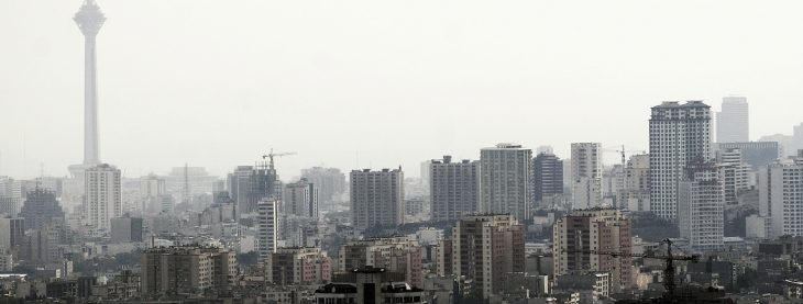
Tehran, the capital city of Iran, is located in the northern part of the country, at the foot of the majestic Alborz Mountains. Tehran is Iran’s largest and most populous city, serving as the political, economic, and cultural center of the country. With a history that dates back more than 2,500 years, Tehran has grown from a small town to a sprawling metropolis, now home to more than 9 million people within the city limits and over 15 million in the greater metropolitan area.
Tehran’s modern history began in 1795 when it was chosen by Agha Mohammad Khan Qajar, the founder of the Qajar dynasty, to be the capital of Iran. This decision marked the beginning of Tehran’s transformation into the hub of political and administrative power in the country. Today, Tehran is a dynamic city with a mix of modern high-rises and traditional Persian architecture, blending the old and the new in a unique way.
The city is located at an altitude of about 1,200 meters (3,900 feet) above sea level, and its proximity to the Caspian Sea and Persian Gulf influences its climate, providing a combination of arid and semi-arid conditions with some cooler periods in the winter. As the capital, Tehran is the seat of the Iranian government, housing the presidential palace, parliament, and supreme leader’s office, as well as the headquarters of many major Iranian businesses, banks, and media outlets.
City Facts
- Area: 730 km²
- Population: Approximately 9 million (2023 estimate)
- Time Zone: Iran Standard Time (IRST), UTC +3:30; Iran Daylight Time (IRDT), UTC +4:30 (during daylight saving time)
- Highest Mountain: Mount Damavand, located north of Tehran, is the highest mountain in Iran, standing at 5,671 meters (18,606 feet). This dormant volcano is one of the most recognizable landmarks in Tehran and holds a significant place in Persian mythology and culture.
- Longest River: The Karun River is the longest river in Iran, flowing from the Zagros Mountains in the west to the Persian Gulf. However, Tehran is not directly situated on this river. The city itself is located near other smaller rivers and dry riverbeds, such as the Jajrood River and Shahrud River.
Major Landmarks in Tehran
Tehran is home to a wide array of important cultural, historical, and architectural landmarks. These landmarks reflect both the city’s ancient roots and its modern development.
1. Golestan Palace
One of Tehran’s most important historical sites is the Golestan Palace, a UNESCO World Heritage Site. The palace complex, originally built in the 16th century during the Safavid dynasty, was expanded by the Qajars. It is an exquisite example of Persian architecture, blending traditional elements with European influences. Visitors can explore the various halls, gardens, and museums within the palace, including the Hall of Mirrors and Shah’s Bedchamber. The Golestan Palace has played an important role in the political history of Iran, serving as the royal residence for several centuries.
2. Azadi Tower
The Azadi Tower, also known as the Freedom Tower, is one of the most iconic symbols of Tehran. Built in 1971 to mark the 2,500th anniversary of the Persian Empire, it is a striking example of modern Iranian architecture, blending elements of Islamic, Persian, and postmodern styles. Standing at 45 meters (148 feet) tall, the tower is located in the Azadi Square, and visitors can enjoy panoramic views of the city from the top. The Azadi Tower is often seen as a symbol of Iran’s pride and sovereignty.
3. National Museum of Iran
The National Museum of Iran is a must-visit for anyone interested in the country’s rich archaeological history. The museum houses a collection of artifacts that date back to the Paleolithic era and spans many civilizations, including the Elamites, Achaemenid Persians, Parthians, and Sassanids. The museum’s Achaemenid Hall is especially notable for its statues and reliefs from ancient Persia, including items from the ruins of Persepolis, the ceremonial capital of the Achaemenid Empire.
4. Milad Tower
The Milad Tower is the tallest structure in Tehran and the sixth tallest tower in the world. At 435 meters (1,427 feet), it offers a stunning panoramic view of the city and beyond. The tower is a modern landmark and serves as a broadcasting center, a cultural and commercial center, and a tourist attraction. Visitors can access the observation deck to see breathtaking views of Tehran and the surrounding mountainous landscape. There is also a revolving restaurant at the top, providing a unique dining experience.
5. Tajrish Bazaar
For those who want to experience the hustle and bustle of traditional Tehran, a visit to the Tajrish Bazaar is essential. Located in the northern part of the city near Shemiran, the bazaar is known for its vibrant atmosphere, diverse range of products, and authentic Persian architecture. Here, visitors can find everything from fresh produce and spices to textiles, antiques, and local crafts. The Tajrish Bazaar is also home to several historic mosques, including the Imamzadeh Saleh, a shrine dedicated to one of the descendants of the Prophet Muhammad.
Climate Overview
Tehran experiences a semi-arid climate, with hot, dry summers and cooler winters. The city is situated in a valley, with the Alborz Mountains to the north and the Desert Plateau to the south, which influences its weather patterns. The mountains help to moderate the temperature, making winters colder and summers less oppressive than they would be otherwise.
Monthly Climate Overview
| Month | Average Temperature (°C) | Precipitation (mm) | Sunny Days |
|---|---|---|---|
| January | 5 | 40 | 8 |
| February | 6 | 35 | 10 |
| March | 10 | 40 | 12 |
| April | 15 | 28 | 14 |
| May | 22 | 15 | 16 |
| June | 28 | 5 | 18 |
| July | 32 | 0 | 20 |
| August | 31 | 1 | 19 |
| September | 26 | 10 | 17 |
| October | 17 | 20 | 14 |
| November | 9 | 30 | 10 |
| December | 5 | 38 | 8 |
Other Cities That Have Served as Capital in Iran’s History
Ctesiphon (224–651 AD)
Before Tehran became the capital, the ancient city of Ctesiphon was the capital of the Parthian Empire and later the Sassanian Empire. Located near the modern-day town of Al-Mada’in, Iraq, it was situated on the Tigris River. Ctesiphon was a thriving metropolis and was known for its grand structures, including the Taq Kasra, the largest vaulted arch in the world at the time. The city fell to the Arab Caliphate in 651 AD and was eventually abandoned.
Isfahan (1598–1722 AD)
Under the Safavid dynasty, Isfahan was chosen as the capital in 1598 by Shah Abbas I. The city flourished during the Safavid era, and it became a prominent center of Persian culture and art. Isfahan is famous for its stunning Islamic architecture, including the Imam Square, Sheikh Lotfollah Mosque, and the Ali Qapu Palace. Though Isfahan was eventually replaced by Tehran in the late 18th century, it remains one of Iran’s most important cultural and historical cities.
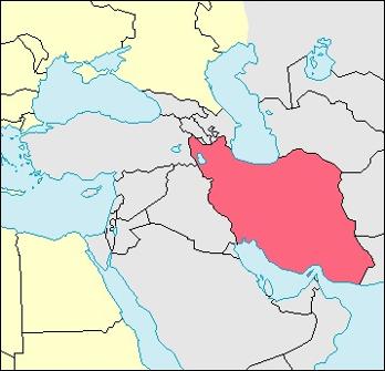
Country Facts: Iran
General Country Information
- Population: Approximately 88 million (2023 estimate)
- Area: 1,648,195 km²
- Largest City: Tehran
- Currency: Iranian Rial (IRR)
- Official Language: Persian (Farsi)
- ISO Country Codes: IR (ISO 3166-1 alpha-2), IRN (ISO 3166-1 alpha-3)
- Government: Islamic Republic
- Supreme Leader: Ali Khamenei (as of 2023)
- President: Ebrahim Raisi (as of 2023)
- Independence: Iran officially gained independence from British and Russian spheres of influence in 1979, following the Iranian Revolution.
Iran, with its rich history and cultural significance, continues to play a prominent role in the political and economic affairs of the Middle East. Tehran, as the capital, serves as both a symbol of the nation’s power and a vibrant center for commerce, education, and tourism.