Where is Iran Located?
Where is Iran located on the map? Iran is an independent nation located in Western Asia. Check out the following images to see location of Iran on maps.
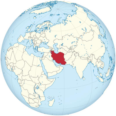
Iran Location in World Map
On this map you can see where exactly Iran is.
Location Information of Iran
Iran is a country located in Western Asia, bordered by Armenia, Azerbaijan, and Turkmenistan to the north, Afghanistan and Pakistan to the east, the Persian Gulf and Gulf of Oman to the south, and Iraq and Turkey to the west. Iran has a rich history and cultural heritage, with a geography that varies from rugged mountains to vast desert landscapes, and is often considered the gateway between the Middle East, Central Asia, and the Caucasus.
Latitude and Longitude
Iran lies approximately between 24° and 40° N latitude and 44° and 64° E longitude. The capital city, Tehran, is located at approximately 35.6892° N latitude and 51.3890° E longitude.
Capital City and Major Cities
Tehran (Capital City)
Tehran is the capital and largest city of Iran, with a population of approximately 9 million people in the metropolitan area. Located in the north-central part of the country, Tehran serves as the political, cultural, and economic center of Iran. The city is home to the government and most of the country’s major institutions, including universities, business hubs, and cultural landmarks.
Tehran is situated at the base of the Alborz Mountains, providing stunning views of snow-capped peaks and a range of outdoor activities such as skiing in winter. The city has a mix of modern infrastructure and traditional architecture, with numerous parks, museums, and historical sites. Key landmarks include:
- Golestan Palace, a UNESCO World Heritage site showcasing Qajar-era architecture.
- The National Museum of Iran, which displays Iran’s ancient history.
- Milad Tower, one of the tallest towers in the world, offering panoramic views of the city.
Isfahan
Located in central Iran, Isfahan is the third-largest city in the country with a population of over 2 million. Known for its historical and architectural significance, Isfahan was once the capital of the Safavid Empire in the 16th century. The city is renowned for its Islamic architecture, including beautiful mosques, bridges, and palaces. Major attractions in Isfahan include:
- Naqsh-e Jahan Square, one of the largest urban squares in the world and a UNESCO World Heritage site.
- Sheikh Lotfollah Mosque, a stunning example of Safavid-era mosque architecture.
- Ali Qapu Palace, a historical palace with a terrace that offers views of the square.
Shiraz
Shiraz, located in southern Iran, is the capital of Fars Province and one of the most historically significant cities in the country. With a population of around 1.5 million, Shiraz is known as the city of poets, literature, and gardens. It is home to some of Iran’s most famous historical figures, such as the poets Hafez and Saadi. Key attractions in Shiraz include:
- Persepolis, the ancient ceremonial capital of the Achaemenid Empire.
- Nasir al-Mulk Mosque, also known as the “Pink Mosque,” famous for its colorful stained glass windows.
- The Tomb of Hafez, a popular destination for those interested in Persian poetry and culture.
Tabriz
Located in the northwest of Iran, Tabriz is one of the oldest cities in the country, with a population of around 1.5 million. Tabriz has long been a cultural and economic hub due to its location on the ancient Silk Road. The city is known for its bazaars, handicrafts, and rich Islamic architecture. Notable landmarks in Tabriz include:
- Tabriz Historic Bazaar Complex, a UNESCO World Heritage site and one of the largest covered bazaars in the world.
- Blue Mosque, an iconic mosque known for its intricate tile work.
- El Goli Park, a popular park with a large artificial lake and scenic views.
Mashhad
Mashhad, located in the northeast of Iran, is the second-largest city in the country with a population of over 3 million. Mashhad is an important religious center, as it is home to the Imam Reza Shrine, the holiest site for Shia Muslims in Iran. Pilgrims from around the world visit Mashhad for religious purposes. The city has several cultural sites, including:
- Imam Reza Shrine, a complex housing the tomb of Imam Reza, which attracts millions of visitors annually.
- Nader Shah Afshar’s Tomb, dedicated to the founder of the Afsharid dynasty.
- The Tomb of Khajeh Rabi, another important religious site in Mashhad.
Time Zone
Iran follows Iran Standard Time (IRST), which is UTC +3:30. In summer, the country observes Iran Daylight Time (IRDT), which is UTC +4:30. This time zone places Iran ahead of countries like India and Pakistan, but behind many European and Eastern Asian countries.
Climate
Iran’s climate is diverse due to its varied geography, which includes vast deserts, towering mountains, and fertile plains. The climate generally consists of four distinct seasons, with a range from hot and dry to cold and wet.
Summer
Iran experiences hot summers, with temperatures often exceeding 40°C (104°F) in lowland areas. The central plateau and southern regions, including Kerman, Yazd, and Isfahan, experience dry conditions, while the northern regions, including the Caspian Sea coast, enjoy milder summer temperatures. Tehran sees an average of 30–35°C (86–95°F) in the summer.
Winter
The winter season in Iran is cold, particularly in the northern regions and mountainous areas. In the Alborz and Zagros Mountains, temperatures often dip below 0°C (32°F), with significant snowfall. Cities like Tabriz and Tehran experience cold winters, while the southern and eastern regions, such as Kerman and Zahedan, tend to have milder temperatures.
Rainfall
Iran’s rainfall is concentrated in the winter months, and the country experiences low average annual precipitation, particularly in the central and southern deserts. The Caspian Sea region receives the most rainfall, with some areas getting up to 1,000 mm (39 inches) per year. Tehran, in the north, receives around 250 mm (10 inches) of rain annually, while the central plateau and Kerman receive much less.
Economic Status
Iran has a mixed economy that is largely state-controlled, with a significant portion of its revenue coming from oil exports. The country possesses some of the world’s largest proven reserves of natural gas and crude oil. Despite this, Iran’s economy faces substantial challenges due to international sanctions, corruption, and political instability. The Iranian economy is highly dependent on the oil and gas sector, which accounts for around 80% of the country’s export revenues.
Key Sectors
- Oil and Gas: Iran is a major oil producer and holds some of the largest oil reserves in the world. The oil industry has long been the backbone of the economy. However, recent sanctions have severely restricted the ability to export oil and access international markets.
- Agriculture: Iran has a diverse agricultural sector, producing crops such as wheat, rice, sugar beets, cotton, and fruits. The Caspian Sea region, along with Khuzestan Province, are significant agricultural areas.
- Industry and Manufacturing: Iran has a substantial manufacturing sector, including automobile production, steel manufacturing, and chemical production. However, industrial development has been hampered by sanctions and a lack of investment.
Economic Challenges
Iran faces numerous economic challenges, including high inflation, unemployment, and a deteriorating currency. The country’s infrastructure is aging, and it has been affected by decades of sanctions, which have impeded its ability to fully integrate into the global economy. The lack of foreign investment, particularly in the oil and gas sector, has further slowed economic growth.
Tourist Attractions
Iran has a rich cultural heritage and is home to many historical sites. Its ancient cities, majestic Persian architecture, and religious landmarks attract tourists despite geopolitical challenges.
Persepolis
Located near Shiraz, Persepolis was the ceremonial capital of the Achaemenid Empire and is one of the most important archaeological sites in the world. Persepolis was founded by King Darius I in the 6th century BCE and was the site of important ceremonies, including the Nowruz (Persian New Year) celebrations. Visitors can explore the ancient ruins, including the Gate of All Nations, the Apadana Palace, and the Tomb of Darius.
Isfahan
Isfahan is renowned for its Safavid architecture, and its Naqsh-e Jahan Square is one of the largest city squares in the world. The square is surrounded by several important buildings, including Imam Mosque, Sheikh Lotfollah Mosque, and Ali Qapu Palace. Isfahan also boasts traditional bridges and bazaars.
Yazd
Known for its ancient mudbrick architecture, Yazd is a UNESCO World Heritage site and one of the oldest cities in Iran. Yazd is known for its traditional wind towers (used for cooling buildings) and its Zoroastrian heritage. The Towers of Silence and the Fire Temple are significant religious sites for followers of the Zoroastrian faith.
Visa Requirements for U.S. Citizens
U.S. citizens traveling to Iran must obtain a visa before arrival. Iran does not have a visa-on-arrival policy for U.S. citizens, so individuals must apply for a tourist visa through the Iranian Interests Section of the Embassy of Pakistan in Washington, D.C., or through an Iranian consulate. The application process generally requires:
- A valid passport with at least six months of validity.
- A completed visa application form.
- An invitation letter from an Iranian travel agency or individual.
- Payment of visa fees.
Visitors may also need to submit biometric data and undergo an interview, depending on the application process.
Distance to New York City and Los Angeles
- From New York City to Tehran: The distance between John F. Kennedy International Airport (JFK) and Tehran Imam Khomeini International Airport (IKA) is approximately 6,200 miles (10,000 kilometers). A direct flight typically takes around 12–13 hours.
- From Los Angeles to Tehran: The distance between Los Angeles International Airport (LAX) and Tehran Imam Khomeini International Airport (IKA) is approximately 7,500 miles (12,000 kilometers). Flights from Los Angeles to Tehran typically take about 14 hours.
Iran Facts
| Size | 1,648,195 km² |
| Residents | 82.9 million |
| Language | Persian |
| Capital | Tehran |
| Longest river | Karun (720 km) |
| Highest mountain | Damāwand (5,604 m) |
| Currency | Iranian rial |


