Where is Eswatini Located?
Where is Eswatini located on the map? Swaziland is an independent nation located in Southern Africa. Check out the following images to see location of Swaziland on maps.
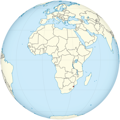
Eswatini Location in World Map
Eswatini – formerly Swaziland – is located in the south of Africa.
Location Information of Eswatini
Eswatini, formerly known as Swaziland, is a landlocked country located in Southern Africa. It is bordered by South Africa to the west, south, and southeast, and Mozambique to the east. Despite its small size, Eswatini is known for its diverse cultures, rich history, and natural beauty. The country offers a wide variety of landscapes, ranging from savannas to mountains, and boasts a number of wildlife reserves.
Latitude and Longitude
Eswatini lies between 26° and 32° South latitude and 30° and 32° East longitude. The country covers a total area of about 17,364 square kilometers (6,704 square miles), making it one of the smallest countries in Africa.
Capital City and Major Cities
Capital City: Mbabane
The capital city of Eswatini is Mbabane, located in the western part of the country in the Middleveld region. It sits at an altitude of around 1,200 meters (3,937 feet) above sea level, nestled in the Mdimba Mountains. Mbabane serves as the political and administrative center of Eswatini and has a population of approximately 95,000. It is known for its modern infrastructure, scenic beauty, and proximity to natural attractions.
Some notable landmarks in Mbabane include:
- The Swaziland National Museum: Showcasing the country’s history and culture.
- The Mbabane Waterfalls: Located just outside the city, these waterfalls are a popular destination for tourists.
- Ludzidzini Royal Village: The official residence of the Royal Family, a significant cultural site in the country.
Major Cities
- Manzini: The largest city in Eswatini, with a population of around 110,000. It is located in the Lowveld region and serves as the economic hub of the country. Manzini is known for its markets, commercial activity, and proximity to nature reserves. Coordinates: 26.5174° S, 31.1360° E.
- Lobamba: Located near Mbabane, Lobamba is the traditional and cultural heart of Eswatini. It is home to the House of Parliament and the King’s Royal Palace. The city is a focal point for national celebrations, particularly during Umhlanga (Reed Dance), a significant cultural event. Coordinates: 26.4099° S, 31.1781° E.
- Nhlangano: A smaller city located in the Shiselweni region, it has a population of around 10,000 people. Nhlangano is an important agricultural center and is located near the border with South Africa. Coordinates: 26.2192° S, 31.1953° E.
- Piggs Peak: A smaller town in the Hhohho region, known for its proximity to the Ngwenya Glass Factory and its scenic views of the surrounding mountains. Coordinates: 26.0299° S, 31.3442° E.
Time Zone
Eswatini operates on Central Africa Time (CAT), which is UTC +2:00 year-round. Eswatini does not observe Daylight Saving Time (DST), so the time remains consistent throughout the year. This time zone is shared with many countries in the region, including South Africa, Botswana, and Namibia.
- Time difference with New York City: Eswatini is 7 hours ahead of New York City during Standard Time (NYC operates on UTC -5).
- Time difference with Los Angeles: Eswatini is 9 hours ahead of Los Angeles during Standard Time (Los Angeles operates on UTC -8).
Climate
Eswatini has a subtropical climate that varies according to altitude. The country experiences a combination of wet and dry seasons, influenced by the summer rainfall from November to April and the cooler, drier period from May to October.
Regional Climate Variations:
- Highveld (Western Region): This region, which includes the capital city of Mbabane, has a temperate climate with mild temperatures. Summer temperatures average around 20°C to 30°C (68°F to 86°F), while winter temperatures can drop to 4°C to 10°C (39°F to 50°F). The region receives moderate rainfall during the wet season.
- Lowveld (Eastern Region): The Lowveld, which includes Manzini, experiences a warmer climate with more pronounced temperature differences between summer and winter. Summer temperatures range from 25°C to 35°C (77°F to 95°F), while winter temperatures can drop to 10°C to 15°C (50°F to 59°F). This region has a more distinct rainy season and is known for its agricultural production.
- Lubombo Plateau: This region, on the eastern border near Mozambique, is characterized by a more tropical climate with hotter temperatures and higher humidity. It can experience annual rainfall of up to 1,000 mm (39 inches).
Economic Status
Eswatini has a small, open economy that is highly dependent on agriculture, manufacturing, and services. The country’s economy is characterized by a relatively low level of industrialization, but it is strategically positioned between South Africa and Mozambique, providing access to regional markets.
Key Sectors of the Economy:
- Agriculture: Agriculture plays a major role in Eswatini’s economy, employing a large portion of the population. Sugarcane is the primary crop, and Eswatini is one of the top sugar producers in the region. Other important agricultural products include citrus fruits, maize, and tobacco.
- Manufacturing: Eswatini’s manufacturing sector is driven by industries such as textiles, clothing, and food processing. The country exports manufactured goods, particularly textiles and clothing, to international markets, including the United States under the African Growth and Opportunity Act (AGOA).
- Mining: Mining is also an important contributor to the economy, with minerals such as coal, iron ore, and gold being extracted. However, the mining sector is relatively small compared to other industries.
- Tourism: The tourism industry in Eswatini is growing, attracting visitors with its wildlife reserves, national parks, and cultural experiences. The country has a significant number of protected areas that are home to a wide variety of flora and fauna.
- Services: The services sector, particularly in finance, banking, and telecommunications, has seen growth in recent years, with the capital Mbabane becoming a hub for regional financial services.
Tourist Attractions
Eswatini is renowned for its natural beauty and cultural richness, offering numerous attractions for visitors interested in wildlife, culture, and outdoor adventure.
1. Hlane Royal National Park
Located in the eastern part of the country, Hlane Royal National Park is the largest protected area in Eswatini. It is home to a wide range of wildlife, including lions, elephants, rhinos, and buffaloes. The park offers opportunities for safaris, bird watching, and game drives.
2. Mkhaya Game Reserve
Known for its conservation efforts, Mkhaya Game Reserve is a private game reserve that focuses on the protection of endangered species like the black rhino and Sable antelope. Visitors can experience guided game drives and stay in luxury accommodations.
3. Sibhida Wetlands
Located in the Lowveld, the Sibhida Wetlands is an important area for bird watching. It is home to many species of waterfowl, herons, and pelicans, making it an ideal spot for birdwatchers and nature enthusiasts.
4. Ngwenya Glass Factory
Eswatini is home to one of the largest glass factories in Africa, the Ngwenya Glass Factory, which produces beautiful handcrafted glass items. Visitors can tour the factory to see how the glass is made and purchase unique souvenirs.
5. Royal Swazi Spa
Located near Lobamba, the Royal Swazi Spa offers a luxury experience with hot springs, golf courses, and wellness facilities. It’s a popular retreat for both locals and international visitors looking for relaxation.
6. The Umhlanga Reed Dance
Held annually in August or September, the Umhlanga Reed Dance is one of the most important cultural events in Eswatini. It celebrates the kingdom’s traditions and gives young women an opportunity to present themselves before the king.
Visa Requirements for U.S. Citizens
U.S. citizens traveling to Eswatini for tourism or business for up to 30 days do not require a visa. However, their passport must be valid for at least six months from the date of entry. For longer stays, such as for work or study, U.S. citizens will need to apply for a visa at the Embassy of Eswatini in Washington, D.C. or at an Eswatini consulate.
Distance to New York City and Los Angeles
- Distance from Mbabane (Eswatini) to New York City: The approximate distance is 12,000 km (7,500 miles), with a flight time of around 16 to 18 hours, depending on layovers.
- Distance from Mbabane (Eswatini) to Los Angeles: The approximate distance is 13,000 km (8,078 miles), with a flight time of around 18 to 20 hours, depending on flight connections.
Eswatini Facts
| Size | 17,363 km² |
| Residents | 1.45 million |
| Languages | Siswati and English |
| Capital | Mbabane |
| Longest river | Lusutfu (also Great Usuto, total length 300 km) |
| Highest mountain | Emlembe (1,862 m) |
| Currency | Lilangeni and South African rand |


