Where is Tajikistan Located?
Where is Tajikistan located on the map? Tajikistan is an independent nation located in Central Asia. Check out the following images to see location of Tajikistan on maps.
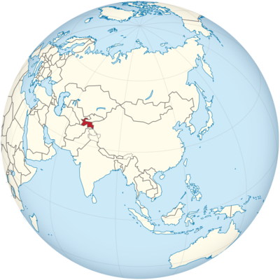
Tajikistan Location in World Map
Tajikistan is in Central Asia.
Location Information of Tajikistan
Tajikistan is a landlocked country in Central Asia, bordered by Kyrgyzstan to the north, Uzbekistan to the west and south, Afghanistan to the south, and China to the east. It is a mountainous country, with the Pamir Mountains in the east, often referred to as the “Roof of the World.” Tajikistan has a rich cultural history influenced by Persian, Turkic, and Soviet elements. Its geography is dominated by mountain ranges, rivers, and desert areas.
Latitude and Longitude
Tajikistan is located between 36° and 41° North latitude and 67° and 75° East longitude. This positioning places it in a transitional zone between Central Asia’s continental climate and the influence of the Himalayan mountain system to the south.
Capital City and Major Cities
Capital City: Dushanbe
The capital and largest city of Tajikistan is Dushanbe. It lies in the western part of the country, along the Varzob River, at an elevation of around 800 meters (2,625 feet) above sea level. Dushanbe has a population of approximately 900,000 people and serves as the economic, political, and cultural center of Tajikistan. The city is a blend of Soviet-era architecture and modern developments, offering a range of cultural and historical attractions.
Key features of Dushanbe include:
- The National Museum of Tajikistan: The museum showcases the country’s rich history, cultural heritage, and ancient artifacts.
- Rudaki Park: A central park dedicated to the famous Persian poet, Rudaki, featuring statues, gardens, and monuments.
- Dushanbe’s Green Bazaar: A vibrant market where visitors can explore local produce, spices, and traditional Tajik goods.
Major Cities
- Khujand: Located in the northern part of Tajikistan, Khujand is the second-largest city in the country. Situated on the Syr Darya River, Khujand has a rich history and is one of the oldest cities in Central Asia, formerly known as Leninabad during the Soviet era. The city is an important industrial and cultural hub in the region, with a population of around 170,000 people. It lies at 40.2833° N, 69.6000° E.
- Kulob: Kulob is located in the south of Tajikistan, near the border with Afghanistan. This city serves as a significant center for agriculture, particularly cotton and fruit production. Kulob has a population of about 100,000 people and is historically important for its association with the region’s Persian heritage. The coordinates of Kulob are 37.8667° N, 69.7500° E.
- Bokhtar: Formerly known as Qurghonteppa, Bokhtar is situated in the southern part of the country and is an important center for agriculture, particularly in the Khatlon Province. The city has a population of around 200,000 people. Bokhtar is located at 37.9667° N, 69.5833° E.
- Isfara: Located in the northern part of Tajikistan, near the Kyrgyzstan border, Isfara has a population of about 70,000 people. The city is a gateway for trade with Kyrgyzstan and Uzbekistan, especially for agricultural goods and textiles. The coordinates of Isfara are 40.2833° N, 69.6000° E.
Time Zone
Tajikistan operates on Tajikistan Time (TJT), which is UTC +5:00. The country does not observe Daylight Saving Time, and the time remains consistent year-round.
- Time difference with New York City: Tajikistan is 10 hours ahead of New York City during Standard Time (EST) and 9 hours ahead during Daylight Saving Time (EDT).
- Time difference with Los Angeles: Tajikistan is 12 hours ahead of Los Angeles during Standard Time (PST) and 11 hours ahead during Daylight Saving Time (PDT).
Climate
Tajikistan experiences a continental climate with sharp contrasts between hot summers and cold winters, influenced by its mountainous topography. Climate variations exist between different regions of the country, ranging from desert-like conditions in the lowlands to a more temperate climate in the mountainous areas.
- Summer (May to September): The summer season in Tajikistan can be very hot, particularly in the lowland areas. Temperatures in cities like Dushanbe can exceed 40°C (104°F) in July and August, while mountainous regions remain cooler. The summer months also experience dry weather, making it the best time for travel and outdoor activities in the mountains.
- Winter (December to February): Winters in Tajikistan are cold, particularly in the mountainous regions. In Dushanbe, temperatures range from -5°C to 10°C (23°F to 50°F), while higher altitudes can experience temperatures as low as -15°C (5°F). Snowfall is common in the higher altitudes, and mountain roads can be difficult to navigate during this period.
- Spring and Autumn (March to May and September to November): These seasons are the most pleasant for visitors, with mild temperatures ranging from 10°C to 25°C (50°F to 77°F). The spring season brings blooming flowers and green landscapes, while autumn is marked by harvest festivals and pleasant weather for outdoor activities.
- Humidity: Tajikistan generally has a dry climate, with low humidity in most regions, although areas near rivers, like Khujand, may experience higher humidity.
Economic Status
Tajikistan is one of the poorest countries in Central Asia, with a low-income economy heavily reliant on agriculture and remittances. The country’s economy has grown in recent years but faces challenges related to infrastructure, energy shortages, and political instability. Tajikistan’s GDP per capita is among the lowest in the region, but the country is gradually moving towards diversification.
Key Sectors of the Economy:
- Agriculture: Agriculture is the backbone of Tajikistan’s economy, employing around 60% of the population. The country is a major producer of cotton, fruits, vegetables, and tobacco. Cotton production remains one of the most important agricultural activities in Tajikistan, though it has been a source of environmental and social issues, such as the depletion of water resources.
- Mining and Minerals: Tajikistan is rich in natural resources, particularly gold, silver, coal, precious metals, and hydropower potential. The country has attracted foreign investment in the mining sector, particularly in the extraction of gold and tantalum.
- Remittances: A significant portion of the country’s GDP comes from remittances sent by Tajik migrants working abroad, primarily in Russia. These remittances contribute to household incomes and have helped alleviate poverty in the country.
- Services: The services sector, particularly transport, finance, and telecommunications, has seen some growth, with foreign investments improving infrastructure. The development of trade routes with China and neighboring Uzbekistan has supported growth in regional commerce.
Tourist Attractions
Tajikistan, with its rugged mountains, historical sites, and pristine landscapes, offers a variety of attractions for adventurous travelers.
1. Pamir Mountains
Known as the “Roof of the World,” the Pamir Mountains are a must-visit destination for trekkers and mountaineers. The Pamir Highway (M41), one of the highest roads in the world, traverses these mountains and provides access to some of the most remote and scenic areas in Tajikistan. The mountains offer hiking, trekking, and cultural experiences with local communities.
2. Fann Mountains
The Fann Mountains, located in the northwest of the country, are famous for their alpine lakes such as Iskanderkul. The area is known for trekking, camping, and wildlife viewing. Iskanderkul Lake, surrounded by towering peaks, is a popular spot for hiking and photography.
3. Dushanbe
Dushanbe itself is a cultural destination, with notable landmarks like the National Museum of Tajikistan, the Rudaki Park, and the Shah-i-Zinda complex. The city’s combination of modern developments and Soviet-era architecture offers a unique experience. The Hissar Fortress, located just outside the city, is a popular historical site that dates back to the 10th century.
4. Zorkul Lake and the Wakhan Corridor
Zorkul Lake, located in the Pamir Mountains, is one of the highest lakes in the world. The surrounding Wakhan Corridor offers incredible scenery, and it is known for its natural beauty and as a base for the ancient Silk Road route. Visitors can also explore the remote Wakhi people who reside in this isolated region.
Visa Requirements for U.S. Citizens
U.S. citizens wishing to travel to Tajikistan for tourism need to obtain a tourist visa. The visa can be obtained through the Tajik Embassy or via an e-visa system available online. The e-visa allows stays of up to 60 days.
Visa Requirements:
- A valid U.S. passport (with at least six months’ validity).
- A completed visa application form.
- A passport-sized photo.
- Proof of accommodation during the stay.
- Visa fee (varies depending on the type of visa).
Distance to New York City and Los Angeles
- Distance from Dushanbe to New York City: Approximately 10,800 km (6,700 miles), with a flight time of about 14 hours with one or two layovers.
- Distance from Dushanbe to Los Angeles: Approximately 11,000 km (6,835 miles), with a flight time of around 15 hours, typically requiring one or two layovers.
Tajikistan Facts
| Size | 143,100 km² |
| Residents | 9.1 million |
| Language | Tajik |
| Capital | Dushanbe (Dušanbe) |
| Longest river | Syrdarja (total 2,212 km) |
| Highest mountain | Pik Ismoil Somoni (7,495 m) |
| Currency | Somoni |


