Where is Tanzania Located?
Where is Tanzania located on the map? Tanzania is an independent nation located in Eastern Africa. Check out the following images to see location of Tanzania on maps.
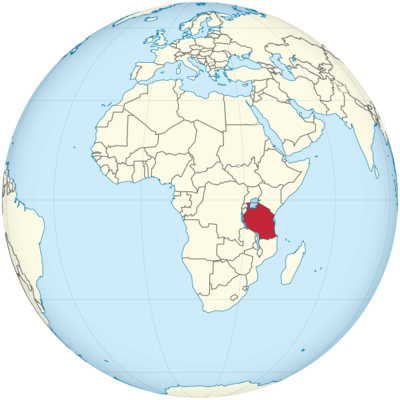
Tanzania Location in World Map
Here you can see the location of Tanzania on the African continent.
Location Information of Tanzania
Tanzania is a country located in East Africa, bordered by Kenya and Uganda to the north, Rwanda, Burundi, and the Democratic Republic of the Congo to the west, and Zambia, Malawi, and Mozambique to the south. To the east, it faces the Indian Ocean. Tanzania also includes the Zanzibar Archipelago, which consists of several islands, including Zanzibar, Pemba, and Unguja. The country is known for its rich biodiversity, large national parks, and iconic landmarks such as Mount Kilimanjaro.
Latitude and Longitude
Tanzania lies between 1° and 12° South latitude and 29° and 41° East longitude. This strategic location places the country in the tropics, giving it a mix of coastal plains, fertile highlands, and central plateaus.
Capital City and Major Cities
Capital City: Dodoma
The capital city of Tanzania is Dodoma, located in the center of the country. Dodoma is not as large as Dar es Salaam, but it has been the political capital since 1974 when the government decided to move the capital from Dar es Salaam for administrative and geographical reasons. Dodoma lies at 6.1659° S, 35.7516° E and serves as the seat of the Tanzanian government.
Despite its role as the capital, Dodoma remains a relatively small city with a population of around 400,000 people. It is characterized by barren landscapes and is surrounded by savannahs and hills. Key features of Dodoma include:
- The Tanzanian Parliament: The Parliament is housed in a modern, large building in Dodoma, where major political decisions are made.
- Gaddafi Mosque: This mosque is one of the largest in Tanzania and serves as an important place of worship for Muslims in Dodoma.
Major Cities
- Dar es Salaam: Situated on the coast of the Indian Ocean, Dar es Salaam is the largest city in Tanzania and the country’s economic and cultural hub. Although Dodoma is the political capital, Dar es Salaam remains Tanzania’s most important city for trade, industry, and transportation. Located at 6.7924° S, 39.2083° E, it has a population of over 6 million people. Dar es Salaam is home to one of East Africa’s busiest ports, making it central to the country’s economy.
- Arusha: Located in the northern part of the country, Arusha serves as a gateway to Serengeti National Park, Mount Kilimanjaro, and Ngorongoro Crater. It is a significant city for tourism and conservation efforts. Arusha lies at -3.3869° S, 36.6820° E and has a population of around 400,000 people. The city is also known for being the location of the International Criminal Tribunal for Rwanda.
- Mwanza: Mwanza is a major city in the Lake Victoria region and is Tanzania’s second-largest port city. It lies at 2.5167° S, 32.9167° E and has a population of around 700,000 people. Mwanza serves as an important trading center for agricultural goods and is known for its fishing industry.
- Mbeya: Located in the southern highlands, Mbeya is an important commercial and administrative center. It is situated near the border with Zambia and serves as a hub for trade between Tanzania and its neighboring countries. Mbeya lies at -8.8944° S, 33.4656° E.
- Tanga: Situated on the northeastern coast, Tanga is Tanzania’s fourth-largest city, with a population of approximately 250,000 people. It is an important port city located at 5.0670° S, 39.1030° E.
Time Zone
Tanzania operates on East Africa Time (EAT), which is UTC +3:00. The country does not observe Daylight Saving Time, and the time remains constant throughout the year.
- Time difference with New York City: Tanzania is 8 hours ahead of New York City during Standard Time (EST) and 7 hours ahead during Daylight Saving Time (EDT).
- Time difference with Los Angeles: Tanzania is 11 hours ahead of Los Angeles during Standard Time (PST) and 10 hours ahead during Daylight Saving Time (PDT).
Climate
Tanzania has a tropical climate with variations due to altitude and proximity to the coast. The country experiences two main seasons: the rainy season and the dry season.
- Rainy Season (March to May and November to December): Tanzania experiences heavy rains during the long rains from March to May and the short rains from November to December. Rainfall is particularly strong in the coastal regions and the Lake Victoria Basin. Average rainfall can range from 100 mm to 600 mm in these months, depending on the region. Temperatures range from 25°C to 30°C (77°F to 86°F).
- Dry Season (June to October): The dry season is from June to October, with cooler temperatures ranging from 18°C to 28°C (64°F to 82°F). The coastal regions remain warm, while the highlands are cooler. This is the best time to visit Tanzania for safaris and mountain trekking, as the weather is dry, and the wildlife is easier to spot.
- Humidity: Coastal regions such as Dar es Salaam and Zanzibar experience high humidity year-round, especially during the rainy season. The northern and central parts of the country, including areas around Mount Kilimanjaro, have a more moderate climate with cooler temperatures at higher altitudes.
Economic Status
Tanzania is one of the fastest-growing economies in Africa, but it still faces significant development challenges. The country is classified as a low-income nation, and its economy is based on agriculture, mining, tourism, and manufacturing. Agriculture accounts for about 30% of GDP, while services and industry contribute significantly to the economy’s growth.
Key Sectors of the Economy:
- Agriculture: Tanzania is a major producer of coffee, tea, cashews, cocoa, maize, and tobacco. Agriculture employs about 60% of the population and is crucial to the livelihoods of rural communities. However, the sector is vulnerable to climate change, particularly in areas affected by drought or floods.
- Mining: Tanzania is rich in mineral resources, including gold, tanzanite, diamonds, and coal. The mining sector has grown rapidly in recent years, with gold being the country’s largest export. Tanzania is the fourth-largest gold producer in Africa.
- Tourism: Tourism is one of the fastest-growing sectors of the Tanzanian economy, contributing significantly to foreign exchange earnings. Key attractions include Mount Kilimanjaro, Serengeti National Park, Ngorongoro Crater, and the Zanzibar Archipelago. Tanzania is renowned for its wildlife, including the Big Five (lion, elephant, buffalo, leopard, and rhinoceros), and attracts millions of tourists each year.
- Services and Infrastructure: The services sector is expanding, particularly in telecommunications, finance, and trade. The government has been investing in infrastructure development, including roads, ports, and airports, to improve the business environment and increase trade connectivity with neighboring countries and international markets.
Tourist Attractions
Tanzania offers a wide array of attractions for tourists, including some of the world’s most famous national parks and wildlife reserves.
1. Mount Kilimanjaro
As the highest peak in Africa at 5,895 meters (19,341 feet), Mount Kilimanjaro is one of the world’s most iconic mountains. The mountain attracts trekkers and climbers from around the world. The climb to the summit offers diverse ecosystems, from tropical rainforests to alpine meadows and glaciers.
2. Serengeti National Park
One of the most famous wildlife reserves in the world, Serengeti National Park is known for the Great Migration of wildebeest, zebras, and gazelles. The park is home to an abundance of wildlife, including the Big Five. Visitors can enjoy safaris, hot air balloon rides, and guided tours.
3. Ngorongoro Crater
The Ngorongoro Crater is the world’s largest intact volcanic caldera. It is a UNESCO World Heritage site and an exceptional place for wildlife viewing. The crater is home to a high concentration of wildlife, including elephants, lions, and black rhinos.
4. Zanzibar Archipelago
Zanzibar, an island off the coast of Tanzania, is famous for its white sandy beaches, spice plantations, and historical sites. Stone Town, a UNESCO World Heritage site, offers a glimpse into the island’s rich history and culture. Visitors can explore Spice Farms, Jozani Forest, and the beautiful beaches of Nungwi and Paje.
5. Selous Game Reserve
Located in southern Tanzania, the Selous Game Reserve is one of the largest faunal reserves in the world. It is a UNESCO World Heritage site and features diverse wildlife, including elephants, hippos, and crocodiles. The park offers boat safaris on the Rufiji River and walking safaris.
Visa Requirements for U.S. Citizens
U.S. citizens visiting Tanzania for tourism purposes typically need a tourist visa unless staying for fewer than 90 days. The visa can be obtained online or on arrival at the airport.
Visa Requirements:
- A valid U.S. passport (with at least six months’ validity).
- A completed visa application form.
- A passport-sized photograph.
- Proof of onward travel (e.g., return ticket).
- Proof of sufficient funds for the duration of stay.
Distance to New York City and Los Angeles
- Distance from Dar es Salaam to New York City: Approximately 12,000 km (7,456 miles), with a flight time of about 16 hours with one or two layovers.
- Distance from Dar es Salaam to Los Angeles: Approximately 14,300 km (8,888 miles), with a flight time of around 18 hours, depending on the number of layovers.
Tanzania Facts
| Size | 945,087 km² |
| Residents | 58 million |
| Languages | Swahili and English |
| Capital | Dodoma |
| Longest river | Rufiji (600 km) |
| Highest mountain | Kibo (5,895 m) |
| Currency | Tanzanian shilling |


