What is the Capital of Suriname? Paramaribo
Capital City of Suriname: Paramaribo
City Overview
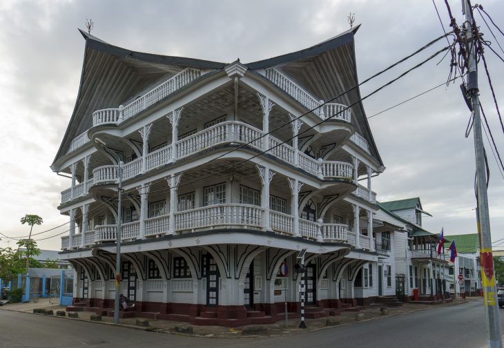
Paramaribo, the capital city of Suriname, is located on the northern coast of South America along the Suriname River, near the Atlantic Ocean. It serves as the political, cultural, and economic center of the country. With its rich history, colonial architecture, and multicultural population, Paramaribo has become one of the most interesting and dynamic cities in the region.
Suriname, a former Dutch colony, has preserved much of its colonial charm, particularly in Paramaribo, where remnants of its colonial past can still be found in the city’s Dutch-influenced architecture. The city itself has grown from a small port town into the heart of Suriname’s economy and government.
Paramaribo has a population of approximately 250,000 people, making it the largest city in Suriname and home to about one-quarter of the country’s total population. The city is also famous for its multiculturalism, as it is home to a diverse blend of ethnic groups, including Hindustani, Creole, Javanese, Maroon, and indigenous peoples. The combination of cultures has influenced the city’s food, language, music, and festivals, making it an exciting place to visit.
City Facts:
- Area: 182 km² (70.3 sq mi)
- Population: Approximately 250,000 (2023 estimate)
- Time Zone: Suriname Time (SRT), UTC -3
- Highest Mountain: Juliana Top, located in the Wilhelmina Mountains, with an elevation of 1,280 meters (4,199 feet).
- Longest River: The Suriname River, which flows approximately 480 km (298 miles) from the central highlands of the country to the Atlantic Ocean at Paramaribo.
Major Landmarks in Paramaribo
- Fort Zeelandia
One of the most iconic landmarks in Paramaribo is Fort Zeelandia, a 17th-century fort built by the Dutch West India Company. Originally constructed to protect the colony’s interests, the fort has since been converted into a museum showcasing the history of Suriname. Visitors can learn about the colonial era, the struggles for independence, and the diverse cultural influences that have shaped the nation. The fort is located at the mouth of the Suriname River, offering a stunning view of the river and surrounding landscape. - Saint Peter & Paul Cathedral
Another prominent landmark is the Saint Peter and Paul Cathedral, a Roman Catholic church that is the largest wooden structure in the Western Hemisphere. Built in the 19th century, the cathedral is renowned for its beautiful interior, including stained glass windows and a tall wooden spire. It serves as an important religious and cultural center for the people of Paramaribo and is an architectural treasure. - Palace of the President
The Palace of the President is a key government building in Paramaribo, serving as the residence of the President of Suriname. Built during the Dutch colonial period, the palace stands as a symbol of the country’s political heritage. Visitors can see the grand exterior, with its large columns and wide staircases, and explore the area around the palace to get a feel for Suriname’s colonial past. - Central Market (Centraal Markt)
The Central Market in Paramaribo is a bustling place where locals and tourists alike can find fresh produce, spices, handicrafts, and other goods. The market is located in the heart of the city and is a vibrant expression of Suriname’s diverse cultural heritage, with vendors selling goods that reflect the ethnic diversity of the country. It’s also a great place to sample local cuisine and experience the unique flavors of Surinamese food. - Neotropical Museum
The Neotropical Museum in Paramaribo offers a fascinating look at the region’s biodiversity, focusing on the tropical plants, animals, and ecosystems found in Suriname. The museum is particularly valuable for understanding Suriname’s rich rainforests and the importance of conservation in the country.
Climate Overview
Paramaribo experiences a tropical rainforest climate, characterized by high humidity, consistent rainfall throughout the year, and temperatures that remain relatively constant. The average temperature in the city is about 28°C (82°F) year-round. The rainy season lasts from December to July, with the wettest months occurring from April to July. December to March is the dry season, although rain showers can still occur sporadically.
Suriname’s tropical climate supports dense rainforests and an incredible variety of wildlife, including birds, reptiles, and primates. The climate also makes it ideal for growing crops like rice, bananas, and tropical fruits.
Monthly Climate Data (Paramaribo)
| Month | Average Temperature (°C) | Precipitation (mm) | Sunny Days |
|---|---|---|---|
| January | 28°C | 229 mm | 8 |
| February | 28°C | 198 mm | 9 |
| March | 28°C | 180 mm | 10 |
| April | 28°C | 241 mm | 7 |
| May | 28°C | 269 mm | 5 |
| June | 28°C | 294 mm | 4 |
| July | 28°C | 283 mm | 5 |
| August | 28°C | 254 mm | 6 |
| September | 28°C | 237 mm | 7 |
| October | 28°C | 211 mm | 8 |
| November | 28°C | 252 mm | 7 |
| December | 28°C | 233 mm | 8 |
Other Cities as Capital in Suriname’s History
1. Batavia (Pre-colonial Period)
Before Suriname became a colony of the Dutch in the 17th century, the region was inhabited by indigenous tribes. During this early period, there was no formal capital, but trading posts along the Suriname River were important centers for commerce. Batavia, a former colonial outpost, was one such location, though it is no longer recognized as a major historical capital.
2. Paramaribo (Colonial Capital – 1667 to Present)
After the Dutch West India Company took control of Suriname in 1667, Paramaribo was established as the colony’s administrative capital. It has remained the capital of Suriname even after the country gained independence in 1975. The city’s colonial architecture and fortifications still reflect its historic role in the colonial era.
Country Facts
Suriname is a small, diverse country located on the northern coast of South America. It is bordered by French Guiana to the east, Brazil to the south, and Guyana to the west, with the Atlantic Ocean to the north. Suriname is the smallest country in South America by land area, but its lush rainforests, rich biodiversity, and diverse population make it unique among its neighbors.
Key Country Facts:
- Population: Approximately 618,000 (2023 estimate)
- Area: 163,820 km² (63,251 square miles)
- Largest City: Paramaribo
- Currency: Surinamese Dollar (SRD)
- Official Language: Dutch (the only Dutch-speaking country in South America)
- ISO Country Codes: SR (Alpha-2), SUR (Alpha-3)
- Government: Presidential Republic
- Capital: Paramaribo
- Independence: Suriname gained its independence from the Netherlands on November 25, 1975.
Suriname’s rich natural resources, including gold, bauxite, oil, and timber, make it an important player in the global economy. Its tropical rainforests and wetlands are a significant part of the global carbon cycle and host incredible biodiversity. Suriname’s ethnic diversity is another key feature, with communities of Creoles, East Indians, Javanese, Indigenous people, and Chinese contributing to the country’s cultural mosaic. Suriname continues to be an important cultural and ecological hub in South America, balancing modernization with its cultural heritage.


