Florida Counties. List Alphabetically (and by Population)
How many counties are there in Florida? As of 2024, there are a total of 67 counties in the state of Florida. Among them, Escambia County is the oldest one (established in 1821) while Gilchrist County is the youngest (established in 1925). With population of 2,662,874, Miami-Dade County is the most populated. The biggest county by land area is Palm Beach County (5,268 km²) and the smallest is Union County (622 km²).
Largest Counties in Florida
1. Palm Beach County
County Seat: West Palm Beach
- Area: 2,034 square miles
- Population: Approximately 1,492,191 (2020 census)
- Area Codes: 561
- Latitude: 26.7153° N
- Longitude: 80.0534° W
Location and History
Palm Beach County is the largest county by area in Florida, located in the southeastern part of the state along the Atlantic coast. Established in 1909, the county was named after the lush palm trees and beaches that characterize its coastline. West Palm Beach, the county seat, is one of the oldest cities in South Florida, founded in 1894 as a resort destination by Henry Flagler, a key figure in the development of Florida’s east coast. The county’s economy has historically been driven by tourism, real estate, and agriculture, with a particular focus on sugarcane, citrus, and nursery plants.
Major Highways and Landmarks
Palm Beach County is served by several major highways, including Interstate 95, which runs north-south along the coast, and Florida’s Turnpike, which provides an alternative route through the county’s interior. U.S. Route 1 also runs parallel to the coast. Significant landmarks include the Henry Morrison Flagler Museum, a Gilded Age mansion in Palm Beach, and the Norton Museum of Art in West Palm Beach, which houses an impressive collection of American, European, and Chinese art. The county is also home to the Everglades Agricultural Area, which provides a glimpse into the region’s rich agricultural heritage. Additionally, Palm Beach’s luxurious resorts and pristine beaches continue to attract visitors from around the world.
2. Collier County
County Seat: Naples
- Area: 2,026 square miles
- Population: Approximately 375,752 (2020 census)
- Area Codes: 239
- Latitude: 26.1420° N
- Longitude: 81.7948° W
Location and History
Collier County is located in southwestern Florida, bordering the Gulf of Mexico to the west and the Everglades to the east. Established in 1923, it was named after Barron Collier, a prominent landowner and developer who played a key role in the construction of the Tamiami Trail, which connects Tampa to Miami through the Everglades. Naples, the county seat, developed as a resort destination in the late 19th century and has since grown into a thriving community known for its high quality of life, upscale shopping, and beautiful beaches.
Major Highways and Landmarks
Collier County is accessible via Interstate 75, which runs through the county and connects it to the rest of Florida. The Tamiami Trail (U.S. Route 41) is another significant highway, providing a scenic route through the Everglades. Key landmarks include the Corkscrew Swamp Sanctuary, a vital wildlife refuge that offers visitors a chance to explore a pristine cypress forest, and the Naples Pier, a historic site and popular spot for fishing and sunset views. The county also boasts portions of the Everglades National Park and the Big Cypress National Preserve, which provide opportunities for outdoor recreation and wildlife observation. The luxurious resorts, golf courses, and cultural attractions of Naples make it a prime destination for both residents and tourists.
3. Miami-Dade County
County Seat: Miami
- Area: 2,431 square miles
- Population: Approximately 2,701,767 (2020 census)
- Area Codes: 305, 786
- Latitude: 25.7617° N
- Longitude: 80.1918° W
Location and History
Miami-Dade County is located in southeastern Florida and is the most populous county in the state. Established in 1836, it was originally named Dade County in honor of Major Francis L. Dade, a soldier killed during the Second Seminole War. The county was renamed Miami-Dade in 1997 to reflect the prominence of Miami, its largest city and economic hub. Miami-Dade County has a rich and diverse cultural history, heavily influenced by its proximity to the Caribbean and Latin America. Miami, founded in 1896, has grown into an international metropolis known for its vibrant arts scene, multicultural population, and role as a global gateway for trade and tourism.
Major Highways and Landmarks
Miami-Dade County is served by several major highways, including Interstate 95, which runs north-south along the coast, and U.S. Route 1, which extends to the Florida Keys. The Palmetto Expressway (State Road 826) and the Dolphin Expressway (State Road 836) are key arteries within the county. Notable landmarks include the Art Deco Historic District in Miami Beach, the vibrant neighborhoods of Little Havana and Wynwood, and the historic Vizcaya Museum and Gardens. The county is also home to the Port of Miami, one of the busiest cruise ports in the world, and Miami International Airport, a major hub for international travel. The Everglades National Park, a UNESCO World Heritage site, occupies a significant portion of the county’s western area, offering unique opportunities for eco-tourism.
4. Polk County
County Seat: Bartow
- Area: 2,011 square miles
- Population: Approximately 725,046 (2020 census)
- Area Codes: 863
- Latitude: 27.8942° N
- Longitude: 81.8432° W
Location and History
Polk County is located in central Florida, between Tampa and Orlando. It was established in 1861 and named after James K. Polk, the 11th President of the United States. The county seat, Bartow, was founded in 1851 and became a significant center for the citrus and phosphate mining industries, both of which remain important to the local economy today. Polk County’s location in the heart of the state has made it a key agricultural area, particularly for citrus production. The county is also known for its historic sites and natural beauty, including numerous lakes and parks.
Major Highways and Landmarks
Polk County is traversed by major highways such as Interstate 4, which connects the county to both Tampa and Orlando, and U.S. Route 27, which runs north-south through the center of the county. State Road 60 also provides an important east-west route. Significant landmarks include the Bok Tower Gardens, a historic site and botanical garden located on one of Florida’s highest points, and the Fantasy of Flight aviation museum, which showcases vintage aircraft. The county is also home to Legoland Florida Resort, a major theme park that attracts visitors from around the world. Lake Wales, with its charming historic district and natural beauty, is another key destination within the county.
5. Hillsborough County
County Seat: Tampa
- Area: 1,266 square miles
- Population: Approximately 1,459,762 (2020 census)
- Area Codes: 813, 656
- Latitude: 27.9506° N
- Longitude: 82.4572° W
Location and History
Hillsborough County is located on the west coast of Florida, bordering the Gulf of Mexico. Established in 1834, the county was named after Wills Hill, the Earl of Hillsborough and a British colonial official. Tampa, the county seat, is one of the largest cities in Florida and has a rich history dating back to the Spanish colonial period. The county’s economy has historically been based on shipping, agriculture, and tourism, with Tampa’s port playing a significant role in its development. Today, Hillsborough County is known for its cultural diversity, vibrant arts scene, and economic growth.
Major Highways and Landmarks
Hillsborough County is served by several major highways, including Interstate 4, which connects Tampa to Orlando, and Interstate 75, which runs north-south along the county’s eastern edge. U.S. Route 41 and State Road 60 are also important routes. Key landmarks include Busch Gardens Tampa Bay, a popular theme park known for its roller coasters and animal exhibits, and the historic Ybor City neighborhood, which was once the cigar-making capital of the world and is now a lively entertainment district. The Tampa Riverwalk, a scenic promenade along the Hillsborough River, is another significant attraction. The county is also home to the University of South Florida, a major research university, and Raymond James Stadium, the home of the Tampa Bay Buccaneers.
6. Lake County
County Seat: Tavares
- Area: 1,157 square miles
- Population: Approximately 383,956 (2020 census)
- Area Codes: 352
- Latitude: 28.8006° N
- Longitude: 81.7455° W
Location and History
Lake County is located in central Florida, northwest of Orlando. Established in 1887, the county was named for its many lakes, with more than 1,400 bodies of water within its borders. Tavares, the county seat, was founded in 1880 and promoted as the “Venice of America” due to its network of canals and waterways. The county’s history is closely tied to agriculture, particularly citrus growing, and tourism, thanks to its proximity to Orlando’s attractions. In recent years, Lake County has experienced significant growth as a bedroom community for the Orlando metropolitan area.
Major Highways and Landmarks
Lake County is traversed by U.S. Route 27, which runs north-south through the county, and U.S. Route 441, which provides an east-west connection. State Road 50 is another key route. Notable landmarks include the Clermont Chain of Lakes, which offers excellent opportunities for fishing, boating, and water sports, and the historic Mount Dora, a charming town known for its antiques shops, festivals, and Victorian architecture. The county is also home to the Lake Apopka Wildlife Drive, a popular spot for birdwatching and wildlife photography. Additionally, the Lakeridge Winery & Vineyards, Florida’s largest winery, is located in the county and offers tours and tastings.
7. Brevard County
County Seat: Titusville
- Area: 1,557 square miles
- Population: Approximately 606,612 (2020 census)
- Area Codes: 321, 772
- Latitude: 28.6122° N
- Longitude: 80.8076° W
Location and History
Brevard County, known as the “Space Coast,” is located on Florida’s east coast, along the Atlantic Ocean. It was established in 1844 and named after Judge Theodore W. Brevard, an early settler and state comptroller. The county’s history is closely tied to the space industry, with NASA’s Kennedy Space Center and Cape Canaveral Air Force Station located on Merritt Island. These sites have played a central role in America’s space exploration efforts, including the Apollo moon landings and Space Shuttle program. The county seat, Titusville, developed as a support community for the space industry and is known for its proximity to these historic sites.
Major Highways and Landmarks
Brevard County is served by Interstate 95, which runs north-south through the county, and U.S. Route 1, which parallels the coast. State Route A1A runs along the barrier islands, providing access to the county’s beaches. Key landmarks include the Kennedy Space Center Visitor Complex, where visitors can learn about the history of space exploration and see actual spacecraft. The Canaveral National Seashore, a protected area with pristine beaches and diverse wildlife, is another significant attraction. The county is also home to the Brevard Zoo, which offers unique experiences such as kayaking through animal exhibits. Additionally, the Indian River Lagoon, one of the most biodiverse estuaries in North America, is a focal point for outdoor recreation and environmental conservation.
8. Volusia County
County Seat: DeLand
- Area: 1,432 square miles
- Population: Approximately 553,543 (2020 census)
- Area Codes: 386
- Latitude: 29.0283° N
- Longitude: 81.3031° W
Location and History
Volusia County is located in east-central Florida, stretching from the Atlantic coast to the St. Johns River. The county was established in 1854, and its name is believed to derive from a French or Spanish word, although its exact origin is unclear. DeLand, the county seat, was founded in 1876 by Henry Addison DeLand, a New York entrepreneur, and is home to Stetson University, the state’s oldest private college. Volusia County is known for its blend of urban and natural environments, with Daytona Beach on the coast being a world-famous destination for motorsports and beachgoers.
Major Highways and Landmarks
Volusia County is traversed by Interstate 95, which runs north-south along the coast, and Interstate 4, which connects the county to Orlando. U.S. Route 1 and State Route A1A are also important coastal highways. Significant landmarks include Daytona International Speedway, home of the Daytona 500, one of the most prestigious races in NASCAR. The county is also known for its beautiful beaches, particularly in Daytona Beach and New Smyrna Beach, which are popular destinations for surfing and sunbathing. The Ponce de Leon Inlet Lighthouse, the tallest lighthouse in Florida, offers panoramic views of the coastline. The historic district of DeLand, with its well-preserved architecture and cultural institutions, reflects the county’s rich heritage.
9. Osceola County
County Seat: Kissimmee
- Area: 1,506 square miles
- Population: Approximately 388,656 (2020 census)
- Area Codes: 407, 321
- Latitude: 28.2920° N
- Longitude: 81.4076° W
Location and History
Osceola County is located in central Florida, south of Orlando. It was established in 1887 and named after Osceola, a famous Seminole leader who resisted removal from Florida in the 19th century. The county seat, Kissimmee, developed as a hub for the cattle industry in the late 19th century and later grew into a major tourist destination due to its proximity to Walt Disney World Resort and other Orlando attractions. The county has seen rapid growth in recent decades, driven by the expansion of tourism, residential development, and service industries.
Major Highways and Landmarks
Osceola County is served by major highways such as Interstate 4, which runs through the northern part of the county, and Florida’s Turnpike, which provides a direct route to Miami. U.S. Route 192 is another key highway, running east-west through Kissimmee and providing access to Walt Disney World Resort. Key landmarks include the Old Town in Kissimmee, a popular entertainment complex with shops, restaurants, and classic car shows. The county is also home to Lake Tohopekaliga, known for its excellent bass fishing, and the Osceola County Historical Society, which operates a museum and pioneer village showcasing the area’s history. The county’s natural areas, such as Shingle Creek Regional Park, offer opportunities for kayaking, hiking, and wildlife observation.
10. Orange County
County Seat: Orlando
- Area: 1,003 square miles
- Population: Approximately 1,429,908 (2020 census)
- Area Codes: 407, 689, 321
- Latitude: 28.5383° N
- Longitude: 81.3792° W
Location and History
Orange County is located in central Florida and is home to Orlando, one of the most visited cities in the world. The county was established in 1824 and originally named Mosquito County, but was renamed Orange County in 1845 after Florida became a state, reflecting the region’s thriving citrus industry. Orlando, the county seat, was a small citrus town until the arrival of Walt Disney World in 1971, which transformed the area into a global tourism and entertainment hub. Today, Orange County is known for its world-class theme parks, vibrant economy, and diverse population.
Major Highways and Landmarks
Orange County is served by several major highways, including Interstate 4, which runs through the county and connects it to Tampa and Daytona Beach, and State Road 528 (the Beachline Expressway), which provides access to the Orlando International Airport and the Space Coast. U.S. Route 441 and State Road 408 are also important routes. Key landmarks include Walt Disney World Resort, the most famous theme park in the world, and Universal Orlando Resort, home to attractions like The Wizarding World of Harry Potter. The Orange County Convention Center, one of the largest convention centers in the United States, hosts numerous events and conferences throughout the year. The county is also home to Lake Eola Park in downtown Orlando, a popular spot for outdoor activities and community events, and the Dr. Phillips Center for the Performing Arts, a major cultural venue in the region.
List of All Counties in Florida Alphabetically
Below please see all Florida counties which are listed in alphabetical order.
- Alachua County, FL
- Baker County, FL
- Bay County, FL
- Bradford County, FL
- Brevard County, FL
- Broward County, FL
- Calhoun County, FL
- Charlotte County, FL
- Citrus County, FL
- Clay County, FL
- Collier County, FL
- Columbia County, FL
- DeSoto County, FL
- Dixie County, FL
- Duval County, FL
- Escambia County, FL
- Flagler County, FL
- Franklin County, FL
- Gadsden County, FL
- Gilchrist County, FL
- Glades County, FL
- Gulf County, FL
- Hamilton County, FL
- Hardee County, FL
- Hendry County, FL
- Hernando County, FL
- Highlands County, FL
- Hillsborough County, FL
- Holmes County, FL
- Indian River County, FL
- Jackson County, FL
- Jefferson County, FL
- Lafayette County, FL
- Lake County, FL
- Lee County, FL
- Leon County, FL
- Levy County, FL
- Liberty County, FL
- Madison County, FL
- Manatee County, FL
- Marion County, FL
- Martin County, FL
- Miami-Dade County, FL
- Monroe County, FL
- Nassau County, FL
- Okaloosa County, FL
- Okeechobee County, FL
- Orange County, FL
- Osceola County, FL
- Palm Beach County, FL
- Pasco County, FL
- Pinellas County, FL
- Polk County, FL
- Putnam County, FL
- Saint Johns County, FL
- Saint Lucie County, FL
- Santa Rosa County, FL
- Sarasota County, FL
- Seminole County, FL
- Sumter County, FL
- Suwannee County, FL
- Taylor County, FL
- Union County, FL
- Volusia County, FL
- Wakulla County, FL
- Walton County, FL
- Washington County, FL
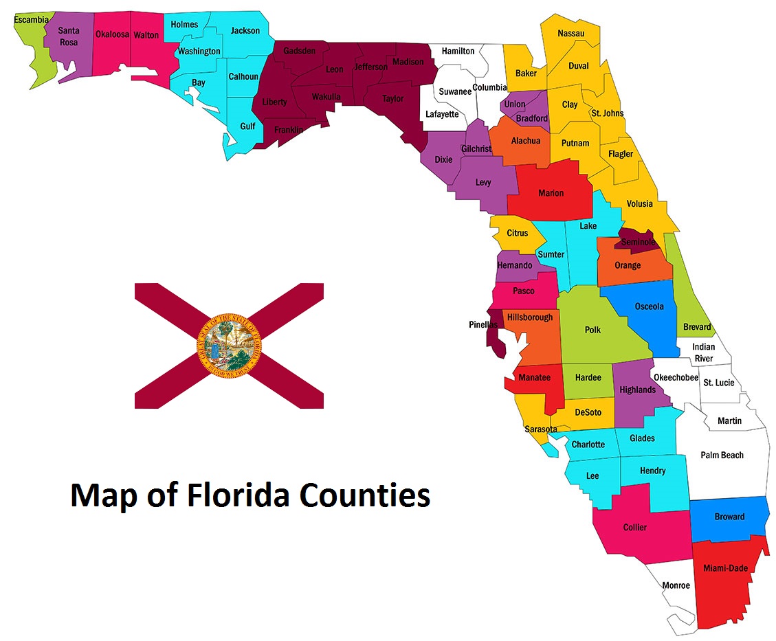
Map of Florida Counties