Algeria Facts
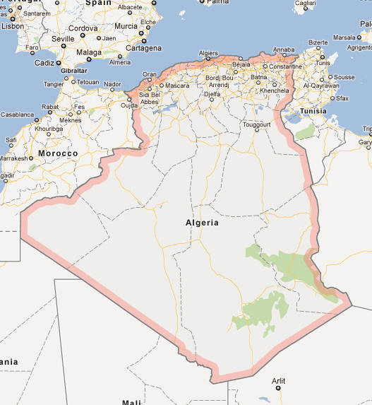
Algeria, Republic of North Africa; 2.4 million km², 42.2 million residents (2019).Algeria borders in the east to Tunisia and Libya, in the southeast to Niger, in the southwest to Mali and Mauritania and in the west to Western Sahara and Morocco and to the north coast to the Mediterranean. The capital is Alger (2.2 million residents, 2010).

Country facts
- Official Name: al-Jumhūrīya al-Jazā’irīya ad-Dīmuqrātiyah / Democratic People’s Republic of Algeria
- Country abbreviation: DZ
- Area: 2 400 000 km²
- Population (2019): 42.2 million residents
- Capital: Algiers
- Main language: Arabic
- State: Republic
- Head of State: Abdelmadjid Tebboune (President)
- Head of Government: Noureddine Bedoui
- Per capita GDP (2018): US $ 4,279
- GNI per capita (2018): US $ 4,060
- Currency unit: 1 dinar = 100 centimes
- Currency code: DZD
- Country number (telephony): 213
- Internet domain name: dz
- Time difference compared to Sweden: 0
- National Day: November 1 (Revolution, 1954)
- Independence Day: July 5, 1962
Nature
- Land use: forest (1.6%), agricultural land (3.4%), other (mainly desert, 95%)
- Highest mountain: Tahat (2,918 m above sea level)
Population
- Population density (2019): 18 residents per km²
- Natural population growth (2019): 2.0%; birthrate 25 ‰, death count 5 ‰
- Age structure (2019): 0-14 years (30%), 15-64 years (64%), 65- (6%)
- Life expectancy (2019): men 77 years, women 78 years
- Infant mortality (2019): 21 per 1,000 live births
- Population forecast 2050: 61 million residents
- HDI (2017): 0.754 (place 85 of 188)
- Urbanization rate (2019): 73%
- Most populous cities (2010): Algiers (2.2 million residents), Oran (678,300 residents), Constantine (460,100)
Business
- Industry’s contribution to GDP (2017): agriculture (13%), industry (39%), service (48%)
- Exports (2017): US $ 34 370 million
- Main export products: oil, natural gas, oil products
- Main exporting countries: Italy, Spain, France
- Imports (2017): US $ 48,540 million
- Main import products: capital goods, food
- Main importing countries: China, France, Italy
- Railway network (2014): 3,970 km
Geography
Location and Borders
Algeria is situated in the Maghreb region of North Africa, bordered by Tunisia and Libya to the northeast, Niger to the southeast, Mali and Mauritania to the southwest, Western Sahara to the west, and Morocco to the northwest. To the north, it has a lengthy coastline along the Mediterranean Sea, stretching approximately 1,200 kilometers (750 miles). Algeria spans an area of about 2.38 million square kilometers (919,595 square miles), making it the tenth-largest country in the world and the largest in Africa.
Topography and Natural Features
Algeria’s topography is marked by significant diversity, ranging from the towering peaks of the Atlas Mountains to the expansive Sahara Desert. The northern region is characterized by fertile coastal plains and rolling hills, which are part of the Tell Atlas mountain range. Moving southward, the landscape transitions into the vast and arid Sahara Desert, covering approximately 80% of the country’s total area. The Hoggar Mountains in the central Sahara are notable for their dramatic scenery and unique geological formations, including volcanic peaks and deep canyons.
One of Algeria’s most prominent natural features is the Chott el Djerid, a large salt flat in the southeast, which plays a crucial role in the region’s hydrology and climate. The country is also home to several significant rivers, including the Chelif River, the longest in Algeria, which flows through the fertile Mitidja plain before emptying into the Mediterranean Sea. Additionally, Algeria possesses numerous oases, particularly in the Sahara, which have historically supported agricultural activities and human settlements.
Flora and Fauna
Despite the harsh conditions of the Sahara, Algeria supports a surprising array of flora and fauna. The northern coastal regions are lush with Mediterranean vegetation, including olive trees, citrus orchards, and diverse shrublands. The Tell Atlas and Hautes Plaines are home to forests dominated by oak, cedar, and pine species, providing habitats for various wildlife such as the Barbary macaque, wild boar, and numerous bird species.
In contrast, the Sahara Desert hosts specialized plant and animal life adapted to extreme aridity. Vegetation includes hardy shrubs, grasses, and succulents like the date palm, which thrives in oases. The desert is inhabited by animals such as the fennec fox, dromedary camels, and the elusive Saharan silver antelope. Migratory birds also traverse Algeria, taking advantage of its diverse ecosystems as stopover points.
Climate
General Climate Overview
Algeria experiences a predominantly arid and semi-arid climate, with significant variations across its vast territory. The northern coastal areas enjoy a Mediterranean climate, characterized by mild, wet winters and hot, dry summers. In contrast, the interior regions, particularly the Sahara Desert, endure extreme heat and aridity, with minimal rainfall and vast temperature fluctuations between day and night.
Seasonal Variations
Spring: Spring in Algeria brings gradually warming temperatures and the onset of the rainy season in the north. This season is marked by blooming vegetation and increased agricultural activities, especially in the fertile plains and valleys. The Sahara region remains largely dry, with sporadic sandstorms occasionally affecting visibility and transportation.
Summer: Summers are intensely hot, particularly in the desert areas where temperatures can soar above 50°C (122°F). Coastal regions experience high temperatures tempered by sea breezes, making them more habitable despite the heat. The scarcity of rainfall during summer contributes to drought conditions, impacting water resources and agriculture.
Autumn: Autumn sees a gradual cooling of temperatures and the retreat of the hot season. Rainfall increases slightly in the northern regions, providing much-needed moisture for crops and replenishing water sources. The desert remains arid, though cooler nights begin to emerge, offering some respite from the daytime heat.
Winter: Winters are mild in the coastal areas, with temperatures rarely dropping below freezing. The Tell Atlas and Hautes Plaines experience cooler temperatures and more substantial rainfall, which supports winter agriculture. In the Sahara, winters are cold, especially at night, with temperatures sometimes dropping near or below freezing.
Extreme Weather and Natural Hazards
Algeria is susceptible to various extreme weather events and natural hazards. Sandstorms and dust storms are common in the Sahara, affecting air quality and transportation. The country also faces periodic droughts, which can have severe implications for agriculture and water supply. Additionally, Algeria is located in a seismically active region, making it prone to earthquakes, particularly in the Tell Atlas and Hoggar Mountains. Volcanic activity is also present, though currently minimal, with the most notable volcanic features found in the Hoggar region.
People
Demographics
Algeria has a population of approximately 45 million people, making it the most populous country in the Arab world. The population is predominantly young, with a significant proportion under the age of 30. Urbanization is a notable trend, with major cities like Algiers, Oran, and Constantine experiencing rapid growth. However, a substantial portion of the population still resides in rural areas, particularly in the northern coastal regions and Saharan oases.
Language and Ethnicity
The official language of Algeria is Modern Standard Arabic, while Berber (Tamazight) is also recognized as a national language, reflecting the country’s indigenous heritage. French remains widely used in business, education, and government, a legacy of Algeria’s colonial past. The majority of the population identifies as Arab-Berber, with a small percentage of other ethnic groups, including Tuareg, Mozabite, and various Mediterranean communities. Islam is the predominant religion, with the vast majority of Algerians adhering to Sunni Islam, playing a central role in the cultural and social life of the country.
Education and Literacy
Education is highly valued in Algerian society, with a comprehensive education system that includes primary, secondary, and tertiary levels. The literacy rate is around 80%, with higher rates in urban areas compared to rural regions. Algeria has several prominent universities, including the University of Algiers and the University of Oran, which offer a wide range of academic programs and contribute to research and innovation. The government has implemented various reforms to improve educational access and quality, aiming to equip the youth with the skills necessary for a modern economy.
Health and Welfare
Algeria provides a universal healthcare system, funded by the government, ensuring that all citizens have access to medical services. The healthcare infrastructure includes hospitals, clinics, and specialized medical centers distributed throughout the country. While urban areas generally have better access to healthcare facilities, rural regions may face shortages of medical professionals and resources. The government continues to invest in healthcare improvements, focusing on enhancing service delivery, combating infectious diseases, and promoting public health initiatives.
Economy
Economic Overview
Algeria’s economy is heavily reliant on hydrocarbons, with oil and natural gas accounting for the majority of its GDP and export revenues. The country is one of the largest natural gas producers in Africa and a significant exporter to Europe. While the energy sector drives economic growth, Algeria has been striving to diversify its economy to reduce dependence on oil and gas. Efforts are being made to develop other sectors such as agriculture, manufacturing, and services, although challenges like bureaucratic inefficiencies and limited foreign investment persist.
Key Sectors
Hydrocarbons
The hydrocarbon sector is the backbone of Algeria’s economy, representing over 90% of export revenues and around 30% of GDP. The state-owned company Sonatrach is a major player in the exploration, production, and distribution of oil and natural gas. Algeria is a member of OPEC and plays a crucial role in the global energy market. Despite fluctuations in global oil prices, the sector remains a significant source of government revenue and employment.
Agriculture
Agriculture is an important sector, employing a significant portion of the population, particularly in rural areas. Key agricultural products include cereals (wheat and barley), olives, citrus fruits, dates, and livestock. The fertile coastal plains and irrigated oases support a variety of crops, contributing to both domestic food security and export markets. However, agriculture faces challenges such as water scarcity, outdated farming techniques, and vulnerability to climate change.
Manufacturing and Industry
Algeria’s manufacturing sector includes industries such as petrochemicals, food processing, textiles, and construction materials. The country has been working to develop its industrial base, with a focus on value-added processing of hydrocarbons and the production of consumer goods. Industrial growth is supported by investments in infrastructure, including roads, ports, and energy facilities, although the sector remains underdeveloped compared to other regions.
Services
The services sector is growing, encompassing areas such as retail, banking, telecommunications, and tourism. Tourism, in particular, holds significant potential given Algeria’s rich historical sites, diverse landscapes, and Mediterranean coastline. Efforts to promote tourism include improving infrastructure, marketing the country’s cultural and natural attractions, and simplifying visa procedures. The digital economy is also emerging, with increasing internet penetration and the growth of information technology services.
Trade and Commerce
Algeria’s trade is dominated by energy exports, primarily to European countries such as Spain, Italy, and France. Imports include machinery, vehicles, pharmaceuticals, and consumer goods. The country is a member of various international organizations, including the World Trade Organization (WTO) and the African Union (AU), which facilitate trade relations and economic cooperation. Algeria has been exploring trade agreements with other nations to diversify its export base and reduce reliance on the European market.
Economic Challenges and Opportunities
Despite its wealth in natural resources, Algeria faces several economic challenges. High unemployment rates, particularly among youth, pose significant social and economic concerns. The economy’s dependence on hydrocarbons makes it vulnerable to global energy price fluctuations and economic downturns. Additionally, bureaucratic inefficiencies, corruption, and a lack of economic diversification hinder sustainable growth.
However, Algeria also has numerous opportunities for economic advancement. The government’s push for economic diversification opens avenues in sectors like renewable energy, agriculture, and tourism. Algeria’s strategic location offers potential as a logistics and trade hub connecting Africa with Europe and the Middle East. Investments in education, infrastructure, and technology can further enhance productivity and innovation, fostering a more resilient and diversified economy.
Government
Political System
Algeria is a semi-presidential republic with a multi-party system, characterized by a blend of executive and legislative powers. The President serves as the head of state, while the Prime Minister acts as the head of government. The political landscape has been shaped by a history of authoritarianism, particularly under the long rule of the National Liberation Front (FLN), though recent years have seen movements toward greater political openness and reforms.
Legislative Structure
The Algerian Parliament is bicameral, consisting of two chambers: the Council of the Nation (upper house) and the People’s National Assembly (lower house). Members of the People’s National Assembly are elected through a proportional representation system, serving five-year terms. The Council of the Nation is composed of representatives appointed by the President and elected by local assemblies, serving six-year terms. The Parliament is responsible for enacting laws, overseeing the government, and representing the interests of the populace.
Executive Branch
The executive branch is headed by the President, who is elected by popular vote for a five-year term and can be re-elected once. The President appoints the Prime Minister, who must secure the confidence of the Parliament. The government, led by the Prime Minister, is responsible for implementing laws, managing the economy, and overseeing public administration. The President also holds significant powers, including the ability to dissolve the Parliament, call for referendums, and appoint key officials.
Judicial System
Algeria’s judicial system is based on both French civil law and Islamic law principles. The system comprises various levels of courts, including local courts, appellate courts, and the Supreme Court, which is the highest judicial authority. Additionally, there is a Constitutional Council responsible for ensuring that laws comply with the constitution. Efforts to reform the judiciary aim to enhance its independence, reduce corruption, and improve the efficiency and transparency of legal proceedings.
International Relations
Algeria maintains an active role in international affairs, particularly within the African and Arab worlds. It is a member of the United Nations (UN), African Union (AU), Arab League, and the Non-Aligned Movement, among other organizations. Algeria plays a significant role in regional stability, particularly in addressing issues related to the Western Sahara conflict and counterterrorism efforts in the Sahel region. The country also seeks to strengthen economic ties with Europe, Asia, and other African nations through trade agreements and diplomatic initiatives.
Culture
Language and Literature
Arabic is the official language of Algeria, with Algerian Arabic being the most widely spoken dialect. Berber languages, such as Tamazight, are also recognized and spoken by indigenous communities. French remains prevalent in education, media, and business, serving as a lingua franca in many professional settings. Algerian literature is rich and diverse, reflecting the country’s complex history and cultural hybridity. Prominent writers like Assia Djebar and Kateb Yacine have gained international acclaim, exploring themes of identity, colonialism, and social change in their works.
Arts and Music
Algerian arts encompass a wide range of expressions, including visual arts, music, dance, and cinema. Traditional music genres like Rai, Chaabi, and Andalusian classical music are integral to Algerian cultural identity. Rai music, originating from the Oran region, blends traditional folk music with contemporary influences and has gained international popularity. Visual arts in Algeria often reflect the country’s social and political narratives, with artists using various mediums to express their perspectives and experiences.
Traditional Crafts and Handicrafts
Algeria has a rich tradition of craftsmanship, with artisans specializing in textiles, pottery, metalwork, and leather goods. Traditional crafts are often passed down through generations, preserving techniques and designs that reflect the country’s cultural heritage. For example, the intricate patterns of Algerian carpets and rugs are renowned for their beauty and craftsmanship. These handicrafts not only serve as cultural expressions but also contribute to the local economy through tourism and artisanal markets.
Cuisine
Algerian cuisine is a vibrant fusion of Mediterranean, Berber, Ottoman, and Arab influences, characterized by the use of fresh ingredients and aromatic spices. Staple foods include couscous, a versatile dish made from steamed semolina, and various stews such as tajine, which combines meat or fish with vegetables and spices. Traditional pastries like baklava and makroud showcase the country’s love for sweet, layered desserts. Olive oil, a key ingredient, is widely used in cooking, adding rich flavor to many dishes. Algerian cuisine also features a variety of breads, such as khobz, which is essential for daily meals.
Festivals and Celebrations
Algeria celebrates a range of cultural and religious festivals that highlight its diverse heritage. Religious holidays like Eid al-Fitr and Eid al-Adha are widely observed, featuring communal prayers, feasts, and family gatherings. National holidays, such as Independence Day on July 5th, commemorate Algeria’s liberation from French colonial rule and are marked by parades, speeches, and public celebrations. Additionally, cultural festivals like the International Festival of Rai Music in Oran and the National Book Fair in Algiers promote the arts and provide platforms for artists and writers to showcase their work.
Sports and Recreation
Sports play an important role in Algerian society, promoting physical fitness and national pride. Football is the most popular sport, with the national team achieving significant success, including winning the Africa Cup of Nations in 2019. Algerian clubs like JS Kabylie and ES Sétif are renowned in African and Arab football circles. Other popular sports include handball, basketball, and athletics. Traditional sports and recreational activities, such as wrestling and equestrian events, also hold cultural significance and are often featured in local festivals and competitions. The country’s diverse landscapes provide ample opportunities for outdoor activities like hiking, desert trekking, and water sports along the Mediterranean coast.
History
Ancient and Medieval Periods
Algeria’s history is deeply intertwined with the broader history of North Africa and the Mediterranean region. In antiquity, the area was inhabited by Berber tribes and later became part of the Phoenician and Carthaginian empires, with notable cities like Timgad and Djemila serving as important centers of trade and culture. Following the decline of Carthage, the region was incorporated into the Roman Empire, which left a lasting legacy through architectural and infrastructural developments.
After the fall of Rome, Algeria became part of the Byzantine Empire before experiencing a series of invasions by various groups, including the Vandals and the Byzantines again. In the 7th century, Arab Muslim armies conquered the region, leading to the spread of Islam and the Arabic language. The subsequent centuries saw the rise and fall of various dynasties, including the Almoravids and the Almohads, who established powerful states that influenced not only Algeria but also the broader Maghreb and Iberian Peninsula.
Ottoman Rule
In the 16th century, Algeria became part of the Ottoman Empire, marking a significant period in its history. The Ottomans established a system of governance through local rulers known as beys and pashas, integrating Algeria into the empire’s administrative and military structures. The capital, Algiers, became a prominent center for trade, piracy, and cultural exchange in the Mediterranean. Ottoman rule introduced new architectural styles, culinary influences, and administrative practices that have had a lasting impact on Algerian society.
French Colonization
The French conquest of Algeria began in 1830, leading to over a century of colonial rule that profoundly shaped the nation’s social, economic, and political landscape. French settlers, known as colons or pieds-noirs, established extensive agricultural and industrial enterprises, often displacing indigenous populations and leading to significant social tensions. The colonization period was marked by resistance movements and uprisings, as Algerians sought to assert their independence and cultural identity against French domination.
Struggle for Independence
The mid-20th century was a pivotal period for Algeria, marked by the intense struggle for independence from French rule. The Algerian War of Independence (1954-1962) was a brutal conflict characterized by guerrilla warfare, terrorism, and widespread atrocities on both sides. The National Liberation Front (FLN) emerged as the leading force in the fight for independence, galvanizing support through its commitment to self-determination and national sovereignty. The war concluded with the Evian Accords in 1962, granting Algeria its independence and ending 132 years of French colonial rule.
Post-Independence Era
Following independence, Algeria adopted a socialist-oriented economic model under the leadership of the FLN. The government nationalized key industries, particularly in the hydrocarbon sector, and implemented land reforms aimed at redistributing land to peasants. However, the post-independence period was also marked by political instability, economic challenges, and social upheaval. The one-party system dominated by the FLN faced growing discontent, leading to demands for political pluralism and economic diversification.
Civil Conflict and Modernization
The late 20th century saw Algeria grappling with significant internal conflict, most notably the Algerian Civil War (1991-2002). Triggered by the cancellation of elections that the Islamic Salvation Front (FIS) was poised to win, the conflict escalated into a brutal and protracted struggle between government forces and various Islamist rebel groups. The war resulted in the loss of hundreds of thousands of lives and left deep scars on Algerian society.
In the aftermath of the civil war, Algeria has focused on rebuilding and modernizing its economy and political institutions. Efforts to diversify the economy beyond hydrocarbons, improve infrastructure, and promote education and technological innovation have been central to national development strategies. Political reforms aimed at increasing transparency, reducing corruption, and fostering democratic governance have also been pursued, although challenges remain in ensuring lasting stability and inclusive growth.
Contemporary Algeria
Today, Algeria stands at a crossroads, balancing its rich historical legacy with the demands of a modern, globalized world. The nation continues to navigate complex regional dynamics, including its relationships with neighboring countries and its role in African and Arab geopolitics. Economic diversification efforts are ongoing, with particular emphasis on developing the renewable energy sector, enhancing agricultural productivity, and expanding the tourism industry.
Algeria’s political landscape remains dynamic, with ongoing debates about the direction of governance, economic policies, and social reforms. The country faces the challenge of addressing youth unemployment, promoting sustainable development, and ensuring equitable growth across its diverse regions. Despite these challenges, Algeria’s strategic importance, natural wealth, and vibrant culture position it as a key player in both regional and global contexts.
Algeria Map