Where is Algeria Located?
Where is Algeria located on the map? Algeria is an independent nation located in Northern Africa. Check out the following images to see location of Algeria on maps.
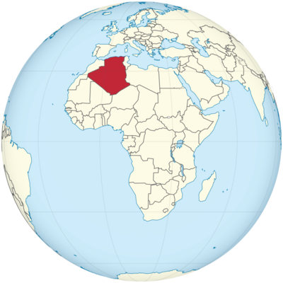
Algeria Location in World Map
Algeria is located in the northwest of Africa.
Location Information of Algeria
Latitude and Longitude
Algeria is the largest country in Africa, located in the northern part of the continent along the Mediterranean coast. The country stretches deep into the Sahara Desert and is bordered by Tunisia and Libya to the northeast, Niger to the southeast, Mali and Mauritania to the southwest, Western Sahara to the west, and the Mediterranean Sea to the north. The geographical coordinates of Algeria are:
- Latitude: 28.0339° N
- Longitude: 1.6596° E
These coordinates place Algeria in a strategic position at the crossroads between Africa and Europe, with its extensive coastline along the Mediterranean playing a significant role in its historical trade and cultural exchanges.
Capital City and Major Cities
- Capital City: AlgiersAlgiers is the capital and largest city of Algeria, situated on the Mediterranean coast. It is known for its unique combination of modern and historical architecture, with French colonial-era buildings alongside Ottoman and Moorish-style structures. Algiers is the political, economic, and cultural center of Algeria, with a bustling port and numerous cultural institutions, including museums, theaters, and universities. The city’s coastal location and its proximity to the Tell Atlas mountains make it a scenic and vibrant place.
- Major Cities:
- Oran – Located on the Mediterranean coast, Oran is Algeria’s second-largest city and an important port. Known for its rich history, Oran has a lively cultural scene, with a mix of Spanish, French, and Arab influences, and is famous for its music, particularly Rai.
- Constantine – Known as the “City of Bridges,” Constantine is situated in the northeast of Algeria. It is one of the oldest cities in the world, perched on a series of cliffs and connected by several striking bridges. Constantine has a rich history, with influences from the Romans, Byzantines, and Arabs.
- Annaba – Situated along the Mediterranean coast in the northeast, Annaba is an important port city known for its beautiful beaches and proximity to the ruins of the ancient Roman city of Hippo Regius.
- Blida – Located near the capital, Blida is surrounded by lush greenery and is known for its scenic beauty and agricultural importance. It is sometimes referred to as the “City of Roses” due to the abundance of roses grown in the area.
- Tlemcen – Located in the northwest of Algeria, Tlemcen is a historical city that was once an important center of the Almoravid and Almohad dynasties. It is famous for its stunning Moorish architecture and rich cultural heritage.
Time Zone
Algeria follows Central European Time (CET), which is UTC+1. The country does not observe daylight saving time, so the time remains the same throughout the year. Algeria is in the same time zone as several other European and North African countries, making it closely aligned with the time practices of Mediterranean nations.
Climate
Algeria has a diverse climate due to its vast size and varied geography, which includes coastal plains, mountainous regions, and expansive desert areas. The climate can be broadly divided into three main types:
- Mediterranean Climate: Along the coast, including cities like Algiers and Oran, Algeria experiences a Mediterranean climate, with hot, dry summers and mild, wet winters. Summer temperatures can reach 30–40°C (86–104°F), while winter temperatures are much cooler, generally between 10–15°C (50–59°F). Rainfall is concentrated in the winter months, especially between November and March.
- Semi-arid Climate: In the interior of Algeria, the climate transitions into a semi-arid type. The regions surrounding the Sahara desert experience hotter temperatures during the summer, but with much lower humidity. These areas can see temperatures exceeding 40°C (104°F) during the summer months and cooler winters.
- Desert Climate: The vast majority of Algeria, comprising the Sahara Desert in the south, experiences an arid desert climate. The temperatures in the Sahara can rise above 45°C (113°F) in the summer, with the daytime heat often being intense and unrelenting. The desert regions have very little rainfall, with the annual precipitation averaging below 100 mm in many areas. Winters in the desert can be cold, with nighttime temperatures sometimes dipping below freezing.
Due to the geographic variation, travelers can experience stark differences in climate depending on the region they visit, ranging from coastal breezes to the extreme heat of the desert.
Economic Status
Algeria’s economy is primarily based on hydrocarbons, with oil and natural gas accounting for a significant portion of the country’s revenues. The country is one of the largest oil producers in Africa and the leading natural gas exporter in the region. However, Algeria’s economy also faces challenges, including the need for diversification and the effects of fluctuating global oil prices.
- Hydrocarbons Sector: The oil and gas industry is the backbone of the Algerian economy, contributing to around 30% of the GDP and over 95% of exports. The country is a major exporter of natural gas, with its resources being vital to European countries. State-owned Sonatrach is the largest company in Algeria and one of the largest in Africa, responsible for the exploration, production, and export of oil and gas.
- Agriculture: Agriculture is another important sector, although it represents a much smaller portion of GDP compared to hydrocarbons. Algeria is a significant producer of crops such as wheat, barley, dates, and olives. The agricultural sector faces challenges due to water scarcity, desertification, and reliance on imported food products.
- Industry and Manufacturing: Algeria has been attempting to diversify its economy beyond hydrocarbons by investing in the industrial and manufacturing sectors. Industries such as cement, steel, and textiles have seen growth, but the sector remains underdeveloped compared to other nations. Algeria is working on improving its infrastructure, including transportation and energy distribution networks.
- Tourism: Although tourism in Algeria has great potential due to the country’s rich history, archaeological sites, and natural beauty, the sector has not been fully developed due to political instability and security concerns. Algeria has ancient Roman ruins, Ottoman architecture, and vast desert landscapes that could attract tourists, but the lack of infrastructure and security challenges have hindered the growth of this sector.
- Economic Challenges: Despite its natural wealth, Algeria faces several economic challenges. These include a dependence on oil and gas revenues, which makes the economy vulnerable to fluctuations in global oil prices. Unemployment, particularly among the youth, remains high, and the country is in need of structural reforms to diversify its economy and reduce reliance on hydrocarbons.
Tourist Attractions
Algeria is home to a wealth of historical and natural attractions, which reflect its diverse cultural influences and rich history. Some of the country’s top tourist destinations include:
- Algiers: The capital city offers a range of attractions, from the Casbah, a UNESCO World Heritage site, to the stunning Notre-Dame d’Afrique cathedral. Algiers also has many museums, including the National Museum of Fine Arts, and beautiful green spaces like the Jardin d’Essai.
- Tipasa: This ancient Roman city, located along the Mediterranean coast, is a UNESCO World Heritage site. Tipasa is famous for its well-preserved Roman ruins, including a theater, basilicas, and ancient baths. The site offers panoramic views of the sea and is one of the most significant archaeological sites in Algeria.
- Djemila: Another UNESCO World Heritage site, Djemila is a Roman city located in the northeast of Algeria. The ruins here are well-preserved, with ancient temples, houses, and mosaics. The site provides insight into Roman life and culture in North Africa.
- M’Zab Valley: Located in the Saharan region of Algeria, M’Zab Valley is a UNESCO World Heritage site known for its unique architecture and traditional Ibadite culture. The valley features ancient fortified cities built from mudbrick, offering a glimpse into the country’s rich Berber history.
- Sahara Desert: The Sahara is one of the most famous natural attractions in the world, and Algeria’s vast portion of the desert offers visitors an unparalleled experience. The stunning sand dunes, rocky plateaus, and oases provide a unique environment for adventure tourism, including camel treks, 4×4 expeditions, and stargazing.
- Ghardaïa: This oasis city in the M’Zab region is a UNESCO World Heritage site and a center for the Mozabite Berber culture. The city is known for its whitewashed buildings, narrow streets, and intricate architecture, and it has remained relatively unchanged for centuries.
- Tassili n’Ajjer National Park: Located in the southeastern part of Algeria, this UNESCO World Heritage site is known for its prehistoric rock art and unique landscapes. The park features ancient cave paintings that date back thousands of years, depicting scenes of early human life and wildlife in the region.
Visa Requirements for U.S. Citizens
U.S. citizens wishing to visit Algeria must obtain a visa before traveling. The visa application process is generally as follows:
- Visa Application Form: U.S. citizens must complete a visa application form, available through the Algerian embassy or consulate. The form requires basic personal information and travel details.
- Passport: A valid U.S. passport with at least six months of validity beyond the planned date of departure from Algeria is required.
- Visa Fee: There is a visa fee that varies depending on the type of visa (tourist, business, etc.) and the duration of stay.
- Invitation Letter: For certain visa types, such as business visas, an invitation letter from an Algerian sponsor or company may be required.
- Proof of Accommodation: Evidence of hotel reservations or other accommodation arrangements during the stay may be necessary.
- Travel Itinerary: U.S. travelers may need to provide a detailed travel itinerary, including entry and exit dates, and flight details.
Visa applications should be submitted to the Algerian embassy or consulate in the applicant’s country of residence. It is advisable to apply well in advance of travel, as processing times can vary.
Distance to Major U.S. Cities
The approximate air distances between Algeria and major U.S. cities are:
- Distance to New York City: The distance from Algiers to New York City is approximately 4,300 miles (6,920 kilometers). Flights typically take around 9 to 10 hours, depending on the route.
- Distance to Los Angeles: The distance from Algiers to Los Angeles is around 6,200 miles (9,977 kilometers). Flights to Los Angeles typically take about 11 to 12 hours with at least one layover.
These distances are estimates and can vary depending on the specific flight routes taken.
Algeria Facts
| Size | 2,381,741 km² |
| Residents | 42.22 million |
| Language | Arabic and Tamazight |
| Capital | Algiers |
| Longest river | Cheliff (725 km) |
| Highest mountain | Tahat (2,908 m) |
| Currency | dinar |


