Cities and Towns in Houston County, Georgia
Founded in 1821, Houston County is one of 159 counties in the state of Georgia. Historically, Houston County was formed from Creek Cession of 1821. The city of Perry is the county seat. With FIPS code of 153, Houston County has a population of 166,829 and area of 377 square miles (976 km²).
List of all cities in Houston County, GA alphabetically
| City/Town | Postal Code | Area Code |
| Bonaire, GA | 31005 | 478 |
| Centerville, GA | 31028 | 478 |
| 31088 | 478 | |
| 31093 | 478 | |
| Clinchfield, GA | 31013 | 478 |
| Elko, GA | 31025 | 478 |
| Kathleen, GA | 31047 | 478 |
| Perry, GA | 31069 | 478 |
| Robins Air Force Base, GA | 31098 | 478 |
| South Base, GA | 31098 | 478 |
| Warner Robins, GA | 31088 | 478 |
| 31093 | 478 | |
| 31095 | 478 | |
| 31098 | 478 | |
| 31099 | 478 |
Major Cities and Towns in Houston County, Georgia
Warner Robins
Area, Population, Zip Codes, Latitude and Longitude
- Area: 37.9 square miles
- Population: Approximately 80,000 (as of the 2020 census)
- Zip Codes: 31088, 31093, 31095, 31098
- Latitude and Longitude: 32.6130° N, 83.6242° W
Location and History
Warner Robins is the largest city in Houston County, Georgia, and one of the fastest-growing cities in the state. The city was established in 1942 and named after Brigadier General Augustine Warner Robins, a pioneer in aviation logistics. The creation of Robins Air Force Base during World War II was the catalyst for the city’s rapid growth, transforming it from a small rural community into a bustling hub of military and civilian activity. Today, Robins Air Force Base remains a central part of the city’s identity and economy, serving as a major employer and playing a key role in the local community. Warner Robins is known for its strong ties to the military, diverse population, and thriving economy.
Major Schools and Landmarks
Warner Robins is served by the Houston County School District, which includes several high schools such as Warner Robins High School, Northside High School, and Houston County High School. The city is home to several notable landmarks, including the Museum of Aviation, which is one of the largest aviation museums in the country and features exhibits on military aviation history. Other important sites include the Warner Robins Little Theatre and the International City Golf Club. The city also hosts annual events such as the Wings Over Warner Robins Air Show, which attracts visitors from across the region. Warner Robins’ combination of historical significance, educational resources, and community amenities make it the heart of Houston County.
Perry
Area, Population, Zip Codes, Latitude and Longitude
- Area: 26.4 square miles
- Population: Approximately 17,000 (as of the 2020 census)
- Zip Codes: 31069, 31088
- Latitude and Longitude: 32.4574° N, 83.7360° W
Location and History
Perry is the county seat of Houston County, Georgia, located in the central part of the state. The city was incorporated in 1824 and named after Commodore Oliver Hazard Perry, a hero of the War of 1812. Perry developed as a center for agriculture, particularly cotton, and became known for its charming downtown and historic homes. The city’s location along major transportation routes, including Interstate 75, has made it a hub for commerce and travel in Middle Georgia. Perry’s historic downtown area, with its quaint shops, restaurants, and antebellum architecture, reflects the city’s rich heritage and Southern charm.
Major Schools and Landmarks
Perry is served by the Houston County School District, which includes Perry High School, Perry Middle School, and Morningside Elementary School. The city is home to several significant landmarks, including the Houston County Courthouse, built in 1825, which is listed on the National Register of Historic Places. Another notable site is the Georgia National Fairgrounds & Agricenter, which hosts the annual Georgia National Fair, one of the state’s largest events, attracting visitors from all over Georgia. Perry also boasts several parks and recreational facilities, including Rozar Park and the Perry Arts Center, which hosts cultural events and performances. Perry’s blend of historical significance, educational institutions, and cultural attractions make it a vital part of Houston County.
Centerville
Area, Population, Zip Codes, Latitude and Longitude
- Area: 3.7 square miles
- Population: Approximately 8,000 (as of the 2020 census)
- Zip Codes: 31028
- Latitude and Longitude: 32.6304° N, 83.6821° W
Location and History
Centerville is a small city located in Houston County, Georgia, just north of Warner Robins. The city was incorporated in 1958, though its history dates back to the 19th century when it served as a rural farming community. Centerville’s name reflects its location at the center of several major roads in the area. Over the years, Centerville has grown steadily, largely due to its proximity to Warner Robins and Robins Air Force Base. The city is known for its suburban feel, well-maintained neighborhoods, and strong sense of community. Despite its growth, Centerville has managed to retain much of its small-town charm.
Major Schools and Landmarks
Centerville is served by the Houston County School District, with students attending schools in nearby Warner Robins, including Northside High School and Thomson Middle School. The city’s landmarks include several parks, such as Center Park at Centerville, which hosts community events and provides recreational facilities for residents. The Galleria Mall, located in Centerville, is a major shopping destination in the area. Centerville’s annual events, such as the Centerville Independence Day Celebration, bring the community together and highlight the city’s strong sense of tradition and pride. Centerville’s suburban appeal, educational resources, and community-focused atmosphere make it a key part of Houston County.
Bonaire
Area, Population, Zip Codes, Latitude and Longitude
- Area: N/A (Unincorporated community)
- Population: Approximately 15,000 (as of the 2020 census)
- Zip Codes: 31005
- Latitude and Longitude: 32.5432° N, 83.5966° W
Location and History
Bonaire is an unincorporated community located in Houston County, Georgia, just south of Warner Robins. The community was established in the late 19th century and developed as a small agricultural area. Bonaire remained largely rural until the expansion of Robins Air Force Base, which brought significant growth to the area. Today, Bonaire is a thriving suburban community known for its excellent schools, quiet neighborhoods, and proximity to Warner Robins. The community’s name, Bonaire, is derived from the French word for “good air,” reflecting the area’s pleasant climate.
Major Schools and Landmarks
Bonaire is served by the Houston County School District, which includes highly regarded schools such as Bonaire Primary School, Bonaire Middle School, and Veterans High School. The community is home to several parks and recreational facilities, including the popular Bonaire Sports Complex, which offers sports fields and walking trails. The nearby E.L. Greenway Welcome Center and the Ocmulgee River provide opportunities for outdoor activities such as hiking, fishing, and kayaking. Bonaire’s annual events, including school functions and community gatherings, foster a strong sense of community. Bonaire’s suburban growth, top-rated schools, and proximity to Warner Robins make it a desirable place to live in Houston County.
Robins Air Force Base
Area, Population, Zip Codes, Latitude and Longitude
- Area: 13.1 square miles
- Population: Approximately 1,200 (on-base personnel as of the 2020 census)
- Zip Codes: 31098
- Latitude and Longitude: 32.6089° N, 83.5914° W
Location and History
Robins Air Force Base is a major U.S. Air Force installation located in Houston County, Georgia, just southeast of Warner Robins. Established in 1941, the base was named after Brigadier General Augustine Warner Robins, a pioneer in aviation logistics. Robins AFB has played a crucial role in the defense of the United States, particularly during World War II, the Cold War, and into the present day. The base is home to the Air Force Materiel Command’s Warner Robins Air Logistics Complex, one of the largest industrial facilities in the state, providing maintenance, repair, and overhaul services for a variety of military aircraft. The presence of the base has had a profound impact on the growth and development of Warner Robins and the surrounding areas.
Major Schools and Landmarks
Robins Air Force Base is served by the Houston County School District, with many military families choosing to live in nearby Warner Robins and enroll their children in schools such as Warner Robins High School and Northside High School. The base itself is home to several important landmarks, including the Museum of Aviation, which offers extensive exhibits on military aviation history and aircraft. The base also provides a range of services and facilities for military personnel and their families, including recreational centers, fitness facilities, and on-base housing. Robins Air Force Base’s critical role in national defense, combined with its community-focused amenities, makes it a central part of Houston County.
Kathleen
Area, Population, Zip Codes, Latitude and Longitude
- Area: N/A (Unincorporated community)
- Population: Approximately 10,000 (as of the 2020 census)
- Zip Codes: 31047
- Latitude and Longitude: 32.4540° N, 83.6541° W
Location and History
Kathleen is an unincorporated community located in Houston County, Georgia, just south of Warner Robins and Bonaire. The community was named after Kathleen McKay, the daughter of a railroad official, and developed as a small rural settlement. Over the years, Kathleen has grown into a suburban area, attracting residents who seek a quiet lifestyle with easy access to the amenities of nearby Warner Robins. The expansion of Robins Air Force Base has also contributed to Kathleen’s growth, making it a popular residential area for military families.
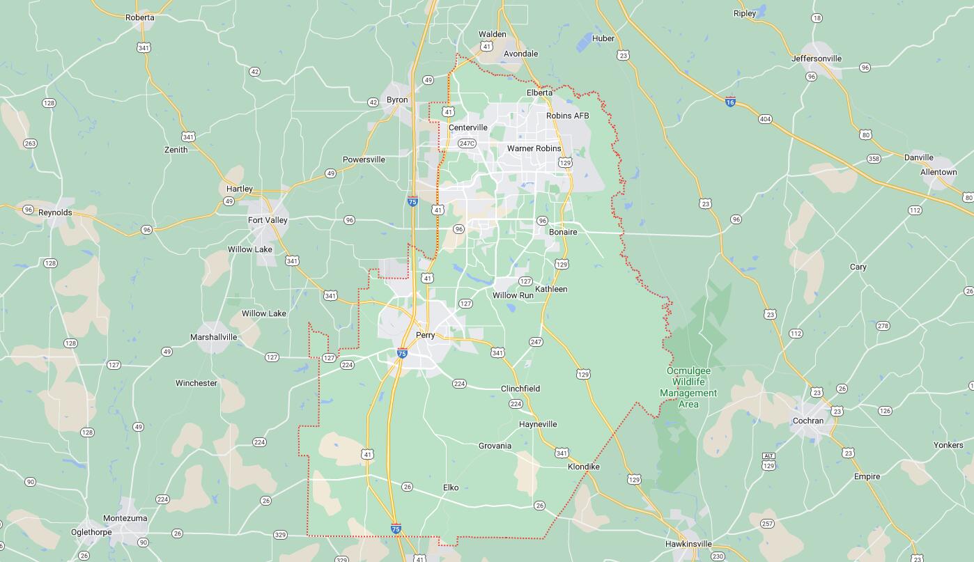
Map of Cities in Houston County, GA