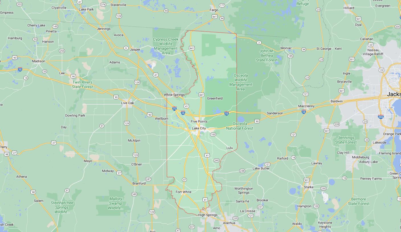
Cities and Towns in Columbia County, Florida
Founded in 1832, Columbia County is one of 67 counties in the state of Florida. Historically, Columbia County was formed from Alachua. The city of Lake City is the county seat. With FIPS code of 23, Columbia County has a population of 70,385 and area of 797 square miles (2,064 km²).
List of all cities in Columbia County, FL alphabetically
| City/Town | Postal Code | Area Code |
| Fort White, FL | 32038 | 386 |
| Lake Butler, FL | 32061 | 386 |
| Lake City, FL | 32024 | 386 |
| 32025 | 386 | |
| 32055 | 386 | |
| 32056 | 386 | |
| Lulu, FL | 32061 | 386 |
Major Cities and Towns in Columbia County, Florida
Lake City
Area, Population, Zip Codes, Latitude and Longitude
- Area: 12.4 square miles
- Population: Approximately 12,000 (as of the 2020 census)
- Zip Codes: 32024, 32025, 32055, 32056
- Latitude and Longitude: 30.1897° N, 82.6393° W
Location and History
Lake City is the county seat of Columbia County and is often referred to as the “Gateway to Florida” due to its strategic location at the crossroads of Interstate 10 and Interstate 75. Established in 1859, Lake City has a rich history that dates back to its early days as a Seminole War fort named Fort White. The city later became a key site during the Civil War, particularly during the Battle of Olustee, which took place nearby in 1864. Over the years, Lake City has evolved from a frontier settlement into a vibrant community that serves as a commercial and cultural hub for the surrounding rural areas. The city’s historic downtown features well-preserved architecture and serves as a reminder of its deep Southern roots.
Major Schools and Landmarks
Lake City is home to several major educational institutions, including Columbia High School, Lake City Middle School, and Florida Gateway College, a key provider of higher education in the region. The city is also known for its historical landmarks, such as the Lake City-Columbia County Historical Museum and the nearby Olustee Battlefield Historic State Park, which commemorates Florida’s largest Civil War battle. The city’s annual Olustee Battle Festival attracts visitors interested in Civil War history. Additionally, Lake DeSoto offers scenic beauty and recreational opportunities right in the heart of the city.
Fort White
Area, Population, Zip Codes, Latitude and Longitude
- Area: 2.3 square miles
- Population: Approximately 600 (as of the 2020 census)
- Zip Codes: 32038
- Latitude and Longitude: 29.9231° N, 82.7157° W
Location and History
Fort White is a small town located in the southern part of Columbia County, near the confluence of the Santa Fe and Ichetucknee Rivers. The town originated as a military fort during the Second Seminole War in 1836, serving as a protective outpost for settlers in the region. After the war, the community that developed around the fort retained the name Fort White. The town flourished in the late 19th and early 20th centuries as a result of the phosphate mining boom, which brought economic growth and an influx of settlers. However, as the mining industry declined, Fort White transitioned into a quiet rural community known for its proximity to natural springs and rivers.
Major Schools and Landmarks
Fort White is home to Fort White High School, which serves students from across the southern part of Columbia County. The town is also known for its proximity to several major natural landmarks, including the Ichetucknee Springs State Park, a popular destination for tubing, snorkeling, and wildlife viewing. The park draws visitors from across Florida, particularly during the summer months. The historic Fort White Public School building, now repurposed, stands as a testament to the town’s long history. Fort White’s rural charm and natural beauty make it an appealing destination for those seeking a quiet lifestyle close to nature.
Five Points
Area, Population, Zip Codes, Latitude and Longitude
- Area: 2.4 square miles
- Population: Approximately 1,300 (as of the 2020 census)
- Zip Codes: 32055
- Latitude and Longitude: 30.2152° N, 82.6490° W
Location and History
Five Points is a small, unincorporated community located just north of Lake City in Columbia County. The community is named for the intersection of five roads that converge at its center, making it a key crossroad in the region. Historically, Five Points has been a residential area with close ties to Lake City, providing a suburban-like environment for those who work in or near the city. Although small in size, Five Points has grown steadily over the years due to its proximity to major highways and the amenities of Lake City, making it a convenient location for commuters and families.
Major Schools and Landmarks
Residents of Five Points are served by schools in the Lake City area, including Summers Elementary School and Columbia High School. While the community itself does not have many landmarks, its proximity to Lake City’s attractions, such as the Lake City-Columbia County Historical Museum and the Olustee Battlefield Historic State Park, offers easy access to cultural and recreational activities. Additionally, Five Points is close to the Osceola National Forest, which provides opportunities for hiking, camping, and exploring Florida’s natural landscapes. The community’s blend of small-town charm and convenient access to larger city amenities makes it a desirable location for residents of Columbia County.
Map of Cities in Columbia County, FL