Cities and Towns in Tuscaloosa County, Alabama
Founded in 1818, Tuscaloosa County is the 6th biggest county by population (out of 67) in the state of Alabama. Historically, Tuscaloosa County was formed from Montgomery County and Choctaw territory. The city of Tuscaloosa is the County seat. With population density of 147.24 residents per square miles, Tuscaloosa County has a population of 194,656 and area of 1,321.75 square miles.
List of all cities and towns in Tuscaloosa County, Al
| City/Town | Postal Code | Area Code |
| Abernant, AL | 35440 | 205/659 |
| Brookwood, AL | 35444 | 205/659 |
| Buhl, AL | 35446 | 205/659 |
| Coaling, AL | 35449, 35453 | 205/659 |
| Coker, AL | 35452 | 205/659 |
| Cottondale, AL | 35453 | 205/659 |
| Duncanville, AL | 35456 | 205/659 |
| Eastside, AL | 35404 | 205/659 |
| Echola, AL | 35457 | 205/659 |
| Elrod, AL | 35458 | 205/659 |
| Fosters, AL | 35463 | 205/659 |
| Holt, AL | 35404 | 205/659 |
| Kellerman, AL | 35468 | 205/659 |
| Northport, AL | 35473, 35475, 35476 | 205/659 |
| Peterson, AL | 35478 | 205/659 |
| Ralph, AL | 35480 | 205/659 |
| Romulus, AL | 35446 | 205/659 |
| Samantha, AL | 35482 | 205/659 |
| Searles, AL | 35468 | 205/659 |
| Skyland, AL | 35405 | 205/659 |
| Tuscaloosa, AL | 35401, 35402, 35403, 35404, 35405, 35406, 35407, 35485, 35486, 35487 | 205/659 |
| University of Alabama, AL | 35487 | 205/659 |
| Vance, AL | 35490 | 205/659 |
| Veterans Hospital, AL | 35401 | 205/659 |
Major Cities and Towns in Tuscaloosa County, Alabama
Tuscaloosa
Area, Population, Zip Codes, Latitude, and Longitude
- Area: 72.0 square miles
- Population: 100,618 (as of the 2020 census)
- Zip Codes: 35401-35407, 35485, 35486, 35487
- Latitude: 33.2098° N
- Longitude: 87.5692° W
Location and History
Tuscaloosa is the county seat and largest city in Tuscaloosa County, located along the banks of the Black Warrior River in west-central Alabama. Founded in 1819 and named after the Choctaw chief Tuskaloosa, the city has a rich history that includes serving as the state capital from 1826 to 1846. Tuscaloosa has long been a center of education, commerce, and culture in Alabama, primarily due to the presence of the University of Alabama, which was established in 1831. The city played a significant role during the Civil Rights Movement, particularly with the integration of the University of Alabama. Today, Tuscaloosa is known for its vibrant community, strong educational institutions, and rich cultural heritage.
Major Schools and Landmarks
Tuscaloosa is home to the University of Alabama, one of the largest and most prestigious public universities in the state, known for its strong academic programs and championship-winning athletics, particularly football. Other major schools include Northridge High School, Central High School, and Paul W. Bryant High School. Tuscaloosa is also home to several significant landmarks, including the historic Capitol Park, the Alabama Museum of Natural History, and the Bryant-Denny Stadium, which is a focal point for Crimson Tide football. The city’s downtown area features a mix of historic architecture, restaurants, and shops, contributing to its vibrant atmosphere. The Tuscaloosa Riverwalk offers scenic views of the Black Warrior River and is a popular spot for outdoor activities. Tuscaloosa’s annual events, such as the Druid City Arts Festival and the Kentuck Festival of the Arts, highlight the city’s cultural richness and community spirit.
Northport
Area, Population, Zip Codes, Latitude, and Longitude
- Area: 16.9 square miles
- Population: 31,125 (as of the 2020 census)
- Zip Codes: 35473, 35475, 35476
- Latitude: 33.2290° N
- Longitude: 87.5861° W
Location and History
Northport is a city located directly across the Black Warrior River from Tuscaloosa in Tuscaloosa County. Established in the early 19th century, Northport was originally a trading post and ferry crossing, serving as a vital link between the agricultural lands to the north and the markets in Tuscaloosa. The city grew steadily over the years, becoming a key center for trade and commerce in the region. Northport is known for its well-preserved historic district, which includes buildings that date back to the 19th century, reflecting the city’s rich heritage. Despite its proximity to the larger city of Tuscaloosa, Northport has maintained its distinct small-town character.
Major Schools and Landmarks
Northport is served by the Tuscaloosa County School System, with major schools including Tuscaloosa County High School, Collins-Riverside Middle School, and Northport Elementary School. The city is home to several significant landmarks, including the Kentuck Art Center, which is a hub for local artists and hosts the annual Kentuck Festival of the Arts, one of the most prestigious arts and crafts festivals in the Southeast. Another key site is the historic downtown Northport, which features a variety of shops, galleries, and restaurants housed in preserved 19th-century buildings. The nearby Lake Tuscaloosa offers opportunities for boating, fishing, and other outdoor activities, making it a popular destination for residents and visitors. Northport’s blend of historical charm, cultural vibrancy, and strong community ties makes it a unique and important part of Tuscaloosa County.
Holt
Area, Population, Zip Codes, Latitude, and Longitude
- Area: 7.5 square miles
- Population: 3,843 (as of the 2020 census)
- Zip Codes: 35404, 35473
- Latitude: 33.2285° N
- Longitude: 87.5041° W
Location and History
Holt is an unincorporated community located just east of Tuscaloosa in Tuscaloosa County. The community was established in the late 19th century as a mill town, centered around the Holt Lumber Company and later the Gulf States Paper Corporation. Holt grew rapidly as the demand for lumber and paper products increased, becoming a significant industrial center in the region. However, the decline of the lumber industry in the mid-20th century led to economic challenges for the community. Despite these challenges, Holt has remained a resilient community with a strong sense of identity and pride in its industrial heritage.
Major Schools and Landmarks
Holt is part of the Tuscaloosa County School System, with major schools including Holt High School and Holt Elementary School. The community is home to several notable landmarks, including the Holt Lock and Dam, which was constructed in the 1960s as part of the Tennessee-Tombigbee Waterway project. The dam provides flood control, navigation, and recreation opportunities, including fishing and boating on Holt Lake. The nearby Paul W. Bryant Museum, located just across the river in Tuscaloosa, celebrates the legacy of legendary University of Alabama football coach Paul “Bear” Bryant and is a popular destination for sports fans. Holt’s annual events, such as local fairs and community gatherings, help to maintain the strong sense of community that defines this resilient town. The community’s industrial history, combined with its scenic location along the Black Warrior River, makes Holt an important part of Tuscaloosa County.
Brookwood
Area, Population, Zip Codes, Latitude, and Longitude
- Area: 8.6 square miles
- Population: 2,504 (as of the 2020 census)
- Zip Codes: 35444
- Latitude: 33.2392° N
- Longitude: 87.3208° W
Location and History
Brookwood is a town located in the eastern part of Tuscaloosa County. The town was incorporated in 1977, but its history dates back much earlier, with its development closely tied to the coal mining industry. Brookwood grew as a coal mining town, with the Warrior Coal Field providing employment for many residents and driving the local economy. The town’s proximity to Tuscaloosa has allowed it to benefit from both its rural setting and its access to urban amenities. Brookwood has managed to retain its small-town charm while adapting to changes in the local economy.
Major Schools and Landmarks
Brookwood is served by the Tuscaloosa County School System, with major schools including Brookwood High School and Brookwood Middle School. The town is home to several significant landmarks, including the Brookwood Baptist Church, which has been a central part of the community since its founding in the early 20th century. The nearby Black Warrior River and the surrounding woodlands provide opportunities for outdoor activities such as hiking, fishing, and hunting. The town’s annual events, such as the Brookwood Christmas Parade and local festivals, bring the community together and celebrate the town’s rich heritage and strong community spirit. Brookwood’s history as a coal mining town, combined with its rural charm and close-knit community, make it an important part of Tuscaloosa County.
Vance
Area, Population, Zip Codes, Latitude, and Longitude
- Area: 11.2 square miles
- Population: 1,529 (as of the 2020 census)
- Zip Codes: 35490
- Latitude: 33.1726° N
- Longitude: 87.2308° W
Location and History
Vance is a small town located in the southeastern part of Tuscaloosa County, straddling the border with Bibb County. The town was originally established as a small agricultural community in the late 19th century. Vance gained significant prominence in the late 20th century when the Mercedes-Benz U.S. International assembly plant was built nearby in 1993. This development transformed Vance into a key industrial hub in Alabama, attracting new businesses and residents to the area. The town has experienced steady growth since the arrival of Mercedes-Benz, balancing its rural roots with its new role as an industrial center.
Major Schools and Landmarks
Vance is served by the Tuscaloosa County School System, with major schools including Vance Elementary School and nearby schools in Brookwood and Tuscaloosa. The town is home to several significant landmarks, most notably the Mercedes-Benz Visitor Center, which offers tours and exhibits related to the company’s manufacturing operations and the history of the automobile. The nearby Tannehill Ironworks Historical State Park, located a short drive from Vance, preserves the remains of a 19th-century ironworks and offers hiking trails, camping, and historical reenactments. Vance’s annual events, such as local festivals and community gatherings, celebrate the town’s heritage and its connection to the automotive industry. The town’s combination of industrial significance, historical landmarks, and rural charm make Vance a unique and important part of Tuscaloosa County.
Moundville
Area, Population, Zip Codes, Latitude, and Longitude
- Area: 4.6 square miles
- Population: 2,429 (as of the 2020 census)
- Zip Codes: 35474
- Latitude: 32.9971° N
- Longitude: 87.6308° W
Location and History
Moundville is a small town located in the southern part of Tuscaloosa County, near the Black Warrior River. The town is named after the Moundville Archaeological Park, which preserves one of the most significant Native American sites in North America. The area was home to the Mississippian culture, which thrived from approximately 1000 to 1450 AD. Moundville was once a large, complex society with a population in the thousands, making it one of the largest cities in North America during its time. The town of Moundville grew up around this historic site and was incorporated in the early 20th century. Today, Moundville is known for its rich history and the preservation of its archaeological heritage.
Major Schools and Landmarks
Moundville is served by the Tuscaloosa County School System, with major schools including Hale County High School and Moundville Elementary School. The town is home to the Moundville Archaeological Park, which is the most significant landmark in the area. The park features well-preserved earthen mounds, a museum with artifacts from the Mississippian culture, and educational programs that explore the history and culture of the Native American people who lived there. The nearby Black Warrior River provides opportunities for fishing, boating, and other outdoor activities. Moundville’s annual Native American Festival, held at the archaeological park, attracts visitors from across the country and celebrates the rich cultural heritage of the area. The town’s historical significance, combined with its scenic location and community-oriented atmosphere, makes Moundville an important and unique part of Tuscaloosa County.
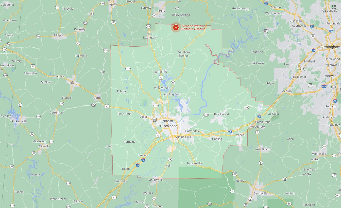
Map of Cities in Tuscaloosa County, Al