Cities and Towns in Santa Clara County, California
Founded in 1850, Santa Clara County is one of 58 counties in the state of California. The city of San Jose is the county seat. With FIPS code of 85, Santa Clara County has a population of 1,885,508 and area of 1,291 square miles (3,344 km²).
List of all cities in Santa Clara County, CA alphabetically
| City/Town | Postal Code | Area Code |
| A M O R C, CA | 95191 | 408 |
| Alviso, CA | 95002 | 408 |
| Blossom Valley, CA | 94040 | 650 |
| California Water Service, CA | 95194 | 408 |
| Campbell, CA | 95008 | 408 |
| 95009 | 408 | |
| 95011 | 408 | |
| Coyote, CA | 95013 | 408 |
| Cupertino, CA | 95014 | 408 |
| 95015 | 408 | |
| East Palo Alto, CA | 94303 | 650 |
| Gilroy, CA | 95020 | 408 |
| 95021 | 408 | |
| Holy City, CA | 95026 | 408 |
| 95044 | 408 | |
| I B M, CA | 95193 | 408 |
| Los Altos, CA | 94022 | 650 |
| 94023 | 650 | |
| 94024 | 650 | |
| Los Altos Hills, CA | 94022 | 650 |
| 94024 | 650 | |
| Los Gatos, CA | 95030 | 408 |
| 95031 | 408 | |
| 95032 | 408 | |
| Milpitas, CA | 95035 | 408 |
| 95036 | 408 | |
| Moffett Field, CA | 94035 | 650 |
| 94035 | 650 | |
| Monte Sereno, CA | 95030 | 408 |
| Monte Vista, CA | 95014 | 408 |
| Morgan Hill, CA | 95037 | 408 |
| 95038 | 408 | |
| Mount Hamilton, CA | 95140 | 408 |
| Mount View, CA | 94040 | 650 |
| Mountain View, CA | 94035 | 650 |
| 94039 | 650 | |
| 94040 | 650 | |
| 94041 | 650 | |
| 94042 | 650 | |
| 94043 | 650 | |
| New Almaden, CA | 95042 | 408 |
| Onizuka AFB, CA | 94088 | 408 |
| Palo Alto, CA | 94301 | 650 |
| 94302 | 650 | |
| 94303 | 650 | |
| 94304 | 650 | |
| 94305 | 650 | |
| 94306 | 650 | |
| 94309 | 650 | |
| Permanente, CA | 95014 | 408 |
| Redwood Estates, CA | 95044 | 408 |
| San Jose, CA | 95101 | 408 |
| 95103 | 408 | |
| 95106 | 408 | |
| 95108 | 408 | |
| 95109 | 408 | |
| 95110 | 408 | |
| 95111 | 408 | |
| 95112 | 408 | |
| 95113 | 408 | |
| 95115 | 408 | |
| 95116 | 408 | |
| 95117 | 408 | |
| 95118 | 408 | |
| 95119 | 408 | |
| 95120 | 408 | |
| 95121 | 408 | |
| 95122 | 408 | |
| 95123 | 408 | |
| 95124 | 408 | |
| 95125 | 408 | |
| 95126 | 408 | |
| 95127 | 408 | |
| 95128 | 408 | |
| 95129 | 408 | |
| 95130 | 408 | |
| 95131 | 408 | |
| 95132 | 408 | |
| 95133 | 408 | |
| 95134 | 408 | |
| 95135 | 408 | |
| 95136 | 408 | |
| 95138 | 408 | |
| 95139 | 408 | |
| 95140 | 408 | |
| 95141 | 408 | |
| 95148 | 408 | |
| 95150 | 408 | |
| 95151 | 408 | |
| 95152 | 408 | |
| 95153 | 408 | |
| 95154 | 408 | |
| 95155 | 408 | |
| 95156 | 408 | |
| 95157 | 408 | |
| 95158 | 408 | |
| 95159 | 408 | |
| 95160 | 408 | |
| 95161 | 408 | |
| 95164 | 408 | |
| 95170 | 408 | |
| 95172 | 408 | |
| 95173 | 408 | |
| 95190 | 408 | |
| 95191 | 408 | |
| 95192 | 408 | |
| 95193 | 408 | |
| 95194 | 408 | |
| 95196 | 408 | |
| San Jose Mercury News, CA | 95190 | 408 |
| San Jose State University, CA | 95192 | 408 |
| San Jose Water Company, CA | 95196 | 408 |
| San Martin, CA | 95046 | 408 |
| Santa Clara, CA | 95050 | 408 |
| 95051 | 408 | |
| 95052 | 408 | |
| 95053 | 408 | |
| 95054 | 408 | |
| 95055 | 408 | |
| 95056 | 408 | |
| Santa Clara University, CA | 95053 | 408 |
| Saratoga, CA | 95070 | 408 |
| 95071 | 408 | |
| Stanford, CA | 94305 | 650 |
| 94309 | 650 | |
| Sunnyvale, CA | 94085 | 408 |
| 94086 | 408 | |
| 94087 | 408 | |
| 94088 | 408 | |
| 94089 | 408 |
Major Cities and Towns in Santa Clara County, California
San Jose
Area, Population, and Geography
- Area: 181.4 square miles
- Population: Approximately 1.03 million (2023 estimate)
- Zip Codes: 95002, 95008, 95032, 95037, 95050-95056, 95101-95196
- Latitude: 37.3382° N
- Longitude: 121.8863° W
City Location and History
San Jose, the largest city in Santa Clara County and the third-largest in California, is located at the southern end of the San Francisco Bay Area. Established in 1777 as El Pueblo de San José de Guadalupe, it was the first civil settlement in California and served as the first state capital after California’s admission to the Union. San Jose grew rapidly in the 19th century, initially as an agricultural hub known for its orchards, particularly prunes and apricots, earning the area the nickname “Valley of Heart’s Delight.” In the mid-20th century, the city transitioned into a major technology and innovation hub, becoming the heart of Silicon Valley. Today, San Jose is known for its booming tech industry, diverse population, and rich cultural heritage.
Major Schools and Landmarks
San Jose is home to numerous educational institutions, including San Jose State University, the oldest public university on the West Coast, and many high-performing public and private schools such as Bellarmine College Preparatory and Leland High School. The city boasts several landmarks, including the Winchester Mystery House, a sprawling Victorian mansion with a mysterious past, and the Tech Interactive, a hands-on technology and science museum. Downtown San Jose features the SAP Center, home to the NHL’s San Jose Sharks, and the San Jose Museum of Art. The city also offers access to numerous parks and trails, including Alum Rock Park, one of California’s oldest municipal parks, and the nearby Santa Cruz Mountains, which provide opportunities for hiking and outdoor recreation.
Sunnyvale
Area, Population, and Geography
- Area: 22.7 square miles
- Population: Approximately 153,000 (2023 estimate)
- Zip Codes: 94085-94089
- Latitude: 37.3688° N
- Longitude: 122.0363° W
City Location and History
Sunnyvale is located in the heart of Silicon Valley, bordered by Mountain View to the west and Santa Clara to the east. The area was originally part of the Rancho Pastoria de las Borregas land grant and later became a small agricultural town known for its orchards and fruit canneries. In the early 20th century, Sunnyvale began to industrialize, attracting major aerospace and defense companies like Lockheed Martin. The city’s transformation continued in the latter half of the century, as it became a key player in the development of Silicon Valley’s technology sector. Today, Sunnyvale is known for its high concentration of tech companies, including the headquarters of Yahoo! and Juniper Networks, as well as its residential neighborhoods and excellent public services.
Major Schools and Landmarks
Sunnyvale is served by several school districts, including the Sunnyvale School District and Fremont Union High School District, with schools like Homestead High School and Fremont High School being highly regarded. Landmarks in Sunnyvale include the historic Murphy Avenue, which is lined with restaurants, shops, and hosts community events like the Sunnyvale Farmers Market. The city is also home to the Sunnyvale Baylands Park, a vast natural area offering trails, picnic spots, and views of the bay. Another significant landmark is the Sunnyvale Heritage Park Museum, which showcases the city’s history from its agricultural roots to its modern role in the tech industry. Sunnyvale’s blend of suburban comfort, technological innovation, and community-oriented amenities makes it a key city in Santa Clara County.
Santa Clara
Area, Population, and Geography
- Area: 18.4 square miles
- Population: Approximately 130,000 (2023 estimate)
- Zip Codes: 95050-95056
- Latitude: 37.3541° N
- Longitude: 121.9552° W
City Location and History
Santa Clara is located in the heart of Silicon Valley, adjacent to San Jose and Sunnyvale. The city was founded in 1777 with the establishment of Mission Santa Clara de Asís, the eighth of the California missions. Santa Clara developed as an agricultural town during the 19th century, known for its orchards and fruit processing industries. The early 20th century saw the city transform with the rise of the semiconductor industry, which laid the groundwork for Silicon Valley. Today, Santa Clara is a hub of technological innovation and home to numerous high-tech companies, including Intel, which has its headquarters here. The city also boasts a rich cultural heritage, balancing its historic roots with its role as a modern urban center.
Major Schools and Landmarks
Santa Clara is home to Santa Clara University, the oldest institution of higher learning in California, known for its beautiful Mission-style campus. The city is served by the Santa Clara Unified School District, with Wilcox High School and Santa Clara High School being prominent institutions. Key landmarks include Levi’s Stadium, home to the NFL’s San Francisco 49ers and host to major events like the Super Bowl 50. The historic Mission Santa Clara, located on the university campus, is another significant site, reflecting the city’s early history. California’s Great America, a large amusement park, and the Intel Museum, which offers insights into the development of the tech industry, are also popular attractions. Santa Clara’s combination of history, education, and technology makes it a dynamic and important city in the region.
Mountain View
Area, Population, and Geography
- Area: 12.0 square miles
- Population: Approximately 83,000 (2023 estimate)
- Zip Codes: 94035, 94039-94043
- Latitude: 37.3861° N
- Longitude: 122.0839° W
City Location and History
Mountain View is located in the northern part of Santa Clara County, nestled between Palo Alto to the northwest and Sunnyvale to the southeast. The city’s name comes from its views of the Santa Cruz Mountains, which are visible from much of the area. Founded in the 19th century, Mountain View was originally an agricultural community, producing fruit and vegetables for the burgeoning Bay Area. The arrival of the railroad in the late 1800s spurred development, and the city eventually became a center for the aerospace and electronics industries. In the latter half of the 20th century, Mountain View played a pivotal role in the growth of Silicon Valley, becoming home to major tech companies like Google, whose headquarters, the Googleplex, is located here.
Major Schools and Landmarks
Mountain View is served by the Mountain View Whisman School District and the Mountain View-Los Altos Union High School District, with Mountain View High School and Los Altos High School being notable institutions. The city’s landmarks include the Googleplex, a sprawling campus that represents the cutting edge of the tech industry, and the Computer History Museum, which traces the development of computing technology from its earliest days to the present. Shoreline Amphitheatre, a major outdoor concert venue, hosts some of the biggest names in music, while Shoreline Park offers a range of recreational activities, including sailing, hiking, and birdwatching. Downtown Mountain View, with its vibrant Castro Street, is known for its diverse dining, shopping, and cultural scene. Mountain View’s mix of innovation, education, and entertainment makes it a key city in Santa Clara County.
Palo Alto
Area, Population, and Geography
- Area: 25.8 square miles
- Population: Approximately 67,000 (2023 estimate)
- Zip Codes: 94301-94306
- Latitude: 37.4419° N
- Longitude: 122.1430° W
City Location and History
Palo Alto is located in the northwestern part of Santa Clara County, adjacent to Stanford University and bordering the San Francisco Bay. The city was founded in 1894 by Leland Stanford, who established Stanford University on his farmstead in honor of his son. Named after the tall redwood trees (“Palo Alto” in Spanish) in the area, the city quickly became a hub for education and innovation. Over the years, Palo Alto has been at the forefront of many technological advancements, with a high concentration of venture capital firms and startups, earning it the title of the “Birthplace of Silicon Valley.” The city’s proximity to Stanford University has made it a center for research, education, and business, contributing significantly to its development as one of the most affluent and educated communities in the United States.
Major Schools and Landmarks
Palo Alto is served by the Palo Alto Unified School District, which is highly regarded and includes top schools like Palo Alto High School and Gunn High School. The city is home to Stanford University, one of the world’s leading research institutions, which greatly influences the local culture and economy. Landmarks in Palo Alto include the historic Stanford Theatre, a beautifully restored movie palace that shows classic films, and the Palo Alto Baylands Nature Preserve, a large area of marshland that offers trails, wildlife viewing, and environmental education. The Hoover Tower, located on the Stanford campus, provides panoramic views of the Bay Area. Downtown Palo Alto, centered around University Avenue, is known for its upscale shopping, dining, and vibrant cultural scene. Palo Alto’s combination of academic excellence, technological innovation, and natural beauty makes it a key city in Santa Clara County.
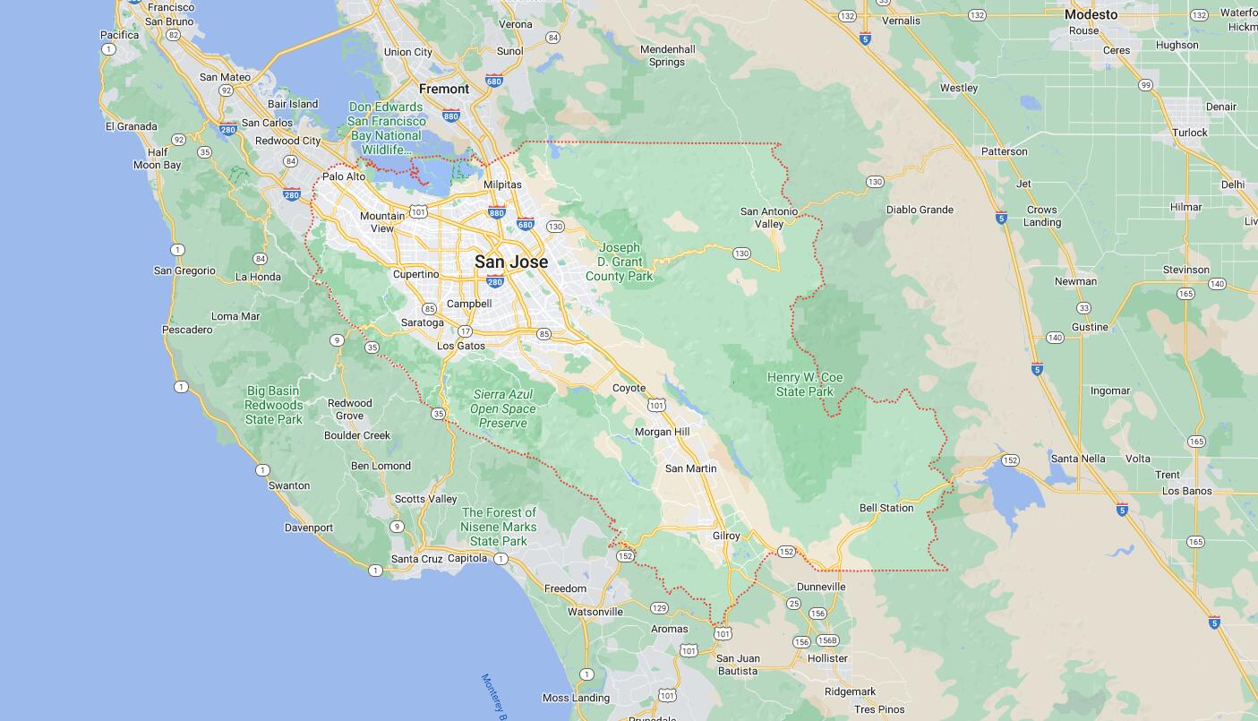
Map of Cities in Santa Clara County, CA