Where is Belize Located?
Where is Belize located on the map? Belize is an independent nation located in North America. Check out the following images to see location of Belize on maps.
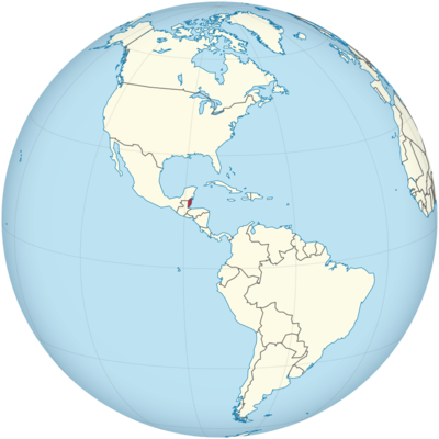
Belize Location in World Map
Belize is located in Central America on the eastern coast facing the Caribbean Sea.
Location Information of Belize
Latitude and Longitude
Belize is a small country located on the northeastern coast of Central America, bordered by Mexico to the north, the Caribbean Sea to the east, Guatemala to the south and west, and the Gulf of Honduras to the east. The geographical coordinates of Belize are:
- Latitude: 17.1899° N
- Longitude: 88.4976° W
These coordinates place Belize within the tropical region of Central America, characterized by its diverse ecosystems, including lush rainforests, coastal mangroves, and barrier reefs.
Capital City and Major Cities
- Capital City: BelmopanBelmopan is the capital of Belize, located inland in the Cayo District. It became the capital in 1970, replacing Belize City after a devastating hurricane. Belmopan is a smaller and more serene city compared to Belize City, with a population of around 20,000 people. It serves as the political and administrative center of the country. Key landmarks in Belmopan include the Belmopan Civic Center, the House of Culture, and the Belize Zoo.
- Major Cities:
- Belize City – Located on the eastern coast of Belize, Belize City is the country’s largest city and was the capital until 1970. It serves as the commercial and economic hub of the country, with the Port of Belize being one of the busiest shipping ports in the Caribbean. Belize City is known for its historical architecture, vibrant street markets, and proximity to the Great Blue Hole, a world-famous diving spot.
- San Ignacio – Situated in the western part of Belize, near the Guatemalan border, San Ignacio is a popular tourist destination due to its proximity to ancient Mayan ruins and lush forests. It is a vibrant town known for its outdoor activities, including hiking, river tubing, and visiting archaeological sites such as Cahal Pech and Xunantunich.
- Orange Walk Town – Located in the north of Belize, Orange Walk is known for its agricultural industry, particularly sugar cane production. The town is also a base for visitors wishing to explore the Lamanai Mayan ruins and the surrounding wildlife reserves.
- Corozal Town – Located on the northern border with Mexico, Corozal is a peaceful town known for its scenic waterfront and historical significance as a former Maya settlement. Corozal is often visited by tourists looking to experience Belize’s diverse culture, as well as those visiting nearby ruins.
- Punta Gorda – The southernmost town in Belize, Punta Gorda serves as the capital of the Toledo District. It is known for its beautiful coastal scenery, cultural diversity, and access to nearby natural attractions such as the Maya Mountain and Cockscomb Basin Wildlife Sanctuary.
Time Zone
Belize operates on Central Standard Time (CST), which is UTC -6. Belize does not observe Daylight Saving Time, so the time remains the same throughout the year. This time zone is shared by several other countries in Central America, including Guatemala, Honduras, and El Salvador.
Climate
Belize has a tropical climate with distinct wet and dry seasons, influenced by its location between the Caribbean Sea and the Gulf of Mexico. The country experiences warm temperatures year-round, with high humidity levels, particularly during the rainy season.
- Dry Season: The dry season typically lasts from November to April. During this period, the weather is sunny, and rainfall is minimal, making it the best time for outdoor activities, including exploring the Mayan ruins, visiting the beaches, and experiencing the wildlife. Temperatures during the dry season range from 25°C (77°F) to 30°C (86°F).
- Rainy Season: The rainy season runs from June to November, with the peak of the rainfall occurring between June and September. During this period, Belize experiences short, heavy rain showers, high humidity, and occasional tropical storms. Temperatures during the rainy season are slightly higher, with daily highs averaging around 28°C (82°F).
- Coastal Climate: The coastal areas of Belize, particularly the islands and the barrier reef, experience slightly cooler temperatures due to the breezes from the Caribbean Sea. The climate is more humid and tropical in these areas, and rainfall is generally higher, especially on the islands, which are subject to tropical storms and hurricanes during the rainy season.
- Inland Climate: The inland regions of Belize, especially areas like San Ignacio and Belmopan, experience warmer temperatures and lower humidity compared to the coastal regions. The inland areas can be significantly hotter, especially during the dry season, with temperatures often exceeding 30°C (86°F).
Economic Status
Belize has a relatively small, but growing, economy, with agriculture, tourism, and services being the primary sectors. The country has historically relied on agriculture, particularly sugar, citrus, and bananas, while the services sector, especially tourism, has become increasingly important.
- Agriculture: Agriculture remains one of the most important sectors in Belize, accounting for a significant portion of the country’s GDP. Major agricultural exports include sugar, bananas, citrus fruits, and seafood, particularly shrimp and lobster. The country’s fertile soil, tropical climate, and abundant water resources support the cultivation of these crops. Belize also produces cacao, which is a growing sector due to the global demand for chocolate.
- Tourism: Tourism is one of the fastest-growing industries in Belize, contributing significantly to the economy. The country is known for its natural beauty, including beaches, coral reefs, the Great Blue Hole, rainforests, and ancient Mayan ruins. Belize attracts tourists for its eco-tourism opportunities, including diving, snorkeling, and hiking. The Belize Barrier Reef, a UNESCO World Heritage site, is one of the most popular attractions for divers. The country also benefits from a growing cruise industry, with many visitors arriving in Belize City by cruise ship.
- Services Sector: The services sector, including banking, real estate, and telecommunications, is another key contributor to the economy. Belize has become an offshore financial center, offering services such as international banking and asset management. The country’s stable political environment and relatively low taxation make it an attractive location for international businesses and investors.
- Manufacturing and Industry: The manufacturing sector in Belize is relatively small but is growing, particularly in the areas of food processing, garment manufacturing, and construction. Belize also has a nascent technology sector, with a small but emerging IT industry. Additionally, the energy sector in Belize is gradually diversifying, with the country seeking to increase its use of renewable energy, such as solar and wind power.
- Challenges: Despite its economic growth, Belize faces several challenges. These include a reliance on a few key industries, vulnerability to climate change, high levels of poverty in rural areas, and a relatively small labor force. Additionally, the country’s small size and geographic isolation limit its ability to fully capitalize on global trade. Belize’s dependence on imports, especially fuel and machinery, means the economy can be affected by global economic fluctuations.
Tourist Attractions
Belize is a popular tourist destination due to its natural beauty, historical sites, and opportunities for outdoor adventure. The country offers a range of attractions for visitors, from pristine beaches to ancient ruins and wildlife sanctuaries. Some of the top tourist destinations in Belize include:
- The Great Blue Hole: Located off the coast of Ambergris Caye, the Great Blue Hole is a UNESCO World Heritage site and one of the most famous dive spots in the world. This massive underwater sinkhole, over 1,000 feet in diameter and 400 feet deep, is surrounded by a coral reef and is home to a wide variety of marine life, including sharks, rays, and fish.
- Tikal Mayan Ruins: Although Tikal is located in neighboring Guatemala, it is easily accessible from Belize and is one of the most significant Mayan archaeological sites in Central America. The ruins, which date back to the 4th century BC, include large pyramids, temples, and plazas surrounded by dense jungle. Visitors can explore the site and learn about the ancient Mayan civilization.
- Cockscomb Basin Wildlife Sanctuary: Located in southern Belize, this wildlife sanctuary is home to a wide variety of flora and fauna, including jaguars, howler monkeys, and tropical birds. The sanctuary offers visitors the chance to hike through rainforests, swim in waterfalls, and spot wildlife in their natural habitats.
- Hol Chan Marine Reserve: Located off the coast of Ambergris Caye, this marine reserve is one of the top snorkeling and diving destinations in Belize. Visitors can explore vibrant coral reefs, swim with sea turtles, and interact with schools of tropical fish. The reserve also includes the Shark Ray Alley, where divers can encounter nurse sharks and stingrays.
- Xunantunich: One of Belize’s most famous Mayan ruins, Xunantunich is located near the Guatemalan border. The site is home to the El Castillo pyramid, which offers stunning views of the surrounding countryside. The ruins also include temples, palaces, and plazas that provide insight into the ancient Mayan civilization.
- Ambergris Caye and San Pedro: Ambergris Caye is Belize’s largest island and is a popular destination for tourists seeking pristine beaches, crystal-clear waters, and vibrant nightlife. The town of San Pedro on the island is known for its lively atmosphere, with numerous bars, restaurants, and boutique shops. Visitors can enjoy snorkeling, diving, and fishing, or simply relax on the island’s beautiful beaches.
- Caracol: Located deep in the Chiquibul Forest, Caracol is the largest Mayan site in Belize. The site includes impressive pyramids, including the Caana (Sky Palace), which is the tallest structure in Belize. Visitors can hike through the jungle to explore the ruins and learn about the ancient Mayan city that once flourished in this region.
- Actun Tunichil Muknal (ATM) Cave: The ATM Cave is one of the most popular and adventurous attractions in Belize. Located in the Tapir Mountain Nature Reserve, the cave system contains ancient Mayan artifacts and human remains, providing a glimpse into the spiritual and ceremonial practices of the Maya civilization. Visitors can swim and crawl through the cave to see the well-preserved relics.
Visa Requirements for U.S. Citizens
U.S. citizens visiting Belize for tourism or business purposes do not need a visa for stays of up to 30 days. However, the following requirements apply:
- Passport: U.S. citizens must have a valid passport with at least six months of validity remaining beyond their intended departure date from Belize.
- Proof of Sufficient Funds: U.S. travelers may be asked to show proof of sufficient funds for the duration of their stay in Belize.
- Return or Onward Travel Ticket: U.S. citizens must provide evidence of a return or onward travel ticket when entering Belize.
- Extension: For stays longer than 30 days, visitors can apply for an extension at the Belize Immigration Office.
For travelers wishing to stay for work, study, or other purposes, a specific visa may be required, and U.S. citizens can apply through the Belizean Embassy or Consulate.
Distance to Major U.S. Cities
The approximate air distances from Belize City to major U.S. cities are as follows:
- Distance to New York City: The distance from Belize City to New York City is approximately 1,500 miles (2,400 kilometers). Flights typically take about 4 to 5 hours, depending on the route and layovers.
- Distance to Los Angeles: The distance from Belize City to Los Angeles is approximately 2,100 miles (3,380 kilometers). Flights generally take around 5 to 6 hours, with one or more layovers, typically in cities such as Miami or Houston.
Belize Facts
| Size | 22,965 km² |
| Residents | 383,000 |
| Language | English (official language) |
| Capital | Belmopan |
| Longest river | Macal River (320 km) |
| Highest mountain | Doyle’s Delight in the Maya Mountains (1,124 m) |
| Currency | Belize dollars |


