Where is Azerbaijan Located?
Where is Azerbaijan located on the map? Azerbaijan is an independent nation located in Western Asia. Check out the following images to see location of Azerbaijan on maps.
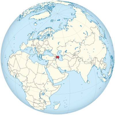
Azerbaijan Location in World Map
Here you can see where Azerbaijan is.
Location Information of Azerbaijan
Latitude and Longitude
Azerbaijan is located at the crossroads of Eastern Europe and Western Asia, bordered by the Caspian Sea to the east, Russia to the north, Armenia to the west, Iran to the south, and Georgia and Turkey to the northwest. The geographical coordinates of Azerbaijan are:
- Latitude: 40.1431° N
- Longitude: 47.5769° E
These coordinates place Azerbaijan in the South Caucasus region, with its vast territory covering both lowlands and highlands. Its position along the Caspian Sea and its proximity to Europe and Asia have historically made it a significant cultural, economic, and strategic location.
Capital City and Major Cities
- Capital City: BakuBaku is the capital and largest city of Azerbaijan, situated on the western coast of the Caspian Sea. As the economic, cultural, and political heart of the country, Baku is a city of great historical significance. It has been a major hub for trade, oil production, and culture for centuries. Today, Baku is known for its modern skyline, the Flame Towers, and the ancient Old City (Icherisheher), a UNESCO World Heritage site. The city has a mix of modern architecture and ancient landmarks, making it a unique destination.
- Major Cities:
- Ganja – Located in the western part of Azerbaijan, Ganja is the country’s second-largest city. It has a rich history, with landmarks such as the Javad Khan Street, Ganja Fortress, and Nizami Mausoleum. The city is also known for its beautiful parks and gardens.
- Mingachevir – Mingachevir is located along the Kur River in central Azerbaijan and is the third-largest city in the country. Known for its power plants, Mingachevir is often called the “Energy Capital” of Azerbaijan due to its role in the country’s energy production. It is also a growing industrial and agricultural hub.
- Lankaran – Situated in the southern part of the country, near the Caspian Sea, Lankaran is known for its subtropical climate, beautiful landscapes, and rich history. The city’s natural beauty, including the nearby Lankaran National Park, draws tourists to the region.
- Sumqayit – Located just north of Baku, Sumqayit is a key industrial city in Azerbaijan. Historically, the city has been a center for chemical and manufacturing industries, although recent years have seen a push toward environmental restoration and economic diversification.
- Sheki – Situated in the foothills of the Caucasus Mountains in the northwest, Sheki is known for its picturesque setting, historical architecture, and vibrant cultural heritage. Key attractions include the Sheki Khan’s Palace and Sheki’s Caravanserai.
Time Zone
Azerbaijan operates on Azerbaijan Standard Time (AZT), which is UTC +4. The country does not observe daylight saving time, meaning the time remains constant throughout the year. This time zone is consistent with countries in the region, including Armenia and Georgia, making travel within the South Caucasus region convenient without the need for time adjustments.
Climate
Azerbaijan has a diverse climate due to its varied geography, ranging from coastal areas on the Caspian Sea to mountainous regions in the north. The climate is characterized by several distinct types:
- Arid and Semi-Arid Climate: Much of Azerbaijan, particularly in the lowlands and central regions, experiences a semi-arid climate with hot, dry summers and mild, wet winters. The region around Baku, the Absheron Peninsula, and parts of the Kura River basin fall into this category. Temperatures can reach 35°C (95°F) or higher in the summer, while winters are typically mild, with average temperatures between 5°C and 10°C (41°F to 50°F).
- Mountain Climate: In the northern and western parts of Azerbaijan, particularly in areas such as Guba, Gabala, and the Caucasus Mountains, the climate is more temperate and cooler, with significant seasonal variation. Winters are colder, and snowfall is common in higher altitudes, making the region a popular destination for winter sports.
- Subtropical Climate: The southern part of Azerbaijan, particularly the region around Lankaran near the Caspian Sea, experiences a subtropical climate. This area receives more rainfall than other parts of the country and has warm, humid summers, and mild, wet winters.
Azerbaijan’s diverse climate zones make it ideal for agriculture, particularly in the fertile lowland areas, and the country is known for producing a variety of fruits, vegetables, and cotton.
Economic Status
Azerbaijan’s economy is one of the fastest-growing in the region, largely due to its vast natural resources, particularly oil and natural gas. The country’s economic growth has been driven by the oil and energy sectors, but Azerbaijan is also working to diversify its economy. Below are key sectors in Azerbaijan’s economy:
- Oil and Gas: Azerbaijan is one of the leading oil producers in the Caspian region. The country’s vast oil reserves, particularly in the Caspian Sea, have been the backbone of its economy since the 19th century. Azerbaijan’s energy exports, particularly to Europe and Asia, have been vital for economic growth. The Baku-Tbilisi-Ceyhan (BTC) pipeline plays a major role in transporting oil to global markets. Natural gas, primarily extracted from the Shah Deniz gas field, is another key export, and Azerbaijan has invested in the Southern Gas Corridor to provide gas to Europe.
- Agriculture: Agriculture remains an important sector in Azerbaijan’s economy, particularly in the regions around the Caspian Sea, the Kura River basin, and in the foothills of the Caucasus Mountains. Azerbaijan is known for producing fruits (such as grapes, pomegranates, and citrus), vegetables, cotton, tobacco, and tea. The government has also worked on improving the infrastructure for farming and agricultural exports.
- Industry and Manufacturing: Azerbaijan has a developing industrial base, with significant growth in sectors such as chemicals, textiles, and food processing. The government has worked to promote non-oil industries, including the manufacture of machinery, electronics, and cement. The country also has a growing textile industry, particularly in the production of cotton and carpets.
- Services and Tourism: Tourism has become an increasingly important sector for Azerbaijan, driven by its rich cultural history, natural beauty, and modern infrastructure. Baku, in particular, has attracted international tourists with its stunning architecture, including the Flame Towers and the Heydar Aliyev Center designed by Zaha Hadid. The country has also developed luxury hotels, resorts, and wellness tourism, especially along the Caspian Sea coast. Other tourist attractions include Gobustan National Park, Sheki, and the Caucasus Mountains.
- Economic Diversification: In recent years, Azerbaijan has sought to diversify its economy by investing in sectors such as information technology, telecommunications, and infrastructure development. The government has made efforts to reduce the economy’s dependency on oil and gas and has initiated projects in education, healthcare, and sustainable energy.
Tourist Attractions
Azerbaijan is a country with diverse landscapes, rich history, and a unique blend of Eastern and Western cultures. Some of the most popular tourist attractions in Azerbaijan include:
- Baku: The capital city is known for its modern skyline, ancient historical sites, and vibrant cultural life. Visitors can explore the Icherisheher (Old City), a UNESCO World Heritage site, which includes landmarks like the Maiden Tower and Palace of the Shirvanshahs. The Flame Towers, a trio of skyscrapers that dominate the city’s skyline, are a modern symbol of Baku. The Heydar Aliyev Center, designed by architect Zaha Hadid, is an iconic architectural site and a cultural hub. The Baku Boulevard along the Caspian Sea is also a popular leisure destination.
- Gobustan National Park: Known for its ancient petroglyphs, Gobustan National Park is a UNESCO World Heritage site that offers a glimpse into prehistoric life in Azerbaijan. The park contains rock carvings that date back to 5,000 to 40,000 years and provides insight into the region’s ancient human settlements.
- Sheki: Located in the foothills of the Caucasus Mountains, Sheki is known for its historical significance and picturesque landscapes. Key attractions in Sheki include the Sheki Khan’s Palace, Gelersen-Gorersen Fortress, and the Sheki Caravanserai. The town is also famous for its traditional handicrafts and natural beauty.
- The Caspian Sea: The Caspian Sea, bordered by Azerbaijan, offers opportunities for beach tourism and water sports. The Caspian coast is home to several resorts, including the Mardakan and Buzovna beaches. The region has seen significant investment in tourism infrastructure, making it an attractive destination for relaxation and recreation.
- Khinalug: Located in the Caucasus Mountains, Khinalug is a remote mountain village that offers spectacular views, alpine meadows, and a unique Azerbaijani mountain culture. The village is known for its historical significance and is popular with hikers and nature enthusiasts.
- Gabala: Known as the “tourist capital” of Azerbaijan, Gabala is a popular resort town located in the foothills of the Caucasus Mountains. It offers outdoor activities such as hiking, skiing, and mountain biking. The Tufandag Mountain Resort and Gabala Shooting Club attract tourists throughout the year.
- Naftalan: Naftalan is a famous spa town in Azerbaijan, known for its therapeutic oil baths that have been used for centuries for their medicinal properties. It is one of the few places in the world where people can bathe in natural oil, which is believed to have healing effects.
Visa Requirements for U.S. Citizens
U.S. citizens visiting Azerbaijan for tourism or business purposes must obtain a visa. The process for acquiring a visa is as follows:
- E-Visa: U.S. citizens can apply for an e-visa online through Azerbaijan’s official e-visa portal. The e-visa allows for a stay of up to 30 days within a 90-day period and is typically processed within three days.
- Visa on Arrival: In some cases, U.S. citizens can obtain a visa on arrival at the airport in Baku, provided they meet certain criteria. This option is available for certain types of visas, such as tourist visas.
- Traditional Visa: For stays longer than 30 days or for purposes such as work, study, or residence, U.S. citizens must apply for a traditional visa through the Azerbaijani Embassy or Consulate.
Required documents for obtaining a visa typically include:
- A valid passport with at least six months of validity beyond the intended date of departure from Azerbaijan.
- A completed visa application form.
- Passport-size photographs.
- Proof of hotel accommodation and/or invitation from an Azerbaijani host (for certain types of visas).
- Proof of sufficient funds for the duration of stay.
Distance to Major U.S. Cities
Azerbaijan’s distance from major U.S. cities is as follows:
- Distance to New York City: The distance from Baku to New York City is approximately 6,100 miles (9,800 kilometers). Flights typically take 11 to 13 hours, depending on layovers and flight routes.
- Distance to Los Angeles: The distance from Baku to Los Angeles is around 7,300 miles (11,748 kilometers). Flights generally take about 14 to 15 hours, with one or more layovers, depending on the airline.
Azerbaijan Facts
| Size | 86,600 km² |
| Residents | 10.20 million |
| Language | Azerbaijani (Azeri) |
| Capital | Baku |
| Longest river | Kura (1,507 km) |
| Highest mountain | Bazardüzü (4,466 m) |
| Currency | Azerbaijan manat |


