Where is Saint Lucia Located?
Where is St. Lucia located on the map? St. Lucia is an independent nation located in North America. Check out the following images to see location of Saint Lucia on maps.
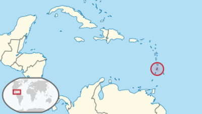
St. Lucia Location in World Map
Location Information of Saint Lucia
Latitude and Longitude
Saint Lucia is an island nation located in the eastern Caribbean Sea, specifically part of the Lesser Antilles. The geographical coordinates of the island, centered around its capital Castries, are:
- Latitude: 13.9094° N
- Longitude: 60.9783° W
The island lies to the north of Saint Vincent and the Grenadines and south of Martinique, making it an essential part of the Windward Islands chain. Its position places it directly in the path of trade winds, contributing to its tropical climate.
Capital City and Major Cities
Capital City: Castries
The capital of Saint Lucia is Castries, situated on the island’s northwest coast. Castries is the largest city in the country, serving as the political, commercial, and cultural center. It is a bustling port city, with a rich history and a mix of colonial-era buildings and modern infrastructure.
Key features of Castries include:
- Castries Harbor: The harbor is one of the busiest in the Caribbean, serving as both a cruise ship stop and a port for cargo. It is a key economic asset for the country.
- Market Square: Known for its vibrant atmosphere, Castries’ market is a place where locals sell produce, spices, crafts, and souvenirs. It’s a popular spot for tourists looking to experience the local culture.
- Cathedral of the Immaculate Conception: This 19th-century cathedral, located in Castries, is an important religious landmark in Saint Lucia.
- Public Sector Hub: The city is home to most government offices, including the Prime Minister’s office and the national parliament.
Major Cities and Towns
While Castries is the largest city, there are several smaller towns and villages that contribute significantly to the country’s economy and cultural identity:
- Vieux Fort: Located on the southern tip of the island, Vieux Fort is a town known for its Hewanorra International Airport, the primary international gateway to the island. It is a bustling town and one of the most important commercial areas of Saint Lucia.
- Gros Islet: Located to the north of Castries, Gros Islet is a popular tourist destination known for its beaches and lively nightlife. It is also home to the famous Friday Night Street Party, where locals and tourists come together to enjoy food, music, and entertainment.
- Soufrière: Situated on the west coast, Soufrière is a small town nestled between the Pitons—two iconic volcanic peaks that are a UNESCO World Heritage site. Soufrière is known for its historical significance, natural beauty, and geothermal features like the Sulphur Springs.
- Dennery: A small town located on the east coast, Dennery is known for its fishing industry and beautiful surrounding beaches. It is a quieter, more rural area, offering visitors a taste of traditional Saint Lucian life.
- Anse La Raye: This small fishing village is located on the west coast, between Castries and Soufrière. It is known for its scenic beauty and cultural festivals, especially the weekly fish fry that attracts both locals and tourists.
Time Zone
Saint Lucia operates on Atlantic Standard Time (AST), which is UTC -4. This time zone is shared with other Caribbean nations such as Puerto Rico, the Dominican Republic, and the U.S. Virgin Islands. Saint Lucia does not observe daylight saving time, meaning the time remains consistent throughout the year.
The country’s time zone places it one hour ahead of cities like New York and Boston, and matches the time in other nearby Caribbean islands. Travelers from the United States can expect a manageable time difference when adjusting to Saint Lucia’s local time.
Climate
Saint Lucia has a tropical climate that is influenced by its location in the Caribbean and proximity to the equator. The island experiences relatively constant temperatures throughout the year, with minor variations between seasons. There are two primary seasons on the island: the wet season and the dry season.
- Wet Season (June to November):
The wet season, which coincides with the Atlantic hurricane season, brings higher humidity and frequent rainfall, particularly from June to November. Heavy rain showers, thunderstorms, and the possibility of hurricanes are common during this period. However, there are still plenty of sunny days. Average temperatures during the wet season range from 24°C to 30°C (75°F to 86°F). - Dry Season (December to May):
The dry season, which runs from December to May, is considered the peak tourist season. During this time, the island experiences lower humidity, more sunny days, and less rain. The dry season is ideal for outdoor activities such as hiking, swimming, and sightseeing. Temperatures range from 23°C to 28°C (73°F to 82°F). - Temperature and Humidity:
Saint Lucia’s average temperature remains fairly consistent year-round, with minimal fluctuation between the wet and dry seasons. Humidity levels are higher during the wet season but are usually alleviated by the trade winds. Coastal areas tend to be hotter and more humid than the inland areas, where cooler temperatures can be found at higher elevations. - Microclimates:
Saint Lucia has several distinct microclimates due to its varied topography. The coastal areas are typically warmer and drier, while the central mountain regions experience cooler temperatures and more rainfall. The lush rainforests in the interior of the island contribute to the island’s unique biodiversity.
Economic Status
Saint Lucia has a mixed economy that is highly dependent on services, agriculture, and tourism. It has one of the more developed economies in the Eastern Caribbean but faces challenges due to its small size and vulnerability to natural disasters.
- Tourism:
Tourism is the dominant sector of Saint Lucia’s economy, contributing significantly to the country’s GDP. The island’s stunning beaches, luxury resorts, and rich cultural heritage attract tourists from around the world. Key attractions include the Pitons, volcanic beaches, rainforests, and the world’s only drive-in volcano, the Sulphur Springs. The island’s appeal as a honeymoon destination, along with growing eco-tourism and adventure tourism markets, makes tourism the largest driver of economic activity. - Agriculture:
Agriculture has historically been the backbone of Saint Lucia’s economy. The main crops include bananas, cocoa, citrus fruits, and vegetables. However, the banana industry has faced challenges in recent years due to international competition, natural disasters, and changing agricultural practices. Despite this, agriculture still remains an important part of the island’s economy, providing employment and contributing to local food production. - Manufacturing:
Saint Lucia’s manufacturing sector is small but diverse. It includes the production of food and beverages, as well as light industries such as garment manufacturing and assembly of electronics. The country also exports processed agricultural products like banana chips and cocoa-based goods. The manufacturing sector contributes modestly to the national economy but faces challenges related to high production costs and limited access to international markets. - Financial Services:
Saint Lucia has developed a small but growing financial services sector, including offshore banking, insurance, and investment services. The island is a popular location for international business due to favorable tax policies and its status as an offshore financial center. The Saint Lucia International Financial Services Authority (SLIFSA) governs and promotes these services, attracting investment from around the globe. - Fishing:
Fishing is an important industry, particularly in coastal towns like Vieux Fort and Anse La Raye. Fish, including tuna, snapper, and lobster, are key exports for the country, contributing to the local economy. - Challenges:
Despite its relatively high standard of living in the Caribbean, Saint Lucia faces several economic challenges, including vulnerability to global economic shifts, dependency on tourism, and exposure to natural disasters like hurricanes and volcanic eruptions. The island is also working on diversifying its economy to reduce its dependence on tourism and agriculture.
Tourist Attractions
Saint Lucia is a paradise for travelers seeking a blend of natural beauty, outdoor adventure, and cultural experiences. The island’s attractions range from its beautiful beaches and dramatic mountain scenery to historical sites and local festivals.
1. The Pitons
The Pitons are Saint Lucia’s most iconic landmarks—two volcanic spires rising steeply from the Caribbean Sea. These twin peaks, Gros Piton and Petit Piton, are UNESCO World Heritage sites and attract hikers, photographers, and nature enthusiasts. The Gros Piton offers a challenging yet rewarding hike with panoramic views of the island and ocean.
2. Sulphur Springs
Located near Soufrière, Sulphur Springs is a geothermal area with hot springs and mud baths, often referred to as the “world’s only drive-in volcano.” Visitors can experience the therapeutic mud baths and warm sulfuric pools that are said to have healing properties.
3. Marigot Bay
Marigot Bay is one of the most beautiful natural harbors in the Caribbean, known for its clear blue waters and lush greenery. It is a popular spot for boating, yachting, and enjoying the laid-back atmosphere. Marigot Bay has been a favorite stop for travelers and is featured in many movies.
4. Anse Chastanet and Sugar Beach
These two beaches, located near Soufrière, are renowned for their natural beauty and crystal-clear waters. Anse Chastanet is particularly popular for snorkeling and diving, while Sugar Beach lies between the Pitons and offers a breathtaking backdrop for a beach vacation.
5. Pigeon Island National Park
Pigeon Island is a historical site and national park offering a mix of nature trails, beaches, and historical ruins. The island is home to the remains of an 18th-century British military fort, and it offers stunning views of the surrounding coastline and nearby islands.
6. Rainforest Adventures
Saint Lucia’s tropical rainforest is perfect for eco-tourism and adventure activities such as hiking, zip-lining, and wildlife watching. Rainforest Adventures offers guided tours where visitors can explore the lush vegetation, waterfalls, and exotic flora and fauna of the island’s interior.
Visa Requirements for U.S. Citizens
U.S. citizens do not require a visa for short visits to Saint Lucia for tourism or business purposes for up to 90 days. The following are the entry requirements:
- Valid Passport: U.S. citizens must present a valid passport that is not expired and is valid for at least six months beyond the planned date of entry.
- Return/Onward Ticket: Travelers must show proof of a return or onward ticket.
- Sufficient Funds: Travelers should have proof of sufficient funds for their stay, either through cash, credit cards, or other financial instruments.
Distance to Major U.S. Cities
Distance from New York City
The distance from New York City to Saint Lucia is approximately 2,000 miles (3,220 kilometers). Flights from New York to Saint Lucia typically take 4 to 5 hours.
Distance from Los Angeles
The distance from Los Angeles to Saint Lucia is approximately 4,200 miles (6,760 kilometers). Flights from Los Angeles typically take around 8 to 9 hours, with at least one stopover, often in Miami or other Caribbean cities.
Saint Lucia Facts
| Size | 616 km² |
| Residents | 166,000 |
| Language | English |
| Capital | Castries |
| Longest river | Cul de sac |
| Highest mountain | Mount Gimie (950 m) |
| Currency | East Caribbean dollar |


