Where is Philippines Located?
Where is Philippines located on the map? Philippines is an independent nation located in Southeastern Asia. Check out the following images to see location of Philippines on maps.
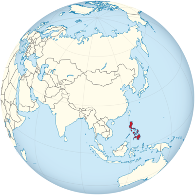
Philippines Location in World Map
Location Information of Philippines
Latitude and Longitude
The Philippines is an archipelago located in Southeast Asia, consisting of over 7,600 islands. It lies between the latitudes 4° 23′ N and 21° 25′ N and longitudes 116° 40′ E and 126° 34′ E. The country is surrounded by several bodies of water, including the South China Sea to the west, the Philippine Sea to the east, and the Celebes Sea to the south. The Philippines is situated in the Pacific Ocean, making it vulnerable to tropical storms, earthquakes, and volcanic activity. Its geographic location places it strategically at the crossroads of maritime trade routes connecting East Asia, Southeast Asia, and the Pacific.
Capital City and Major Cities
Capital City: Manila
Manila is the capital city of the Philippines, located on the western shore of Luzon Island, the country’s largest island. It is one of the most densely populated cities in the world, with a population of around 1.7 million people, but its metropolitan area, known as the National Capital Region (NCR) or Metro Manila, houses over 12 million residents. Manila serves as the political, economic, and cultural heart of the Philippines.
The city is a major hub for business, education, and government. Historical landmarks such as Intramuros, the San Agustin Church, and Rizal Park are significant points of interest. The Manila Bay area is also known for its sunset views and the presence of luxury hotels, malls, and entertainment venues. The city has a long history dating back to Spanish colonial rule, which influences much of its architecture and culture today.
Major Cities
- Quezon City
Located just north of Manila, Quezon City is the most populous city in the Philippines and one of the primary centers for government and education. It houses the Philippine Congress, the University of the Philippines, and a number of national government offices. The city also has extensive parks, such as the Quezon Memorial Circle, and is known for its modern shopping malls and cultural venues. - Cebu City
Cebu City, situated in the central Visayas region, is one of the oldest cities in the Philippines. It serves as the primary hub for commerce, trade, and tourism in the Visayan Islands. Cebu is known for its rich cultural heritage, with landmarks like Magellan’s Cross and the Basilica Minore del Santo Niño. Cebu also boasts beautiful beaches, making it a major destination for both local and international tourists. - Davao City
Located on the southern island of Mindanao, Davao City is one of the largest cities in the country in terms of land area. It is known for its environmental sustainability and high standard of living. The city is home to the Philippine Eagle Center, dedicated to preserving the endangered Philippine eagle, and Mt. Apo, the country’s highest peak. Davao is also known for its robust agriculture, especially the production of durian and banana. - Zamboanga City
Situated on the southwestern tip of Mindanao, Zamboanga City is an important port and trade center. The city is known for its beautiful landscapes, with white sandy beaches, historical forts like Fort Pilar, and a diverse cultural heritage influenced by its Muslim, Christian, and indigenous populations. - Taguig City
Taguig, part of Metro Manila, has emerged as a prominent business and financial district. It is home to the Bonifacio Global City (BGC), an upscale area with office buildings, shopping malls, residential areas, and entertainment venues. Taguig is also the site of several multinational company headquarters and modern infrastructure projects.
Time Zone
The Philippines is in the Philippine Time Zone (PHT), which is UTC +8:00 hours. The country does not observe daylight saving time, so the time remains constant throughout the year. This time zone places the Philippines in line with several other countries in Southeast Asia, such as China, Malaysia, and Singapore.
Climate
The climate of the Philippines is characterized as tropical, with distinct wet and dry seasons. The country experiences a diverse range of weather conditions due to its geographic location in the Pacific Ocean and its numerous islands.
Wet Season (Monsoon)
The wet season typically lasts from June to November and is influenced by the Southwest Monsoon (Habagat). During this period, the country experiences frequent rainfall, with typhoons being most common from July to September. These storms can cause flooding and landslides, especially in the central and northern regions. The wet season is more pronounced in the western and central parts of the Philippines, including Manila, Palawan, and other coastal areas.
Dry Season
The dry season is from December to May and is primarily influenced by the Northeast Monsoon (Amihan), which brings cooler and drier air from the Asian mainland. This period is considered the best time for travel, particularly from March to May, as temperatures are higher but rainfall is minimal. The dry season is experienced more strongly in the eastern and southern regions, while the western regions of the Philippines receive less rainfall.
Temperature and Humidity
Average temperatures in the Philippines range from 25°C (77°F) to 32°C (90°F), with the hottest months being April and May. The country also experiences high humidity levels, often exceeding 80% during the wet season. The combination of heat and humidity can make the weather feel hotter than the actual temperature.
Economic Status
The Philippines has a mixed economy that is driven by a combination of agriculture, manufacturing, services, and remittances from overseas workers. Over the past decade, the country has experienced significant economic growth, with the services sector, particularly the business process outsourcing (BPO) industry, playing a significant role. However, poverty, income inequality, and infrastructure issues remain challenges for the country’s economic development.
Key Economic Sectors
- Agriculture
Agriculture has traditionally been a major contributor to the Philippine economy. The country produces a wide variety of agricultural products, including rice, corn, coconuts, sugarcane, bananas, and pineapples. The agriculture sector remains a vital source of employment, especially in rural areas, but it faces challenges related to climate change, land use, and low productivity. - Manufacturing
The Philippines has a growing manufacturing sector that includes electronics, semiconductors, automobiles, and food processing. The electronics industry is particularly important, as the country is one of the leading exporters of electronic components globally. The Cebu region, in particular, is a hub for manufacturing and assembly. - Services and BPO
The service sector, particularly business process outsourcing (BPO), has been a key driver of economic growth in the Philippines. Cities like Metro Manila, Cebu, and Davao host a number of call centers and outsourcing businesses. The BPO industry provides employment for millions of Filipinos and contributes significantly to foreign exchange earnings. - Remittances
Overseas Filipino Workers (OFWs) are a critical source of income for the country. Remittances from OFWs contribute significantly to household incomes and have helped lift millions of people out of poverty. The Philippines is one of the largest remittance-receiving countries globally, with billions of dollars sent home each year. - Tourism
Tourism is an important part of the Philippine economy, with popular destinations such as Boracay, Palawan, and Cebu attracting millions of visitors annually. The tourism industry provides jobs in hospitality, transport, and retail. The country has diverse attractions, including natural wonders, beaches, historical sites, and cultural festivals.
Despite the country’s impressive growth, poverty remains an issue, particularly in rural areas, where a significant portion of the population relies on subsistence agriculture. The government has implemented various programs to address poverty and infrastructure challenges, but progress remains slow in some regions.
Tourist Attractions
The Philippines is known for its stunning beaches, rich biodiversity, historical landmarks, and vibrant culture. The country’s islands and natural landscapes make it one of the top destinations for travelers worldwide.
- Boracay Island
Boracay is known for its powdery white sand beaches and crystal-clear waters. It has been a popular destination for beach lovers and water sports enthusiasts. The island offers a range of activities, including diving, kite surfing, and island hopping. After a period of rehabilitation, Boracay remains a premier tourist destination. - Palawan
Palawan is often regarded as one of the most beautiful islands in the world, known for its stunning lagoons, limestone cliffs, and crystal-clear waters. El Nido and Coron are famous for their scenic views, while the Puerto Princesa Underground River, a UNESCO World Heritage Site, is one of the longest navigable underground rivers in the world. - Chocolate Hills
Located in the province of Bohol, the Chocolate Hills are a series of 1,268 perfectly cone-shaped hills that turn brown during the dry season. The site is one of the most recognized natural wonders in the Philippines and is a popular spot for tourists. - Taal Volcano and Lake
Taal is an active volcano located in the middle of Taal Lake, about 50 kilometers south of Manila. Visitors can take boat rides to the volcanic island and hike to the crater, offering breathtaking views of the lake and surrounding landscape. - Manaoag Church
The Our Lady of Manaoag Church, located in Pangasinan, is one of the most famous pilgrimage sites in the Philippines. It is known for its rich history and its association with the veneration of the Virgin Mary. - Vigan
The city of Vigan, located in the Ilocos region, is a UNESCO World Heritage Site known for its well-preserved Spanish colonial architecture. The city’s cobblestone streets, ancestral houses, and the Vigan Cathedral make it a significant cultural attraction. - Banaue Rice Terraces
The Banaue Rice Terraces, located in the Ifugao province, are often referred to as the “Eighth Wonder of the World.” These ancient terraces, carved into the mountains, are still used for rice farming by indigenous communities.
Visa Requirements for U.S. Citizens
U.S. citizens visiting the Philippines for tourism purposes do not need a visa for stays of up to 30 days. Visitors must present a valid U.S. passport with at least six months of validity beyond their intended stay. Extensions can be applied for a longer stay. U.S. tourists must also show proof of a return ticket or onward travel and may need to present evidence of sufficient funds to cover their stay.
In certain cases, such as for business or employment, U.S. citizens may need to apply for a special visa. Additionally, travelers who have visited countries with yellow fever outbreaks may be required to provide proof of vaccination.
Distance to New York City and Los Angeles
- Distance from New York City to Manila
The distance between New York City and Manila is approximately 8,500 miles (13,680 kilometers). Direct flights typically take about 16 to 18 hours, depending on the airline and specific route. - Distance from Los Angeles to Manila
The distance between Los Angeles and Manila is around 7,300 miles (11,748 kilometers). Flights from Los Angeles to Manila typically take around 14 to 16 hours. Direct flights are available, making it a relatively convenient route from the West Coast of the United States.
Philippines Facts
| Size | 343,448 km² |
| Residents | 110.04 million |
| Languages | Filipino and English |
| Capital | Manila |
| Longest river | Agusan (350 km) |
| Highest mountain | Mount Apo (2,953 m) |
| Currency | Philippine peso |


