Where is Germany Located?
Where is Germany located on the map? Germany is an independent nation located in Western Europe. Check out the following images to see location of Germany on maps.
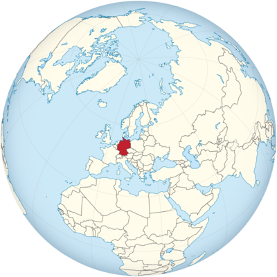
Germany Location in World Map
Germany is located in central Europe.
Location Information of Germany
Germany is a central European country known for its rich history, cultural heritage, and economic strength. It is the largest country in Central Europe and plays a pivotal role in the European Union. Germany is bordered by nine countries, and it has access to the North Sea and the Baltic Sea. From historical landmarks to modern cities and vast landscapes, Germany is a major player in global politics, economics, and culture.
Latitude and Longitude
Germany is located between 47° and 55° N latitude and 5° and 15° E longitude. Its central location in Europe means it serves as a key connection point between various European nations. The country stretches from the flat plains of the north to the Alpine mountains in the south, offering diverse landscapes and ecosystems.
Capital City and Major Cities
Berlin (Capital City)
Berlin is the capital and largest city of Germany. It is known for its history, culture, and vibrant atmosphere. The city is one of the most significant cultural and political hubs in Europe.
- Brandenburg Gate: One of the most iconic landmarks in Germany, the Brandenburg Gate is a symbol of Germany’s reunification after the fall of the Berlin Wall in 1989.
- Berlin Wall Memorial: The Berlin Wall Memorial preserves parts of the Wall, providing historical insight into the division of East and West Germany during the Cold War era.
- Museum Island: Located in the heart of Berlin, Museum Island is home to several world-class museums, including the Pergamon Museum and the Altes Museum.
- Reichstag Building: The seat of the German parliament, this historical building offers panoramic views of the city from its glass dome, a modern addition designed by architect Sir Norman Foster.
- Alexanderplatz: A major public square in central Berlin, home to the Berlin TV Tower (Fernsehturm), one of the tallest structures in Germany, which offers an observation deck with stunning views.
Munich
Munich, located in the Bavaria region, is the third-largest city in Germany and one of the most important cultural and economic centers in the country.
- Marienplatz: The central square of Munich, where the New Town Hall (Neues Rathaus) is located. The Glockenspiel clock tower attracts tourists daily for its mechanical show.
- English Garden (Englischer Garten): One of the largest urban parks in the world, the English Garden is famous for its wide lawns, serene lakes, and picturesque walking paths. It’s also home to traditional beer gardens.
- Nymphenburg Palace: A magnificent Baroque palace surrounded by beautiful gardens, it was once the summer residence of Bavarian kings.
- BMW Museum: Munich is home to the headquarters of BMW, and the BMW Museum showcases the company’s iconic vehicles, from classic models to futuristic concepts.
Hamburg
Hamburg, located in northern Germany, is Germany’s second-largest city and an important port city. It is known for its maritime heritage and modern business district.
- Miniatur Wunderland: This is the world’s largest model railway exhibition, located in Hamburg, attracting visitors with its detailed landscapes and miniature cities.
- Hamburg Harbor: Known as the “Gateway to the World,” Hamburg’s harbor is one of the largest and busiest in Europe, offering boat tours and waterfront dining.
- Speicherstadt: A UNESCO World Heritage site, Speicherstadt is the largest warehouse district in the world, with red-brick warehouses, canals, and bridges.
Frankfurt
Frankfurt is Germany’s financial capital and is located in the central part of the country. It is home to the European Central Bank and serves as a hub for banking, finance, and trade.
- Römerberg: The medieval square in the heart of Frankfurt, known for its charming half-timbered houses and historic buildings.
- Frankfurt Cathedral: This Gothic cathedral, also known as St. Bartholomew’s Cathedral, is one of the city’s tallest buildings and a key landmark.
- Palmengarten: One of the largest botanical gardens in Germany, offering a variety of plants from around the world.
Cologne
Cologne, located in western Germany, is a major cultural center and is known for its remarkable Gothic architecture and lively cultural scene.
- Cologne Cathedral (Kölner Dom): A UNESCO World Heritage site, this stunning Gothic cathedral is one of the largest churches in Europe and a symbol of Cologne.
- Rhine River Cruises: Visitors can take a relaxing cruise along the Rhine River, which flows through Cologne, providing scenic views of the city and its surroundings.
- Museum Ludwig: This museum houses an impressive collection of modern art, including works by Pablo Picasso and Andy Warhol.
Time Zone
Germany operates on Central European Time (CET) during standard time and Central European Summer Time (CEST) during daylight saving time, which begins in late March and ends in late October.
- CET: UTC +1 hour
- CEST: UTC +2 hours
Germany is one hour ahead of the United Kingdom and two hours ahead of countries like Portugal, Brazil, and the United States (Eastern Time Zone during standard time).
Climate
Germany experiences a temperate climate, with moderate to heavy rainfall throughout the year. Due to its geographical location, the climate varies from region to region, with the southern parts of the country being colder in winter and the northern areas generally milder.
Northern Germany
- Coastal Climate: Northern Germany, particularly along the coast, experiences a maritime climate with mild winters and cool summers. Rainfall is spread throughout the year, with the wettest months being from July to October.
Central and Western Germany
- Moderate Climate: This region experiences a mix of continental and maritime influences, which means cool winters with snow, and warm summers with occasional heatwaves. The Rhine Valley and Frankfurt areas have relatively mild winters and pleasant summers.
Southern Germany
- Alpine Climate: The southern region, including Bavaria, has a more continental climate. Winters can be cold and snowy, especially in the Alps, while summers are warmer, making it ideal for outdoor activities such as hiking and skiing.
Average Temperatures
- Winter: January temperatures range from -2°C to 3°C (28°F to 37°F) in most regions.
- Summer: July temperatures are typically between 16°C to 30°C (61°F to 86°F), with southern regions being hotter.
Economic Status
Germany has the largest economy in Europe and the fourth-largest in the world by nominal GDP. Known for its industrial strength, the country is a global leader in manufacturing, automobiles, and engineering. It is also the home of some of the world’s most renowned companies such as Volkswagen, BMW, Siemens, and Allianz.
Key Economic Sectors
- Automotive Industry: Germany is known for its iconic car manufacturers such as Mercedes-Benz, BMW, and Audi, making the automotive sector a cornerstone of the country’s economy.
- Manufacturing and Engineering: German engineering is legendary, particularly in areas such as machinery, chemical products, and electronics. German products are often associated with high quality, precision, and innovation.
- Financial Services: Frankfurt is the financial center of Germany and is home to the European Central Bank. The country’s financial services sector is highly developed, with a strong banking system and a large insurance industry.
- Renewable Energy: Germany has made significant investments in renewable energy, particularly wind and solar power, positioning itself as a leader in sustainable energy solutions.
Unemployment and Income
Germany has a relatively low unemployment rate, consistently hovering around 3-5%, with high wages and a strong social welfare system. The country has a high standard of living, with excellent healthcare, education, and social services available to its residents.
Tourist Attractions
Germany is known for its beautiful landscapes, rich history, and cultural diversity. Whether it’s medieval castles, modern museums, or stunning natural parks, Germany offers a wide range of attractions for travelers.
Neuschwanstein Castle
Located in Bavaria, Neuschwanstein Castle is one of the most famous castles in the world. It served as the inspiration for Disney’s Sleeping Beauty Castle and attracts millions of tourists each year.
The Romantic Road
The Romantic Road is a scenic route that stretches through southern Germany, connecting medieval towns, castles, and villages. The route is known for its picturesque views, charming villages, and historic landmarks.
The Black Forest
Located in southwestern Germany, the Black Forest is known for its dense forests, hiking trails, and picturesque villages. It is a popular destination for nature lovers, hikers, and cyclists.
Rhine Valley
The Rhine Valley is famous for its stunning landscapes, castles, vineyards, and the winding Rhine River. Visitors can take a boat tour along the river and explore the charming towns of Bacharach and Bingen.
Zugspitze
The Zugspitze is Germany’s highest mountain, located in the Bavarian Alps. It offers breathtaking views, ski resorts, and hiking trails. The Zugspitze Glacier allows for year-round skiing.
Visa Requirements for U.S. Citizens
U.S. citizens can travel to Germany for tourism or business without a visa for up to 90 days within a 180-day period, as part of the Schengen Area agreement. However, they must carry a valid U.S. passport and meet the following requirements:
- Valid Passport: U.S. citizens must have a passport that is valid for at least three months beyond the date of their intended departure from Germany.
- Proof of Sufficient Funds: Travelers may be asked to provide proof of sufficient funds to cover their stay in Germany.
- Return Ticket: Travelers may also need to show proof of a return or onward ticket.
- Travel Insurance: Some travelers may be required to show proof of travel health insurance covering their stay in Germany.
U.S. citizens can also apply for a longer-term visa if they plan to stay for purposes such as work or study.
Distance to New York City and Los Angeles
- New York City to Berlin: The distance between John F. Kennedy International Airport (JFK) and Berlin Brandenburg Airport (BER) is approximately 4,100 miles (6,600 kilometers), with a flight time of around 8 to 9 hours.
- Los Angeles to Berlin: The distance from Los Angeles International Airport (LAX) to Berlin Brandenburg Airport (BER) is about 5,700 miles (9,200 kilometers), with a flight time of approximately 10 to 11 hours.
Germany Facts
| Size | 357,376 km² |
| Residents | 83.2 million |
| Language | German |
| Capital | Berlin |
| Longest river | Rhine (865 km in Germany) |
| Highest mountain | Zugspitze (2962 m) |
| Currency | Euro |


