Where is Mongolia Located?
Where is Mongolia located on the map? Mongolia is an independent nation located in Eastern Asia. Check out the following images to see location of Mongolia on maps.
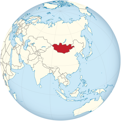
Mongolia Location in World Map
Here you can see where Mongolia is.
Location Information of Mongolia
Latitude and Longitude
Mongolia is a landlocked country located in Central Asia, bordered by Russia to the north and China to the south. It lies at approximately 46.8625° N latitude and 103.8467° E longitude. The country’s vast land area, approximately 1.56 million square kilometers (603,909 square miles), makes it the 18th-largest country in the world. Mongolia’s geography is diverse, consisting of mountains, steppes, deserts, and plains. It is positioned at the heart of Asia, making it a crossroads between Russia, China, and other Central Asian nations.
Mongolia’s location at the juncture of the Siberian and Chinese climates results in extreme seasonal temperature variations, which contributes to its unique climate and geography.
Capital City and Major Cities
Capital City: Ulaanbaatar
Ulaanbaatar, also known as Ulan Bator, is the capital and largest city of Mongolia. It is situated in the north-central part of the country, at the confluence of the Tuul and Selbe rivers. With a population of over 1.5 million people, Ulaanbaatar accounts for nearly half of Mongolia’s total population. The city is the political, economic, and cultural center of the country, and it hosts the government, most major businesses, and international organizations.
Ulaanbaatar experiences a harsh continental climate, and it is known for its remarkable cultural heritage, including the Gandan Monastery, Sukhbaatar Square, and the Mongolian National Museum. The city also serves as the primary hub for transportation, education, and tourism in the country.
Major Cities
- Erdenet: Located in northern Mongolia, Erdenet is the second-largest city and is an important industrial center. The city is known for its copper and molybdenum mines, which are among the largest in the world. Erdenet’s population is around 100,000 people, and it plays a crucial role in the mining industry, one of Mongolia’s primary economic sectors.
- Darkhan: Darkhan is the third-largest city in Mongolia, located in the north of the country. With a population of approximately 80,000, Darkhan is an industrial city known for its metallurgy and textile industries. It serves as a key regional center for trade and services in the northern part of Mongolia.
- Mörön: The capital of Khövsgöl Province, Mörön is situated in the northern part of Mongolia near Lake Khövsgöl, one of the largest freshwater lakes in Central Asia. Mörön has a population of around 30,000 people and is known for its proximity to natural attractions, including the lake and the surrounding forests.
- Choibalsan: Located in the eastern part of Mongolia, Choibalsan is the capital of Dornod Province. It has a population of about 30,000 people and is an important administrative and transportation hub in the eastern region of the country.
- Baganuur: A mining town located about 100 kilometers from Ulaanbaatar, Baganuur is known for its coal mining industry. The town has a population of approximately 30,000, and it plays an important role in supplying coal to Ulaanbaatar and surrounding regions.
Time Zone
Mongolia operates on Mongolia Standard Time (UTC +8:00). This time zone places Mongolia in the same time zone as several other East Asian countries, including China, and it does not observe daylight saving time. As a result, the country maintains a consistent time throughout the year. Mongolia’s time zone is an advantage for trade and communication with neighboring countries like China and Russia, which operate in similar time zones.
Climate
Mongolia experiences a continental climate, characterized by extreme temperature variations between summer and winter. The country is known for its harsh winters and relatively short, warm summers, with large temperature swings between day and night, particularly in the desert and steppe regions.
1. Winter Climate
Winter in Mongolia, lasting from November to March, is long and very cold, with temperatures often dropping below -20°C (-4°F) in many areas. In the capital, Ulaanbaatar, winter temperatures can fall as low as -40°C (-40°F). The country experiences frequent snow, but it is typically dry due to the lack of moisture in the air. The Gobi Desert in the south has a particularly harsh winter, where temperatures can plummet to -50°C (-58°F).
2. Summer Climate
Summer in Mongolia, from June to August, is relatively short and characterized by warm temperatures ranging between 20°C (68°F) and 30°C (86°F) in many areas. However, temperatures can vary greatly, especially in the steppe regions, where daytime temperatures can reach up to 35°C (95°F), while nighttime temperatures may drop to 10°C (50°F) or lower. Rainfall is generally sparse in the summer months, and most precipitation falls in the north and northeastern regions.
3. Spring and Autumn
Both spring and autumn are transitional seasons. Spring (April to May) sees temperatures gradually warming, but occasional snowstorms can still occur. Autumn (September to November) experiences decreasing temperatures and the onset of winter, especially in the northern and central parts of the country. In general, these seasons are cool, with moderate rainfall, particularly in the northern mountains and the eastern regions.
Economic Status
Mongolia has a developing economy, with major industries including mining, agriculture, livestock, and tourism. The country is heavily dependent on its vast natural resources, including coal, copper, gold, and oil. Mongolia is landlocked, which means that it depends on trade agreements with China and Russia for access to international markets.
1. Mining
Mongolia is rich in mineral resources and is one of the world’s largest producers of copper, coal, and gold. The country’s mining sector has attracted significant foreign investment, particularly in the Oyu Tolgoi copper and gold mine in the southern Gobi Desert, which is one of the world’s largest untapped copper deposits. Mining accounts for around 20-25% of Mongolia’s GDP, and the country is heavily reliant on commodity exports.
2. Agriculture and Livestock
Agriculture plays a key role in the Mongolian economy, particularly livestock farming, with sheep, goats, cattle, and camels being the most common animals raised. Mongolia’s vast grasslands provide excellent grazing land for animals, and the livestock sector accounts for around 10% of GDP. Cashmere production is particularly important, with Mongolia being one of the world’s largest producers and exporters of cashmere wool.
3. Tourism
Tourism in Mongolia is growing, with visitors drawn to the country’s stunning natural landscapes, traditional culture, and historical sites. Mongolia’s famous Naadam Festival, which celebrates the country’s heritage, attracts many international tourists. Major attractions include the Gobi Desert, Khustain Nuruu National Park, and the Mongolian Steppe, which offers tourists an opportunity to experience traditional nomadic culture.
4. Challenges
Despite its rich natural resources, Mongolia faces challenges such as economic dependence on foreign markets, especially China, income inequality, and environmental degradation. The country’s reliance on mining makes it vulnerable to fluctuating global commodity prices, and the harsh climate and geographic remoteness hinder large-scale industrialization. Efforts are being made to diversify the economy and reduce reliance on natural resources, but these challenges remain significant.
Tourist Attractions
- Gobi Desert The Gobi Desert is one of the most famous and unique landscapes in Mongolia, characterized by its vast sand dunes, mountains, and rare wildlife. Tourists can experience camel riding, visit ancient ruins such as the Khongoryn Els dunes, and explore the Flaming Cliffs, where dinosaur fossils have been discovered.
- Naadam Festival Held annually in July, the Naadam Festival is a celebration of Mongolian culture, featuring traditional sports like wrestling, horse racing, and archery. It is one of the most important festivals in Mongolia and provides a deep insight into the country’s historical traditions.
- Lake Khövsgöl Known as the “Blue Pearl of Mongolia,” Lake Khövsgöl is one of the largest freshwater lakes in the world. Located in the north of Mongolia, it is surrounded by mountains and forests, making it a popular spot for hiking, camping, and boat trips. The area is also home to indigenous nomadic people and wildlife.
- Erdene Zuu Monastery The Erdene Zuu Monastery, located in Karakorum, was established in the 16th century and is the oldest surviving Buddhist monastery in Mongolia. The monastery features beautiful temples, walls, and stupas, offering a glimpse into Mongolia’s religious heritage.
- Khustai National Park Khustai National Park is home to the wild Przewalski’s horses, also known as the Takhi, which were reintroduced to the park after being extinct in the wild. The park offers opportunities for wildlife viewing, hiking, and enjoying the natural beauty of the Mongolian steppes.
Visa Requirements for U.S. Citizens
U.S. citizens visiting Mongolia for tourism do not require a visa for stays of up to 90 days. A valid U.S. passport is required for entry, and visitors should ensure that their passport remains valid for at least six months beyond their intended stay. For longer stays or visits for business or other purposes, a visa is required, which can be obtained from a Mongolian embassy or consulate.
Distance to New York City and Los Angeles
Distance to New York City
The distance from New York City to Ulaanbaatar, the capital of Mongolia, is approximately 10,600 kilometers (6,600 miles). Flights generally require at least one layover, and the total flight time typically ranges from 14 to 17 hours, depending on the route and layover locations.
Distance to Los Angeles
The distance from Los Angeles to Ulaanbaatar is about 9,700 kilometers (6,000 miles). Similar to flights from New York, those traveling from Los Angeles usually need to make one or two layovers, with total flight times typically ranging from 13 to 16 hours depending on the stops and routes chosen.
Mongolia Facts
| Size | 1,564,116 km² |
| Residents | 3.2 million |
| Language | Mongolian (Khalkha) |
| Capital | Ulan Bator (Ulaanbaatar) |
| Longest river | Orkhon (1,124 km) |
| Highest mountain | Nayramdal Uur (Hüyten, 4,374 m) |
| Currency | Mongolian tugrik |


