Where is Lesotho Located?
Where is Lesotho located on the map? Lesotho is an independent nation located in Southern Africa. Check out the following images to see location of Lesotho on maps.
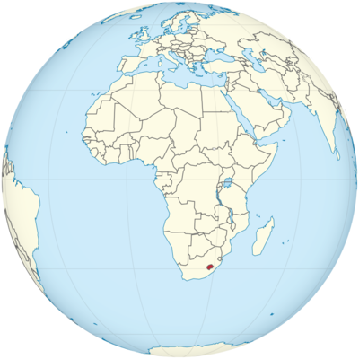
Lesotho Location in World Map
Lesotho is a small country in the south of Africa. It’s about the size of Belgium. The special thing about Lesotho is that South Africa completely encloses the state. It is an enclave and at the same time a landlocked state, i.e. a state that does not border on any sea. Although the country is completely enclosed by South Africa, it was never politically one of them.
On the map you can see where Lesotho is and how small the country is compared to South Africa.
Location Information of Lesotho
Lesotho is a landlocked country situated in Southern Africa, entirely surrounded by South Africa. It is one of the few independent nations in the world that is entirely situated within another country. Known as the “Kingdom in the Sky” due to its mountainous terrain, Lesotho is famous for its stunning landscapes, including towering peaks and rugged valleys. The country’s unique geography and location give it a strategic position in Southern Africa.
Latitude and Longitude
Lesotho is located between 28° and 31°S latitude and 27° and 30°E longitude. This positioning places the country entirely in the Southern Hemisphere, bordered on all sides by South Africa. The country’s terrain is predominantly mountainous, which impacts its climate and population distribution.
Capital City and Major Cities
Capital City: Maseru
Maseru is the capital and largest city of Lesotho, located on the western edge of the country, just across the border from South Africa. The city serves as the administrative, economic, and cultural hub of the country. Maseru has a population of approximately 300,000 people and is the primary gateway for trade and communication between Lesotho and South Africa. The city is known for its modern infrastructure, bustling markets, and a mix of colonial-era buildings and newer structures.
Major Cities
- Teyateyaneng:
Located in the central part of Lesotho, Teyateyaneng is one of the country’s largest towns and an important commercial center. It is situated along the main highway that connects Maseru with the eastern parts of the country. Teyateyaneng has a population of about 50,000 people and is an important agricultural and trading hub. - Butha-Buthe:
Situated in the northern part of Lesotho near the border with South Africa, Butha-Buthe is a town known for its beautiful scenery and close proximity to the Maluti Mountains. It serves as an important center for trade and agriculture, with a population of around 40,000 people. The area is rich in cultural history and natural beauty. - Mohale’s Hoek:
Mohale’s Hoek is located in the southern part of Lesotho, near the border with South Africa. It is an important administrative and agricultural center with a population of about 35,000 people. The town is known for its surrounding agricultural activities and scenic views of the lowlands and mountains. - Quthing:
Located in the southern part of the country, Quthing is a regional hub with a population of around 35,000 people. It is strategically positioned near the border with South Africa and is an essential point for cross-border trade. - Leribe:
Leribe is situated in the northern part of Lesotho, not far from the border with South Africa. The town serves as a key trading post and is important for the country’s textile industry, particularly since it is in the proximity of major agricultural and industrial sectors.
Time Zone
Lesotho operates on South Africa Standard Time (SAST), which is UTC+2 year-round. The country does not observe daylight saving time, so the time remains consistent throughout the year. Lesotho’s time zone is the same as that of neighboring South Africa.
Climate
Lesotho has a temperate climate, with variations depending on altitude and location. Due to its mountainous terrain, the country experiences a mix of Mediterranean, continental, and subtropical climates. The higher elevations in Lesotho have cooler temperatures compared to the lowlands, which affects the types of crops grown and the lifestyle of the inhabitants.
- Summer (November to March):
Summers in Lesotho are warm and relatively wet. Average temperatures in the lowlands range from 18°C to 30°C (64°F to 86°F), while in the highlands, temperatures can be cooler. The summer months bring most of the annual rainfall, particularly in the form of thunderstorms, which can lead to flooding in some areas. - Winter (May to August):
Winters in Lesotho can be quite cold, especially in the mountains, where temperatures can drop below 0°C (32°F), and snow is common. In the lowlands, winter temperatures are milder, ranging from 5°C to 20°C (41°F to 68°F), but nighttime temperatures can fall close to freezing. The winter season is dry, with little to no rainfall. - Spring and Autumn (September to November):
Both spring and autumn are transitional seasons, marked by mild temperatures and less precipitation. During these times, Lesotho experiences moderate temperatures ranging from 10°C to 20°C (50°F to 68°F). These seasons are often considered the most pleasant for outdoor activities and travel.
Economic Status
Lesotho is a small but stable economy, heavily dependent on its natural resources, agriculture, and its close relationship with South Africa. While the country has made significant strides in economic development, it faces challenges such as high unemployment rates, poverty, and reliance on remittances from the Basotho diaspora, particularly in South Africa.
- Agriculture:
Agriculture is the backbone of Lesotho’s economy, employing a significant portion of the population. The country produces crops such as maize, wheat, and vegetables, as well as livestock, including cattle and sheep. The country is also known for its wool and mohair industry, which is one of the main exports. However, agricultural production is often hindered by the country’s rugged terrain, which limits the amount of arable land. - Mining:
Mining, particularly diamonds, plays a vital role in Lesotho’s economy. The country is home to some high-quality diamond mines, including the Letseng Diamond Mine, which is known for producing large, high-value diamonds. Other minerals such as sand, clay, and limestone are also extracted and contribute to the economy. - Manufacturing and Textiles:
The manufacturing sector, including textiles and clothing production, contributes significantly to Lesotho’s economy. Due to preferential trade agreements with the United States under the African Growth and Opportunity Act (AGOA), Lesotho has become a major exporter of garments, particularly to the U.S. market. - Services:
The service sector in Lesotho is growing, particularly in telecommunications, banking, and tourism. The country’s proximity to South Africa has helped boost trade and services, particularly through cross-border supply chains and migrant labor. - Challenges:
Despite steady progress, Lesotho faces significant economic challenges, including high unemployment rates (especially among youth), an over-reliance on imports, and vulnerability to external shocks such as fluctuations in diamond prices and agricultural output. The country also struggles with a high incidence of poverty, particularly in rural areas.
Tourist Attractions
Lesotho offers a wealth of natural beauty, cultural experiences, and outdoor activities, making it an attractive destination for adventurous travelers and those interested in African history and culture. The country’s diverse landscape, rich history, and warm hospitality are major draws for visitors.
1. Maluti Mountains
The Maluti Mountains are one of the most prominent features of Lesotho’s geography. These mountains offer spectacular landscapes, ideal for hiking, mountaineering, and photography. The area is also home to several protected wildlife reserves, such as the Sehlabathebe National Park.
2. Lesotho Highlands
The Lesotho Highlands is a region famous for its rugged mountains and beautiful valleys. It is a popular destination for those interested in trekking, fishing, and skiing. The Katse Dam, one of the largest dams in Africa, offers both scenic views and opportunities for water-based activities.
3. Sani Pass
The Sani Pass is a well-known mountain pass connecting Lesotho to South Africa, offering breathtaking views and a challenging drive. Located in the Drakensberg Mountains, it is one of the highest motorable roads in Southern Africa and is popular among tourists seeking adventure.
4. Thaba Bosiu
Thaba Bosiu is a historic mountain that served as the seat of the Basotho Kingdom during the reign of King Moshoeshoe I. It is considered the birthplace of the Basotho nation. Visitors can explore the ruins, learn about the history of the Basotho people, and enjoy panoramic views from the summit.
5. Katse Dam
Located in the Lesotho Highlands, the Katse Dam is not only an engineering marvel but also an important tourism site. The surrounding area offers beautiful landscapes, and visitors can participate in water-based activities like fishing and boat tours.
6. Mokhotlong
Mokhotlong is one of the most remote regions in Lesotho, offering visitors a chance to explore some of the most pristine and untouched landscapes in the country. Located near the eastern border with South Africa, the area is known for its wildlife and stunning mountain scenery.
Visa Requirements for U.S. Citizens
As of 2024, U.S. citizens require a tourist visa to visit Lesotho. However, U.S. citizens can also obtain a visa on arrival at the Moshoeshoe I International Airport and at land border posts. The visa on arrival is typically valid for 30 days and can be extended if necessary.
Visa on Arrival Requirements:
- A valid U.S. passport with at least six months’ validity.
- A return ticket or proof of onward travel.
- Proof of sufficient funds for the duration of the stay.
- A visa fee, which is approximately $30.
Alternatively, U.S. citizens can apply for a visa at the Lesotho Embassy in Washington, D.C.
Distance to New York City and Los Angeles
- New York City to Maseru:
The distance from New York City (JFK) to Maseru (Moshoeshoe I International Airport) is approximately 8,000 miles (12,875 kilometers). A flight typically takes around 18 to 20 hours, depending on layovers. - Los Angeles to Maseru:
The distance from Los Angeles (LAX) to Maseru is about 9,000 miles (14,485 kilometers). Flights typically take 21 to 23 hours, with at least one layover, often in Johannesburg or another major African hub.
Mountains
Lesotho is quite high. In the west there are areas at an altitude of 1700 meters. The mountains in the east reach a height of 2000 meters and consist mostly of basalt rock. The Drakensberg also run through the country. These extend to South Africa. That is why the country is also called “Kingdom in Heaven”.
Other mountain ranges and deep river valleys shape the picture. The highest mountain is called Thabana Ntlenyana. In all of Lesotho there is no point lower than 1000 meters. Table mountains and river landscapes determine the Lesothic landscape.
Incidentally, the altitude of Lesotho is unique. As the only independent country in the world, the entire area of the state is over 1000 meters high, 80 percent of it even at 1800 meters. So if you want to live in Lesotho, you shouldn’t have any problems with altitude.
Rivers and Lakes
Two rivers in South Africa have their source in Lesotho: They are called Oranje and Caledon. The Orange River in particular has cut deep canyons into the country. By the way, in Lesotho it is called Senqu.
A geographic feature of Lesotho is the Maletsunyane waterfall, which reaches a height of 192 meters. It is the tallest uninterrupted waterfall in southern Africa.
Climate
The altitude in particular influences the climate in Lesotho. The temperature differences are also large. In summer it can be 35 degrees and in winter temperatures can reach minus degrees to -15 degrees. Since Lesotho is very high overall, there are mountain regions where snow falls all year round. By the way, you can also go skiing in Lesotho. The country has its own ski area. Tourists from South Africa come here primarily.
In summer it gets very humid, there is a lot of precipitation and also frequent thunderstorms. Since we are in the southern hemisphere, the seasons are opposite to ours. When we freeze in winter, it’s summer in Lesotho and of course vice versa.
Lesotho Facts
| Size | 30,355 km² |
| Residents | 2.1 million |
| Languages | Lesotho and English |
| Capital | Maseru |
| Longest river | Oranje (total length 2,160 km) |
| Highest mountain | Thabana Ntlenyana (3,482 m) |
| Currency | Loti |


