Where is Bolivia Located?
Where is Bolivia located on the map? Bolivia is an independent nation located in South America. Check out the following images to see location of Bolivia on maps.
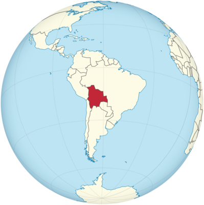
Bolivia Location in World Map
On the map you can see where Bolivia is.
Location Information of Bolivia
Latitude and Longitude
Bolivia is a landlocked country located in central South America. It is bordered by Brazil to the north and east, Argentina and Chile to the south, and Peru to the west. The country is known for its diverse landscapes, which range from the Andes mountain range in the west to the Amazon basin in the east. The geographical coordinates of Bolivia are:
- Latitude: 16.2902° S
- Longitude: 63.5887° W
These coordinates place Bolivia in a region of high altitudes, particularly in the Andes, with the western part of the country being dominated by mountain peaks, while the eastern portion lies within the lower-altitude Amazon basin.
Capital City and Major Cities
- Capital City: Sucre (Constitutional Capital)Sucre is the constitutional capital of Bolivia, located in the south-central part of the country. Sucre was the original capital of Bolivia and is the historical and judicial center of the country. The city is a UNESCO World Heritage site, known for its colonial architecture, including the Sucre Cathedral and Casa de la Libertad, where Bolivia’s declaration of independence was signed. Sucre is also home to the National Museum of Ethnography and Folklore and La Recoleta, a beautiful viewpoint offering scenic views of the city.
However, while Sucre is the constitutional capital, the seat of government and executive functions is in La Paz, the de facto capital.
- Major Cities:
- La Paz – La Paz is the administrative capital and the largest city in Bolivia. Located at an elevation of about 3,650 meters (11,975 feet) above sea level, it is the highest capital city in the world. La Paz is known for its dramatic landscapes, nestled between towering mountains such as Mount Illimani. The city is famous for its vibrant markets, including Mercado de Las Brujas (Witches’ Market), and landmarks such as the Plaza Murillo, San Francisco Church, and Valle de la Luna.
- Santa Cruz de la Sierra – Santa Cruz, located in the eastern part of Bolivia, is the country’s largest city and its economic powerhouse. The city has a tropical climate and is the center of Bolivia’s commercial activities, particularly in agriculture, oil, and gas industries. Santa Cruz is also the gateway to the lowland regions of the Amazon, with a rapidly expanding population and a modern infrastructure.
- Cochabamba – Cochabamba is located in central Bolivia, nestled in a valley surrounded by mountains. It is known for its mild climate and beautiful landscapes, including the Cristo de la Concordia, the world’s second-largest statue of Christ. The city is an agricultural hub and is known for producing a variety of crops, including potatoes, quinoa, and vegetables.
- Potosí – Located in the southern part of Bolivia, Potosí is historically significant for its role during the Spanish colonial era. The city was once one of the richest in the world due to the vast silver mines at Cerro Rico. Visitors can explore the Potosí Mint, San Francisco Church, and the Tupiza area, which is known for its dramatic landscapes.
- Oruro – Oruro, situated in the western part of Bolivia, is famous for its vibrant Oruro Carnival, a UNESCO-recognized event that is considered one of the largest folk festivals in South America. Oruro is also known for its historical significance, including the Santuario de la Virgen del Socavón, which is an important religious site.
Time Zone
Bolivia operates on Bolivia Time (BOT), which is UTC -4. The country does not observe Daylight Saving Time, so the time remains consistent throughout the year. This time zone places Bolivia in line with other countries in South America, including Paraguay, and makes it convenient for travel between neighboring countries like Brazil and Argentina.
Climate
Bolivia’s climate is diverse, with different regions of the country experiencing distinct weather patterns due to the varied geography. From the high-altitude Andean region to the lowland tropical areas in the east, Bolivia’s climate ranges from arid and cold to humid and hot.
- Highlands Climate: The western part of Bolivia, including La Paz, Oruro, and Potosí, experiences a high-altitude climate, characterized by cool to cold temperatures throughout the year. The altitude, which often exceeds 3,000 meters (9,800 feet), means that temperatures can vary widely between day and night. During the summer months (November to March), daytime temperatures can reach 15°C (59°F) to 20°C (68°F), while nighttime temperatures can drop well below freezing. Winters are cold, with temperatures ranging from 5°C (41°F) to 10°C (50°F) during the day, and freezing temperatures at night.
- Tropical Climate: The lowland regions in the east, including Santa Cruz and Beni, have a tropical climate. These areas experience hot and humid conditions year-round, with average temperatures ranging from 25°C (77°F) to 35°C (95°F). The rainy season typically lasts from November to March, bringing significant rainfall, while the dry season extends from May to September. During the rainy season, the temperature is typically accompanied by high humidity.
- Subtropical Climate: In between the highlands and lowlands, regions like Cochabamba experience a subtropical climate, with moderate temperatures. This area has warm, pleasant temperatures year-round, ranging from 10°C (50°F) in the mornings to 25°C (77°F) during the day. The climate here is considered ideal for agriculture, particularly for crops like potatoes, corn, and quinoa.
- Rainfall: Bolivia’s rainfall patterns vary considerably depending on the region. The tropical and subtropical regions in the east receive heavy rainfall during the wet season, while the western highlands are much drier, particularly in the Altiplano region, where rainfall is minimal and the landscape is dominated by deserts and salt flats.
Economic Status
Bolivia is one of the poorest countries in South America, but its economy has experienced growth in recent years, largely due to its natural resources, particularly natural gas, oil, and minerals. The country follows a mixed economy, with a combination of state-controlled and private industries.
- Natural Resources: Bolivia is rich in natural resources, with large reserves of minerals such as silver, tin, lithium, and zinc. The country also possesses significant natural gas and oil reserves, which have become important export products, particularly to Brazil and Argentina. Bolivia’s salt flats, notably the Salar de Uyuni, contain the world’s largest known reserves of lithium, which is increasingly valuable in the production of batteries for electric vehicles.
- Agriculture: Agriculture plays a key role in Bolivia’s economy, particularly in the highland and tropical regions. Major agricultural products include soybeans, quinoa, potatoes, corn, and coffee. Bolivia is one of the world’s largest producers of quinoa, a crop that has gained popularity in international markets due to its nutritional value. The agricultural sector faces challenges related to climate change, land distribution, and access to global markets.
- Manufacturing: The manufacturing sector in Bolivia is relatively small compared to other South American countries. However, there has been growth in the food processing, textiles, and construction industries. Bolivia’s manufacturing sector benefits from its natural resources, particularly in the production of processed foods and beverages, textiles, and chemicals derived from minerals.
- Tourism: Tourism is an increasingly important sector for Bolivia, with visitors attracted by the country’s cultural heritage, natural landscapes, and ancient ruins. Bolivia is known for its unique geographical features, such as the Salar de Uyuni, the Lake Titicaca region, and the Madidi National Park. The government has focused on promoting tourism as a means of generating revenue and creating jobs, particularly in areas like Cochabamba, Potosí, and La Paz.
- Challenges: Bolivia faces several challenges in its economic development. These include political instability, income inequality, infrastructure deficiencies, and dependence on commodity exports. The country has historically struggled with high levels of poverty, particularly in rural areas, and the reliance on natural resources leaves the economy vulnerable to price fluctuations in global markets. Despite these challenges, Bolivia has made strides toward improving its social programs and addressing poverty.
Tourist Attractions
Bolivia offers a range of stunning and unique attractions, from natural wonders to historical and cultural sites. Some of the top tourist destinations in the country include:
- Salar de Uyuni: The Salar de Uyuni is the largest salt flat in the world, located in the southwestern part of Bolivia. It spans over 10,000 square kilometers (3,900 square miles) and is one of the country’s most iconic attractions. The vast, flat expanse of white salt creates a surreal and breathtaking landscape, especially during the rainy season when it transforms into a giant mirror. The salt flats are also home to Incahuasi Island, where visitors can explore giant cacti and panoramic views of the flats.
- Lake Titicaca: Located on the border between Bolivia and Peru, Lake Titicaca is the highest navigable lake in the world. The lake is surrounded by picturesque villages and ancient ruins, including the Isla del Sol (Island of the Sun) and Isla de la Luna (Island of the Moon), which are believed to be sacred sites of the Inca civilization. Visitors can explore the lake by boat and visit indigenous communities living on the islands.
- Madidi National Park: Located in the Amazon Basin in northern Bolivia, Madidi National Park is one of the most biodiverse protected areas in the world. The park is home to a wide variety of wildlife, including jaguars, monkeys, and exotic birds. It offers opportunities for eco-tourism, including trekking, birdwatching, and camping.
- Potosí and the Cerro Rico: The city of Potosí is a UNESCO World Heritage site known for its historical significance during the Spanish colonial period. The Cerro Rico (Rich Mountain) once provided vast amounts of silver to the Spanish Empire. Today, visitors can explore the mining heritage of the area by touring the mines and visiting the Potosí Mint and San Francisco Church.
- La Paz: La Paz is known for its dramatic setting between the mountains, offering a unique landscape for exploration. Key attractions include the Valle de la Luna, a strange and beautiful rock formation, and Chacaltaya, a former ski resort that offers spectacular views of the surrounding mountains. Visitors can also take the Teleférico (cable car) for a unique view of the city and its surroundings.
- Tiwanaku: The Tiwanaku archaeological site is located near the shores of Lake Titicaca in western Bolivia. This ancient city, which predates the Inca civilization, is known for its monumental stone structures and mysterious carvings, including the Gate of the Sun. Tiwanaku is an important site for understanding pre-Columbian civilizations in the Andes region.
- Isla de la Luna and Isla del Sol: Both islands on Lake Titicaca are steeped in Incan history. Isla del Sol is considered the birthplace of the sun in Incan mythology and is home to several Incan ruins, while Isla de la Luna is associated with the Moon deity and features sacred temples.
Visa Requirements for U.S. Citizens
U.S. citizens need a visa to visit Bolivia, except for those who are staying for less than 90 days for tourism purposes, in which case they can obtain a tourist visa upon arrival. Requirements for obtaining a visa for longer stays or for other purposes (such as business or work) are as follows:
- Visa Application: U.S. citizens must apply for a visa at the Embassy of Bolivia or Consulate in the United States. The application includes personal details, purpose of travel, and an itinerary.
- Passport: A valid U.S. passport is required with at least six months of validity beyond the planned departure date.
- Visa Fee: There is a visa fee, which varies depending on the type of visa (tourist, business, etc.) and the processing time.
- Supporting Documents: U.S. travelers may need to provide a travel itinerary, hotel reservations, proof of financial stability, and sometimes a letter of invitation from a host in Bolivia.
Distance to Major U.S. Cities
The approximate air distances from La Paz, Bolivia, to major U.S. cities are as follows:
- Distance to New York City: The distance from La Paz to New York City is approximately 3,700 miles (5,955 kilometers). Flights typically take about 8-10 hours, depending on the route and layovers.
- Distance to Los Angeles: The distance from La Paz to Los Angeles is approximately 4,200 miles (6,760 kilometers). Flights generally take around 10-12 hours, with layovers in cities like Lima or Santiago.
Bolivia Facts
| Size | 1,098,581 km² |
| Residents | 11.35 million |
| Languages | Spanish (official language), plus 36 indigenous languages, including Quechua, Aymara and Guaraní |
| Capital | Sucre (seat of government: La Paz) |
| Longest river | Río Mamoré (1,170 km) |
| Highest mountain | Sajama (6,542 m) |
| Currency | Boliviano |


