Where is Barbados Located?
Where is Barbados located on the map? Barbados is an independent nation located in North America. Check out the following images to see location of Barbados on maps.
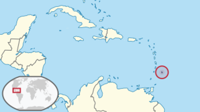
Barbados Location in World Map
Here you can see where Barbados is.
Location Information of Barbados
Latitude and Longitude
Barbados is an island nation located in the Caribbean Sea, specifically in the Lesser Antilles region, east of the Caribbean’s main island chain. It lies to the east of the Windward Islands, off the coast of Venezuela, and is surrounded by the Atlantic Ocean on the north and the Caribbean Sea on the south. The geographical coordinates of Barbados are:
- Latitude: 13.1939° N
- Longitude: 59.5432° W
These coordinates place Barbados in a tropical location, making it a popular destination for tourists seeking year-round sunshine, clear waters, and beautiful beaches. Its position also provides the country with a strategic location for trade and travel within the Caribbean and beyond.
Capital City and Major Cities
- Capital City: BridgetownBridgetown is the capital and largest city of Barbados, located on the southwestern coast of the island. The city is the economic, cultural, and historical heart of the country. It is home to major commercial activities, government offices, and a bustling port that serves as a hub for international trade. Bridgetown is a UNESCO World Heritage site, known for its colonial architecture and historic buildings, including the Garrison Historic Area and St. Michael’s Cathedral. The city also has a vibrant shopping district with local markets, international boutiques, and duty-free shopping opportunities.
- Major Cities:
- Speightstown – Located on the northwest coast of Barbados, Speightstown is the second-largest town in the country. Historically a center for trade, Speightstown offers a more laid-back atmosphere compared to Bridgetown. It has beautiful beaches and a variety of cultural attractions, including the Arlington House Museum.
- Oistins – Situated on the southern coast, Oistins is a bustling town known for its fishing industry and vibrant Oistins Fish Fry, a popular event for both locals and tourists. Oistins is a key part of the southern region’s tourism and nightlife scene.
- Holetown – Located on the west coast, Holetown is one of the country’s oldest towns and the site of the first British landing in Barbados. Today, it is known for its upscale resorts, shopping areas, and fine dining options. It is a major tourist destination on the island.
- Bathsheba – Located on the east coast, Bathsheba is a quieter, more scenic village known for its dramatic landscapes, surf beaches, and the Soup Bowl, one of the island’s most famous surf spots. The town offers a more natural and untouched experience compared to other urban areas.
- Saint Lawrence Gap – Often referred to as “The Gap,” Saint Lawrence Gap is a popular tourist district located in the parish of Christ Church. It is known for its vibrant nightlife, bars, restaurants, and beachfront accommodations. It is one of the top destinations for tourists seeking entertainment and relaxation.
Time Zone
Barbados operates on Atlantic Standard Time (AST), which is UTC -4. Unlike many other Caribbean nations, Barbados does not observe Daylight Saving Time, so the time remains constant throughout the year. This time zone aligns with several other Caribbean islands, such as the Dominican Republic and Puerto Rico. The country’s time zone facilitates easy access to both North and South America, serving as a hub for regional trade and tourism.
Climate
Barbados has a tropical climate, characterized by warm temperatures and relatively high humidity year-round. The island’s climate is influenced by its location in the Atlantic, with the cool trade winds providing a natural air conditioning effect. The climate can be divided into two main seasons: the dry season and the wet season.
- Dry Season: The dry season lasts from December to May, which is also considered the peak tourist season. During this period, the weather is typically sunny, with average temperatures ranging from 24°C (75°F) in the evening to 30°C (86°F) during the day. Humidity is lower during the dry season, and the island experiences little rainfall, making it the ideal time for outdoor activities, beachgoing, and exploring the island.
- Wet Season: The wet season spans from June to November, with the heaviest rainfall occurring in September and October. This period corresponds with the Atlantic hurricane season, though Barbados is generally less affected by hurricanes compared to other Caribbean islands. Rainfall is typically short but intense, with occasional storms and high humidity. Daytime temperatures during the wet season range from 25°C (77°F) to 30°C (86°F).
- Humidity and Wind: The trade winds blowing from the east help moderate the temperature and make the climate more bearable, even during the hotter months. The humidity, however, can be high, particularly during the wet season. Coastal areas typically experience milder temperatures compared to inland regions, which can be warmer.
- Cyclones and Hurricanes: Although Barbados is located within the hurricane belt, the island is less frequently impacted by major hurricanes than other islands in the region. The island’s position provides some protection from direct hits, but the country still faces occasional tropical storms and floods.
Economic Status
Barbados has a mixed economy, with a strong reliance on tourism, services, and agriculture. The country has historically been one of the wealthiest Caribbean nations, with a relatively high GDP per capita. Over the years, Barbados has transitioned from an agricultural-based economy to one that is more diversified, with a focus on tourism, international business, and finance.
- Tourism: The tourism industry is the largest sector of the Barbadian economy, contributing significantly to GDP. Barbados is known for its beautiful beaches, luxury resorts, and vibrant culture, which attract millions of visitors each year, especially from the United States, Canada, and the United Kingdom. The island is also known for its world-class diving spots, golf courses, and cultural festivals, such as Crop Over, an annual celebration of Barbadian heritage and music.
- Agriculture: Although agriculture’s contribution to GDP has decreased, it remains important to the local economy, particularly in rural areas. Sugarcane was historically the most significant agricultural product, and although sugar production has declined, the industry still plays a role in the country’s economic activities. Other agricultural products include fruits, vegetables, and livestock, which are produced mainly for local consumption.
- Manufacturing: Barbados has a relatively small manufacturing sector that produces goods such as beverages, food products, pharmaceuticals, and building materials. The manufacturing industry is focused on serving both the local population and regional markets in the Caribbean.
- Financial Services: In recent years, Barbados has become an important offshore financial center, attracting foreign investors and international businesses due to its favorable tax policies. The country offers financial services such as banking, insurance, and investment management, and its banking sector is well-developed, with many international banks operating in the country.
- Energy and Utilities: Barbados has been working on diversifying its energy sources, with an emphasis on renewable energy, including solar and wind power. The country is also known for its efficient water treatment and distribution systems.
- Challenges: Despite strong economic performance in certain sectors, Barbados faces challenges such as high public debt, a reliance on imported goods, and the need for economic diversification beyond tourism. Climate change and vulnerability to natural disasters also present risks to the country’s agricultural and infrastructure sectors.
Tourist Attractions
Barbados is a popular tourist destination due to its stunning beaches, vibrant culture, and range of activities. Whether visitors are looking for a relaxing beach vacation, an adventure-filled exploration of nature, or a cultural experience, Barbados offers something for everyone.
- Bridgetown and its Garrison: Bridgetown is a UNESCO World Heritage site and is home to historical landmarks such as The Garrison, St. Michael’s Cathedral, and The Careenage, a waterfront area with shops, restaurants, and historical buildings. Visitors can explore the National Heroes Square and learn about the island’s colonial past at the Barbados Museum.
- Beaches: Barbados is famous for its stunning beaches, such as Crane Beach, Dover Beach, and Bathsheba Beach. The island offers a variety of beach experiences, from calm, clear waters for swimming and snorkeling to more rugged areas suitable for surfing and windsurfing. Pink Sands Beach is especially popular for its beauty, featuring powdery pink sand and crystal-clear waters.
- Harrison’s Cave: One of the island’s most famous natural attractions, Harrison’s Cave is an impressive limestone cavern filled with stalactites and stalagmites. Visitors can take a tram tour through the cave, exploring its subterranean lakes and underground streams.
- Mount Gay Rum Distillery: Barbados is known as the birthplace of rum, and the Mount Gay Rum Distillery offers guided tours where visitors can learn about the history and process of rum production, as well as enjoy tastings of various rums.
- St. Nicholas Abbey: A plantation house built in the 17th century, St. Nicholas Abbey is one of the most significant historic sites in Barbados. Visitors can tour the mansion, which houses an impressive collection of antiques, and learn about the island’s sugar industry.
- Wildlife and Nature: Barbados is home to several wildlife parks and reserves, including the Barbados Wildlife Reserve in the parish of St. Peter, where visitors can see green monkeys, tortoises, and other native species. Andromeda Botanic Gardens offers lush tropical gardens with over 600 plant species, while the Frank Worrell Memorial Park is an excellent spot for birdwatching and outdoor activities.
- Animal Flower Cave: Located at the northern tip of Barbados, Animal Flower Cave is a natural sea cave that offers stunning views of the Atlantic Ocean. The cave is accessible to visitors who want to explore its rock formations and dip into its tidal pools.
Visa Requirements for U.S. Citizens
U.S. citizens do not need a visa to enter Barbados for tourism purposes for stays of up to 90 days. To enter the country, U.S. travelers must meet the following requirements:
- Passport: U.S. citizens must have a valid passport with at least six months of validity remaining beyond their intended departure date from Barbados.
- Proof of Sufficient Funds: Travelers may be required to show proof of sufficient funds for their stay in Barbados.
- Return or Onward Travel Ticket: U.S. travelers must provide evidence of a return or onward travel ticket when entering the country.
- No Visa Needed for Tourism: The 90-day visa exemption applies to tourism, business, and family visits. For longer stays, or for work, study, or residence purposes, U.S. citizens must apply for an appropriate visa.
Distance to Major U.S. Cities
The approximate air distances from Barbados to major U.S. cities are:
- Distance to New York City: The distance from Bridgetown to New York City is approximately 2,200 miles (3,540 kilometers). Flights typically take about 4 to 5 hours, depending on the route and layovers.
- Distance to Los Angeles: The distance from Bridgetown to Los Angeles is approximately 3,800 miles (6,100 kilometers). Flights usually take around 7 to 8 hours, with layovers in major international hubs such as Miami or Fort Lauderdale.
Barbados Facts
| Size | 430 km² |
| Residents | 286,000 |
| Language | English |
| Capital | Bridgetown |
| Longest river | – |
| Highest mountain | Mount Hillaby (340 m) |
| Currency | Barbados dollars |


