Where is Bahrain Located?
Where is Bahrain located on the map? Bahrain is an independent nation located in Western Asia. Check out the following images to see location of Bahrain on maps.
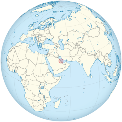
Bahrain Location in World Map
On the map you can see the location of Bahrain.
Location Information of Bahrain
Latitude and Longitude
Bahrain is a small island country located in the Persian Gulf, off the coast of the Arabian Peninsula. It consists of a small archipelago of 33 islands, with Bahrain Island being the largest and most populated. The geographical coordinates of Bahrain are:
- Latitude: 26.0667° N
- Longitude: 50.5577° E
These coordinates place Bahrain in the Middle East region, bordered by the Saudi Arabian mainland to the west and the Qatar Peninsula to the southeast. Its location at the crossroads of important global trade routes between Asia and Europe has made it a historically significant commercial hub.
Capital City and Major Cities
- Capital City: ManamaManama is the capital and largest city of Bahrain, located on the northeastern coast of Bahrain Island. It serves as the country’s political, economic, and cultural center. Manama is a bustling metropolis known for its modern architecture, bustling souks, luxury shopping malls, and rich cultural heritage. The city’s skyline is dominated by skyscrapers such as the Bahrain World Trade Center and Bahrain Financial Harbour, which reflect the country’s growing prominence as a financial center in the Gulf region.
- Major Cities:
- Riffa – Located in the central part of Bahrain, Riffa is the second-largest city in the country. It has a more suburban atmosphere compared to Manama and is known for its residential areas, shopping centers, and historical sites such as Riffa Fort.
- Muharraq – Situated to the north of Manama, Muharraq is Bahrain’s third-largest city and an important cultural center. The city is home to several historical sites, including the Bahrain Fort and the Pearl Diving Museum. Historically, Muharraq was the center of Bahrain’s pearling industry.
- Isa Town – Located in the central part of Bahrain, Isa Town is primarily residential, with a mix of commercial, educational, and recreational facilities. It is home to Bahrain International Circuit, a venue for Formula 1 races.
- Sitra – Located on Sitra Island, south of Bahrain Island, Sitra is a major industrial and residential area. The city is home to the Sitra Industrial Area, which hosts several oil refineries and manufacturing plants.
- Zallaq – Zallaq is a town located on the western coast of Bahrain Island, known for its resorts and beaches. It is a popular destination for both tourists and locals seeking recreation.
Time Zone
Bahrain operates in the Arabian Standard Time (AST) zone, which is UTC +3 year-round. Bahrain does not observe daylight saving time, so the time remains constant throughout the year. This time zone is shared with several other Gulf countries, including Saudi Arabia, Kuwait, and Qatar.
Climate
Bahrain experiences a desert climate, characterized by long, hot summers and mild winters. The country is located in a region that is influenced by the subtropical high-pressure system, which results in high temperatures and low rainfall throughout most of the year. Below are the key features of Bahrain’s climate:
- Hot and Dry Summers: Summers in Bahrain, which run from May to September, are extremely hot, with average daily high temperatures ranging from 35°C (95°F) to 45°C (113°F). The heat is often accompanied by high humidity, particularly in coastal areas. Sandstorms are also common during this period, reducing visibility and air quality.
- Mild Winters: Winters in Bahrain, from November to March, are much milder, with temperatures ranging from 15°C (59°F) to 25°C (77°F). This makes winter the best time to visit Bahrain, as it offers pleasant weather conditions for outdoor activities. Rainfall is minimal, with most of the rain falling in the winter months, particularly in December and January.
- Humidity: Due to Bahrain’s proximity to the Persian Gulf, the country experiences high humidity levels, especially during the summer months. Humidity can reach over 90% in coastal areas, which can make the hot temperatures feel even more intense.
- Rainfall: Bahrain receives very little rainfall, averaging just 70-80 mm annually. The rain is usually sporadic and falls in short bursts, typically during the winter months.
Economic Status
Bahrain has a highly developed and diversified economy, one of the most advanced in the Gulf region. Historically, Bahrain’s wealth was derived from its pearling industry, but in modern times, the country has become a financial and commercial center. Key sectors of the Bahraini economy include oil, banking and finance, construction, and tourism. Below are the major economic sectors in Bahrain:
- Oil and Gas: Bahrain was one of the first Gulf countries to discover oil, and oil production remains a significant part of its economy. However, the country’s oil reserves are smaller than those of its neighbors, such as Saudi Arabia, and Bahrain has worked to diversify its economy away from oil dependency. Despite this, the petroleum industry still contributes around 30% of the country’s GDP.
- Banking and Finance: Bahrain has established itself as a leading financial hub in the Middle East. The country’s financial sector is one of the largest in the region, with over 400 banks and financial institutions operating in Manama. Bahrain is home to the Bahrain Financial Harbour, a major business district that caters to international banking and investment firms. The country has developed a strong regulatory environment that attracts foreign investment, making it a key player in global finance.
- Manufacturing and Industry: Bahrain’s manufacturing sector has grown in recent decades, with industries such as aluminum production, textiles, and construction materials being key contributors to the economy. The Alba Aluminum Smelter is one of the largest industrial facilities in Bahrain, and the country is a major exporter of aluminum. The Bahrain International Investment Park is a major industrial zone that hosts companies from various sectors, including manufacturing, technology, and logistics.
- Tourism: Bahrain has invested heavily in tourism infrastructure, and tourism is an important contributor to the economy. The country’s rich cultural heritage, modern amenities, and luxury resorts attract visitors from around the world. Popular attractions include Qal’at al-Bahrain, a UNESCO World Heritage site, and Bahrain International Circuit, the host of the Formula 1 Bahrain Grand Prix. Bahrain’s proximity to Saudi Arabia also makes it a popular destination for religious tourism, with the country hosting pilgrims visiting the holy city of Mecca.
- Construction: Bahrain’s real estate and construction sectors have boomed in recent years. There is significant investment in residential and commercial development, as well as large infrastructure projects like the King Fahd Causeway, which connects Bahrain with Saudi Arabia. The country is also seeing rapid development in the hospitality sector, with several luxury hotels and resorts being built to cater to the growing number of international tourists.
- Challenges: Despite its economic growth, Bahrain faces challenges such as political instability, income inequality, and dependence on oil revenues. The government is actively working on diversifying the economy through initiatives such as the Economic Vision 2030, which aims to reduce the country’s reliance on oil and promote sustainable economic growth.
Tourist Attractions
Bahrain offers a rich blend of modern development and traditional Arab culture, with several world-class attractions for visitors. Some of the key tourist attractions include:
- Qal’at al-Bahrain (Bahrain Fort): A UNESCO World Heritage site, Qal’at al-Bahrain is an ancient fort located on the north coast of Bahrain Island. The site dates back to the Dilmun civilization and offers visitors a glimpse into the region’s long history. The fort is surrounded by archaeological digs and a museum showcasing artifacts from Bahrain’s past.
- Bahrain National Museum: Located in Manama, the Bahrain National Museum is one of the oldest and largest museums in the Arabian Gulf. It features exhibits on the island’s history, culture, and natural environment, with collections of ancient artifacts, Islamic art, and historical documents.
- Formula 1 Bahrain Grand Prix: Bahrain is home to one of the most important events in the motorsport world—the Bahrain Grand Prix. Held annually at the Bahrain International Circuit, this Formula 1 race attracts visitors from around the world, adding to Bahrain’s international tourism appeal.
- Bahrain International Circuit: Besides the Formula 1 race, the Bahrain International Circuit hosts numerous motorsport events, including Endurance Races and Drift Racing. The state-of-the-art track is one of the key attractions for sports enthusiasts and adrenaline junkies.
- Al Fateh Grand Mosque: One of the largest mosques in the world, the Al Fateh Grand Mosque in Manama is open to visitors who want to learn more about Bahrain’s Islamic culture and architecture. It features stunning Islamic art, including intricate calligraphy and stained glass windows.
- The Tree of Life: Located in the desert of Bahrain, the Tree of Life is a 400-year-old mesquite tree that thrives in the arid environment without any apparent source of water. The tree is a symbol of resilience and has become a popular tourist spot, attracting both locals and tourists.
- Bahrain Bay: Bahrain Bay is a modern development in Manama that includes luxury hotels, office buildings, and waterfront properties. The bay area also offers walking trails, shopping malls, and restaurants, making it a popular destination for both locals and tourists.
- Amwaj Islands: These man-made islands are located northeast of Bahrain’s main island and feature luxury resorts, marinas, and residential developments. The islands are known for their beautiful beaches and water-based activities, including diving, sailing, and kite surfing.
Visa Requirements for U.S. Citizens
U.S. citizens can visit Bahrain for up to 14 days without a visa for tourism or business purposes. However, they must meet the following requirements:
- Passport: A valid U.S. passport with at least six months of validity remaining beyond the intended departure date from Bahrain is required.
- Proof of Return: U.S. travelers may need to provide proof of a return or onward travel ticket when entering Bahrain.
- Visa on Arrival: U.S. citizens can obtain a visa on arrival at Bahrain’s international airports for stays up to 14 days. This visa is available for tourism, business, and transit purposes.
- Bahrain eVisa: U.S. citizens can also apply for an eVisa online before traveling to Bahrain. This process is available for stays of up to 30 days for tourism purposes.
For longer stays, such as for work or study, U.S. citizens will need to apply for the appropriate visa through the Bahraini Embassy or Consulate.
Distance to Major U.S. Cities
Bahrain is located in the Middle East, and the approximate air distances to major U.S. cities are as follows:
- Distance to New York City: The distance from Bahrain to New York City is approximately 6,500 miles (10,460 kilometers). Flights typically take about 12-13 hours with one or more layovers.
- Distance to Los Angeles: The distance from Bahrain to Los Angeles is approximately 8,100 miles (13,000 kilometers). Flights generally take around 16-17 hours, depending on the route and layovers.
Bahrain Facts
| Size | 750 m² |
| Residents | 1.6 million |
| Language | Arabic |
| Capital | Manama |
| Longest river | no rivers, just wadis |
| Highest mountain | Jabal al Bukhan (135 m) |
| Currency | Bahraini dinar |


