Where is Austria Located?
Where is Austria located on the map? Austria is an independent nation located in Western Europe. Check out the following images to see location of Austria on maps.
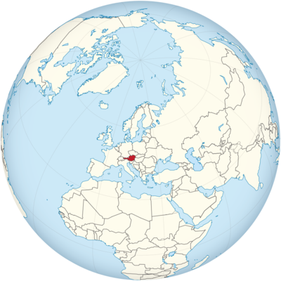
Austria Location in World Map
Austria lies in Central Europe.
Location Information of Austria
Latitude and Longitude
Austria is a landlocked country located in Central Europe. It is bordered by eight countries: Germany and the Czech Republic to the north, Slovakia to the northeast, Hungary to the east, Slovenia and Italy to the south, and Switzerland and Liechtenstein to the west. The geographical coordinates of Austria are approximately:
- Latitude: 47.5162° N
- Longitude: 14.5501° E
These coordinates place Austria in a central location in Europe, making it a key country in the European Union and a historically important center for cultural and political exchange. The country’s varied terrain includes the Alps in the west and north, and fertile plains in the east.
Capital City and Major Cities
- Capital City: ViennaVienna is the capital and largest city of Austria, located in the eastern part of the country on the banks of the Danube River. Known for its rich cultural history, Vienna has been a major center for music, art, and philosophy. The city has been the home of famous composers such as Mozart, Beethoven, and Schubert, and it is known for its grand palaces, operas, and classical music venues. Landmarks like the Hofburg Palace, the Vienna State Opera, and the Belvedere Palace make the city a cultural hub of Europe. Vienna is often ranked among the best cities in the world to live due to its high quality of life, excellent public services, and vibrant cultural scene.
- Major Cities:
- Salzburg – Known for being the birthplace of Wolfgang Amadeus Mozart, Salzburg is located in the northwestern part of Austria, near the border with Germany. The city is famous for its baroque architecture, scenic beauty, and the Hohensalzburg Fortress. It is also a popular destination for classical music lovers, particularly during the Salzburg Festival.
- Graz – Situated in southeastern Austria, Graz is the country’s second-largest city. It is known for its well-preserved medieval architecture, vibrant student population, and being the cultural and educational center of the Styria region. Graz has a significant artistic community and is a UNESCO City of Design.
- Linz – Located in the northern part of Austria, Linz is an industrial city on the banks of the Danube River. It has a strong focus on high-tech industries, and its cultural offerings, including the Lentos Art Museum and the Ars Electronica Center, attract visitors from around the world.
- Innsbruck – Nestled in the Alps in western Austria, Innsbruck is famous for its role as a ski resort city and as the host of the 1964 and 1976 Winter Olympics. Innsbruck offers a picturesque mix of modernity and tradition, with the Golden Roof and Hofburg Imperial Palace being key attractions.
- Klagenfurt – Located near the Austrian-Slovenian border, Klagenfurt is a city surrounded by lakes and mountains. It is known for its Mediterranean-style architecture and is a popular tourist destination for visitors seeking nature, culture, and outdoor activities.
Time Zone
Austria follows Central European Time (CET), which is UTC +1 during standard time. In the summer months, the country observes Central European Summer Time (CEST), which is UTC +2, in line with daylight saving time. This helps to maximize daylight during the longer days of summer. The country shares its time zone with several other European countries, including Germany, Italy, and France.
Climate
Austria experiences a continental climate with diverse climatic conditions across the country due to its varied geography. The climate ranges from alpine in the mountains to temperate in the lowlands. Below are the key climatic zones in Austria:
- Alpine Climate: The regions of Austria that are situated in the Alps, particularly in the west and south, experience an alpine climate. Winters are cold with heavy snowfall, making it a popular region for winter sports like skiing and snowboarding. Summers are mild but can be unpredictable, with occasional rain.
- Continental Climate (Lower Elevations): The central and eastern parts of Austria, including Vienna and Graz, experience a more continental climate. Summers can be quite warm, with temperatures reaching 30°C (86°F) or higher, while winters can be cold and dry, with temperatures often dropping below freezing.
- Mediterranean Climate: In the southernmost regions, such as Carinthia, the climate leans toward a Mediterranean style, with warmer winters and hot, dry summers. These areas see more rainfall than the rest of the country and have a more temperate climate due to their proximity to the Mediterranean.
Austria experiences four distinct seasons: spring, summer, autumn, and winter. Winters can be quite harsh in the mountainous regions, while the lowland areas experience more moderate winters with occasional snowfall.
Economic Status
Austria has a highly developed and diverse economy, characterized by its focus on industrial manufacturing, services, and tourism. As one of the richest countries in the European Union, Austria maintains a high standard of living and a stable economy. The country’s economic performance is bolstered by its natural resources, strategic location in Europe, and robust industrial and services sectors.
- Industry and Manufacturing: Austria is a leading industrial hub in Central Europe, with a strong focus on manufacturing and exports. Key industries include automotive, machinery, metal products, and chemicals. Austria is home to global companies such as Red Bull, Swarovski, and Voestalpine. The industrial sector also includes the production of electrical equipment, pharmaceuticals, and textiles.
- Services: The services sector is a major contributor to Austria’s GDP, with key areas including banking, insurance, real estate, tourism, and information technology. Vienna is a financial center, and Austria is known for its high-quality healthcare and education systems.
- Agriculture: Agriculture in Austria plays a smaller role in the economy but is still important, particularly in rural areas. The country is known for its high-quality agricultural products such as dairy, wine, vegetables, and meat. Austria is famous for its wine regions, particularly Wachau and Burgenland, which produce internationally recognized wines.
- Tourism: Tourism is an essential part of Austria’s economy, contributing significantly to GDP. The country’s rich cultural heritage, historic sites, beautiful landscapes, and world-class ski resorts attract millions of international visitors every year. Notable tourist destinations include Vienna, Salzburg, the Alps, and historic sites like Schönbrunn Palace and Hohenwerfen Castle.
- Energy and Sustainability: Austria is committed to sustainable energy and environmental protection. It generates a significant portion of its electricity from renewable sources, particularly hydropower. The country also invests heavily in wind and solar energy, aiming to reduce its carbon emissions and transition to a greener economy.
Austria’s economy is bolstered by high-quality exports, a skilled workforce, and a focus on environmental sustainability. Despite global challenges, the country maintains a strong economic position within the European Union.
Tourist Attractions
Austria is renowned for its rich cultural heritage, stunning landscapes, and architectural beauty. Visitors can enjoy world-class attractions ranging from historic palaces to outdoor activities in the Alps. Some of the country’s most popular tourist attractions include:
- Vienna: The capital city is home to a wide range of attractions, including the Vienna State Opera, Hofburg Palace, and St. Stephen’s Cathedral. Vienna is also famous for its coffeehouses, art museums, and imperial architecture. The Belvedere Palace, housing works by Gustav Klimt, and the Prater Park with its famous Ferris wheel are also major attractions.
- Salzburg: Famous for being the birthplace of Mozart, Salzburg is a UNESCO World Heritage site known for its baroque architecture and music festivals. The Hohensalzburg Fortress, Mirabell Palace, and Hellbrunn Palace are popular tourist sites. Salzburg also offers stunning views of the surrounding Alps.
- Schönbrunn Palace: Located in Vienna, Schönbrunn Palace is one of the most visited cultural monuments in Austria. It was the summer residence of the Habsburg rulers and features beautiful gardens, grand halls, and the Gloriette, offering a panoramic view of the city.
- The Austrian Alps: Austria’s alpine region offers exceptional opportunities for winter sports, including skiing, snowboarding, and ice skating. Popular ski resorts such as St. Anton, Kitzbühel, and Zell am See attract visitors in the winter months. In the summer, the Alps are a haven for hiking, mountain biking, and enjoying the natural beauty of the region.
- Lake Neusiedl: Located in the eastern part of Austria, Lake Neusiedl is the largest endorheic lake in Central Europe. The lake offers opportunities for boating, windsurfing, and cycling, and the surrounding area is known for its vineyards.
- Innsbruck: Known as the capital of the Austrian Alps, Innsbruck is a prime destination for skiing in the winter. The Golden Roof, Hofburg Imperial Palace, and the Nordkette Cable Car offering panoramic views of the Alps make it a year-round destination.
- Wachau Valley: The Wachau Valley, a UNESCO World Heritage site, is famous for its picturesque landscapes, vineyards, and medieval castles. Visitors can enjoy boat cruises along the Danube River and explore the charming towns of Dürnstein and Melk, home to the Melk Abbey.
- Hohenwerfen Castle: Located in the Salzach River Valley, this medieval castle is one of Austria’s most iconic fortresses. It offers guided tours, a falconry center, and breathtaking views of the surrounding mountains.
Visa Requirements for U.S. Citizens
U.S. citizens do not need a visa for short visits (up to 90 days) to Austria for tourism or business purposes. The following are the key requirements for entry into Austria:
- Passport: U.S. citizens must have a valid passport with at least six months of validity beyond their planned departure date from Austria.
- Proof of Funds: Travelers may be required to demonstrate sufficient funds for the duration of their stay in Austria.
- Return or Onward Ticket: Travelers must show proof of a return or onward travel ticket.
- Schengen Area: Austria is part of the Schengen Area, and U.S. citizens can travel freely between Austria and other Schengen countries for up to 90 days within a 180-day period.
For longer stays, such as for work, study, or residence, U.S. citizens will need to apply for the appropriate visa through the Austrian Embassy or Consulate.
Distance to Major U.S. Cities
The approximate air distances from Vienna, Austria, to major U.S. cities are:
- Distance to New York City: The distance from Vienna to New York City is approximately 4,300 miles (6,920 kilometers). The flight time is typically around 8 to 9 hours, depending on the route and layovers.
- Distance to Los Angeles: The distance from Vienna to Los Angeles is about 5,800 miles (9,334 kilometers). Flights generally take around 11 to 12 hours with one or more layovers, typically in cities such as Frankfurt or London.
Austria Facts
| Size | 83,879 km² |
| Residents | 8.85 million |
| Languages | German, Slovenian (regional), Croatian (regional), Hungarian |
| Capital | Vienna |
| Longest river | Danube (350 km in Austria) |
| Highest mountain | Grossglockner (3,798 m) |
| Currency | Euro |


