Where is Australia Located?
Where is Australia located on the map? Australia is an independent nation located in Australasia. Check out the following images to see location of Australia on maps.
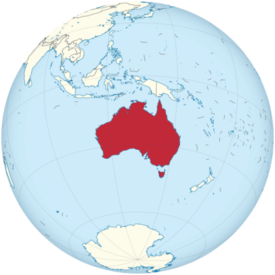
Australia Location in World Map
On this map you can see where the landscape is flat (green color) and where it is mountainous (brown color).
Location Information of Australia
Latitude and Longitude
Australia is the world’s smallest continent but the sixth-largest country by land area, located in the Southern Hemisphere. It is surrounded by the Indian and Pacific Oceans, with notable distances from other regions, making it one of the most geographically isolated countries. The country’s geographical coordinates are:
- Latitude: 25.2744° S
- Longitude: 133.7751° E
These coordinates place Australia in the southeastern part of the world, bordered by the Indian Ocean to the west and the Pacific Ocean to the east. The country is entirely surrounded by water, with the closest neighboring countries being Indonesia, Papua New Guinea, and New Zealand.
Capital City and Major Cities
- Capital City: CanberraCanberra is the capital city of Australia and is located in the Australian Capital Territory (ACT), positioned inland between Sydney and Melbourne. While it is not as large or as populous as Sydney or Melbourne, Canberra plays an important role as the political and administrative heart of the country. Key institutions, such as the Australian Parliament House, the High Court of Australia, and several national museums and galleries, are based in Canberra. The city was specifically selected as the capital in 1908 to resolve the rivalry between Sydney and Melbourne, both of which were vying for the status of the capital.
- Major Cities:
- Sydney – Sydney, located in the southeastern part of Australia, is the largest city in the country and one of the most iconic cities globally. Known for its beautiful harbor, including landmarks like the Sydney Opera House and Sydney Harbour Bridge, Sydney is a major cultural, financial, and tourism hub. It is also famous for its beaches, such as Bondi Beach and Manly Beach.
- Melbourne – Situated in the southeastern part of the country, Melbourne is Australia’s second-largest city. Known for its cultural diversity, Melbourne is often considered the cultural capital of Australia, with a vibrant arts scene, international cuisine, and a thriving coffee culture. It is also renowned for its sports, including Australian rules football, cricket, and tennis (with the Australian Open).
- Brisbane – Located in the northeastern part of the country, Brisbane is the capital of Queensland and the third-largest city in Australia. Known for its subtropical climate, Brisbane is a major center for business, commerce, and tourism. The South Bank Parklands, the Lone Pine Koala Sanctuary, and nearby Moreton Island are popular tourist attractions.
- Perth – Located on the west coast of Australia, Perth is the capital of Western Australia and is known for its isolated location relative to other major Australian cities. Perth has a vibrant cultural scene, beautiful beaches, and a booming economy, largely due to the mining industry in Western Australia.
- Adelaide – Situated in the southern part of the country, Adelaide is the capital of South Australia. Known for its festivals, wineries, and a laid-back lifestyle, Adelaide is a center for the arts and culinary innovation, particularly in the Barossa Valley wine region.
Time Zone
Australia spans several time zones due to its large geographical size. The time zones in Australia are as follows:
- Australian Western Standard Time (AWST): UTC +8 (e.g., Perth)
- Australian Central Standard Time (ACST): UTC +9:30 (e.g., Adelaide, Darwin)
- Australian Eastern Standard Time (AEST): UTC +10 (e.g., Sydney, Melbourne, Brisbane)
Australia also observes daylight saving time (DST) in certain regions during the summer months, shifting one hour forward from the standard time. This applies to regions in the Australian Eastern Daylight Time (AEDT) zone (UTC +11) and Australian Central Daylight Time (ACDT) zone (UTC +10:30). However, not all states and territories participate in DST. For instance, Queensland, Western Australia, and the Northern Territory do not observe DST.
Climate
Australia has a diverse climate due to its vast size and variety of geographic features. The climate ranges from tropical in the north to temperate in the south, and arid in the interior. Below are the key climate zones:
- Tropical Climate (Northern Australia): The northern regions of Australia, including parts of Queensland and the Northern Territory, experience a tropical climate, with hot, humid summers and mild, dry winters. This area experiences two distinct seasons: the wet season, from November to April, and the dry season, from May to October.
- Desert/Arid Climate (Interior Australia): Much of central and western Australia, including the Outback, has an arid desert climate. This region receives very little rainfall, and temperatures can soar above 40°C (104°F) during the summer months. The Outback is known for its vast, barren landscapes, including the iconic Uluru (Ayers Rock).
- Temperate Climate (Southern Australia): The southern parts of the country, including cities like Melbourne, Adelaide, and Sydney, experience a more temperate climate, with four distinct seasons. Summers are warm to hot, with temperatures reaching up to 30°C (86°F), while winters are cooler, especially in the southeastern parts, with temperatures ranging from 5°C (41°F) to 15°C (59°F).
- Mediterranean Climate (Southern Coastal Areas): The coastal regions in the southernmost parts of the country, such as parts of Western Australia, enjoy a Mediterranean climate with dry, hot summers and mild, wet winters. This climate is favorable for agricultural activities, particularly wine production.
- Mountain Climate (Australian Alps): The Australian Alps, located in the southeast of the country, experience a cooler mountain climate. Winters bring snow to the region, making it a popular destination for skiing and snowboarding. Summer temperatures are mild, making it ideal for hiking and other outdoor activities.
Economic Status
Australia has one of the largest and most developed economies in the world, with a high standard of living and a diversified economy. The country benefits from its vast natural resources, a strong services sector, and a well-developed manufacturing industry. Key aspects of Australia’s economic landscape include:
- Natural Resources: Australia is rich in natural resources, including coal, iron ore, gold, natural gas, and uranium. The mining sector is a significant contributor to the country’s GDP and export revenues. Australia is one of the world’s largest producers and exporters of coal and iron ore. The mining industry has driven economic growth, particularly in regions like Western Australia.
- Agriculture: Despite its relatively small agricultural sector in terms of GDP, Australia is a major global exporter of agricultural products. The country produces significant quantities of wheat, barley, sugarcane, wine, and livestock. Australia’s agricultural exports are particularly important to the economies of countries in the Asia-Pacific region.
- Services Sector: The services sector is the largest contributor to Australia’s economy, particularly in areas such as finance, education, tourism, and healthcare. Australia has become a hub for financial services in the Asia-Pacific region, with Melbourne and Sydney being major financial centers.
- Manufacturing and Industry: Manufacturing is an important part of the Australian economy, though it has declined in recent decades as the country shifted towards a service-based economy. Key industries include food processing, machinery, chemicals, and consumer electronics. The automotive and steel industries were once strong in Australia, but many manufacturing plants have closed in recent years due to globalization and competition.
- Tourism: Tourism is a key industry in Australia, contributing significantly to GDP. Popular tourist destinations include the Great Barrier Reef, Sydney Opera House, Uluru, and numerous national parks and beaches. Australia attracts millions of international visitors each year, especially from China, the United States, and the United Kingdom.
- Trade and Export: Australia’s export economy is driven by natural resources, agricultural products, and services. The country’s largest trading partners include China, Japan, the United States, and South Korea. The Australia-United States Free Trade Agreement and other trade agreements with Asian countries have helped boost the country’s exports.
Tourist Attractions
Australia is home to some of the world’s most iconic landmarks, unique wildlife, and natural beauty, making it one of the world’s leading tourist destinations. Here are some of the top attractions:
- Great Barrier Reef: One of the Seven Natural Wonders of the World, the Great Barrier Reef is the world’s largest coral reef system, located off the coast of Queensland. It is a UNESCO World Heritage site and a haven for divers, snorkelers, and marine enthusiasts.
- Sydney Opera House: An architectural masterpiece and cultural icon, the Sydney Opera House is one of the most recognizable buildings in the world. Visitors can take guided tours or enjoy performances in music, dance, and theater.
- Uluru (Ayers Rock): A UNESCO World Heritage site, Uluru is a massive sandstone monolith located in the heart of the Outback. It is sacred to the indigenous Anangu people and a popular destination for sunrise and sunset viewing.
- Bondi Beach: One of Australia’s most famous beaches, Bondi Beach is known for its golden sands, surf culture, and vibrant atmosphere. Located in Sydney, it’s a popular spot for both locals and tourists.
- Blue Mountains: A UNESCO World Heritage site, the Blue Mountains are located just outside of Sydney. The region is known for its dramatic landscapes, including deep gorges, waterfalls, and towering sandstone cliffs.
- Tasmania: Known for its pristine wilderness, Tasmania is home to numerous national parks, hiking trails, and unique wildlife, such as the Tasmanian Devil. The Cradle Mountain and Freycinet National Park are among the island’s most popular tourist attractions.
- Great Ocean Road: The Great Ocean Road is a scenic coastal drive that stretches along the southern coast of Victoria, offering stunning views of the ocean, cliffs, and famous landmarks like the Twelve Apostles limestone formations.
Visa Requirements for U.S. Citizens
U.S. citizens visiting Australia for tourism or business purposes typically do not require a visa for short stays, but they must apply for an Electronic Travel Authority (ETA) or eVisitor visa before traveling. These visas allow stays of up to 90 days for tourism or business purposes.
- Electronic Travel Authority (ETA): The ETA is available to U.S. citizens who wish to visit Australia for tourism or business purposes. It can be applied for online and is electronically linked to the traveler’s passport.
- eVisitor Visa: This is another type of short-stay visa available to U.S. citizens who are traveling to Australia for tourism or business. It also allows a stay of up to 90 days and is applied for online.
- Other Visa Types: For longer stays, such as for study or work purposes, U.S. citizens will need to apply for the appropriate visa through the Australian Embassy or Consulate.
Distance to Major U.S. Cities
The approximate air distances from Australia to major U.S. cities are as follows:
- Distance to New York City: The distance from Sydney to New York City is about 10,100 miles (16,260 kilometers). Flights typically take around 20 hours, with one or more layovers.
- Distance to Los Angeles: The distance from Sydney to Los Angeles is about 7,500 miles (12,070 kilometers). Direct flights generally take around 14 to 15 hours.
Australia Facts
| Size | 7,692,024 km² |
| Residents | 24.99 million |
| Languages | English and the Aboriginal languages |
| Capital | Canberra |
| Longest river | Murray (2575 km) |
| Highest mountain | Mont Kosciusko (2,229 m) |
| Currency | Australian dollar |


