Where is Portugal Located?
Where is Portugal located on the map? Portugal is an independent nation located in Southern Europe. Check out the following images to see location of Portugal on maps.
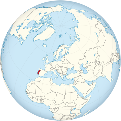
Portugal Location in World Map
Portugal is located in the southwest of Europe.
Location Information of Portugal
Latitude and Longitude
Portugal is located in Southern Europe, occupying the westernmost edge of the continent. The country is bordered by Spain to the east and north, and it has a long coastline along the Atlantic Ocean to the west and south. The geographical coordinates of Portugal are approximately between Latitude 36° 00′ N and 42° 00′ N and Longitude 6° 00′ W and 9° 30′ W. The mainland of Portugal is often divided into distinct regions based on geographical features, including the coastal plains, the mountainous interior, and the rural, agricultural regions.
Capital City and Major Cities
Capital City: Lisbon
Lisbon, the capital of Portugal, is the largest city and one of the most important cultural, political, and economic centers in the country. Situated on the western coast of the Iberian Peninsula, Lisbon lies along the banks of the Tagus River and has a population of over 500,000 people, with the metropolitan area exceeding 2.8 million people. Lisbon is a vibrant, cosmopolitan city with a rich history, dating back to Roman times, and it was once one of the leading cities of the Age of Exploration.
Key landmarks in Lisbon include the Belém Tower, Jerónimos Monastery, São Jorge Castle, and Rossio Square. The city’s neighborhoods, such as Alfama, Bairro Alto, and Baixa, are famous for their narrow streets, historic buildings, and vibrant cultural life. Lisbon also serves as the hub for Portugal’s banking, commerce, and tourism industries, with many international businesses operating within the city.
Major Cities
- Porto
Porto, located in the north of Portugal, is the country’s second-largest city. Known for its historic significance, Porto is famous for its Port wine production and has a rich maritime history. The city is home to the iconic Ribeira District, a UNESCO World Heritage Site, and the Dom Luís I Bridge. Porto’s economy is heavily based on trade, industry, and tourism. Its historic architecture and vibrant arts scene, along with the picturesque Douro River, make it a popular destination for visitors. - Amadora
Amadora is located in the Greater Lisbon area, to the northwest of the capital city. With a population of around 175,000, it is one of the most densely populated cities in Portugal. Amadora is part of the Lisbon Metropolitan Area and is considered a suburban extension of Lisbon, with residential areas and commercial businesses. The city is known for its parks and green spaces, including the Parque Central and Jardim da Amadora. - Braga
Braga is located in the northern part of Portugal and is known for its deep religious roots. It is one of the oldest cities in the country, with its origins dating back to Roman times. Known as the Portuguese Rome, it is famous for its churches, religious festivals, and monuments, including the Sanctuary of Bom Jesus do Monte. The city is also an important regional economic and educational hub. - Coimbra
Coimbra, situated in central Portugal, is famous for its prestigious university, the University of Coimbra, one of the oldest universities in Europe. The city is a cultural and intellectual center, with historical landmarks such as the Joanina Library and Conímbriga, a well-preserved Roman site. Coimbra is a key educational and administrative center in Portugal and a prominent cultural destination. - Funchal
Funchal is the capital city of Madeira, an autonomous region of Portugal located off the northwest coast of Africa. Funchal is known for its lush landscapes, mild climate, and historical significance. Visitors flock to Funchal for its beautiful gardens, such as the Monte Palace and Botanical Garden of Madeira, as well as its historic center, which includes the Funchal Cathedral and various cultural venues. Funchal also plays a key role in tourism and the export of Madeira wine.
Time Zone
Portugal is located in the Western European Time Zone (WET), which is UTC +0:00 during standard time. However, Portugal observes Western European Summer Time (WEST) during daylight saving time, which is UTC +1:00. Daylight saving time typically begins on the last Sunday in March and ends on the last Sunday in October. The Azores, an autonomous region of Portugal, is in the Azores Time Zone (AZOT) during standard time, and Azores Summer Time (AZOST) during daylight saving time.
Climate
Portugal has a Mediterranean climate, characterized by mild, wet winters and hot, dry summers. However, the climate can vary significantly depending on the region, due to the country’s diverse geography, which includes mountains, coastal areas, and inland plains.
Coastal Climate
Along the coast, including cities like Lisbon, Porto, and Funchal, the climate is influenced by the Atlantic Ocean, leading to mild winters and warm, dry summers. Average temperatures in the summer range between 22°C (72°F) and 28°C (82°F), while in winter, temperatures usually stay between 8°C (46°F) and 15°C (59°F). Rainfall is relatively evenly distributed throughout the year, although the wettest months are from November to February.
Interior and Northern Portugal
The interior of the country, especially in the northern and mountainous regions, experiences a more continental climate. The winters can be cold, with temperatures dropping below 0°C (32°F), especially in areas such as the Douro Valley and Serra da Estrela. Summers in these regions can be hot, with temperatures often exceeding 30°C (86°F). Snow is common in the mountainous areas during the winter months, making them popular for winter sports.
The Azores and Madeira
The Azores and Madeira regions enjoy subtropical climates. The Azores have a mild, oceanic climate, with moderate temperatures year-round and high humidity. Madeira, with its subtropical climate, enjoys mild temperatures year-round, averaging 18°C (64°F) in winter and 25°C (77°F) in summer. These islands are characterized by lush vegetation and frequent rainfall.
Economic Status
Portugal has a developed economy that is diversified across various sectors, including services, industry, agriculture, and tourism. Over the past few decades, Portugal has successfully transitioned from a primarily agricultural economy to one that is heavily reliant on services and exports. Despite this transition, the country still maintains a strong agricultural sector and has an important role in international trade, especially within the European Union (EU).
Key Economic Sectors
- Tourism
Tourism is one of the largest sectors of the Portuguese economy. The country’s mild climate, historic cities, beautiful beaches, and unique cultural attractions draw millions of tourists each year. Lisbon, Porto, the Algarve, Madeira, and the Azores are some of the most popular destinations. The tourism industry generates significant revenue, supports millions of jobs, and contributes to the country’s GDP. - Agriculture
Agriculture remains a vital part of Portugal’s economy, though it has seen a decline in its share of GDP in recent years. Key agricultural products include olive oil, wine, cork, fruits, and vegetables. Portugal is one of the largest producers of wine in the world, especially famous for its Port wine from the Douro Valley. Cork production is also a significant export, with Portugal being the largest exporter of cork products globally. - Industry and Manufacturing
Portugal has a diverse manufacturing sector, which includes the production of automobiles, textiles, footwear, ceramics, furniture, and electronics. The country’s industrial base is centered in cities like Porto, Amadora, and Setúbal. The automotive and electronics industries are particularly important for exports, while the textile and footwear sectors remain prominent. - Renewable Energy
Portugal has made significant strides in adopting renewable energy sources, particularly wind, solar, and hydroelectric power. The country has invested heavily in renewable energy infrastructure and has one of the highest percentages of electricity generated from renewable sources in Europe. - Fishing and Maritime Industry
Portugal has one of the largest fishing industries in Europe, with a significant focus on sardines, tuna, and cod. The country’s strategic position on the Atlantic Ocean allows for a strong maritime industry, including shipbuilding, fishing, and port services. Portugal’s ports are vital hubs for international trade.
Tourist Attractions
Portugal is renowned for its diverse and captivating tourist attractions, which range from historic cities, natural parks, beaches, and cultural landmarks. Some of the top attractions include:
- Lisbon
Lisbon offers a mix of old and new, with its historic neighborhoods like Alfama, the Jerónimos Monastery, and the Belem Tower. Visitors can also enjoy the vibrant nightlife in Bairro Alto, the views from São Jorge Castle, and the scenic beauty of the Tagus River. - Porto and the Douro Valley
Porto is known for its beautiful riverside views, historic bridges like the Dom Luís I Bridge, and its famous wine cellars, where tourists can sample Port wine. The Douro Valley, a UNESCO World Heritage site, is famed for its terraced vineyards and scenic river views. - Algarve
The Algarve region, located in southern Portugal, is famous for its stunning beaches, limestone cliffs, and picturesque towns like Lagos, Albufeira, and Faro. It is a popular summer destination for European tourists, known for its vibrant nightlife and golf resorts. - Madeira
Madeira, known as the “Island of Eternal Spring,” is celebrated for its lush landscapes, stunning gardens, and mild climate. Monte Palace and the Madeira Botanical Garden are among the island’s key attractions. The island is also known for its levadas (historic irrigation channels), which provide scenic hiking routes. - Sintra
Sintra, located near Lisbon, is famous for its fairytale castles and palaces, including the Pena Palace and the Moorish Castle. The town is surrounded by beautiful forests and offers a rich historical and cultural experience.
Visa Requirements for U.S. Citizens
U.S. citizens do not require a visa for tourism visits to Portugal for stays of up to 90 days within a 180-day period. However, travelers must have a valid U.S. passport with at least three months of validity beyond the planned departure date. U.S. citizens may need to provide evidence of sufficient funds for their stay and proof of return or onward travel. For stays longer than 90 days or for work purposes, U.S. citizens must apply for the appropriate visa.
Distance to New York City and Los Angeles
- Distance from New York City to Lisbon
The distance between New York City and Lisbon is approximately 3,550 miles (5,710 kilometers). Flights typically take around 7 to 8 hours, depending on wind conditions and the specific route taken. - Distance from Los Angeles to Lisbon
The distance from Los Angeles to Lisbon is around 5,600 miles (9,000 kilometers). Flights from Los Angeles to Lisbon typically take about 10 to 11 hours, depending on layovers and flight paths.
Portugal Facts
| Size | 92,345 km² |
| Residents | 10.32 million |
| Language | Portuguese |
| Capital | Lisbon |
| Longest river | Douro (320 km) |
| Highest mountain | Ponta do Pico in the Azores (2,351 m) |
| Currency | Euro |


