Where is Nicaragua Located?
Where is Nicaragua located on the map? Nicaragua is an independent nation located in North America. Check out the following images to see location of Nicaragua on maps.
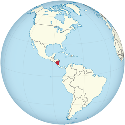
Nicaragua Location in World Map
Nicaragua is in Central America.
Location Information of Nicaragua
Latitude and Longitude
Nicaragua is located in Central America, bordered by Honduras to the north, Costa Rica to the south, the Caribbean Sea to the east, and the Pacific Ocean to the west. The approximate geographic coordinates of Nicaragua are 12.8654° N latitude and 85.2072° W longitude. With a land area of about 130,375 square kilometers (50,338 square miles), Nicaragua is the largest country in Central America. Its geographical location places it between the Tropics of Cancer and Capricorn, providing a tropical climate and diverse ecosystems, from mountain ranges to coastal plains.
Nicaragua’s diverse geography includes rainforests, lakes, volcanoes, and beaches, making it a significant country in terms of biodiversity.
Capital City and Major Cities
Capital City: Managua
The capital city of Nicaragua is Managua, located on the Pacific coast of the country, near Lake Cocibolca. Managua is the largest city in Nicaragua, with a population of about 1.1 million people in the city proper, and over 2 million people in the metropolitan area. Managua is the country’s political, economic, and cultural center. Despite being affected by earthquakes in the past, Managua has grown to be the main hub for government institutions, business, and commerce in Nicaragua. The city is known for its lakefront setting, historic landmarks, and modern infrastructure.
Major Cities
- León: Located in the western part of Nicaragua, León is one of the country’s oldest cities and has a population of around 200,000 people. León is a cultural center, known for its colonial architecture, historic cathedrals, and as the birthplace of many revolutionary movements. Key attractions include the León Cathedral, a UNESCO World Heritage Site, and La Merced Church.
- Granada: Situated on the shores of Lake Cocibolca, Granada is a picturesque city known for its well-preserved colonial architecture and vibrant cultural scene. With a population of around 120,000, Granada is a popular tourist destination and an important cultural and historical center. Key attractions include the Granada Cathedral, Isla de Ometepe (an island on Lake Cocibolca), and the Mombacho Volcano.
- Matagalpa: Located in the central highlands, Matagalpa is a small city with a population of around 150,000 people. The city is known for its coffee production, as the surrounding region is one of Nicaragua’s primary coffee-growing areas. Matagalpa is also a gateway to the Bosawás Biosphere Reserve, a UNESCO-listed site that is home to diverse wildlife.
- Bluefields: Bluefields, located on the Caribbean coast of Nicaragua, has a population of about 60,000 people. The city serves as the largest urban center on the Caribbean side and is an important port for the country. Bluefields has a unique Afro-Caribbean culture, and the region is known for its lush rainforests, rivers, and beaches.
- Estelí: In the northern part of the country, Estelí is a city with a population of around 130,000 people. Estelí is known for its tobacco industry, as it is home to some of the finest Nicaraguan cigars. The city also has beautiful mountain landscapes and is close to Cerro de la Pelona, one of the country’s highest peaks.
Time Zone
Nicaragua operates on Central Standard Time (CST), which is UTC -6:00. Unlike many other countries in the region, Nicaragua does not observe daylight saving time, so the time remains constant throughout the year. This time zone places Nicaragua in the same time zone as Costa Rica, Honduras, and El Salvador, making it convenient for travel and business across Central America.
Climate
Nicaragua has a tropical climate, with distinct wet and dry seasons. Due to its location in Central America, the country experiences a combination of Pacific and Caribbean climates, with cooler temperatures in the highlands and warmer conditions in the lowlands.
1. Dry Season (November to April)
The dry season in Nicaragua is characterized by warm and dry weather, with temperatures ranging from 25°C to 35°C (77°F to 95°F) in many areas. This period is especially popular for tourists, as there is little to no rainfall, and the weather is ideal for outdoor activities, beach visits, and hiking. The dry season also coincides with the North American winter, attracting many visitors from the United States and Canada.
2. Wet Season (May to October)
The wet season in Nicaragua brings heavy rains, particularly from June to September. During this period, the average temperatures range from 22°C to 30°C (72°F to 86°F), and the country can experience substantial rainfall, especially in the rainforests and mountain regions. The Caribbean coast, in particular, receives heavy rainfall year-round. The wet season is the low season for tourism, as the rains can sometimes cause disruptions to travel plans.
3. Temperature Variation
While the coastal regions remain relatively warm throughout the year, the highlands of Nicaragua, such as in Matagalpa and Estelí, have a moderate climate with cooler temperatures. The highlands can have daytime temperatures between 18°C to 25°C (64°F to 77°F), which makes these areas more comfortable to visit during the hotter months.
Economic Status
Nicaragua is considered one of the poorer countries in Central America, but it has a growing economy with diverse sectors such as agriculture, tourism, manufacturing, and remittances. The country has made significant progress in terms of infrastructure development, energy production, and economic liberalization in recent years. However, Nicaragua still faces challenges such as poverty, unemployment, and political instability.
1. Agriculture
Agriculture remains the backbone of the Nicaraguan economy, contributing a significant portion to the country’s GDP and employing a large proportion of the population. Key agricultural products include coffee, bananas, sugar, tobacco, and cattle. Nicaragua is one of the leading producers of coffee in the world, and the coffee industry is vital for both domestic consumption and export.
2. Tourism
Tourism has become an increasingly important industry for Nicaragua. The country’s diverse natural beauty, including lakes, volcanoes, rainforests, and beaches, attracts tourists for activities such as hiking, surfing, and eco-tourism. Nicaragua is also famous for its colonial cities, such as Granada, and adventure tourism in the Isla de Ometepe region, offering opportunities for kayaking, wildlife watching, and hiking volcanoes.
3. Manufacturing and Industry
Nicaragua has a relatively small industrial sector, but it is growing, particularly in areas such as textiles, clothing, and construction materials. The country has benefited from free trade agreements, such as the Central American Free Trade Agreement (CAFTA-DR), which has boosted its manufacturing exports, particularly in textiles and apparel. Nicaragua also produces cement, beer, and food products for domestic consumption and export.
4. Remittances
A large portion of Nicaragua’s GDP comes from remittances sent by Nicaraguans living abroad, particularly in the United States. These remittances support many families and are an essential part of the country’s economy. While remittances are a vital source of income for many households, the economy is vulnerable to global economic changes that affect employment and wages abroad.
5. Challenges
Despite progress, Nicaragua continues to struggle with issues such as income inequality, political corruption, underdeveloped infrastructure, and economic dependence on a few sectors. The country’s reliance on agriculture makes it vulnerable to natural disasters, such as hurricanes and droughts, and the political situation, particularly following recent unrest, has also affected investor confidence.
Tourist Attractions
- Granada Granada is one of the oldest colonial cities in the Americas, known for its well-preserved colonial architecture, cobblestone streets, and historical landmarks. Key attractions include Granada Cathedral, Lake Cocibolca, and the nearby Masaya Volcano National Park. Granada is also famous for its Isla de Ometepe, an island on Lake Cocibolca known for hiking, kayaking, and the Maderas Volcano.
- Masaya Volcano National Park Masaya Volcano National Park is one of Nicaragua’s most active volcanoes and offers a thrilling experience for visitors interested in geothermal activity. Tourists can visit the active crater and view lava flows, as well as explore surrounding areas with rich wildlife. The park also has a museum and offers opportunities for hiking.
- Isla de Ometepe Isla de Ometepe, located in Lake Cocibolca, is a volcanic island known for its natural beauty. The island features two towering volcanoes, Concepción and Maderas, and is a popular destination for outdoor activities such as hiking, biking, kayaking, and wildlife watching. The island is also home to pre-Columbian petroglyphs and several eco-lodges.
- San Juan del Sur San Juan del Sur is a beach town on the Pacific coast of Nicaragua, known for its beautiful beaches, surfing, and vibrant nightlife. It is a popular spot for tourists looking for a combination of relaxation and adventure. Visitors can explore the surrounding hills and coves, or enjoy the town’s lively restaurants and bars.
- Corn Islands The Corn Islands are located off the Caribbean coast of Nicaragua. The islands are known for their pristine beaches, crystal-clear waters, and laid-back atmosphere. Visitors can enjoy snorkeling, scuba diving, and exploring unspoiled beaches. The islands are a popular getaway for those looking to escape the more tourist-heavy destinations in Nicaragua.
Visa Requirements for U.S. Citizens
U.S. citizens traveling to Nicaragua for tourism do not require a visa for stays of up to 90 days. A valid U.S. passport is required for entry, and the passport must remain valid for at least six months beyond the planned departure date. Travelers may need to show proof of return or onward travel and sufficient funds for their stay. If staying longer than 90 days, U.S. citizens must apply for a tourist visa or residency.
Distance to New York City and Los Angeles
Distance to New York City
The distance from New York City to Managua, the capital of Nicaragua, is approximately 3,300 kilometers (2,050 miles). Flights typically take 4.5 to 5.5 hours, depending on the airline and the specific route.
Distance to Los Angeles
The distance from Los Angeles to Managua is around 4,100 kilometers (2,550 miles). Flights from Los Angeles to Managua typically take 5 to 6 hours, with direct flights being common.
Nicaragua Facts
| Size | 120,254 km² |
| Residents | 6.46 million |
| Language | Spanish (official language) |
| Capital | Managua |
| Longest river | Río Coco (685 km) |
| Highest mountain | Pico Mogotón (2,438 m) |
| Currency | Cordoba |


