Cities and Towns in Kalawao County, Hawaii
Founded in 1905, Kalawao County is one of 5 counties in the state of Hawaii. Historically, Kalawao County was formed from The Kalaupapa Peninsula on Molokaʻi. The city of is the county seat. With FIPS code of 5, Kalawao County has a population of 82 and area of 5.2 square miles (13 km²).
List of all cities in Kalawao County, HI alphabetically
- Kalaupapa, HI
Major Cities and Towns in Kalawao County, Hawaii
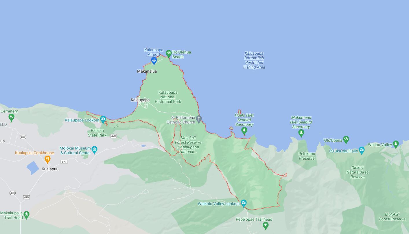
Kalaupapa
Area, Population, Zip Codes, Latitude, and Longitude
- Area: 53 square miles
- Population: 82 (as of the 2020 census)
- Zip Codes: 96742
- Latitude: 21.1867° N
- Longitude: 156.9809° W
Location and History
Kalaupapa is a small, isolated community located on the northern coast of the island of Molokai, within Kalawao County, Hawaii. Kalawao County, established in 1905, is unique in that it is the smallest county in the United States by population, and it is specifically designated for the Kalaupapa Settlement. The settlement was established in 1866 as a quarantine colony for individuals suffering from Hansen’s disease (leprosy), under the orders of King Kamehameha V. Patients were forcibly relocated to Kalaupapa, a remote and rugged peninsula, to prevent the spread of the disease. The settlement is most famously associated with Saint Damien of Molokai and Saint Marianne Cope, who dedicated their lives to caring for those afflicted with the disease. Although a cure for Hansen’s disease was discovered in the 1940s, residents who were sent to Kalaupapa were given the choice to stay, and many did, preferring the community they had built over the years. Today, Kalaupapa is both a National Historical Park and a living community, preserving the history and honoring the legacy of those who lived there.
Major Schools and Landmarks
Kalaupapa does not have any schools within its boundaries, as the community’s population is small and primarily composed of elderly former patients who chose to remain after the settlement’s closure as a quarantine facility. Education for residents is generally provided through distance learning or services from other parts of Molokai. The primary landmarks in Kalaupapa are closely tied to its history as a Hansen’s disease settlement. The Kalaupapa National Historical Park is the most significant landmark, established to preserve the history and memory of the patients and caregivers who lived there. Within the park, visitors can find the St. Philomena Catholic Church, where Saint Damien served, and the grave sites of both Saint Damien and Saint Marianne Cope. The settlement itself, with its old buildings and the surrounding natural beauty, offers a poignant reminder of the community’s resilience and the isolation experienced by its residents. The Palaau State Park, located on the cliffs above Kalaupapa, provides a lookout point with stunning views of the peninsula and the Pacific Ocean, offering a sobering perspective on the settlement’s remote location.
Map of Cities in Kalawao County, HI