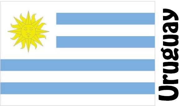
Uruguay Facts
Uruguay, State of Southeastern South America; 176,220 km², 3.4 million residents (2019).Uruguay borders Brazil in the north, the Uruguay River forms in the west border with Argentina, and in the south and south-east Uruguay has a coast towards the Atlantic. The capital is Montevideo (1.3 million residents, 2012).

Country facts
- Republic of Oriental del Uruguay / Republic of Uruguay
- Country abbreviation: UY
- Area: 176 220 km²
- Population (2019): 3.4 million residents
- Capital: Montevideo
- Main language: Spanish
- State: Republic
- Head of State and Head of Government: Luis Lacalle Pou (President)
- Per capita GDP (2018): US $ 17,278
- GNI per capita (2018): US $ 15,650
- Currency unit: 1 peso = 100 cents
- Currency code: UYU
- Country Number (Telephony): 598
- Internet Domain Name: uy
- Time difference compared to Sweden: −4
- National Day: August 25 (Declaration of Independence, 1825)
Nature
- Land use: forest (15%), agricultural land (8%), other (77%)
- Highest mountain: Catedral (513 m above sea level)
- Longest river: Uruguay River (2,188 km)
Population
- Population density (2019): 19 residents per km²
- Natural population growth (2019): 0.4%; birth rate 13 ‰, death rate 9 ‰
- Age structure (2019): 0-14 years (20%), 15-64 (66%), 65- (14%)
- Average life expectancy (2019): men 74 years, women 81 years
- Infant mortality (2019): 9 per 1,000 live births
- Population forecast 2050: 4 million residents
- HDI (2017): 0.804 (place 55 of 189)
- Urbanization rate (2019): 95%
- Most populous city (2013): Montevideo (1.3 million residents)
Business
- Industry’s contribution to GDP (2017): agriculture (6%), industry (24%), service (70%)
- Exports (2017): USD 11,410 million
- Main export products: meat, soybeans, cellulose
- Main exporting countries: China, Brazil, USA
- Imports (2017): US $ 8,607 million
- Main import products: oil and oil products, vehicles, mobile phones
- Main importing countries: China, Brazil, Argentina
- Railway network (2016): 1 600 km
Uruguay is located in the transition zone between the South Brazilian Plateau and Argentina’s Pampas and is for the most part a gently rolling backland between 200 and 400 meters above sea level. Along the Atlantic, a wide, low-lying plain is spreading. The climate is temperate with the most rainy season in the autumn (April – May).
According to the constitution, the executive power is exercised by the president and the government, while the legislative power lies with Congress, which consists of two chambers: the House of Representatives and the Senate. President, Vice President and Congress are elected on a joint election day through open and free elections every five years.
Agriculture, especially livestock management, is the most important industry in Uruguay. The unilateral dependence on agricultural products makes the country’s economy very sensitive to price fluctuations in the world market. Against this background, Uruguay has invested in developing other industries such as banking and tourism. The government is trying to make the economy competitive by means of moderate liberalization. Its efforts are hampered by widespread popular resistance to privatizations and restrictions in the social security system.
Uruguay Map


