Where is Somalia Located?
Where is Somalia located on the map? Somalia is an independent nation located in Eastern Africa. Check out the following images to see location of Somalia on maps.
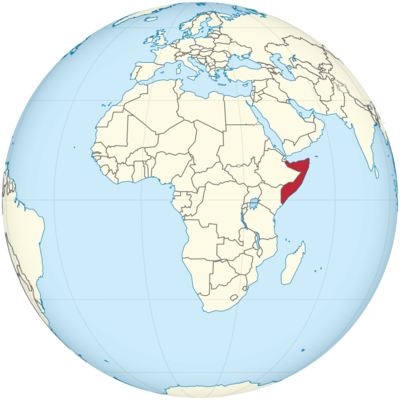
Somalia Location in World Map
Location Information of Somalia
Somalia is located in the Horn of Africa, a strategically important region of the African continent. It lies along the Indian Ocean to the east, and is bordered by Ethiopia to the west, Djibouti to the northwest, and Kenya to the southwest. With its vast coastline, rich history, and unique cultural heritage, Somalia is a country of great significance in the East African region.
Latitude and Longitude
Somalia lies between approximately 1° and 12° N latitude and 41° and 51° E longitude. It is one of the few African countries to have a coastline on the Indian Ocean, providing it with strategic maritime access to global trade routes.
Capital City and Major Cities
Capital City: Mogadishu
Mogadishu, the capital city of Somalia, is located on the Indian Ocean coast. It serves as the political, economic, and cultural center of the country. Although the city has faced significant challenges due to conflict and instability over the years, it remains Somalia’s largest city and a hub for trade and commerce.
Coordinates: 2.0469° N, 45.3182° E
Major Cities
- Hargeisa: The capital of the self-declared Republic of Somaliland, Hargeisa is located in the western part of Somalia, near the Ethiopian border. It is the second-largest city in the country and serves as an important center for trade, education, and culture. Coordinates: 9.5600° N, 44.0700° E
- Kismayo: Kismayo is a coastal city located in the southern part of Somalia, near the Juba River. It is an important port city and a center for the Somali fishing industry. Coordinates: 0.3580° S, 42.5445° E
- Bosaso: Bosaso is a port city in the northeastern part of Somalia, located on the Gulf of Aden. It serves as a major trade hub for the Puntland region, especially for the import and export of goods like livestock and minerals. Coordinates: 11.2795° N, 49.1816° E
- Baidoa: Located in the southwestern part of the country, Baidoa is a major town and the administrative capital of the Bay Region. It is an important agricultural area, known for its farming of crops such as maize and sorghum. Coordinates: 3.1167° N, 43.6500° E
- Merca: Situated south of Mogadishu along the coast, Merca is a smaller port city that plays a role in Somalia’s agricultural and maritime sectors. Coordinates: 2.7827° N, 44.7845° E
Time Zone
Somalia operates on East Africa Time (EAT), which is UTC +3:00. There is no Daylight Saving Time observed in Somalia. This time zone is the same as other East African countries, including Kenya, Uganda, and Ethiopia.
- Time difference with New York City: Somalia is 8 hours ahead of New York City during Standard Time and 7 hours ahead during Daylight Saving Time.
- Time difference with Los Angeles: Somalia is 11 hours ahead of Los Angeles during Standard Time and 10 hours ahead during Daylight Saving Time.
Climate
Somalia has a largely arid and semi-arid climate, with regions along the coast experiencing more moderate temperatures. The climate is heavily influenced by the Indian Ocean and the Hadal sea to the east.
Seasonal Breakdown
- Rainy Season (April to October): The rainy season in Somalia is characterized by the Gu rains (April to June) and the Deyr rains (October to December). These rains are essential for agricultural production, although they can also cause flooding and disrupt daily life in some areas.
- Dry Season (November to March): The dry season in Somalia can be very hot, with temperatures regularly exceeding 40°C (104°F) in the central and northern parts of the country. The coastal regions are slightly cooler, thanks to the oceanic influence, but the temperature can still be very high.
- Temperature Variation: In general, temperatures range from 20°C to 30°C (68°F to 86°F) in coastal areas. The interior, particularly the Somali Desert region, can experience extreme heat with temperatures that can reach over 40°C (104°F) during the dry season.
Economic Status
Somalia’s economy is heavily reliant on agriculture, livestock, and remittances from the Somali diaspora. However, due to ongoing challenges such as political instability, conflict, and droughts, the country’s economic development has been hindered. Despite these difficulties, Somalia is a resource-rich country, with significant potential in sectors such as agriculture, fishing, and minerals.
Key Economic Sectors
- Agriculture: Agriculture is the backbone of Somalia’s economy, employing a large portion of the population. The country is known for producing livestock, fruits, and vegetables, especially bananas, sorghum, and maize. Livestock (including camels, goats, and cattle) is the primary agricultural export, especially to the Gulf States.
- Fishing: With its long coastline along the Indian Ocean and the Gulf of Aden, Somalia has a significant fishing industry. The country’s waters are rich in marine life, particularly fish, lobster, and shrimps. However, illegal, unreported, and unregulated fishing remains a challenge for the industry.
- Trade and Services: Somalia has a growing service sector, with remittances from the Somali diaspora playing an essential role in the economy. Somali nationals living abroad, particularly in Europe and the Middle East, contribute significantly to the country’s economy through remittances, which are used for both personal and business needs.
Challenges
Despite its resource potential, Somalia continues to face significant economic challenges. Political instability, insecurity, corruption, and poor infrastructure hamper economic growth. Additionally, the country faces issues such as droughts, famine, and the need for significant development in sectors like education, healthcare, and public services.
Tourist Attractions
Somalia has significant potential for tourism, given its stunning landscapes, historical sites, and rich cultural heritage. However, due to political instability and security concerns, tourism remains limited. Nonetheless, Somalia has several attractions that make it an intriguing destination for adventurous travelers.
1. Laas Geel Cave Paintings
The Laas Geel cave paintings, located in the northern regions of Somalia, are one of the most important archaeological sites in East Africa. The paintings, believed to date back over 5,000 years, depict scenes of early human life, including domesticated cattle and other animals. The site is located in the Hargeisa region and is an important symbol of the country’s rich history.
Coordinates: 9.5089° N, 44.0849° E
2. Somali Coastline
Somalia boasts one of the longest coastlines in Africa, stretching over 3,300 kilometers. The coastline is known for its pristine beaches, clear waters, and coral reefs. Coastal cities like Mogadishu, Kismayo, and Bosaso offer opportunities for diving, fishing, and exploring beautiful, untouched beaches.
3. Mogadishu
Mogadishu, the capital of Somalia, is home to several historical landmarks, including Arba’a Rukun Mosque and Mogadishu Cathedral. Though the city has faced decades of conflict, it is slowly recovering and becoming more accessible to tourists, offering a glimpse into Somalia’s rich cultural and architectural history.
Coordinates: 2.0469° N, 45.3182° E
4. National Parks and Reserves
Somalia has several national parks and reserves, including Kismayo National Park and Jubba Valley National Park, which are home to unique wildlife, including various species of antelopes, wildcats, and baboons. While tourism in these parks is still developing, they have potential for eco-tourism and wildlife safaris.
Visa Requirements for U.S. Citizens
U.S. citizens traveling to Somalia for tourism or business purposes must obtain a visa. Somali visas can be applied for at a Somali embassy or consulate or through a visa on arrival system at certain entry points. The typical requirements include:
- Valid U.S. passport with at least six months’ validity from the date of arrival.
- Completed visa application form.
- Visa fee (fees vary depending on the type and length of stay).
- Proof of onward or return travel.
- Additional documentation such as invitation letters may be required, particularly for business visas.
Distance to New York City and Los Angeles
- Distance from Mogadishu to New York City: The distance is approximately 12,600 km (7,830 miles), with a flight time of about 15 hours.
- Distance from Mogadishu to Los Angeles: The distance is approximately 13,200 km (8,200 miles), with a flight time of around 16 hours.
Somalia Facts
| Size | 637,657 km² |
| Residents | 15.4 million |
| Languages | Somali and Arabic |
| Capital | Mogadishu |
| Longest river | Jubba (total length 1,658 km) |
| Highest mountain | Shimbiris (2,460 m) |
| Currency | Somalia shilling |


