Where is Saudi Arabia Located?
Where is Saudi Arabia located on the map? Saudi Arabia is an independent nation located in Western Asia. Check out the following images to see location of Saudi Arabia on maps.
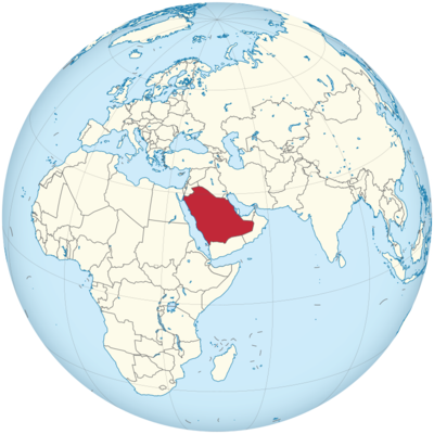
Saudi Arabia Location in World Map
Saudi Arabia occupies most of the Arabian Peninsula.
Location Information of Saudi Arabia
Saudi Arabia is a country located in the Middle East, occupying most of the Arabian Peninsula. It is bordered by Jordan, Iraq, Kuwait, Bahrain, Qatar, the United Arab Emirates, Oman, and Yemen. The country also has a long coastline along both the Red Sea to the west and the Persian Gulf to the east, providing it with strategic access to key maritime trade routes. Saudi Arabia is a central player in both regional and global affairs, known for its vast deserts, religious significance, and economic prowess, primarily derived from its oil reserves.
Latitude and Longitude
Saudi Arabia is situated at the following approximate coordinates:
- Latitude: 23.8859° N
- Longitude: 45.0792° E
These coordinates place Saudi Arabia in the desert zone of the Middle East, where much of its land area is arid, with vast stretches of desert, mountainous regions, and a few coastal plains.
Capital City and Major Cities
The capital city of Saudi Arabia is Riyadh, which serves as the political, administrative, and economic center of the country. Riyadh is located in the central part of the country, in the Najd region, and is one of the most developed cities in the Middle East.
Major Cities in Saudi Arabia:
- Jeddah: Located on the Red Sea coast, Jeddah is Saudi Arabia’s second-largest city and an important port city. It serves as the gateway for Muslim pilgrims traveling to Mecca for the annual Hajj pilgrimage. Jeddah has a vibrant economy, with industries ranging from shipping and trade to oil and tourism.
- Mecca (Makkah): Mecca is the holiest city in Islam, as it is the birthplace of the Prophet Muhammad and the site of the Kaaba, the most sacred structure in Islam. Every year, millions of Muslims from around the world visit Mecca for the Hajj pilgrimage. Mecca is located in the western part of Saudi Arabia, close to the Red Sea.
- Medina (Madinah): Located about 340 kilometers (210 miles) north of Mecca, Medina is the second holiest city in Islam. It is the site of the Prophet’s Mosque, which houses the tomb of the Prophet Muhammad. Like Mecca, Medina attracts millions of religious tourists, particularly during the Hajj and Umrah pilgrimage seasons.
- Khobar: Located in the Eastern Province, Khobar is an important industrial and commercial hub, especially due to its proximity to the city of Dhahran, the headquarters of the Saudi Arabian Oil Company (Aramco). It is part of the Dammam Metropolitan Area and has a developed infrastructure, making it a vital part of Saudi Arabia’s oil and gas sector.
- Dammam: Dammam is the capital of the Eastern Province and a key city for Saudi Arabia’s oil industry. The city, located on the Persian Gulf coast, is vital for the country’s oil exports and the economy of the region. Dammam is well-connected to other major cities in Saudi Arabia through modern highways and rail systems.
Time Zone
Saudi Arabia operates on Arabian Standard Time (AST), which is UTC +3. The country does not observe daylight saving time, so the time remains the same throughout the year. This time zone is shared by several other countries in the Arabian Peninsula, including Kuwait, Bahrain, and Qatar.
Climate
Saudi Arabia has a predominantly desert climate, characterized by extremely hot summers and mild winters. Due to its location on the Arabian Peninsula, much of the country is covered by sand deserts such as the Rub’ al Khali (Empty Quarter), the largest continuous sand desert in the world. However, Saudi Arabia’s climate also varies in different regions, with coastal cities experiencing milder conditions compared to the vast desert interior.
Seasonal Breakdown:
- Summer (June to September): Summer in Saudi Arabia is harsh, with temperatures often reaching 45°C to 50°C (113°F to 122°F) in many areas, particularly in the central and eastern regions. Cities like Riyadh and the desert regions can experience extreme heat, while coastal cities like Jeddah and Dammam are somewhat more bearable due to the proximity of the sea. The interior, especially areas like the Rub’ al Khali, sees very high temperatures during the summer.
- Winter (December to February): Winter temperatures are much milder, especially in the central and eastern parts of the country. In cities like Riyadh, temperatures typically range from 8°C to 22°C (46°F to 72°F). Coastal areas like Jeddah and Khobar enjoy a more moderate climate, ranging from 15°C to 28°C (59°F to 82°F). Snowfall is rare but can occur in higher elevations, particularly in the Asir Mountains.
- Spring (March to May): Spring is considered one of the most pleasant seasons in Saudi Arabia, with temperatures ranging from 25°C to 35°C (77°F to 95°F) in most regions. The desert regions start to experience higher temperatures, while coastal cities enjoy relatively mild conditions. Rainfall is sparse, though occasional thunderstorms may occur.
- Autumn (October to November): Autumn sees a gradual cooling in temperature after the intense heat of summer. The average temperature ranges from 25°C to 40°C (77°F to 104°F). While rain is still limited, occasional showers can provide a welcome respite from the heat.
Economic Status
Saudi Arabia is one of the wealthiest countries in the Middle East, largely due to its vast reserves of oil and its position as one of the world’s leading oil exporters. The country’s economy is heavily reliant on the petroleum sector, which accounts for around 50% of its GDP and about 90% of export earnings. However, Saudi Arabia has been making concerted efforts to diversify its economy under its Vision 2030 initiative, with a focus on sectors such as tourism, technology, entertainment, and renewable energy.
Key Economic Sectors:
- Oil and Gas: The oil sector is by far the most important part of the Saudi economy. Saudi Arabia is one of the largest producers and exporters of crude oil in the world. The state-owned Saudi Aramco is the world’s most valuable company and manages the country’s oil resources. Oil revenue has been the cornerstone of the country’s economic growth and development for decades.
- Petrochemicals: In addition to crude oil production, Saudi Arabia has a large and growing petrochemical industry. The country produces a wide range of petrochemical products, including plastics, fertilizers, and chemicals, which are exported globally.
- Finance and Banking: Saudi Arabia has a modern banking and financial services sector, with major banks like National Commercial Bank (NCB), Al Rajhi Bank, and Samba Financial Group playing key roles in both the domestic and regional markets. The government has been making efforts to further develop the financial sector as part of its economic diversification strategy.
- Tourism: Tourism in Saudi Arabia is seeing rapid growth, especially with the country’s emphasis on becoming a global tourism hub as part of its Vision 2030. The government has invested heavily in tourism infrastructure, with the aim of attracting international visitors, particularly through initiatives like the Saudi Arabia Tourist Visa program. Key areas of focus include religious tourism (Hajj and Umrah), leisure tourism, and cultural tourism.
- Technology and Innovation: Saudi Arabia is also working to become a regional leader in technology and innovation. The government has launched numerous initiatives to promote digital transformation and innovation in various sectors, from health to transportation to entertainment.
Tourist Attractions
Saudi Arabia has much to offer tourists, with a mix of historical, cultural, natural, and religious sites. While the country is primarily known for its religious significance, it is increasingly gaining attention for its developing tourism sector.
1. Mecca:
- The Kaaba: Located in the Masjid al-Haram mosque, the Kaaba is the holiest site in Islam and the focal point of the annual Hajj pilgrimage.
- Mount Arafat: A significant site during Hajj, Mount Arafat is where pilgrims gather for the climactic rituals of the pilgrimage.
2. Medina:
- Prophet’s Mosque: The second holiest site in Islam, this mosque houses the tomb of the Prophet Muhammad.
- Quba Mosque: The first mosque ever built in Islamic history, located on the outskirts of Medina.
3. Riyadh:
- National Museum of Saudi Arabia: Located in Riyadh, the museum offers a fascinating insight into the history, culture, and traditions of Saudi Arabia.
- Al-Masmak Fortress: A historical fort in Riyadh, known for its role in the unification of Saudi Arabia.
4. Al-Ula:
A UNESCO World Heritage site, Al-Ula is home to ancient Nabatean tombs and rock formations, and is a key site for archaeological and historical tourism in Saudi Arabia.
5. Red Sea Coast:
Cities like Jeddah and Yanbu on the Red Sea coast offer pristine beaches, coral reefs, and diving opportunities.
Visa Requirements for U.S. Citizens
U.S. citizens are required to obtain a visa to enter Saudi Arabia. The country has recently opened up to tourism, with the introduction of the Saudi Tourist Visa. The following are the key requirements:
- Tourist Visa: U.S. citizens can apply for an e-visa or a traditional visa, depending on the nature of the visit. The Saudi Tourist Visa is valid for tourism purposes, allowing a stay of up to 90 days.
- Hajj or Umrah Visa: U.S. citizens intending to perform the Hajj or Umrah pilgrimage must apply for a specific visa.
- Passport: A valid U.S. passport with at least six months of validity beyond the intended stay.
- Visa Application: The visa application process can be completed online for most tourism-related purposes, although a consular visit may be required in some cases.
- Vaccinations: Saudi Arabia may require certain vaccinations, such as the Meningococcal vaccine for pilgrims.
Distance to Major U.S. Cities
1. Distance from New York City
The distance between New York City (JFK) and Riyadh (RUH) is approximately 6,500 miles (10,460 kilometers). A direct flight typically takes about 12 to 14 hours.
2. Distance from Los Angeles
The distance between Los Angeles (LAX) and Riyadh is around 8,000 miles (12,875 kilometers), with flight times generally taking around 14 to 16 hours, depending on the route.
Saudi Arabia Facts
| Size | 2,149,690 km² |
| Residents | 31.74 million |
| Language | Arabic |
| Capital | Riad |
| Longest river | – |
| Highest mountain | Jebel Sauda (3,133 meters) |
| Currency | Saudi riyal |


