Cities and Towns in Sebastian County, Arkansas
Founded on January 6, 1851, Sebastian County is one of 75 counties in the state of Arkansas. Historically, Sebastian County was formed from Crawford and Scott. The city of Fort Smith, Greenwood is the county seat. With FIPS code of 131, Sebastian County has a population of 128,400 and area of 546.04 square miles (1,414 km²).
List of all cities in Sebastian County, AR alphabetically
| City/Town | Postal Code | Area Code |
| Barling, AR | 72923 | 479 |
| Bonanza, AR | 72916 | 479 |
| Central City, AR | 72941 | 479 |
| Fort Chaffee, AR | 72905 | 479 |
| Fort Smith, AR | 72901 | 479 |
| 72902 | 479 | |
| 72903 | 479 | |
| 72904 | 479 | |
| 72905 | 479 | |
| 72906 | 479 | |
| 72908 | 479 | |
| 72913 | 479 | |
| 72914 | 479 | |
| 72916 | 479 | |
| 72917 | 479 | |
| 72918 | 479 | |
| 72919 | 479 | |
| Golden Ventures, AR | 72919 | 479 |
| Greenwood, AR | 72936 | 479 |
| Hackett, AR | 72937 | 479 |
| Hartford, AR | 72938 | 479 |
| Huntington, AR | 72940 | 479 |
| Lavaca, AR | 72941 | 479 |
| Midland, AR | 72945 | 479 |
Major Cities and Towns in Sebastian County, Arkansas
Fort Smith
- Area: 68.2 square miles
- Population: 89,142 (2020 Census)
- ZIP Codes: 72901, 72903, 72904, 72908, 72916
- Latitude and Longitude: 35.3859° N, 94.3985° W
Location and History
Fort Smith is the largest city in Sebastian County and the second-largest city in Arkansas. Located on the Arkansas-Oklahoma border along the Arkansas River, Fort Smith was established in 1817 as a military outpost to maintain peace between settlers and Native American tribes. The city grew rapidly due to its strategic location as a gateway to the West, becoming a hub for trade, transportation, and law enforcement. Fort Smith’s history is deeply intertwined with the American frontier, particularly during the era of Judge Isaac C. Parker, known as the “Hanging Judge,” who presided over the U.S. District Court for the Western District of Arkansas in the late 19th century. Today, Fort Smith is a vibrant city with a diverse economy that includes manufacturing, healthcare, and education, while also serving as a cultural and historical center in the region.
Major Schools and Landmarks
Fort Smith is served by the Fort Smith School District, which includes several high schools, such as Northside High School and Southside High School, known for their strong academic and athletic programs. The city is home to the University of Arkansas at Fort Smith, offering higher education opportunities to the region. Major landmarks in Fort Smith include the Fort Smith National Historic Site, which preserves the original military fort and courthouse, and the historic downtown area, which features restored buildings, museums, and the popular Riverfront Park. The city also boasts the Fort Smith Museum of History and the Fort Smith Regional Art Museum, both of which contribute to the cultural richness of the area. Additionally, the Arkansas River offers recreational activities such as boating and fishing, making Fort Smith a well-rounded community with a blend of history, culture, and modern amenities.
Greenwood
- Area: 10.6 square miles
- Population: 9,397 (2020 Census)
- ZIP Codes: 72936
- Latitude and Longitude: 35.2156° N, 94.2555° W
Location and History
Greenwood, located southeast of Fort Smith, is a city rich in history and community spirit. Established in 1851, Greenwood quickly developed as a key agricultural and mining center in Sebastian County. The town’s early economy was bolstered by cotton farming and coal mining, which attracted workers and their families to the area. Greenwood’s historical significance is also marked by its role in the Civil War, during which it served as a strategic location due to its proximity to the Confederate stronghold in Fort Smith. The city experienced significant growth throughout the 20th century, evolving from a small farming community into a thriving suburban city with strong ties to Fort Smith. Today, Greenwood is known for its family-friendly atmosphere, excellent schools, and a strong sense of community pride.
Major Schools and Landmarks
Greenwood is served by the Greenwood School District, which includes Greenwood High School, known for its strong academic programs and successful sports teams, particularly in football. The city is also home to East Hills Middle School and Greenwood Junior High School. Significant landmarks in Greenwood include the Old Jail Museum, which preserves the city’s early history, and the historic Bell Park, offering stunning views of the surrounding area. The Sebastian County Courthouse, located in Greenwood, is another key landmark, reflecting the city’s historical importance. Greenwood also hosts the annual Freedom Fest, a community celebration featuring live music, fireworks, and a parade, highlighting the city’s strong patriotic spirit.
Barling
- Area: 22.1 square miles
- Population: 4,888 (2020 Census)
- ZIP Codes: 72923
- Latitude and Longitude: 35.3217° N, 94.2939° W
Location and History
Barling is a growing city located east of Fort Smith along the Arkansas River. The city was incorporated in 1956, but its history dates back much earlier, with roots in agriculture and small-scale industry. Barling was named after Aaron Barling, an early settler who played a significant role in the area’s development. The city’s proximity to Fort Smith and the Fort Chaffee military base has heavily influenced its growth, especially after World War II, when the region saw a surge in population and development. Barling has gradually transformed from a small, rural community into a suburban area that offers a quieter lifestyle while still being close to the amenities of Fort Smith. The city’s growth has been steady, with residential developments and community facilities expanding over the past few decades.
Major Schools and Landmarks
Barling is part of the Fort Smith School District, with children attending schools in nearby Fort Smith, including Chaffin Junior High and Southside High School. The city is also close to the Fort Smith campus of the University of Arkansas, providing higher education opportunities to residents. Key landmarks in Barling include the Chaffee Crossing Historic District, which features preserved buildings from the Fort Chaffee military base and the Barling City Park, offering recreational facilities such as walking trails, playgrounds, and sports fields. The Arkansas River, which borders the city, provides opportunities for fishing and boating. Barling’s proximity to Fort Chaffee also makes it a site of historical significance, particularly in relation to its role in military history and as a training ground during World War II.
Lavaca
- Area: 2.3 square miles
- Population: 2,608 (2020 Census)
- ZIP Codes: 72941
- Latitude and Longitude: 35.3342° N, 94.1727° W
Location and History
Lavaca is a small city located in eastern Sebastian County, Arkansas. The town was established in the late 19th century and has maintained its small-town charm over the years. Lavaca’s early history is closely tied to agriculture, with the surrounding fertile land being used for farming and livestock. The town’s growth was gradual, with a steady population that has remained relatively stable over the decades. Lavaca has retained much of its rural character while benefiting from its proximity to larger cities like Fort Smith. The community is known for its friendly atmosphere, low crime rate, and strong local traditions, making it an appealing place for families and those seeking a quieter lifestyle.
Major Schools and Landmarks
Lavaca is served by the Lavaca School District, which includes Lavaca High School, Lavaca Middle School, and Lavaca Elementary School. The schools are known for their supportive environment and active participation in both academics and sports. Significant landmarks in Lavaca include the Lavaca Heritage Museum, which showcases the town’s history and local culture. The city also has several parks, including Veterans Memorial Park, which honors local veterans and provides a space for community events. The nearby Arkansas River and the Ozark National Forest offer additional opportunities for outdoor recreation. Lavaca’s annual events, such as the Fourth of July celebration and the fall festival, reflect the town’s strong sense of community and pride in its heritage.
Hackett
- Area: 1.9 square miles
- Population: 881 (2020 Census)
- ZIP Codes: 72937
- Latitude and Longitude: 35.1895° N, 94.4113° W
Location and History
Hackett is a small city located in the southwestern part of Sebastian County, Arkansas, near the Oklahoma border. The town was established in the late 19th century, primarily as a farming community, and was named after Major John Hackett, a local landowner and Civil War veteran. Hackett’s growth was modest, with agriculture and coal mining serving as the mainstays of the local economy. Over the years, the town has maintained its rural character and close-knit community atmosphere. Hackett offers a peaceful, small-town lifestyle with easy access to the larger city of Fort Smith, making it an attractive option for those seeking a quieter environment while still being close to urban amenities.
Major Schools and Landmarks
Hackett is part of the Hackett School District, with Hackett High School and Hackett Elementary School serving the educational needs of the community. The schools are known for their strong community involvement and a variety of extracurricular activities, particularly in athletics. Key landmarks in Hackett include the Hackett City Park, which provides recreational facilities such as playgrounds, sports fields, and picnic areas. The town is also close to the Poteau Mountain area, offering hiking, camping, and other outdoor activities. Hackett’s annual community events, such as the Hackett Christmas Parade, showcase the town’s strong community spirit and traditions. The town’s history is also reflected in its well-preserved historic buildings, which add to its charm and appeal as a small, rural community in Sebastian County.
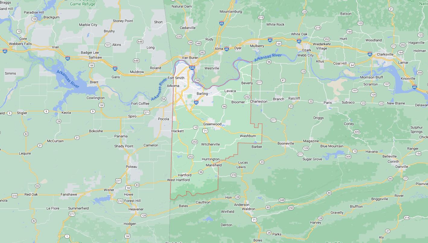
Map of Cities in Sebastian County, AR