Cities and Towns in Riverside County, California
Founded in 1893, Riverside County is one of 58 counties in the state of California. Historically, Riverside County was formed from San Bernardino and San Diego. The city of Riverside is the county seat. With FIPS code of 65, Riverside County has a population of 2,458,395 and area of 7,208 square miles (18,669 km²).
List of all cities in Riverside County, CA alphabetically
| City/Town | Postal Code | Area Code |
| Aguanga, CA | 92536 | 951 |
| Anza, CA | 92539 | 951 |
| Arlington, CA | 92503 | 951 |
| Banning, CA | 92220 | 951 |
| Barona Rancheria, CA | 92262 | 760 |
| Beaumont, CA | 92223 | 951 |
| Bermuda Dunes, CA | 92203 | 760 |
| Blythe, CA | 92225 | 760 |
| 92226 | 760 | |
| Box Springs, CA | 92507 | 951 |
| Cabazon, CA | 92230 | 951 |
| 92282 | 760 | |
| Calimesa, CA | 92320 | 909 |
| Canyon Crest, CA | 92507 | 951 |
| Canyon Lake, CA | 92587 | 951 |
| Casa Blanca, CA | 92504 | 951 |
| Cathedral City, CA | 92234 | 760 |
| 92235 | 760 | |
| Cherry Valley, CA | 92223 | 951 |
| Chiriaco Summit, CA | 92201 | 760 |
| City of Riverside, CA | 92522 | 951 |
| Coachella, CA | 92236 | 760 |
| Corona, CA | 92877 | 951 |
| 92878 | 951 | |
| 92879 | 951 | |
| 92880 | 951 | |
| 92881 | 951 | |
| 92882 | 951 | |
| 92883 | 951 | |
| Desert Center, CA | 92239 | 760 |
| Desert Edge, CA | 92241 | 760 |
| Desert Hot Springs, CA | 92240 | 760 |
| 92241 | 760 | |
| Desert Shores, CA | 92274 | 760 |
| Eagle Mountain, CA | 92239 | 760 |
| Gilman Hot Springs, CA | 92583 | 951 |
| Hemet, CA | 92543 | 951 |
| 92544 | 951 | |
| 92545 | 951 | |
| 92546 | 951 | |
| Holcomb Village, CA | 92536 | 951 |
| Homeland, CA | 92548 | 951 |
| Idyllwild, CA | 92549 | 951 |
| Indian Wells, CA | 92210 | 760 |
| Indio, CA | 92201 | 760 |
| 92202 | 760 | |
| 92203 | 760 | |
| Jurupa, CA | 92509 | 951 |
| La Quinta, CA | 92247 | 760 |
| 92248 | 760 | |
| 92253 | 760 | |
| La Sierra, CA | 92505 | 951 |
| Lake Elsinore, CA | 92530 | 951 |
| 92531 | 951 | |
| 92532 | 951 | |
| Lakeview, CA | 92567 | 951 |
| March Air Reserve Base, CA | 92518 | 951 |
| Mecca, CA | 92254 | 760 |
| Menifee, CA | 92584 | 951 |
| Mesa Verde, CA | 92225 | 760 |
| Mira Loma, CA | 91752 | 951 |
| Moreno Valley, CA | 92551 | 951 |
| 92552 | 951 | |
| 92553 | 951 | |
| 92554 | 951 | |
| 92555 | 951 | |
| 92556 | 951 | |
| 92557 | 951 | |
| Mountain Center, CA | 92561 | 951 |
| Murrieta, CA | 92562 | 951 |
| 92563 | 951 | |
| 92564 | 951 | |
| Murrieta Hot Springs, CA | 92562 | 951 |
| 92563 | 951 | |
| 92564 | 951 | |
| Norco, CA | 92860 | 951 |
| North Palm Springs, CA | 92258 | 760 |
| North Shore, CA | 92254 | 760 |
| Nuevo, CA | 92567 | 951 |
| One Hundred Palms, CA | 92274 | 760 |
| Palm Desert, CA | 92210 | 760 |
| 92211 | 760 | |
| 92255 | 760 | |
| 92260 | 760 | |
| 92261 | 760 | |
| Palm Springs, CA | 92262 | 760 |
| 92263 | 760 | |
| 92264 | 760 | |
| 92292 | 760 | |
| Palm Springs Municipal Airpo, CA | 92262 | 760 |
| Palms, CA | 92274 | 760 |
| 92276 | 760 | |
| 92570 | 951 | |
| 92571 | 951 | |
| 92572 | 951 | |
| 92599 | 951 | |
| Pinyon Pines, CA | 92561 | 951 |
| Quail Valley, CA | 92587 | 951 |
| Rancho Belago, CA | 92555 | 951 |
| Rancho California, CA | 92589 | 951 |
| 92590 | 951 | |
| 92591 | 951 | |
| 92592 | 951 | |
| 92593 | 951 | |
| Rancho Mirage, CA | 92270 | 760 |
| Ripley, CA | 92225 | 760 |
| Riverside, CA | 92501 | 951 |
| 92502 | 951 | |
| 92503 | 951 | |
| 92504 | 951 | |
| 92505 | 951 | |
| 92506 | 951 | |
| 92507 | 951 | |
| 92508 | 951 | |
| 92509 | 951 | |
| 92513 | 951 | |
| 92514 | 951 | |
| 92515 | 951 | |
| 92516 | 951 | |
| 92517 | 951 | |
| 92518 | 951 | |
| 92519 | 951 | |
| 92521 | 951 | |
| 92522 | 951 | |
| Romoland, CA | 92585 | 951 |
| Rubidoux, CA | 92509 | 951 |
| 92519 | 951 | |
| San Jacinto, CA | 92581 | 951 |
| 92582 | 951 | |
| 92583 | 951 | |
| Sandy Korner, CA | 92274 | 760 |
| Sky Valley, CA | 92241 | 760 |
| Smoke Tree, CA | 92262 | 760 |
| Starcrest of Cal, CA | 92599 | 951 |
| Sun City, CA | 92584 | 951 |
| 92585 | 951 | |
| 92586 | 951 | |
| 92587 | 951 | |
| Temecula, CA | 92589 | 951 |
| 92590 | 951 | |
| 92591 | 951 | |
| 92592 | 951 | |
| 92593 | 951 | |
| Thermal, CA | 92274 | 760 |
| Thousand Palms, CA | 92276 | 760 |
| Thousand Plms, CA | 92276 | 760 |
| Torres Martinez Indian Reser, CA | 92274 | 760 |
| University of CA Riverside, CA | 92521 | 951 |
| Valerie, CA | 92274 | 760 |
| Vista Santa Rosa, CA | 92274 | 760 |
| Whitewater, CA | 92282 | 760 |
| Wildomar, CA | 92595 | 951 |
| Winchester, CA | 92596 | 951 |
| 92504 | 951 |
Major Cities and Towns in Riverside County, California
Riverside
Area, Population, and Geography
- Area: 81.5 square miles
- Population: Approximately 330,000 (2023 estimate)
- Zip Codes: 92501-92509, 92513-92519, 92521-92522
- Latitude: 33.9533° N
- Longitude: 117.3962° W
City Location and History
Riverside, the county seat of Riverside County, is located in the Inland Empire region of Southern California, approximately 60 miles east of Los Angeles. The city was founded in 1870 by John W. North and a group of Easterners who intended to create a dry, temperate, and prosperous community. Riverside quickly gained prominence with the introduction of the Washington navel orange, which was first successfully cultivated in the area in the 1870s. This sparked the California citrus industry, making Riverside one of the wealthiest cities in the United States at the time. The city’s growth was further fueled by the railroad and its central location in Southern California. Today, Riverside is known for its rich history, vibrant arts scene, and as a center for education and government in the region.
Major Schools and Landmarks
Riverside is home to several major educational institutions, including the University of California, Riverside (UCR), which is known for its research programs and contributions to agriculture and environmental sciences. The city’s landmarks include the historic Mission Inn Hotel & Spa, a sprawling, mission-style hotel that has hosted numerous U.S. presidents and celebrities. The Riverside Metropolitan Museum, the Riverside Art Museum, and the California Museum of Photography are key cultural institutions in the city. Mount Rubidoux, a prominent local landmark, offers hiking trails and panoramic views of the city, and it is famous for its annual Easter Sunrise Service. Riverside’s combination of historic charm, educational excellence, and cultural amenities make it a central and dynamic city in Riverside County.
Moreno Valley
Area, Population, and Geography
- Area: 51.3 square miles
- Population: Approximately 215,000 (2023 estimate)
- Zip Codes: 92551-92557
- Latitude: 33.9425° N
- Longitude: 117.2297° W
City Location and History
Moreno Valley is located in the western part of Riverside County, bordered by Riverside to the west and the San Bernardino Mountains to the north. The area was initially part of the Rancho San Jacinto Nuevo y Potrero land grant, which was used primarily for ranching in the 19th century. Moreno Valley began to develop in the early 20th century as a rural community, but it remained sparsely populated until the 1980s when suburban development began to accelerate. The city was incorporated in 1984 and has since grown rapidly into one of the largest cities in Riverside County. Moreno Valley’s growth has been driven by its proximity to major transportation routes, affordable housing, and its role as a bedroom community for the larger metropolitan areas of Riverside and Los Angeles.
Major Schools and Landmarks
Moreno Valley is served by the Moreno Valley Unified School District, with schools like Moreno Valley High School and Canyon Springs High School being key educational institutions. The city’s major landmarks include the March Air Reserve Base, which has played a significant role in the region’s development since its establishment in 1918. The base also hosts the March Field Air Museum, where visitors can explore a collection of historic aircraft and learn about aviation history. Lake Perris, located just southeast of the city, is a popular destination for boating, fishing, and camping. The city also features Box Springs Mountain Reserve, offering hiking trails and scenic views of the Inland Empire. Moreno Valley’s combination of rapid growth, military history, and outdoor recreation makes it a significant city in Riverside County.
Corona
Area, Population, and Geography
- Area: 39.9 square miles
- Population: Approximately 170,000 (2023 estimate)
- Zip Codes: 92877-92883
- Latitude: 33.8753° N
- Longitude: 117.5664° W
City Location and History
Corona is located in the northwestern part of Riverside County, about 45 miles southeast of Los Angeles. The city was founded in 1886 during the Southern California citrus boom and was originally known as South Riverside. Corona’s name, which means “crown” in Spanish, reflects the circular layout of its original streets, which were designed to host auto races in the early 20th century. The city became known as the “Lemon Capital of the World” due to its vast citrus groves. Over the years, Corona transitioned from an agricultural town to a suburban city, driven by its location along key transportation routes such as the Santa Fe Railway and later the Riverside Freeway (SR 91). Today, Corona is a thriving suburban community with a diverse economy.
Major Schools and Landmarks
Corona is served by the Corona-Norco Unified School District, with Santiago High School and Centennial High School being among the notable institutions. The city’s major landmarks include the Fender Museum of Music and the Arts, which celebrates Corona’s rich musical history, particularly its connection to Fender guitars. Another key site is the Corona Heritage Park & Museum, which preserves the city’s agricultural past and features historic buildings and artifacts. The Dos Lagos area offers shopping, dining, and entertainment, set around two lakes with walking paths. The nearby Cleveland National Forest provides outdoor recreation opportunities such as hiking, mountain biking, and camping. Corona’s blend of suburban living, historical significance, and access to natural areas makes it a key city in Riverside County.
Temecula
Area, Population, and Geography
- Area: 37.3 square miles
- Population: Approximately 115,000 (2023 estimate)
- Zip Codes: 92589-92593
- Latitude: 33.4936° N
- Longitude: 117.1484° W
City Location and History
Temecula is located in the southwestern part of Riverside County, near the border with San Diego County. The area was originally inhabited by the Luiseño Native American tribe and later became part of a Spanish land grant. The town of Temecula was officially established in 1859 and developed as a stop along the Southern Emigrant Trail and later the California Southern Railroad. Temecula remained a small, rural community until the 1980s when suburban development began to transform the area into a rapidly growing city. Temecula is now known for its wine country, which has become one of Southern California’s premier wine-producing regions, as well as for its historic Old Town and annual festivals.
Major Schools and Landmarks
Temecula is served by the Temecula Valley Unified School District, with schools like Temecula Valley High School and Great Oak High School being notable institutions. The city’s major landmarks include Old Town Temecula, a historic district that features preserved 19th-century buildings, shops, restaurants, and the Temecula Valley Museum, which explores the region’s history. The Temecula Valley Wine Country is a major attraction, with over 40 wineries offering tours, tastings, and events. The Pechanga Resort & Casino, owned by the Pechanga Band of Luiseño Indians, is one of the largest casinos in California and a significant entertainment destination. Temecula also hosts the annual Temecula Valley Balloon & Wine Festival, which draws visitors from across the region. Temecula’s blend of history, wine culture, and modern amenities makes it a standout city in Riverside County.
Murrieta
Area, Population, and Geography
- Area: 33.6 square miles
- Population: Approximately 120,000 (2023 estimate)
- Zip Codes: 92562-92564
- Latitude: 33.5539° N
- Longitude: 117.2139° W
City Location and History
Murrieta is located in the southwestern part of Riverside County, adjacent to Temecula. The area was originally part of a Mexican land grant called Rancho Temecula, and it was settled by Ezequiel Murrieta in the late 19th century, who brought sheep to the area. The town of Murrieta developed as a small, rural community but remained relatively quiet until the 1980s, when suburban development began to accelerate, largely driven by its proximity to San Diego and Orange County. Murrieta was incorporated as a city in 1991 and has since grown rapidly, becoming one of the safest cities in California and a popular residential area for families and professionals.
Major Schools and Landmarks
Murrieta is served by the Murrieta Valley Unified School District, with Murrieta Valley High School and Vista Murrieta High School being key educational institutions. The city’s major landmarks include the Santa Rosa Plateau Ecological Reserve, a protected area that offers hiking trails, wildlife viewing, and scenic views of the surrounding landscape. The Murrieta Hot Springs, once a famous resort and spa destination, now serves as a Christian retreat center. Old Town Murrieta features historic buildings, shops, and restaurants, reflecting the city’s heritage. The city also hosts the annual Murrieta Fire & Rescue Fireman’s Barbecue, a community event that supports local public safety efforts. Murrieta’s combination of suburban growth, natural beauty, and community-oriented events make it a significant city in Riverside County.
Palm Springs
Area, Population, and Geography
- Area: 94.1 square miles
- Population: Approximately 48,000 (2023 estimate)
- Zip Codes: 92262-92264
- Latitude: 33.8303° N
- Longitude: 116.5453° W
City Location and History
Palm Springs is located in the Coachella Valley in the eastern part of Riverside County, about 100 miles east of Los Angeles. The area was originally inhabited by the Agua Caliente Band of Cahuilla Indians and later became a health resort destination for travelers seeking the dry desert air. Palm Springs developed as a tourist destination in the early 20th century, particularly among Hollywood celebrities who sought a retreat from the bustle of Los Angeles. The city became famous for its modernist architecture, golf courses, and luxury resorts. Today, Palm Springs remains a popular destination for tourists and retirees, known for its warm climate, vibrant arts scene, and outdoor activities.
Major Schools and Landmarks
Palm Springs is served by the Palm Springs Unified School District, with Palm Springs High School being the main secondary institution. The city’s major landmarks include the Palm Springs Aerial Tramway, which transports visitors from the desert floor to the cooler climate of Mount San Jacinto State Park. The Palm Springs Art Museum features a collection of modern and contemporary art, as well as cultural exhibits related to the region’s history. The city is also known for its mid-century modern architecture, with many homes and buildings designed by famous architects like Richard Neutra and Albert Frey. The annual Palm Springs International Film Festival attracts filmmakers and celebrities from around the world. Palm Springs’ mix of historical significance, cultural attractions, and outdoor recreation makes it a unique and iconic city in Riverside County.
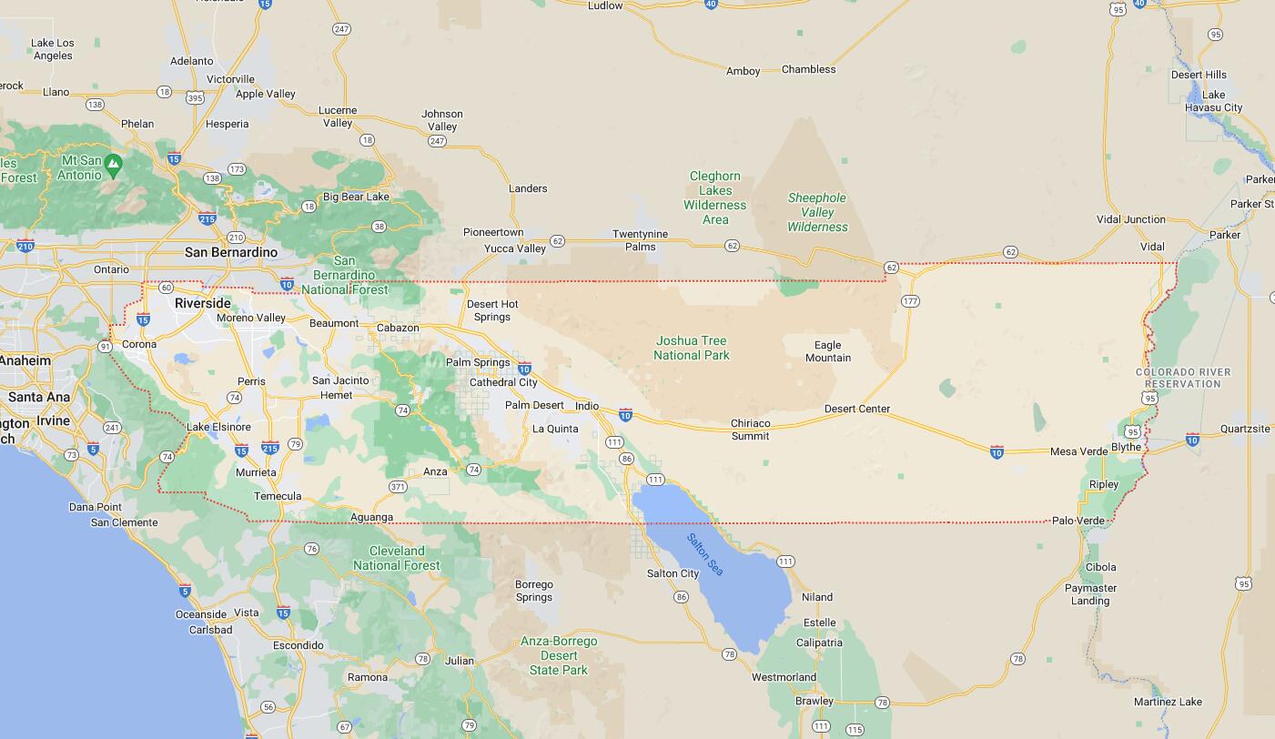
Map of Cities in Riverside County, CA