Where is Vietnam Located?
Where is Vietnam located on the map? Vietnam is an independent nation located in Southeastern Asia. Check out the following images to see location of Vietnam on maps.
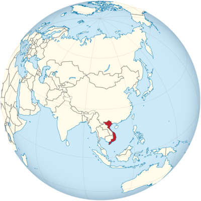
Vietnam Location in World Map
Vietnam is located in Southeast Asia. Translated, Vietnam means “country in the south”. Vietnam is 331,210 square kilometers and therefore a bit smaller than Germany.
If you look at the map, the country is very elongated and covers two large climate zones: tropical climate prevails in the north and subtropical climate in the south. Vietnam stretches 1650 kilometers from north to south.
The coastline is 3400 kilometers long. Vietnam is mainly located on the South China Sea. The country borders the Gulf of Thailand only in the southwest.
There are land borders with three states. In the west, Laos and Cambodia border Vietnam, in the north lies China. In the north Vietnam extends to a maximum width of 600 kilometers, in the south of 350 kilometers. At its narrowest point, it is only 50 kilometers wide.
Like a seahorse?
If you look closely at Vietnam on the map, you will see that it is somehow shaped like an elongated “S”. It kind of looks a bit like a seahorse too, what do you think?
The shape of the country is reminiscent of an “S”.
Regions of Vietnam
Vietnam is divided into five major regions. In the south is the Mekong Delta. The Mekong River crosses a total of six Asian countries before it reaches the South China Sea in Vietnam. This region is fertile and many people live here.
To the northeast of the delta is Ho Chi Minh City, a city that was formerly known as Saigon. Although the city is no longer officially called that, the Vietnamese still call it that today. Saigon is also shorter than Ho Chi Minh City and easier to pronounce. You can also see where it is on the map above.
France in Vietnam
Many cities in Vietnam still show traces of the French today. Vietnam was part of French Indochina and part of the French colonial empire for almost 100 years. The opera house in Ho Chi Minh City was also built during the colonial era and is strongly reminiscent of French architecture. The history of Vietnam can be found in many places, reminding both visitors and locals how the country came into being.
Mountains
The Annamite Coastal Strip, a narrow coastal strip between the Annamite Mountains and the South China Sea, is very densely populated.
A little further north is the Annamite Mountains. Not that many people live here. This mountain range connects North and South Vietnam.
It follows further north the delta of the Red River, that is the region around the capital of Vietnam Hanoi. Halong Bay is also in this region and attracts tourists from near and far year after year.
In the north is the border with China. Here in the Yunnan highlands is also the highest mountain in Vietnam, which is called Phan-xi-pang and is 3144 meters high. Many ethnic minorities settle here.
Location Information of Vietnam
Vietnam is a Southeast Asian country located on the easternmost coast of the Indochinese Peninsula. The country is known for its rich culture, history, and diverse landscapes, ranging from rugged mountains and lush forests to sprawling rice paddies and long coastlines. Vietnam is bordered by China to the north, Laos to the northwest, Cambodia to the southwest, and the South China Sea to the east.
Latitude and Longitude
Vietnam is situated approximately between Latitude 8°N to 23°N and Longitude 102°E to 110°E. This geographical position gives Vietnam a long coastline that stretches over 3,000 kilometers (1,864 miles) along the South China Sea, making it a key player in regional maritime trade.
Capital City and Major Cities
Capital City: Hanoi
Hanoi, the capital city of Vietnam, is located in the northern part of the country. The city, which has been the political and cultural center of Vietnam for over a thousand years, is famous for its well-preserved colonial architecture, ancient temples, and vibrant street life. Hanoi is situated at Latitude 21.0285° N and Longitude 105.8542° E.
The city lies on the Red River, which has historically been an essential waterway for transportation and trade. Hanoi’s old quarter is a bustling area filled with narrow streets, traditional markets, and a blend of French and Vietnamese colonial architecture.
Major Cities
- Ho Chi Minh City (Saigon) Ho Chi Minh City, formerly known as Saigon, is the largest city in Vietnam and its economic powerhouse. Located in the southern part of the country, it is a bustling metropolis with a dynamic economy, vibrant culture, and a growing population. The city is located at Latitude 10.8231° N and Longitude 106.6297° E. Ho Chi Minh City is home to various cultural landmarks, including Notre-Dame Cathedral Basilica of Saigon, Ben Thanh Market, and the War Remnants Museum.
- Da Nang Da Nang is a coastal city located in central Vietnam, known for its beautiful beaches, historic sites, and proximity to the UNESCO World Heritage sites of Hoi An and My Son. Da Nang is a key economic hub in central Vietnam and is situated at Latitude 16.0544° N and Longitude 108.2022° E.
- Hai Phong Hai Phong is an important port city in northern Vietnam, located near the Gulf of Tonkin. The city is a major industrial center, with industries such as shipbuilding, manufacturing, and logistics. Hai Phong is located at Latitude 20.8443° N and Longitude 106.6884° E.
- Can Tho Can Tho is the largest city in the Mekong Delta in southern Vietnam. Known for its picturesque canals and floating markets, Can Tho is a key center for agriculture and trade in the region. The city is located at Latitude 10.0450° N and Longitude 105.7461° E.
- Hue Hue, located in central Vietnam, was the capital of the Nguyen dynasty from 1802 to 1945. The city is renowned for its historic imperial architecture, including the Imperial City, which is a UNESCO World Heritage site. Hue is situated at Latitude 16.4637° N and Longitude 107.5909° E.
Time Zone
Vietnam operates on Indochina Time (ICT), which is UTC +7. The country does not observe daylight saving time, so the time remains constant throughout the year.
Climate
Vietnam experiences a tropical climate, which can be classified into two major seasons: the wet season and the dry season. However, due to its varied topography, Vietnam’s climate differs from region to region.
- Northern Vietnam (Hanoi) The northern region of Vietnam experiences a distinct four-season climate, with cold winters and hot, humid summers. Winter temperatures in Hanoi can drop to 10°C (50°F), while summer temperatures can rise to 30°C to 35°C (86°F to 95°F). The wet season lasts from May to September, with the heaviest rainfall occurring in July and August.
- Central Vietnam (Da Nang, Hue) Central Vietnam has a tropical monsoon climate, with distinct wet and dry seasons. The dry season lasts from February to August, with temperatures ranging from 25°C to 35°C (77°F to 95°F). The wet season, from September to January, can bring heavy rains and occasional typhoons. Da Nang, for instance, is known for its mild winters and hot, humid summers.
- Southern Vietnam (Ho Chi Minh City, Can Tho) Southern Vietnam has a tropical climate with two distinct seasons: the wet season from May to November and the dry season from December to April. During the wet season, temperatures remain around 28°C to 32°C (82°F to 90°F), with brief but intense rainfall in the afternoons. The dry season is characterized by sunny weather and slightly cooler temperatures.
Economic Status
Vietnam is considered a developing economy with rapid growth, particularly since the country implemented economic reforms (Đổi Mới) in the late 1980s. Over the past few decades, Vietnam has emerged as one of the fastest-growing economies in Asia, driven by a combination of industrialization, export growth, and a booming manufacturing sector.
Key Sectors of the Economy:
- Manufacturing and Exports Vietnam has become a major global manufacturing hub, particularly for electronics, textiles, footwear, and furniture. It is a key exporter of products like mobile phones, garments, and seafood. In recent years, the country has attracted significant foreign direct investment (FDI), particularly from multinational companies looking to set up production facilities in Vietnam.
- Agriculture Agriculture remains an important part of Vietnam’s economy, employing a large proportion of the population. The country is one of the world’s largest producers and exporters of rice, coffee, pepper, and cashews. The Mekong Delta in the south is a key agricultural region, known for its rice production and fisheries.
- Tourism Vietnam’s tourism industry has grown rapidly in recent years, with visitors flocking to the country’s beautiful landscapes, vibrant cities, and rich cultural heritage. Major tourist destinations include Ha Long Bay, Hue, Hoi An, and the Mekong Delta. Tourism contributes significantly to the country’s GDP and job creation.
- Services and Technology The services sector, including finance, telecommunications, and information technology, has seen rapid growth. Vietnam has become a popular destination for outsourcing and IT services, thanks to its skilled workforce and competitive labor costs.
Challenges:
Despite its economic progress, Vietnam faces several challenges, including income inequality, an aging population, environmental degradation, and over-reliance on exports. However, the country is making strides toward addressing these issues through reforms and investments in infrastructure and education.
Tourist Attractions
Vietnam offers a wealth of natural beauty, historical landmarks, and cultural sites that attract millions of tourists every year.
1. Ha Long Bay
Ha Long Bay, located in northern Vietnam, is a UNESCO World Heritage site known for its dramatic limestone karsts and emerald-green waters. Visitors can take cruises, kayak through the caves, and explore the region’s islands, caves, and fishing villages.
2. Hoi An
Hoi An, a UNESCO World Heritage city, is famous for its well-preserved ancient town, traditional wooden houses, and vibrant lantern-lit streets. The city is also known for its tailor shops, where visitors can have custom-made clothing.
3. Hue
The ancient city of Hue, located along the Perfume River, was the capital of Vietnam for over a century. Its Imperial City, which includes royal palaces, temples, and gardens, is a major tourist draw. Hue also offers access to scenic sites like the Thien Mu Pagoda and the Tombs of the Emperors.
4. Phong Nha-Kẻ Bàng National Park
This UNESCO World Heritage site is known for its massive caves, including Son Doong, the largest cave in the world. Phong Nha-Kẻ Bàng is a popular destination for spelunking, trekking, and nature tours.
5. Mekong Delta
The Mekong Delta, often referred to as the “Rice Bowl” of Vietnam, offers visitors the chance to explore its lush waterways, floating markets, and traditional villages. Tourists can take boat trips through the canals and experience the local way of life.
Visa Requirements for U.S. Citizens
U.S. citizens planning to visit Vietnam need a visa. The most common types of visas include tourist visas, business visas, and transit visas. Vietnam offers several ways to obtain a visa:
- Tourist Visa:
U.S. citizens can apply for a tourist visa through the Vietnamese embassy or consulate in their home country or through an e-visa application online. A tourist visa typically allows a stay of 30 days, which can be extended in some cases. - eVisa:
Vietnam offers an eVisa to citizens from eligible countries, including the U.S. This visa allows for a stay of up to 30 days and is valid for single-entry visits. The eVisa can be applied for online, and approval usually takes about 3 business days. - Visa on Arrival:
The visa on arrival is available for tourists arriving by air, but applicants must first obtain an approval letter from a Vietnamese travel agency before arriving in Vietnam. Upon arrival, visitors can pick up their visa at the airport.
Distance to New York City and Los Angeles
- Distance from Hanoi to New York City
The distance between Hanoi, Vietnam, and New York City is approximately 12,900 kilometers (8,000 miles). A direct flight typically takes around 17-18 hours, though most flights involve layovers, extending travel time. - Distance from Hanoi to Los Angeles
The distance between Hanoi and Los Angeles is about 13,200 kilometers (8,200 miles). Flight times typically range from 18 to 20 hours, depending on layovers and flight routes.
Vietnam Facts
| Size | 331,210 km² |
| Residents | 94.51 million |
| Language | Vietnamese |
| Capital | Hanoi |
| Longest river | Red River (510 km in Vietnam) |
| Highest mountain | Phan-xi-pang (Fansipan, 3,143 m) |
| Currency | Dong |


