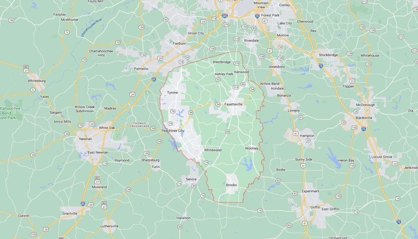
Cities and Towns in Fayette County, Georgia
Founded in 1821, Fayette County is one of 159 counties in the state of Georgia. Historically, Fayette County was formed from Creek Cession of 1821. The city of Fayetteville is the county seat. With FIPS code of 113, Fayette County has a population of 120,574 and area of 197 square miles (510 km²).
List of all cities in Fayette County, GA alphabetically
| City/Town | Postal Code | Area Code |
| Brooks, GA | 30205 | 770/678/470 |
| Fayetteville, GA | 30214 | 770/678/470 |
| 30215 | 770/678/470 | |
| 30270 | 770/678/470 | |
| Peachtree City, GA | 30269 | 770/678/470 |
| 30270 | 770/678/470 | |
| Peachtree City Parcel Return, GA | 30270 | 770/678/470 |
| Tyrone, GA | 30290 | 770/678/470 |
| Woolsey, GA | 30214 | 770/678/470 |
Major Cities and Towns in Fayette County, Georgia
Fayetteville
Area, Population, Zip Codes, Latitude, and Longitude
- Area: 13.5 square miles
- Population: 18,957 (as of the 2020 census)
- Zip Codes: 30214, 30215
- Latitude: 33.4487° N
- Longitude: 84.4549° W
Location and History
Fayetteville is the county seat of Fayette County, located in the central part of the county and roughly 22 miles south of downtown Atlanta. Established in 1822, Fayetteville was named in honor of Marquis de Lafayette, a French hero of the American Revolutionary War. The town quickly developed as a center of agriculture and trade, with its economy traditionally based on cotton farming and small-scale industries. Fayetteville has retained much of its historical charm, with a well-preserved downtown area featuring historic buildings and the Fayette County Courthouse, built in 1825, which is the oldest surviving courthouse in Georgia still in use. Over the years, Fayetteville has grown into a thriving suburban community, blending its rich history with modern amenities and a high quality of life.
Major Schools and Landmarks
Fayetteville is served by the Fayette County School District, with Fayette County High School and Whitewater High School being prominent educational institutions. The town is home to several significant landmarks, including the Holliday-Dorsey-Fife House Museum, a historic home built in 1855 that now serves as a museum showcasing local history. Another key site is the Fayetteville Amphitheater, a popular venue for concerts and events, set in a picturesque location near downtown. The Pinewood Atlanta Studios, one of the largest film and television production facilities in the United States, is also located in Fayetteville, making the city a hub for the entertainment industry. Fayetteville’s annual events, such as the Fayette County Earth Day Festival and the Taste of Fayette, reflect the town’s strong sense of community and commitment to preserving its cultural heritage.
Peachtree City
Area, Population, Zip Codes, Latitude, and Longitude
- Area: 25.4 square miles
- Population: 38,244 (as of the 2020 census)
- Zip Codes: 30269
- Latitude: 33.3968° N
- Longitude: 84.5952° W
Location and History
Peachtree City is the largest city in Fayette County, located in the western part of the county. It was developed in the 1950s as a master-planned community, one of the earliest of its kind in the United States. The city was designed with a network of golf cart paths that connect neighborhoods, schools, shopping centers, and parks, making it unique for its emphasis on golf cart transportation. Peachtree City has grown rapidly over the decades, becoming a model for suburban planning and a highly desirable place to live due to its quality of life, excellent schools, and numerous recreational amenities. The city is known for its carefully planned neighborhoods, extensive green spaces, and a strong sense of community.
Major Schools and Landmarks
Peachtree City is served by the Fayette County School District, with top-rated schools such as McIntosh High School and Starr’s Mill High School. The city is home to several landmarks, including Lake Peachtree and Lake Kedron, both of which provide residents with opportunities for boating, fishing, and other water sports. The Frederick Brown Jr. Amphitheater, often referred to as “The Fred,” is a popular venue for concerts and cultural events, drawing performers from around the country. Peachtree City also boasts a number of golf courses, including the Braelinn Golf Club and Flat Creek Country Club, which are central to the city’s recreational offerings. The city’s annual events, such as the Peachtree City Classic Road Race and the Fourth of July Parade and Fireworks, highlight its vibrant community spirit and commitment to outdoor living.
Tyrone
Area, Population, Zip Codes, Latitude, and Longitude
- Area: 12.9 square miles
- Population: 7,154 (as of the 2020 census)
- Zip Codes: 30290
- Latitude: 33.4718° N
- Longitude: 84.5972° W
Location and History
Tyrone is a small town located in the northern part of Fayette County, just southwest of Atlanta. Established in 1907, the town was named by early Irish settlers who were reminded of their homeland’s rolling hills and lush landscapes. Tyrone began as a small agricultural community, with cotton farming playing a significant role in its early economy. Over the years, Tyrone has maintained its rural charm while experiencing gradual growth, particularly as the Atlanta metropolitan area has expanded. Today, Tyrone is known for its quiet, residential atmosphere, strong community values, and easy access to both the amenities of Peachtree City and the cultural offerings of Atlanta.
Major Schools and Landmarks
Tyrone is part of the Fayette County School District, with notable schools including Sandy Creek High School and Robert J. Burch Elementary School. The town is home to Shamrock Park, a central gathering place for residents that features walking trails, sports fields, and playgrounds. Another key landmark is the Legacy Theatre, a professional theater that offers a range of productions, from musicals to dramas, and serves as a cultural hub for the town. Tyrone’s historic downtown area, while small, includes several preserved buildings that reflect its early 20th-century roots. The town hosts various community events throughout the year, including the Tyrone Founders Day Festival, which celebrates the town’s heritage with parades, live music, and family-friendly activities.
Brooks
Area, Population, Zip Codes, Latitude, and Longitude
- Area: 4.4 square miles
- Population: 524 (as of the 2020 census)
- Zip Codes: 30205
- Latitude: 33.2946° N
- Longitude: 84.4594° W
Location and History
Brooks is a small town located in the southeastern part of Fayette County. Established in 1905, the town was named after an early settler family and developed as an agricultural community. Brooks has retained much of its rural character, with farming remaining a key part of the local economy. The town’s small size and close-knit community have helped preserve its historic charm, with many of its original buildings and homes still standing. Despite being a short drive from the larger cities of Fayetteville and Peachtree City, Brooks has maintained a peaceful, country atmosphere, making it an attractive place for those seeking a quiet, rural lifestyle.
Major Schools and Landmarks
Brooks is served by the Fayette County School District, with students typically attending schools in nearby Fayetteville or Peachtree City. The town’s most notable landmark is the Brooks United Methodist Church, which has been a central part of the community since its founding in the early 20th century. The town is also home to the historic Brooks Depot, which serves as a reminder of the town’s early days as a stop along the railroad. The surrounding countryside offers opportunities for outdoor activities, including horseback riding, hiking, and farming. Brooks’ annual events, such as the Brooks Day Festival, bring the community together to celebrate its heritage with local crafts, food, and music, reinforcing the town’s strong sense of tradition and community.
Woolsey
Area, Population, Zip Codes, Latitude, and Longitude
- Area: 0.8 square miles
- Population: 158 (as of the 2020 census)
- Zip Codes: 30215
- Latitude: 33.3478° N
- Longitude: 84.4136° W
Location and History
Woolsey is the smallest town in Fayette County, located in the southern part of the county. Incorporated in 1893, the town was named after Dr. I.G. Woolsey, a prominent local figure who contributed to the community’s early development. Woolsey began as a rural farming community, with agriculture as the backbone of its economy. Over the years, Woolsey has remained a small, quiet town with a strong sense of community and a deep connection to its agricultural roots. The town’s small size has helped it retain a peaceful, rural atmosphere, making it a desirable location for those looking for a slower pace of life.
Major Schools and Landmarks
Woolsey is part of the Fayette County School District, with students attending schools in nearby Fayetteville or Brooks. The town’s key landmark is the historic Woolsey Baptist Church, which has been serving the community for over a century and remains a central gathering place for residents. The surrounding area is characterized by rolling farmland, forests, and small creeks, offering a picturesque rural landscape. Woolsey’s community events, including the annual church picnics and local fairs, play a significant role in bringing residents together and maintaining the town’s strong sense of tradition and community. Despite its small size, Woolsey’s rich history and peaceful environment make it a unique and cherished part of Fayette County.
Map of Cities in Fayette County, GA