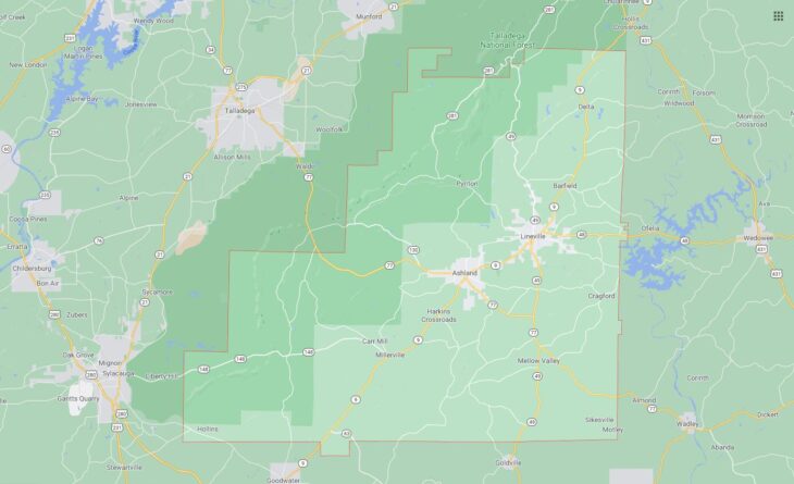
Cities and Towns in Clay County, Alabama
Founded in 1866, Clay County is the 57th biggest county by population (out of 67) in the state of Alabama. Historically, Clay County was formed from Randolph and Talladega counties. The city of Ashland is the County seat. With population density of 23.1 residents per square miles, Clay County has a population of 13,932 and area of 603.96 square miles.
List of all cities and towns in Clay County, Al
| City/Town | Postal Code | Area Code |
| Abel, AL | 36258 | 256 |
| Ashland, AL | 36251 | 256 |
| Barfield, AL | 36266 | 256 |
| Bluff Spring, AL | 36251 | 256 |
| Campbells Crossroads, AL | 36266 | 256 |
| Carr Mill, AL | 36251 | 256 |
| Christiana, AL | 36258 | 256 |
| Cragford, AL | 36255 | 256 |
| Delta, AL | 36258 | 256 |
| Erin, AL | 36266 | 256 |
| Fishhead, AL | 36258 | 256 |
| Gibsonville, AL | 36251 | 256 |
| Harkins Crossroads, AL | 36251 | 256 |
| Highland, AL | 36266 | 256 |
| Hollins, AL | 35082 | 256 |
| Idaho, AL | 36251 | 256 |
| Lineville, AL | 36266 | 256 |
| Mellow Valley, AL | 36255 | 256 |
| Millerville, AL | 36267 | 256 |
| Ofelia, AL | 36266 | 256 |
| Pyriton, AL | 36266 | 256 |
| Shinebone, AL | 36266 | 256 |
| Watts Mill, AL | 36266 | 256 |


