Cities and Towns in Bethel Census Area, Alaska

Founded in, Bethel Census Area is one of 20 boroughs in the state of Alaska. The city of is the borough seat. With FIPS code of 50, Bethel Census Area has a population of 18,557 and area of 40,627 square miles (105,223 km²).

List of all cities in Bethel Census Area, AK alphabetically

City/Town Postal Code Area Code
Akiachak, AK 99551 907
Akiak, AK 99552 907
99557 907
Atmautluak, AK 99559 907
Bethel, AK 99559 907
99637 907
99679 907
99680 907
99690 907
Chefornak, AK 99561 907
Chuathbaluk, AK 99557 907
Crooked Creek, AK 99575 907
Eek, AK 99578 907
Goodnews Bay, AK 99589 907
Kalskag, AK 99607 907
Kasigluk, AK 99609 907
Kipnuk, AK 99614 907
Kongiganak, AK 99545 907
Kwethluk, AK 99621 907
Kwigillingok, AK 99545 907
99622 907
Lower Kalskag, AK 99626 907
Mekoryuk, AK 99630 907
Napakiak, AK 99634 907
Napaskiak, AK 99559 907
Newtok, AK 99559 907
Nightmute, AK 99690 907
Nunapitchuk, AK 99641 907
Platinum, AK 99651 907
Quinhagak, AK 99655 907
Red Devil, AK 99656 907
Sleetmute, AK 99668 907
Stony River, AK 99557 907
Toksook Bay, AK 99637 907
Tuluksak, AK 99679 907
Tuntutuliak, AK 99680 907
Tununak, AK 99681 907

Major Cities and Towns in Bethel Census Area, Alaska

Bethel

Area, Population, and Coordinates

  • Area: 50.7 square miles
  • Population: 6,325 (as of the last census)
  • ZIP Codes: 99559
  • Latitude and Longitude:
    • Latitude: 60.7922° N
    • Longitude: 161.7558° W

Location and History

Bethel is the largest city in the Bethel Census Area and serves as the administrative hub for the region. It is located along the Kuskokwim River, approximately 400 miles west of Anchorage. Bethel’s origins date back to the late 19th century when it was established as a trading post and mission by the Moravian Church. The town grew in importance as a center for the surrounding Yup’ik communities, serving as a key location for trade, education, and healthcare. During the 20th century, Bethel expanded rapidly, becoming a vital transportation and commercial center for western Alaska. The city is accessible only by air and river, emphasizing its remote and unique position in Alaska’s landscape.

Major Schools and Landmarks

Bethel is served by the Lower Kuskokwim School District, with Bethel Regional High School being the primary educational institution in the area. The Yuut Elitnaurviat – The People’s Learning Center – provides vocational training and higher education opportunities to the region. Notable landmarks in Bethel include the Yukon-Kuskokwim Delta National Wildlife Refuge, which offers stunning landscapes and rich biodiversity, particularly for birdwatching. The Kuskokwim 300 Sled Dog Race, held annually, is a significant cultural event that draws mushers from across Alaska and highlights the city’s deep connection to traditional Alaskan activities.

Napaskiak

Area, Population, and Coordinates

  • Area: 4.6 square miles
  • Population: 405 (as of the last census)
  • ZIP Codes: 99559
  • Latitude and Longitude:
    • Latitude: 60.7083° N
    • Longitude: 161.7750° W

Location and History

Napaskiak is a small village in the Bethel Census Area, located along the Kuskokwim River, just a few miles southwest of Bethel. The village is predominantly inhabited by Yup’ik people, and its history is deeply connected to the traditional subsistence lifestyle of the region. Napaskiak was officially established as a city in the mid-20th century, but the area has been occupied by indigenous peoples for thousands of years. The community relies heavily on fishing, hunting, and gathering for sustenance, and the Kuskokwim River plays a central role in the village’s economy and daily life. The isolation of Napaskiak, accessible primarily by river or small aircraft, underscores the remote and self-sufficient nature of the community.

Major Schools and Landmarks

Napaskiak is served by the Lower Kuskokwim School District, with Napaskiak School providing education from kindergarten through 12th grade. The village does not have many formal landmarks, but its cultural heritage is embodied in the traditional Yup’ik lifestyle and practices that are passed down through generations. The Kuskokwim River is the lifeblood of the community, offering opportunities for fishing, transportation, and cultural activities. The surrounding wetlands and tundra provide a rich environment for subsistence hunting and gathering, making Napaskiak a living example of the deep connection between the land and the people in rural Alaska.

Kwethluk

Area, Population, and Coordinates

  • Area: 12.5 square miles
  • Population: 777 (as of the last census)
  • ZIP Codes: 99621
  • Latitude and Longitude:
    • Latitude: 60.8128° N
    • Longitude: 161.4367° W

Location and History

Kwethluk is a small city in the Bethel Census Area, located on the Kwethluk River, a tributary of the Kuskokwim River. The city is primarily inhabited by Yup’ik people and has a history rooted in traditional subsistence activities. Kwethluk’s name means “river current” in the Yup’ik language, reflecting the community’s deep connection to the water that surrounds it. The village has been occupied for centuries, with modern development beginning in the early 20th century. Like many communities in the region, Kwethluk relies heavily on fishing, hunting, and gathering, with the river providing a vital resource for transportation and sustenance.

Major Schools and Landmarks

Kwethluk is served by the Lower Kuskokwim School District, with Kwethluk School providing education from kindergarten through 12th grade. The community’s landmarks are closely tied to its natural environment and cultural heritage. The Kwethluk River is central to the village’s way of life, offering opportunities for subsistence fishing, transportation, and traditional cultural practices. The surrounding tundra and wetlands provide rich resources for hunting and gathering, making Kwethluk a model of subsistence living in rural Alaska. The village also participates in traditional Yup’ik ceremonies and events, preserving its cultural heritage for future generations.

Tuntutuliak

Area, Population, and Coordinates

  • Area: 35.4 square miles
  • Population: 408 (as of the last census)
  • ZIP Codes: 99680
  • Latitude and Longitude:
    • Latitude: 60.3428° N
    • Longitude: 162.6692° W

Location and History

Tuntutuliak is a small village in the Bethel Census Area, located near the mouth of the Kuskokwim River on the western coast of Alaska. The village is predominantly inhabited by Yup’ik people and has a history deeply connected to the subsistence lifestyle that characterizes much of the region. Tuntutuliak was officially established in the 20th century, but the area has been inhabited for thousands of years by indigenous peoples who have relied on the rich natural resources of the Kuskokwim River and the surrounding tundra. The village’s remote location makes it accessible primarily by air or river, with a strong emphasis on self-sufficiency and community.

Major Schools and Landmarks

Tuntutuliak is served by the Lower Kuskokwim School District, with Tuntutuliak School providing education from kindergarten through 12th grade. The village’s most significant landmarks are its natural surroundings and the cultural practices of its people. The Kuskokwim River plays a central role in the community’s economy, providing fish and transportation routes that are vital to daily life. The surrounding wetlands and tundra offer rich opportunities for subsistence hunting and gathering, with the community maintaining a deep connection to the land and its resources. Tuntutuliak also participates in traditional Yup’ik ceremonies, which are essential to preserving the village’s cultural heritage.

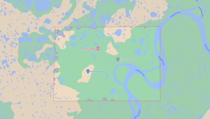
Map of Cities in Bethel Census Area, AK

Map of Cities in Bethel Census Area, AK