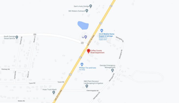
Cities and Towns in Coffee County, Georgia

Founded in 1854, Coffee County is one of 159 counties in the state of Georgia. Historically, Coffee County was formed from Clinch, Irwin, Telfair and Ware counties. The city of Douglas is the county seat. With FIPS code of 69, Coffee County has a population of 43,386 and area of 599 square miles (1,551 km²).

List of all cities in Coffee County, GA alphabetically

City/Town Postal Code Area Code
Ambrose, GA 31512 912
Beach, GA 31554 912
Bickley, GA 31554 912
Broxton, GA 31519 912
Chatterton, GA 31554 912
Douglas, GA 31533 912
31534 912
31535 912
Lotts, GA 31519 912
Nicholls, GA 31554 912
Pridgen, GA 31519 912
Sessoms, GA 31554 912
West Green, GA 31567 912
Wilsonville, GA 31554 912

Major Cities and Towns in Coffee County, Georgia

Douglas

Area, Population, Zip Codes, and Coordinates

  • Area: 14.0 square miles
  • Population: Approximately 11,700
  • Zip Codes: 31533, 31534, 31535
  • Latitude: 31.5087° N
  • Longitude: 82.8495° W

City Location and History

Douglas, the county seat of Coffee County, is located in the southeastern part of Georgia. Founded in 1855, the city was named after Stephen A. Douglas, a prominent U.S. Senator and political figure of the era. Douglas quickly grew into a regional hub for agriculture, particularly in the tobacco and cotton industries. The arrival of the railroad in the late 19th century further boosted the city’s economic development, making it a key transportation and trade center in the region. Over the years, Douglas has diversified its economy, incorporating manufacturing, education, and healthcare as major sectors. The city is known for its historic charm, with several buildings and sites reflecting its rich past.

Major Schools and Landmarks

Douglas is served by the Coffee County School District, with Coffee High School being a major educational institution in the area. The city is also home to South Georgia State College, which plays a significant role in the community’s educational and cultural life. Notable landmarks in Douglas include the Ashley-Slater House, a historic home that now serves as a museum, and the Heritage Station Museum, which showcases the city’s history and its role in the region’s development. The General Coffee State Park, located nearby, offers a variety of outdoor recreational activities and is a popular destination for residents and visitors alike.

Nicholls

Area, Population, Zip Codes, and Coordinates

  • Area: 2.6 square miles
  • Population: Approximately 3,000
  • Zip Codes: 31554
  • Latitude: 31.5227° N
  • Longitude: 82.6348° W

City Location and History

Nicholls is a small town located in the southeastern part of Coffee County, Georgia. The town was incorporated in 1899 and was named after John C. Nicholls, a prominent local politician and Confederate officer. Nicholls developed primarily as an agricultural community, with its economy historically centered around the production of tobacco and other crops. The arrival of the railroad provided a vital link to larger markets, helping the town to grow and prosper. Over time, Nicholls has maintained its rural character and small-town charm, with a close-knit community that values its agricultural heritage.

Major Schools and Landmarks

Nicholls is served by the Coffee County School District, with Nicholls Elementary School being a key educational institution in the town. The town’s landmarks include several historic churches and buildings that reflect its long-standing community values. Nicholls is also known for its proximity to natural attractions such as the Satilla River, which offers opportunities for fishing, boating, and other outdoor activities. The town’s annual events, such as the Nicholls Christmas Parade, bring the community together and celebrate its rich history and traditions.

Broxton

Area, Population, Zip Codes, and Coordinates

  • Area: 1.4 square miles
  • Population: Approximately 1,100
  • Zip Codes: 31519
  • Latitude: 31.6252° N
  • Longitude: 82.8857° W

City Location and History

Broxton is a small town located in the northern part of Coffee County, Georgia. The town was incorporated in 1902 and was named after a local family that played a significant role in its early development. Broxton grew as an agricultural community, with cotton being the dominant crop in its early years. The town’s location along the railroad provided a critical link to markets and contributed to its growth. Despite its small size, Broxton has retained much of its historical character, with a number of buildings and homes from the early 20th century still standing. The town’s residents take pride in their community’s history and rural heritage.

Major Schools and Landmarks

Broxton is served by the Coffee County School District, with students typically attending schools in nearby Douglas. The town’s landmarks include the historic Broxton Methodist Church and the Broxton Rocks Preserve, a unique natural area that features rare plants, rock formations, and scenic views. The preserve is managed by The Nature Conservancy and attracts nature enthusiasts and researchers. Broxton’s combination of historical significance and natural beauty makes it a distinctive community within Coffee County.

Ambrose

Area, Population, Zip Codes, and Coordinates

  • Area: 1.1 square miles
  • Population: Approximately 400
  • Zip Codes: 31512
  • Latitude: 31.5932° N
  • Longitude: 83.0154° W

City Location and History

Ambrose is a small town located in the western part of Coffee County, Georgia. The town was incorporated in 1905 and named after its founder, John Ambrose. Ambrose developed as a rural farming community, with its economy primarily based on agriculture. The town’s location in the fertile plains of southeastern Georgia made it an ideal spot for farming, and for many years, agriculture remained the backbone of the local economy. Despite its small size, Ambrose has a strong sense of community and has managed to preserve its rural character while adapting to modern changes.

Major Schools and Landmarks

Ambrose is served by the Coffee County School District, with students attending schools in nearby towns such as Douglas and Nicholls. The town’s landmarks include several historic buildings and churches that reflect its long-standing community values. The surrounding countryside offers opportunities for outdoor activities such as hunting, fishing, and farming, which are central to the lifestyle of Ambrose’s residents. The town’s annual events, such as community fairs and holiday celebrations, help to maintain a strong sense of community and tradition in Ambrose.

Pearson (Partly in Coffee County)

Area, Population, Zip Codes, and Coordinates

  • Area: 3.1 square miles (portion in Coffee County)
  • Population: Approximately 2,100 (entire town)
  • Zip Codes: 31642
  • Latitude: 31.2975° N
  • Longitude: 82.8521° W

City Location and History

Pearson is a small town that straddles the border between Atkinson and Coffee counties in southeastern Georgia. The town was incorporated in 1891 and was named after Benajah Pearson, a prominent local figure. Pearson developed as an agricultural community, with its economy historically centered on the production of tobacco, cotton, and other crops. The town’s location along the railroad provided vital access to markets, contributing to its growth and development. Today, Pearson remains a small, rural community with a rich agricultural heritage and a close-knit population.

Major Schools and Landmarks

The portion of Pearson within Coffee County is served by the Coffee County School District, while the remainder of the town is served by the Atkinson County School District. Key landmarks in Pearson include the historic downtown area, which features several old buildings and churches, and the nearby Satilla River, which offers opportunities for fishing, boating, and outdoor recreation. Pearson’s rural charm and agricultural roots make it a peaceful and appealing place to live within the broader Coffee County region.

Map of Cities in Coffee County, GA

Map of Cities in Coffee County, GA