Kde se nachází Jižní Súdán?
Kde se na mapě nachází Jižní Súdán? Jižní Súdán je nezávislý stát nacházející se ve východní Africe. Podívejte se na následující obrázky, kde najdete umístění Jižního Súdánu na mapě.
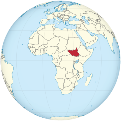
Poloha Jižního Súdánu na mapě světa
Informace o poloze v Jižním Súdánu
Jižní Súdán je vnitrozemský stát nacházející se ve střední a východní Africe. Nejmladším národem světa se stal v roce 2011, kdy získal nezávislost na Súdánu. Jižní Súdán má bohaté kulturní dědictví, rozmanité etnické skupiny a rozmanitou krajinu, od tropických deštných pralesů až po rozlehlé savany. Navzdory výzvám způsobeným politickou nestabilitou a probíhajícími konflikty je Jižní Súdán zemí s velkým potenciálem a odolností.
Zeměpisná šířka a délka
Jižní Súdán se nachází mezi 3° a 13° severní šířky a 25° a 35° východní délky. Sousedí se šesti zeměmi: Súdánem na severu, Etiopií na východě, Keňou a Ugandou na jihovýchodě, Demokratickou republikou Kongo (DRK) na jihozápadě a Středoafrickou republikou na západě.
Hlavní město a velká města
Hlavní město: Džuba
Hlavním městem Jižního Súdánu je Džuba, která se nachází v jižní části země, na březích Bílého Nilu. Džuba slouží jako politické, ekonomické a kulturní centrum země. Je to největší město v Jižním Súdánu a sídlí zde vládní úřady, mezinárodní organizace a řada nevládních organizací.
Souřadnice: 4,8594° s. š., 31,5820° v. d.
Džuba se v letech od získání nezávislosti země rychle rozvíjela, a to navzdory přetrvávajícím problémům, které představují konflikty a nestabilita. Je důležitým obchodním centrem a slouží jako vstupní bod pro většinu mezinárodních návštěvníků země.
Velká města
- Wau: Wau, které se nachází na severozápadě, je druhým největším městem Jižního Súdánu a důležitým ekonomickým a kulturním centrem. Město má přibližně 200 000 obyvatel. Leží v úrodné oblasti a slouží jako regionální centrum zemědělství a obchodu. Blízkost Wau k Súdánu z něj učinila také důležitý bod spojení pro přeshraniční obchod. Souřadnice: 7,6351° s. š., 28,3925° v. d.
- Malakal: Situated in the northeastern part of the country, near the confluence of the White Nile and Sobat River, Malakal is one of South Sudan’s oldest cities. It was once a major trading center and has a population of approximately 120,000 people. The city has witnessed significant conflict in recent years but remains an important economic and political center in Upper Nile State.Coordinates: 9.3333° N, 31.6600° E
- Bentiu: Located in the northern part of the country, Bentiu is the capital of Unity State. This city is strategically important due to its proximity to oil fields and the Sudd wetlands, one of the world’s largest tropical wetlands. Bentiu has a population of approximately 100,000 people and serves as a key administrative and trade center.Coordinates: 9.2672° N, 29.7833° E
- Rumbek: Rumbek, in Lakes State, is located in the central region of South Sudan. It is an important cultural and commercial hub for the surrounding region. The city is home to several ethnic groups, including the Dinka and Nuer, and is vital for trade, particularly livestock. Rumbek has a population of about 50,000.Coordinates: 6.8256° N, 29.6833° E
Time Zone
South Sudan follows East Africa Time (EAT, UTC+3) throughout the year. The country does not observe Daylight Saving Time, so the time difference with countries like the United States remains consistent year-round.
- Time difference with New York City: South Sudan is 8 hours ahead of New York City during Standard Time and 7 hours ahead during Daylight Saving Time.
- Time difference with Los Angeles: South Sudan is 11 hours ahead of Los Angeles during Standard Time and 10 hours ahead during Daylight Saving Time.
Climate
South Sudan’s climate varies from tropical savanna in the south to desert conditions in the north. The country experiences distinct wet and dry seasons, which influence agricultural activities and living conditions for its population.
Climate Zones
- Tropical Wet and Dry Climate: The central and southern regions of South Sudan experience a tropical climate with distinct wet and dry seasons. The rainy season typically runs from May to October, while the dry season spans from November to April. The average annual temperature is around 30°C (86°F), though temperatures can rise significantly during the dry season.
- Semi-Arid Climate: Northern parts of South Sudan, especially areas close to Sudan, experience a semi-arid climate with higher temperatures and lower rainfall. The landscape is dominated by desert and steppe environments, which restrict the potential for large-scale agriculture.
- Monsoon Influence: South Sudan’s climate is also influenced by the seasonal monsoon winds from the Indian Ocean, which bring significant rainfall during the wet season. The White Nile and Sobat River are vital to the country’s water resources and agriculture.
Economic Status
South Sudan’s economy is heavily dependent on oil, which accounts for nearly 90% of the country’s export revenues. However, the country has faced significant challenges in developing a diversified economy due to ongoing conflict, political instability, and inadequate infrastructure.
Key Economic Sectors
- Oil: South Sudan is one of the top oil producers in Africa, with large reserves of oil located in the Unity State and Upper Nile State. Oil extraction is the primary source of income for the government, but the sector has been disrupted due to conflict and infrastructure damage, particularly in areas where pipelines and refineries are located.
- Agriculture: Despite the challenges posed by conflict and climate, agriculture plays an important role in South Sudan’s economy. The country produces sorghum, maize, groundnuts, and livestock. Subsistence farming is common, though commercial agriculture remains underdeveloped due to limited access to markets and resources.
- Trade and Services: South Sudan’s economy also relies on trade, including imports of food, fuel, and machinery. The service sector, particularly in Juba, has grown with the presence of international NGOs, government organizations, and aid agencies.
- Infrastructure: South Sudan faces significant challenges in terms of infrastructure, with inadequate roads, electricity, and telecommunications. The country’s transport system is largely limited to air travel and river transport, with few functional roads connecting the country’s major cities.
Economic Challenges
South Sudan has been hindered by a civil war, which broke out in 2013, devastating its economy. The war severely impacted oil production, agriculture, and trade, leading to widespread poverty and displacement. The 2013-2018 civil war had a profound impact on the country’s human capital, with significant loss of life and destruction of infrastructure. Additionally, political instability and corruption remain significant barriers to economic growth.
The country’s economic growth is also affected by external factors such as fluctuating oil prices and international sanctions.
Tourist Attractions
While South Sudan is not a major global tourism destination, it does have unique attractions, including wildlife, cultural heritage sites, and natural landscapes. Tourism remains limited due to the country’s political situation, but some locations are notable for their potential in the future.
1. Boma National Park
Boma National Park is one of South Sudan’s most famous wildlife conservation areas, located in the southeastern part of the country. It is known for its diverse wildlife, including elephants, buffaloes, and lions, as well as its birdlife. The park also serves as a migratory corridor for the white-eared kob and is part of the Greater Boma Landscape.
Coordinates: 5.5220° N, 33.1800° E
2. Bandingilo National Park
Bandingilo National Park, located in the Jonglei State, is another prominent wildlife reserve in South Sudan. It is home to the world’s largest migratory herds of white-eared kob, gazelles, and other antelope species. The park has great potential for ecotourism and wildlife safaris.
Coordinates: 6.8400° N, 31.8500° E
3. Juba Nile River
The Nile River flows through South Sudan, offering potential for river tourism. The Juba Nile is particularly scenic, with opportunities for boat rides and viewing the natural beauty of the region. The river also plays an essential role in the lives of local communities.
4. Cultural Sites
South Sudan is home to various ethnic groups with distinct cultures and traditions. Exploring the Dinka, Nuer, and Shilluk peoples’ customs, dances, and festivals provides tourists with an immersive cultural experience.
Visa Requirements for U.S. Citizens
U.S. citizens require a visa to enter South Sudan. Visas can be obtained through the South Sudanese embassy or consulate. The process requires submitting a valid passport, a completed visa application, and a visa fee.
Typy víz pro občany USA
- Turistické vízum: Pro ty, kteří navštíví Jižní Súdán za účelem turistiky, je vyžadováno turistické vízum. Vízum je obvykle platné 30 dní, ale o prodloužení lze požádat na imigračním úřadu.
- Obchodní vízum: Občané USA cestující za obchodními účely musí požádat o obchodní vízum, které může vyžadovat pozvání od jihosúdánské společnosti nebo organizace.
Požadované dokumenty
- Platný cestovní pas (platnost alespoň 6 měsíců)
- Vyplněný formulář žádosti o vízum
- Fotografie pasového formátu
- Doklad o dostatečných finančních prostředcích nebo cestovní pojištění
- Vízový poplatek (liší se)
Vzdálenost do New Yorku a Los Angeles
- Vzdálenost z Juby do New Yorku: Letová vzdálenost je přibližně 12 100 km (7 520 mil) s dobou letu přibližně 14 hodin.
- Vzdálenost z Juby do Los Angeles: Vzdálenost je přibližně 13 000 km (8 078 mil) s dobou letu přibližně 15 hodin.
Fakta o Jižním Súdánu
| Velikost | 644 329 km² |
| Obyvatelé | 11 milionů |
| Jazyky | Angličtina a všechny rodné jazyky |
| Kapitál | Džuba |
| Nejdelší řeka | Bílý Nil |
| Nejvyšší hora | Kinyeti (3 187 m) |
| Měna | Jihosúdánská libra |


