Where is South Africa Located?
Where is South Africa located on the map? South Africa is an independent nation located in Southern Africa. Check out the following images to see location of South Africa on maps.
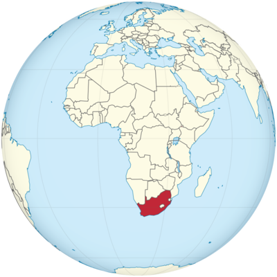
South Africa Location in World Map
Location Information of South Africa
South Africa is a country located at the southernmost tip of the African continent, bordered by Namibia, Botswana, Zimbabwe, and Mozambique, with the Atlantic Ocean to the west and the Indian Ocean to the southeast. Known for its diverse landscapes, rich history, and vibrant culture, South Africa is one of the most influential countries in Africa.
Latitude and Longitude
South Africa lies between 22° and 35° South latitude and 16° and 33° East longitude. It is a unique geographical location, as it is surrounded by oceans on two sides and features varied topography, from coastal plains to mountainous regions.
Capital City and Major Cities
Capital City: Pretoria, Bloemfontein, and Cape Town
South Africa has three capital cities, each serving a different function:
- Pretoria is the administrative capital of South Africa and is home to government ministries, embassies, and foreign missions. It is located in the Gauteng province, northeast of Johannesburg.
Coordinates: 25.7460° S, 28.1881° E - Bloemfontein is the judicial capital and the judicial hub of the country. It hosts the Supreme Court of Appeal and serves as a key legal center.
Coordinates: 29.0852° S, 26.1596° E - Cape Town is the legislative capital of South Africa and houses the Parliament of South Africa. It is also known for its scenic beauty and is situated on the southwestern tip of the country.
Coordinates: 33.9249° S, 18.4241° E
Major Cities
- Johannesburg: Johannesburg is the largest city in South Africa and is known as the country’s economic and industrial powerhouse. It is situated in the Gauteng province, a hub for business, trade, and finance. Johannesburg is also the center of the country’s mining industry, particularly gold mining.
Coordinates: 26.2041° S, 28.0473° E - Durban: Durban is the third-largest city, located on the eastern coast along the Indian Ocean. It is known for its port, which is the busiest in Africa, as well as its warm subtropical climate and beaches. Durban is also a cultural and historical city with a significant Indian population.
Coordinates: 29.8587° S, 31.0218° E - Port Elizabeth: Port Elizabeth, now known as Gqeberha, is located on the southeastern coast of South Africa and serves as a key port city. It is an industrial center, particularly for the automotive sector, and also boasts scenic beaches.
Coordinates: 33.9186° S, 25.5707° E - East London: Situated on the southeastern coast, East London is another important port city known for its automotive manufacturing industry and textile production.
Coordinates: 33.0294° S, 27.9114° E
Time Zone
South Africa operates on South Africa Standard Time (SAST), which is UTC +2:00 throughout the year. Unlike many other countries, South Africa does not observe Daylight Saving Time. This time zone is shared by several countries in the southern part of Africa, making it a consistent reference for travelers and businesses within the region.
- Time difference with New York City: South Africa is 7 hours ahead of New York City during Standard Time and 6 hours ahead during Daylight Saving Time.
- Time difference with Los Angeles: South Africa is 10 hours ahead of Los Angeles during Standard Time and 9 hours ahead during Daylight Saving Time.
Climate
South Africa has a varied climate due to its diverse geography, with regions experiencing different weather patterns. The climate can be broadly classified into the following categories:
Seasonal Breakdown
- Summer (December to February): The summer season in South Africa is typically hot and humid, with temperatures ranging from 20°C to 30°C (68°F to 86°F) in most regions. The highveld (interior plateau) experiences afternoon thunderstorms, while coastal regions like Durban are humid and hot. Summer is the peak tourism season due to school holidays and favorable weather.
- Autumn (March to May): Autumn in South Africa is characterized by cooler temperatures, with average daytime highs between 15°C and 25°C (59°F to 77°F). Rainfall tends to decrease, especially in the coastal areas, making this a popular time for outdoor activities.
- Winter (June to August): Winters in South Africa are cold and dry, particularly in the inland regions. The highveld can experience temperatures that drop below 0°C (32°F), while coastal cities like Cape Town and Durban remain milder. Snow is common in the Drakensberg Mountains and other high-altitude areas. In general, daytime highs range between 10°C and 20°C (50°F to 68°F).
- Spring (September to November): Spring brings mild temperatures and the beginning of the rainy season, particularly in the interior. Coastal cities remain pleasant, with average temperatures between 15°C and 25°C (59°F and 77°F). This season is marked by blooming flowers and the start of the wildflower season in regions like the Namaqualand.
Economic Status
South Africa is the second-largest economy in Africa, following Nigeria. Despite challenges such as high unemployment, inequality, and a slow recovery from past economic setbacks, it remains a key player on the African continent. South Africa has a mixed economy, combining elements of free-market capitalism with government regulation in key sectors.
Key Economic Sectors
- Mining: South Africa is one of the world’s leading producers of minerals, particularly gold, platinum, coal, and diamonds. The mining sector is integral to the country’s economy, contributing significantly to export revenues.
- Manufacturing: The manufacturing sector, particularly the automotive industry, is a key driver of economic growth. South Africa is home to several international car manufacturers, including Volkswagen, BMW, and Toyota, with manufacturing plants located in cities such as Port Elizabeth and Pretoria.
- Agriculture: Agriculture plays a significant role, especially in fruits, wine, maize, and wheat production. The Western Cape is known for its wine industry, which is one of the largest in the Southern Hemisphere.
- Services: South Africa has a highly developed financial sector, with Johannesburg being a leading financial hub on the continent. The JSE (Johannesburg Stock Exchange) is the largest stock exchange in Africa and ranks among the top 20 globally.
Challenges
South Africa’s economy faces several structural issues, such as high unemployment rates, particularly among youth, and poverty that affects a significant portion of the population. The government is working to address these challenges through initiatives like Black Economic Empowerment (BEE) and economic reforms, but the country faces slow economic growth.
Tourist Attractions
South Africa is a top global tourist destination, offering a variety of natural landscapes, historical landmarks, and cultural experiences.
1. Kruger National Park
One of the largest game reserves in Africa, Kruger National Park is located in the northeastern part of the country, close to the border with Mozambique. The park is home to the famous Big Five (lion, elephant, buffalo, leopard, and rhino) and offers excellent safari opportunities.
Coordinates: -24.0000° S, 31.6000° E
2. Table Mountain
Located in Cape Town, Table Mountain is a flat-topped mountain that provides breathtaking views of the city and coastline. It is a UNESCO World Heritage Site and a popular hiking destination. The Table Mountain Aerial Cableway offers an easy way to reach the summit.
Coordinates: 33.9627° S, 18.4100° E
3. Cape of Good Hope
A famous natural landmark located at the southern tip of the Cape Peninsula, the Cape of Good Hope is a must-see for travelers visiting Cape Town. It is a place of scenic beauty and historical significance, where the Atlantic and Indian Oceans meet.
Coordinates: 34.3583° S, 18.4769° E
4. Robben Island
Robben Island, located off the coast of Cape Town, is a UNESCO World Heritage Site and was the location of the former prison where Nelson Mandela was held for 18 years. The island is now a museum, offering guided tours that provide a powerful insight into South Africa’s history.
Coordinates: 33.8050° S, 18.3667° E
5. Garden Route
The Garden Route is a scenic drive along the southern coast, stretching from Mossel Bay to Storms River. Known for its lush forests, mountains, and coastal views, the Garden Route is one of the most beautiful drives in the world.
Coordinates: 34.0530° S, 22.0739° E
Visa Requirements for U.S. Citizens
U.S. citizens visiting South Africa for tourism or business purposes do not require a visa for stays of 90 days or less. However, they must meet the following requirements:
- A valid U.S. passport with at least 6 months of validity beyond the date of arrival.
- Proof of onward or return travel.
- Sufficient funds for the stay.
Distance to New York City and Los Angeles
- Distance from Johannesburg to New York City: The approximate distance is 12,850 km (7,990 miles), with a flight time of around 16 hours.
- Distance from Johannesburg to Los Angeles: The distance is about 14,100 km (8,750 miles), with a flight time of approximately 18 hours.
South Africa Facts
| Size | 1,219,912 km² |
| Residents | 58.6 million |
| Languages | Afrikaans and English as well as Ndebele, Northern Sotho, Sesotho, Siswati, Tsonga, Tswana, Venda, Xhosa, Zulu |
| Capital | Pretoria (Tshwane) |
| Longest river | Orange (1,860 km) |
| Highest mountain | Mafadi (3,450 m) |
| Currency | edge |


