Where is Ethiopia Located?
Where is Ethiopia located on the map? Ethiopia is an independent nation located in Eastern Africa. Check out the following images to see location of Ethiopia on maps.
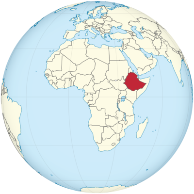
Ethiopia Location in World Map
Location Information of Ethiopia
Ethiopia, located in the Horn of Africa, is a landlocked country that boasts a rich cultural heritage, diverse landscapes, and a unique position in the history of civilization. It is one of the oldest countries in the world, with a history that spans over 3,000 years, and is known for its ancient kingdoms, particularly the Kingdom of Aksum. Ethiopia is bordered by Eritrea to the north, Djibouti and Somalia to the east, Kenya to the south, South Sudan to the west, and Sudan to the northwest.
Latitude and Longitude
Ethiopia is located at approximately 9°N latitude and 40°E longitude, placing it in the northeastern region of the African continent. The country spans a significant part of the Horn of Africa, and its geographical coordinates place it within both tropical and temperate climates, depending on altitude.
- Latitude: Ethiopia stretches from about 3°N in the south to about 15°N in the north. This positioning gives the country a varied climate that ranges from tropical in the lowlands to temperate in the highlands.
- Longitude: The country spans 33°E to 48°E, which covers a vast distance east to west. The central part of Ethiopia, where the capital city of Addis Ababa is located, lies near 38°E longitude.
Capital City and Major Cities
The capital of Ethiopia is Addis Ababa, which means “new flower” in Amharic. The city is the political, economic, and cultural hub of the country. Addis Ababa is not only the seat of the Ethiopian government but also an important center for international diplomacy, hosting the headquarters of the African Union.
- Addis Ababa: Situated at an altitude of 2,355 meters (7,726 feet), Addis Ababa is the largest city in Ethiopia and serves as the focal point for commerce, education, and culture. The city is home to several important institutions, including Addis Ababa University, the National Museum of Ethiopia (which houses the famous fossil “Lucy”), and the Holy Trinity Cathedral. The city also has a vibrant arts scene, with a variety of music, dance, and theater performances reflecting Ethiopia’s cultural diversity.
- Dire Dawa: Located in the eastern part of the country, Dire Dawa is Ethiopia’s second-largest city. It serves as a commercial center for the eastern regions and is strategically positioned as a gateway to the Djibouti port. The city has a diverse population and is known for its historical importance and rapidly growing economy. The architecture of Dire Dawa blends modern and traditional influences, with a vibrant market scene and nearby natural attractions.
- Mekelle: The capital of the Tigray region, Mekelle is situated in the northern part of Ethiopia. The city has a rich history and is known for its role in the ancient Aksumite Empire. It has a mix of modern development and historical sites, including the Tigray Rock-Hewn Churches. The surrounding highlands offer trekking opportunities and beautiful landscapes.
- Gondar: Often referred to as the “Camelot of Africa,” Gondar is located in the northwest highlands of Ethiopia. It is famous for its historical and cultural heritage, particularly the Royal Enclosure (Fasil Ghebbi), a UNESCO World Heritage Site, and its medieval castles, which were the seat of Ethiopian emperors. Gondar is also known for its Debre Berhan Selassie Church, famous for its stunning ceiling paintings.
- Hawassa: Located in the southern part of Ethiopia, Hawassa is the capital of the Southern Nations, Nationalities, and Peoples’ Region. The city is situated on the shores of Lake Hawassa and is known for its scenic beauty, being a popular destination for tourists seeking a more relaxed atmosphere. The city is a growing economic and cultural hub, with many new hotels, cafes, and restaurants catering to both locals and tourists.
- Bahir Dar: Situated on the shores of Lake Tana, the largest lake in Ethiopia, Bahir Dar is the capital of the Amhara Region. The city is known for its pleasant climate, ancient monasteries, and the Blue Nile Falls, which are a major tourist attraction. Bahir Dar also serves as a regional administrative and commercial center.
Time Zone
Ethiopia follows the East Africa Time Zone (EAT), which is UTC +3:00. The country does not observe daylight saving time, and the time remains constant throughout the year.
Ethiopia’s unique timekeeping system is worth noting: Ethiopia uses a 12-hour clock system that differs from the standard international timekeeping system. The day starts at 6:00 AM by the Ethiopian clock, which corresponds to 12:00 AM (midnight) in the international system. The Ethiopian day runs from 6:00 AM to 6:00 PM, with the hours counted in the same format as the 12-hour clock. Thus, 7:00 AM in Ethiopia corresponds to 1:00 AM in the international time system.
Climate
Ethiopia’s climate is influenced by its geography, which varies significantly in altitude and topography. The climate in Ethiopia ranges from tropical in the lowland areas to temperate in the highland regions. The highlands are cooler and have a more moderate climate, while the lowlands experience hotter and more arid conditions.
- Highlands: The central and northern parts of Ethiopia, including Addis Ababa, Mekelle, and Gondar, have a temperate climate with moderate temperatures year-round. In the highlands, the climate is generally cool, with daytime temperatures ranging from 15°C to 25°C (59°F to 77°F), while nighttime temperatures can drop to 5°C to 10°C (41°F to 50°F).
- Lowlands: The eastern, southeastern, and southwestern lowlands of Ethiopia experience hot temperatures year-round. Cities like Dire Dawa and Afder have a more arid, tropical climate with average temperatures ranging from 30°C to 40°C (86°F to 104°F). These areas experience very little rainfall, and drought is a significant concern.
- Rainfall: Ethiopia has two main rainy seasons: the belg (short rains) from March to May and the kiremt (main rainy season) from June to September. The most substantial rainfall occurs during the kiremt season, particularly in the highland areas, while the lowlands generally receive less precipitation.
- Seasons: Ethiopia’s climate is highly seasonal, with dry conditions prevailing between October and May, and wet weather during the June to September period. The country’s altitude influences the local climate, meaning that many regions experience significant variation in temperature depending on elevation.
Economic Status
Ethiopia is one of the fastest-growing economies in Africa, despite facing challenges related to poverty, infrastructure, and political instability. The country has transitioned from a primarily agricultural economy to a more diverse one, with manufacturing, services, and tourism growing sectors.
- Agriculture: Agriculture is the backbone of Ethiopia’s economy, employing around 70% of the population. The country is a major producer of coffee, which is a key export and integral to Ethiopian culture. Other important agricultural exports include teff, maize, wheat, barley, and livestock. Ethiopia is the world’s largest producer of teff, a cereal grain used to make injera, a traditional sourdough flatbread.
- Industry: While Ethiopia’s industrial sector is smaller compared to agriculture, it is expanding rapidly. Textiles and garments, construction, and cement manufacturing are some of the most notable industries in the country. The Industrial Park Development program is attracting significant foreign investment and is expected to boost the manufacturing sector further.
- Services: The services sector has been growing steadily, driven by improvements in telecommunications, banking, and tourism. The expansion of hotels, restaurants, and transportation networks is contributing to a vibrant service economy.
- Tourism: Ethiopia has a rich history and diverse cultural heritage, making tourism an increasingly important part of the economy. Key attractions such as Rock-Hewn Churches of Lalibela, Simien Mountains National Park, and the Omo Valley attract international tourists interested in history, culture, and natural beauty. The country is also gaining recognition for its eco-tourism and adventure travel offerings.
- Challenges: Despite its economic growth, Ethiopia faces significant challenges, including poverty, unemployment, income inequality, and political instability. Climate change and recurrent droughts also threaten food security and the agricultural economy.
Tourist Attractions
Ethiopia offers an array of tourist attractions, from ancient historical sites to natural wonders and cultural experiences.
- Rock-Hewn Churches of Lalibela: Lalibela, located in the northern highlands of Ethiopia, is famous for its 11 medieval rock-hewn churches, which were carved out of solid rock in the 12th and 13th centuries. These churches are a UNESCO World Heritage Site and are an important pilgrimage destination for Ethiopian Orthodox Christians.
- Simien Mountains National Park: This UNESCO World Heritage Site is located in the northern highlands and is known for its stunning landscapes, including dramatic cliffs, deep valleys, and snow-capped peaks. The park is home to unique wildlife such as the Gelada baboon, Ethiopian wolf, and Walia ibex. It is a popular destination for trekking and hiking.
- Omo Valley: The Omo Valley is home to a variety of indigenous tribes, including the Hamar, Mursi, and Surma, who maintain traditional lifestyles. The area is known for its rich cultural diversity, with visitors able to experience unique customs, dances, and rituals.
- Axum: Axum was the capital of the ancient Aksumite Empire, which was one of the great civilizations of the ancient world. The city is home to impressive historical sites, including the Obelisks of Axum, ancient royal tombs, and the ruins of the Palace of the Queen of Sheba.
- Lake Tana: Lake Tana, located in the Amhara Region, is the largest lake in Ethiopia and the source of the Blue Nile River. Visitors can explore the lake’s beautiful islands, many of which house ancient monasteries and churches with stunning artwork.
Visa Requirements for U.S. Citizens
U.S. citizens wishing to travel to Ethiopia for tourism need to apply for a tourist visa unless they are eligible for visa-on-arrival status. The visa process includes the following:
- Tourist Visa: U.S. citizens can apply for a tourist visa through the Ethiopian embassy or consulate or through the E-visa system available on the official Ethiopian government website. The tourist visa typically allows stays of up to 90 days.
- Visa-on-Arrival: U.S. citizens can also obtain a visa on arrival at the Addis Ababa Bole International Airport or other entry points. However, it is recommended to apply for the visa beforehand to avoid potential delays.
- Health and Safety: U.S. citizens should also be aware of vaccination requirements, such as the need for yellow fever vaccination if arriving from an infected country. Additionally, travelers should check for any travel advisories or updates related to health and security.
Distance to New York City and Los Angeles
- Distance to New York City: The distance from Addis Ababa to New York City is approximately 7,300 miles (11,748 kilometers). Flights typically take around 12-14 hours with one or more stopovers.
- Distance to Los Angeles: The distance from Addis Ababa to Los Angeles is around 8,300 miles (13,370 kilometers). Non-stop flights usually take 14-16 hours, depending on the route taken.
Ethiopia Facts
| Size | 1,133,380 km² |
| Residents | 111 million |
| Language | Amharic |
| Capital | Addis Ababa |
| Longest river | Omo (about 1,000 km) |
| Highest mountain | Ras Daschän (4,550 m) |
| Currency | Birr |


