Where is Egypt Located?
Where is Egypt located on the map? Egypt is an independent nation located in Northern Africa. Check out the following images to see location of Egypt on maps.
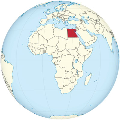
Egypt Location in World Map
On this map you can see that Egypt is almost square.
Location Information of Egypt
Egypt is a country that lies in both North Africa and the Middle East, making it a transcontinental country. Located at the crossroads of Africa and Asia, Egypt is renowned for its historical and cultural significance, particularly in relation to the ancient civilizations that flourished there. The country is bordered by the Mediterranean Sea to the north, the Red Sea to the east, Sudan to the south, and Libya to the west. The Suez Canal, which connects the Mediterranean Sea with the Red Sea, serves as one of the world’s most important waterways, both geographically and economically.
Latitude and Longitude
Egypt is situated between 22°N and 31°N latitude and 25°E to 35°E longitude, positioning it in the northeastern part of Africa, with its northeast boundary touching the Mediterranean Sea. The country extends far from the Nile Delta in the north down to the Sudanese border in the south, and from the Libyan border in the west to the Red Sea in the east.
- Latitude: Egypt lies mainly between 22°N and 31°N, which places it firmly within the subtropical zone, influencing its hot desert climate.
- Longitude: The country’s east-west extent is between 25°E and 35°E, making it a critical point in connecting continents and cultures throughout history.
Capital City and Major Cities
The capital of Egypt is Cairo, a bustling metropolis and the largest city in the Arab world. Cairo is the political, cultural, and economic heart of Egypt. Other significant cities include Alexandria, Giza, Luxor, and Aswan, each with its own importance in Egypt’s history and modern-day economy.
Cairo
Cairo, located on the banks of the Nile River, has a population of over 20 million in the metropolitan area, making it the largest city in Africa and the Arab world. As the capital, Cairo is Egypt’s economic and political center, housing government buildings, embassies, business districts, and cultural institutions.
- Economy: Cairo is a major economic hub in the Middle East and North Africa (MENA) region, with key industries such as manufacturing, tourism, banking, and media. The city’s location along the Nile River makes it an important trade and transportation center.
- Culture and Landmarks: Cairo is home to many historic sites, including the Great Pyramids of Giza, the Sphinx, and the Egyptian Museum, which houses an extensive collection of ancient artifacts, including treasures from Tutankhamun’s tomb.
Alexandria
Located on the Mediterranean coast, Alexandria is Egypt’s second-largest city and one of its most historically significant. Founded by Alexander the Great in 331 BCE, Alexandria has long been a center of culture and learning.
- Economy: Alexandria is a major port city and industrial center. It is crucial to Egypt’s economy as it handles a significant portion of the country’s foreign trade. The city is also home to several universities and research institutions.
- Tourism: Alexandria boasts numerous attractions, such as the Bibliotheca Alexandrina, a modern library and cultural center, and the ancient Fort Qaitbey, which sits at the site of the ancient Pharos Lighthouse, one of the Seven Wonders of the Ancient World.
Giza
Giza, located just outside Cairo, is famous for the Pyramids of Giza, including the Great Pyramid, which is one of the Seven Wonders of the Ancient World. The city has become a major center for Egyptology and tourism.
- Tourism: In addition to the Pyramids, the Great Sphinx and the Solar Boat Museum attract millions of visitors annually, making Giza one of the most visited tourist destinations in Egypt.
- Economy: Tourism in Giza contributes significantly to the local economy, as visitors flock to the area to witness the ancient wonders.
Luxor
Known as the “world’s greatest open-air museum,” Luxor is located in southern Egypt on the banks of the Nile River. It is famous for its temples, tombs, and the Valley of the Kings, where many of Egypt’s pharaohs were buried.
- Tourism: Luxor is a significant destination for tourists interested in ancient Egyptian history. Notable attractions include the Temple of Karnak, Luxor Temple, and the Valley of the Kings, where the tomb of Tutankhamun was discovered.
- Economy: Luxor’s economy is largely driven by tourism, with local businesses catering to visitors exploring Egypt’s ancient monuments.
Aswan
Located further south, Aswan is known for its Nubian culture and is a key location for Egypt’s hydroelectric power generation due to the Aswan High Dam.
- Tourism: Aswan is famous for its beautiful Nile River views, the Philae Temple, and its proximity to the Abu Simbel temples, carved into the mountains by Ramses II.
- Economy: Aswan is a key supplier of materials such as granite, and it is also involved in the production of electricity from the Aswan High Dam.
Time Zone
Egypt operates in the Eastern European Time (EET) zone, which is UTC +2:00. The country does not observe daylight saving time, and the time remains consistent throughout the year.
- Standard Time: Egypt follows UTC +2:00 year-round. This time zone is shared with several other countries in the Eastern Mediterranean and North Africa region, including Jordan, Israel, Greece, and Turkey.
Climate
Egypt has a predominantly desert climate, with very hot summers and mild winters. The climate is influenced by its geographical location and the presence of the Sahara Desert to the west.
- Coastal Areas: The coastal regions, particularly along the Mediterranean, enjoy a more moderate climate, with cooler temperatures compared to the interior. Summers are hot, with temperatures ranging from 30°C to 40°C (86°F to 104°F), and winters are mild, with temperatures ranging from 10°C to 20°C (50°F to 68°F).
- Interior and Desert: The inland areas experience extreme temperature variations, with scorching hot summers and cooler winters. Daytime temperatures in the summer months often exceed 40°C (104°F), while nighttime temperatures can drop sharply.
- Nile Delta and Valley: The Nile Delta, including Cairo and Giza, experiences a relatively humid climate compared to other parts of the country, with higher precipitation levels, especially in the winter months. Rain is generally scarce in the rest of Egypt, with some regions receiving less than 3 cm (1 inch) annually.
- Desert Winds: The Khamsin wind, a hot, dry wind from the Sahara Desert, can cause significant temperature spikes and dust storms, especially in the spring months.
Economic Status
Egypt has one of the largest economies in Africa and the Arab world, characterized by a diversified base that includes agriculture, industry, and services. However, the country faces challenges, such as high unemployment rates, inflation, and a large informal economy.
- Agriculture: Agriculture remains an important sector, contributing to 11% of GDP and providing employment for a large portion of the population. Key crops include cotton, rice, wheat, and corn. The Nile River is vital for irrigation, particularly in the delta region.
- Industry: Egypt’s industrial sector is diverse, with major industries including textiles, chemicals, petroleum, cement, and steel production. The Suez Canal is a significant trade route for the global shipping industry, further enhancing Egypt’s industrial activities.
- Tourism: Tourism plays a critical role in Egypt’s economy. The country’s ancient monuments, beaches along the Red Sea, and vibrant culture attract millions of visitors every year, contributing significantly to the country’s foreign exchange earnings.
- Oil and Gas: Egypt has substantial natural gas and petroleum reserves. The Suez Canal provides an essential route for global oil transportation, and the Zhor gas field is one of the largest offshore natural gas fields in the world.
- Challenges: Despite its resources, Egypt faces economic challenges, such as high poverty rates, unemployment, inflation, and political instability. The country has received aid from international organizations, such as the IMF, to help stabilize its economy.
Tourist Attractions
Egypt is home to some of the most iconic historical and natural landmarks in the world. The country’s rich history, from the ancient Pharaonic era to Islamic and modern Egypt, makes it a major tourist destination.
Ancient Egyptian Monuments
- The Great Pyramids of Giza: One of the Seven Wonders of the Ancient World, the Great Pyramid of Giza and the Sphinx attract millions of visitors every year. These monuments are among the most recognized and enduring symbols of Egypt’s ancient civilization.
- Luxor: Known for its temples and tombs, Luxor is often referred to as the world’s greatest open-air museum. The Temple of Karnak, Luxor Temple, and the Valley of the Kings are must-see destinations for history enthusiasts.
- Abu Simbel: The Abu Simbel temples, carved into the mountains by Ramses II, are among Egypt’s most impressive archaeological sites. They are located near the Sudanese border, in southern Egypt.
Mediterranean and Red Sea Resorts
- Sharm El-Sheikh: Located on the Sinai Peninsula, Sharm El-Sheikh is known for its beautiful beaches, crystal-clear waters, and excellent diving and snorkeling opportunities. The Red Sea coral reefs attract divers from all over the world.
- Hurghada: Another famous beach resort on the Red Sea, Hurghada offers opportunities for water sports, coral reef exploration, and relaxation.
Visa Requirements for U.S. Citizens
U.S. citizens need a tourist visa to enter Egypt, which can be obtained through an Egyptian consulate or on arrival at Egyptian airports.
- Tourist Visa: U.S. citizens can obtain a 30-day tourist visa either upon arrival or through the Egyptian consulate before traveling. The visa requires a valid passport, a completed application form, and payment of the visa fee.
- Business and Other Visas: U.S. business travelers and individuals planning to stay for longer periods or purposes such as study or residency must apply for the appropriate visa type.
Distance to New York City and Los Angeles
- Distance to New York City: The distance from Cairo to New York City is approximately 5,600 miles (9,000 kilometers). Direct flights typically take about 10-12 hours.
- Distance to Los Angeles: The distance from Cairo to Los Angeles is about 7,500 miles (12,000 kilometers). A direct flight generally takes about 13-14 hours, though most flights involve layovers.
Egypt Facts
| Size | 1,001,449 km² |
| Residents | 100.4 million |
| Language | Arabic |
| Capital | Cairo |
| Longest river | Nile (total length 6,852 km) |
| Highest mountain | Jebel Katrina (Katharinenberg, 2,637 m) |
| Currency | Egyptian pound |


