Where is Czech Republic Located?
Where is Czech Republic located on the map? Czech Republic is an independent nation located in Eastern Europe. Check out the following images to see location of Czech Republic on maps.
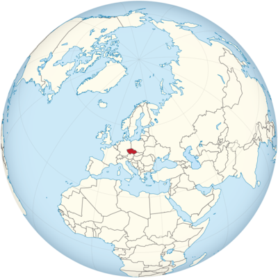
Czech Republic Location in World Map
The Czech Republic is located in Central Europe.
Location Information of the Czech Republic
The Czech Republic, also known as Czechia, is a landlocked country situated in Central Europe. It is bordered by Germany to the west, Austria to the south, Slovakia to the east, and Poland to the north. With a rich cultural heritage, vibrant cities, and stunning natural landscapes, Czechia has become a popular destination for both tourists and businesses alike.
Latitude and Longitude
The Czech Republic is located at approximately Latitude: 49.8176° N and Longitude: 15.4730° E. The country’s central location in Europe gives it access to several neighboring countries, contributing to its role as a cultural and historical crossroads in Europe.
Capital City and Major Cities
Capital City: Prague
Prague is the capital and largest city of the Czech Republic, with a population of over 1.3 million people. It is a key political, economic, and cultural center of the country. Known for its well-preserved medieval architecture, vibrant arts scene, and rich history, Prague is one of Europe’s most beautiful cities.
- Location: Central Bohemia region
- Population: Approximately 1.3 million (2023)
- Key Features: Some of Prague’s most iconic landmarks include Prague Castle, Charles Bridge, Old Town Square, and the Astronomical Clock. The city is also renowned for its theaters, museums, galleries, and music festivals, drawing millions of visitors each year.
Major Cities
- Brno
- Location: Southeastern Czech Republic, in the Moravia region
- Population: Approximately 380,000
- Key Features: Brno is the Czech Republic’s second-largest city and a major hub for education, research, and technology. It is home to the University of Brno and many scientific institutions. Brno also offers attractions like Špilberk Castle, the Cathedral of St. Peter and Paul, and the modernist Villa Tugendhat (a UNESCO World Heritage site).
- Ostrava
- Location: Northeastern Czech Republic, near the Polish border
- Population: Approximately 300,000
- Key Features: Historically an industrial center, Ostrava has undergone significant transformation and is now known for its cultural activities, including the Ostrava Music Festival and numerous theaters. The city is also famous for its industrial heritage, particularly the Lower Vítkovice area, where steel production once dominated.
- Plzeň (Pilsen)
- Location: Western Czech Republic, near the German border
- Population: Approximately 175,000
- Key Features: Pilsen is globally famous for being the birthplace of Pilsner lager. The city boasts a rich brewing tradition, with the Pilsner Urquell Brewery being one of its most important landmarks. Other notable sites include St. Bartholomew’s Cathedral and the Great Synagogue.
- Liberec
- Location: Northern Czech Republic, near the Polish and German borders
- Population: Approximately 100,000
- Key Features: Liberec is known for its ski resorts, particularly in the Jizera Mountains, as well as the historic Liberec Town Hall and the stunning Liberec Botanical Garden.
Time Zone
The Czech Republic operates on Central European Time (CET) during standard time and Central European Summer Time (CEST) during daylight saving time.
- Standard Time: UTC +1
- Daylight Saving Time: UTC +2 (from the last Sunday in March to the last Sunday in October)
This time zone is shared by several neighboring countries in Central Europe, making travel and business between the Czech Republic and its neighbors relatively synchronized.
Climate
Czechia experiences a continental climate characterized by four distinct seasons: cold winters, mild springs, warm summers, and cool autumns. The climate varies depending on the region, with areas in the Bohemian Basin being more temperate and the mountainous regions in the north and east experiencing cooler temperatures.
Seasons:
- Winter: Winter temperatures in the Czech Republic can be cold, especially in the northern and mountainous areas, with temperatures often dropping below freezing (around -5°C to -10°C, or 23°F to 14°F). Snowfall is common in winter, especially in higher altitudes.
- Spring: Spring is mild, with temperatures ranging from 5°C to 15°C (41°F to 59°F). It is a time when the countryside and parks bloom, and outdoor activities become more popular.
- Summer: Summer is generally warm, with temperatures averaging 20°C to 25°C (68°F to 77°F), although occasional heatwaves can push temperatures above 30°C (86°F). Summer is also the wettest season, with occasional thunderstorms.
- Autumn: Autumn temperatures range from 10°C to 18°C (50°F to 64°F), and the season is known for its vibrant foliage, particularly in forests and rural areas.
Economic Status
The Czech Republic has a highly developed and export-oriented economy, with a strong industrial base, a growing services sector, and a well-established tourism industry. It is one of the wealthiest countries in Central Europe, with a high standard of living and a robust labor market.
Key Economic Sectors:
- Manufacturing and Industry: The Czech Republic has a strong manufacturing sector, particularly in machinery, automobiles, and consumer electronics. The country is known for its automobile production, with major companies like Škoda Auto, a subsidiary of the Volkswagen Group, having significant manufacturing operations in the country.
- Services: The services sector has grown significantly over the past two decades, particularly in finance, IT, and business services. Prague is a major hub for business and finance, attracting foreign investment.
- Agriculture: Although less significant than other sectors, agriculture plays a role in the Czech economy. The country produces various crops, such as barley, wheat, and corn, and is known for its beer production. Czech beers are highly regarded internationally.
- Tourism: Czechia is one of Europe’s top tourist destinations, attracting millions of visitors annually. The country’s historical sites, architecture, and natural beauty make it a popular destination for cultural, nature, and adventure tourism.
Economic Challenges and Growth:
The Czech economy has grown steadily over the past two decades, but it faces challenges such as a declining population due to low birth rates and an aging demographic. Despite these challenges, the country remains an attractive location for investment due to its skilled labor force, robust infrastructure, and relatively low cost of doing business compared to Western Europe.
Tourist Attractions
The Czech Republic offers a wealth of attractions for visitors, ranging from medieval castles and charming villages to vibrant cities and picturesque landscapes.
1. Prague
- Prague Castle: The largest ancient castle in the world, it is a UNESCO World Heritage site and a symbol of Czech history.
- Charles Bridge: This iconic 14th-century stone bridge connects Prague Castle with the Old Town and offers stunning views of the Vltava River.
- Old Town Square: The heart of Prague’s historic center, surrounded by colorful buildings, shops, and cafés. The Astronomical Clock on the Old Town Hall is one of the city’s most famous landmarks.
2. Český Krumlov
- Located in southern Bohemia, Český Krumlov is a beautifully preserved medieval town known for its charming narrow streets, colorful buildings, and Český Krumlov Castle, which overlooks the town.
3. Karlovy Vary (Carlsbad)
- Famous for its healing thermal springs, Karlovy Vary is one of Europe’s oldest and most luxurious spa towns. The city also hosts the renowned Karlovy Vary International Film Festival.
4. Kutná Hora
- A UNESCO World Heritage site, Kutná Hora is home to the Sedlec Ossuary (Bone Church), which features decorative arrangements made from human bones. The town also boasts the stunning St. Barbara’s Church and the Italian Court, which was once the royal mint.
5. Natural Wonders
- Bohemian Switzerland National Park: This national park in the Czech-German border region is known for its stunning sandstone formations, gorges, and unique rock formations like the Pravčická brána (Pravčice Gate).
- Šumava National Park: A large, forested area in the southwest, perfect for hiking, cycling, and cross-country skiing in the winter months.
Visa Requirements for U.S. Citizens
U.S. citizens can visit the Czech Republic without a visa for short stays of up to 90 days within a 180-day period for tourism, business, or family visits. The following requirements apply:
- Passport Validity: U.S. citizens must have a passport that is valid for at least three months beyond the intended date of departure from the Czech Republic and the Schengen Area.
- Travel Insurance: While travel insurance is not mandatory for U.S. tourists, it is highly recommended to cover potential medical emergencies or unexpected travel disruptions.
- Work and Study Visas: If U.S. citizens intend to work or study in the Czech Republic, they must apply for the appropriate long-term visa or residence permit. These are typically processed through the Czech consulate or embassy.
It is important to note that the Czech Republic is part of the Schengen Area, meaning that travelers from the U.S. will need to follow Schengen visa rules if their stay exceeds the 90-day limit or if they plan to visit other Schengen Area countries.
Distance to Major U.S. Cities
The Czech Republic is located in Central Europe, which is a considerable distance from the United States. Major cities like Prague are well-connected by international flights, but the journey typically requires a layover in major European hubs.
- Distance to New York City: The flight distance from New York City to Prague is approximately 4,350 miles (7,000 kilometers). A non-stop flight typically takes around 8 to 9 hours.
- Distance to Los Angeles: The flight distance from Los Angeles to Prague is about 5,800 miles (9,300 kilometers), with a flight time of 11 to 12 hours for a non-stop flight.
Czech Republic Facts
| Size | 78,866 km² |
| Residents | 10.63 million |
| Language | Czech |
| Capital | Prague |
| Longest river | Moldova (430 km) |
| Highest mountain | Schneekoppe (1,603 m) |
| Currency | Czech crown |


