Where is Cyprus Located?
Where is Cyprus located on the map? Cyprus is an independent nation located in Western Asia. Check out the following images to see location of Cyprus on maps.
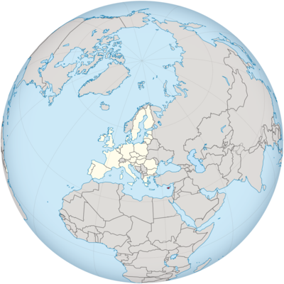
Cyprus Location in World Map
Location Information of Cyprus
Cyprus is an island nation located in the Eastern Mediterranean, positioned strategically at the crossroads of Europe, Asia, and Africa. The country’s location plays a significant role in its history, culture, and geopolitical importance.
Latitude and Longitude
Cyprus lies approximately between Latitude: 35.0° N and Longitude: 33.0° E. It is the third-largest island in the Mediterranean Sea, after Sicily and Sardinia.
Capital City and Major Cities
Capital City: Nicosia
Nicosia is the capital and largest city of Cyprus. It serves as the administrative, financial, and cultural center of the island. Uniquely, Nicosia is the last divided capital in Europe, with the northern part of the city under Turkish Cypriot control and the southern part under Greek Cypriot administration.
- Location: Central Cyprus
- Population: Approximately 330,000 (2023)
- Key Features: Nicosia hosts the headquarters of the European Union’s Cyprus delegation, ancient archaeological sites, and a mix of modern and traditional Cypriot architecture. The city also houses the buffer zone, which separates the Greek and Turkish parts of the island.
Major Cities
- Limassol
- Location: Southern coast of Cyprus
- Population: Approximately 240,000
- Key Features: Limassol is a major port city, vital to the island’s economy. Known for its modern infrastructure, Mediterranean beaches, and vibrant nightlife, Limassol is a hub for international business and tourism.
- Larnaca
- Location: Southeastern coast
- Population: Approximately 85,000
- Key Features: Larnaca is famous for its picturesque beaches, the Larnaca Salt Lake, and the Hala Sultan Tekke mosque. It is also home to the country’s primary international airport, Larnaca International Airport.
- Paphos
- Location: Southwestern coast
- Population: Approximately 35,000
- Key Features: Paphos is a UNESCO World Heritage site, known for its historical and archaeological significance, such as the Tombs of the Kings and the Paphos Archaeological Park.
- Famagusta (Varosha)
- Location: Eastern coast (under Turkish control)
- Population: Historically around 40,000 (currently in a controlled area)
- Key Features: Famagusta is known for its ancient ruins, but the modern city, Varosha, was abandoned during the 1974 Turkish invasion. It remains a symbol of the conflict and division on the island.
Time Zone
Cyprus follows the Eastern European Time (EET) during standard time and Eastern European Summer Time (EEST) during daylight saving time.
- Standard Time: UTC +2
- Daylight Saving Time: UTC +3 (from the last Sunday in March to the last Sunday in October)
Climate
Cyprus enjoys a Mediterranean climate with hot, dry summers and mild, wet winters. The climate varies slightly depending on the region, with coastal areas being hotter and more humid than the inland and mountainous regions.
Coastal Regions:
- Summer: Hot and dry with temperatures ranging from 25°C to 35°C (77°F to 95°F).
- Winter: Mild with temperatures between 10°C and 18°C (50°F to 64°F).
Inland and Mountainous Regions:
- Summer: Temperatures can soar above 40°C (104°F) in some areas, especially in the interior.
- Winter: Colder and snow may fall in higher altitudes like the Troodos Mountains.
Cyprus has an average of 300 days of sunshine per year, making it a desirable destination for beach tourism and outdoor activities.
Economic Status
Cyprus has a relatively high-income economy, with services playing a dominant role. Tourism, financial services, shipping, and real estate are key sectors driving the country’s economic activities.
Key Economic Sectors:
- Tourism: Cyprus is one of the most popular tourist destinations in the Mediterranean, known for its historical sites, beaches, and cultural heritage.
- Financial Services: The island has a well-developed banking sector and is considered a financial hub for businesses, particularly in Eastern Europe and the Middle East.
- Shipping and Maritime Industry: Cyprus has one of the largest merchant fleets in the world, driven by its strategic location and favorable shipping policies.
- Agriculture: While less significant than services and industry, agriculture still plays a role, especially in the production of citrus fruits, olives, and wine.
Recent Developments:
Cyprus joined the European Union in 2004 and the Eurozone in 2008, which has significantly boosted its economic integration into European markets. However, the economic crisis in 2012-2013 and the subsequent bailout program by the European Central Bank and the International Monetary Fund led to a period of economic challenges. Nevertheless, Cyprus has managed a recovery and remains a prosperous nation within the EU.
Tourist Attractions
Cyprus is a vibrant tourist destination with a mix of cultural, historical, and natural attractions. Whether it’s the ancient ruins, the beautiful beaches, or the charming villages, Cyprus offers something for every traveler.
1. Ancient Ruins and Archaeological Sites
- Kourion: An ancient city-kingdom near Limassol, featuring spectacular ruins such as a Greco-Roman theater and beautiful mosaics.
- Paphos Archaeological Park: A UNESCO World Heritage Site, this area contains the ancient ruins of the Greek and Roman periods, including the House of Dionysos, famous for its intricate mosaics.
- Choirokoitia: A prehistoric settlement site dating back to the Neolithic period, providing insight into the island’s early history.
2. Beaches
- Nissi Beach (Ayia Napa): Known for its crystal-clear waters and golden sands, Nissi Beach is a popular summer destination.
- Fig Tree Bay (Protaras): A family-friendly beach with shallow waters and a relaxing atmosphere.
- Coral Bay (Paphos): A beautiful crescent-shaped beach, offering both tranquility and water sports activities.
3. Historical Landmarks
- Kyrenia Castle: Situated in the northern part of the island, this medieval castle overlooks the harbor of Kyrenia.
- Hala Sultan Tekke Mosque (Larnaca): One of the holiest sites for Muslims, it is located near the Larnaca Salt Lake.
4. Nature and Hiking
- Troodos Mountains: Offering hiking trails, scenic villages, and Byzantine-era monasteries, this mountainous region is perfect for nature lovers.
- Akamas Peninsula: A nature reserve known for its diverse flora and fauna, as well as the Baths of Aphrodite.
5. Cultural Events
- Cyprus hosts numerous festivals throughout the year, including the Limassol Wine Festival, Paphos Aphrodite Festival, and Cyprus International Film Festival, celebrating the island’s rich cultural and artistic heritage.
Visa Requirements for U.S. Citizens
As Cyprus is a member of the European Union, U.S. citizens visiting for tourism purposes do not require a visa for stays of up to 90 days within a 180-day period. However, there are a few important points to consider:
- Passport Validity: U.S. citizens must have a passport valid for at least three months beyond their intended date of departure from Cyprus.
- Entry via Northern Cyprus: While Cyprus is internationally recognized as a single country, the northern part of the island is controlled by Turkey and is not recognized by the EU. Travelers should be cautious when crossing between the two parts, as different entry and exit regulations may apply.
- Work and Study Visas: For longer stays or if U.S. citizens wish to work or study in Cyprus, they will need to apply for the appropriate visa or residence permit.
Distance to Major U.S. Cities
Cyprus is located quite far from the United States, and travel between the two typically involves a layover in a major European city.
- Distance to New York City: The flight distance from New York City to Cyprus is approximately 5,600 miles (9,000 kilometers). A non-stop flight typically takes about 10 to 12 hours.
- Distance to Los Angeles: The flight distance from Los Angeles to Cyprus is around 7,200 miles (11,600 kilometers). Non-stop flights are less common, and the journey usually takes 14 to 16 hours with layovers.
Cyprus Facts
| Size | Republic of Cyprus 5,896 km², total Cyprus 9,251 km² |
| Residents | Republic of Cyprus 848,000, total Cyprus 1.19 million |
| Languages | Greek and Turkish |
| Capital | Nicosia |
| Longest river | Pedias (about 100 km) |
| Highest mountain | Olympos (1,952 m) |
| Currency | Euro |


