Where is Costa Rica Located?
Where is Costa Rica located on the map? Costa Rica is an independent nation located in North America. Check out the following images to see location of Costa Rica on maps.
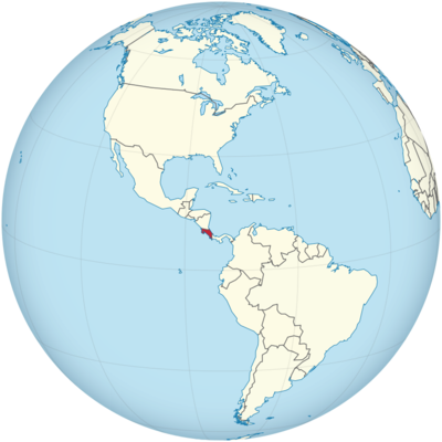
Costa Rica Location in World Map
Costa Rica is in Central America.
Location Information of Costa Rica
Costa Rica is a Central American country bordered by Nicaragua to the north, Panama to the south, the Caribbean Sea to the east, and the Pacific Ocean to the west. It is known for its stunning biodiversity, eco-friendly tourism, and stable political environment. The country has become a prime destination for those seeking both adventure and relaxation, offering everything from tropical rainforests and volcanoes to pristine beaches. Its position at the crossroads of North and South America makes it a key ecological hotspot and a convenient travel hub for those exploring the Americas.
Latitude and Longitude
Costa Rica is situated between approximately 8.0° N latitude and 83.5° W longitude. It lies within the tropical zone, making it an ideal location for tropical forests, diverse wildlife, and agricultural production. The country stretches from the Caribbean Sea on its eastern side to the Pacific Ocean on the west, giving it extensive coastlines and a variety of ecosystems within relatively short distances.
Capital City and Major Cities
Capital City: San José
The capital and largest city of Costa Rica is San José, located in the Central Valley region of the country. With a population of approximately 1.5 million in the metropolitan area, San José is the political, economic, and cultural center of Costa Rica. Situated at an elevation of about 1,170 meters (3,840 feet) above sea level, the city enjoys a temperate climate despite its location near the equator. San José serves as the hub for Costa Rica’s government, commerce, industry, and tourism.
San José features a blend of colonial architecture and modern structures, including the National Theater of Costa Rica, which is a historical landmark, and the National Museum, which highlights the country’s indigenous cultures and history. The city is also known for its shopping, gastronomy, and nightlife. While not directly on the coast, it is strategically located near major transportation routes, making it a common base for tourists visiting nearby destinations like Arenal Volcano and Manuel Antonio National Park.
Major Cities
- Alajuela Located about 20 kilometers (12 miles) northwest of San José, Alajuela is the second-largest city in Costa Rica, with a population of approximately 250,000 people. Alajuela is known for its proximity to the Juan Santamaría International Airport, Costa Rica’s primary international gateway, and serves as a major commercial and industrial hub. The city is also famous for its historical significance, including the Central Park and the Cathedral of Alajuela.
- Cartago Cartago is one of the oldest cities in Costa Rica, having been founded in 1563. It is located about 22 kilometers (14 miles) east of San José and was once the capital of Costa Rica. Today, Cartago is a smaller city with a population of around 150,000 but is an important religious and cultural center. It is home to the famous Basilica de Nuestra Señora de los Ángeles, a pilgrimage site for many Costa Ricans.
- Liberia Liberia, located in the northwestern part of the country in the Guanacaste province, is a growing city known for its proximity to Guanacaste’s beaches and national parks. The city has a population of around 50,000 and serves as a gateway for tourists traveling to the Pacific beaches, including those around Tamarindo and Playa del Coco. Liberia is also known for its colonial-style architecture and the Museum of Guanacaste, which highlights the region’s history.
- Puntarenas Puntarenas is a port city located on the Pacific coast of Costa Rica. It is an important center for tourism, especially for those visiting the nearby Gulf of Nicoya and the Isla Tortuga. The city has a population of around 100,000 people and serves as a key destination for cruise ships and international visitors exploring Costa Rica’s coastlines.
- Quepos A small but significant town, Quepos is located on the Pacific coast, near the Manuel Antonio National Park. With a population of around 20,000, Quepos is famous for its role as a gateway to the park and its stunning beaches. The area has developed into a major tourism destination, particularly for eco-tourists and wildlife enthusiasts, thanks to its proximity to the diverse flora and fauna of Manuel Antonio.
Time Zone
Costa Rica operates on Central Standard Time (CST), which is UTC -6 hours. Unlike many other countries, Costa Rica does not observe Daylight Saving Time (DST), so its time zone remains the same throughout the year. This makes scheduling and communication easier for travelers who are in countries that observe DST, as Costa Rica’s time zone does not change seasonally.
Climate
Costa Rica’s climate is diverse, influenced by its geographic variation, proximity to both the Pacific and the Caribbean, and its elevation. The country enjoys a generally tropical climate, but the type of climate can vary dramatically across regions due to differences in altitude, proximity to coastlines, and other factors.
Tropical Climate (Lowlands)
In the coastal and lowland areas, the climate is predominantly tropical. These regions, including cities like Liberia, Quepos, and the Caribbean coast, are characterized by hot and humid conditions year-round. The average temperature in these areas is around 27°C to 30°C (81°F to 86°F). The rainy season in the lowlands typically runs from May to October, while the dry season lasts from November to April.
Temperate Climate (Central Valley)
In the Central Valley, where cities like San José, Alajuela, and Cartago are located, the climate is more temperate due to the higher elevation. The average temperature in this region ranges from 18°C to 25°C (64°F to 77°F), making it more comfortable and cooler than the coastal regions. The Central Valley experiences a pronounced wet season from May to October, with the dry season running from November to April.
Rainforest and Cloud Forests (Highlands)
Costa Rica’s highland regions, especially areas around the Monteverde Cloud Forest and Arenal Volcano, experience cooler temperatures and are known for their lush rainforests and cloud forests. The Monteverde region, located at an elevation of around 1,440 meters (4,700 feet), experiences cool weather year-round, with temperatures averaging 15°C to 22°C (59°F to 72°F). These areas also receive significant rainfall, particularly during the green season from May to October.
Dry Climate (Northwestern Region)
The northwestern region, particularly the Guanacaste province, has a more arid and dry climate compared to other parts of the country. The area experiences long dry seasons, from November to April, and higher temperatures, with averages ranging from 28°C to 35°C (82°F to 95°F). The rainy season in this area is shorter, and rainfall is generally less frequent compared to the rest of the country.
Economic Status
Costa Rica is classified as an upper-middle-income country and is known for its stable economy, strong governance, and progressive policies. The country has made significant strides in improving its human development indicators, such as healthcare, education, and life expectancy. Costa Rica’s economy is diversified, with major sectors including agriculture, tourism, manufacturing, and services. The country is also known for its eco-tourism and commitment to environmental sustainability.
Key Industries
- Agriculture Agriculture has historically been the backbone of the Costa Rican economy. The country is a major exporter of bananas, pineapples, coffee, and cocoa. Costa Rican coffee, in particular, is renowned worldwide for its quality, and the country ranks among the top producers of coffee in the world. In addition to these primary exports, Costa Rica also produces sugar, palm oil, and vegetables for domestic consumption and international trade.
- Tourism Tourism is one of the most important economic drivers in Costa Rica, contributing significantly to the country’s GDP. Costa Rica’s eco-tourism sector is particularly popular, attracting visitors for its national parks, biodiversity, and adventure activities such as zip-lining, rafting, hiking, and surfing. The country’s commitment to environmental preservation and sustainable tourism practices has helped it maintain its status as a leading eco-tourism destination.
- Manufacturing Costa Rica has a growing manufacturing sector, which includes industries like electronics, medical devices, and pharmaceuticals. Costa Rica has become a major hub for foreign direct investment (FDI), particularly in the field of high-tech industries. Companies like Intel, Medtronic, and Boston Scientific have established large manufacturing plants in the country, particularly in the Free Trade Zones.
- Services and Finance The services and financial sectors have expanded rapidly, particularly in information technology (IT), business process outsourcing (BPO), and call centers. Costa Rica has become a popular destination for global outsourcing, thanks to its skilled workforce, political stability, and favorable business climate. The country’s banking system is also well-developed, with Costa Rica maintaining a stable and secure financial infrastructure.
- Renewable Energy Costa Rica is a global leader in renewable energy, with approximately 98% of its electricity generated from renewable sources such as hydroelectric, wind, solar, and geothermal power. This focus on sustainability has contributed to Costa Rica’s reputation as an environmentally conscious nation.
Tourist Attractions
Costa Rica is renowned for its stunning natural beauty, attracting millions of visitors annually. The country’s diverse landscapes offer a wide range of attractions, from tropical rainforests and cloud forests to volcanic mountains and pristine beaches.
- Arenal Volcano and National Park The Arenal Volcano is one of Costa Rica’s most famous landmarks, located in the Northern Plains. Arenal National Park offers hiking opportunities, hot springs, and views of the volcano’s dramatic landscape. It is a popular destination for those interested in volcano tours, wildlife viewing, and adventure sports.
- Manuel Antonio National Park This Pacific coastal park is one of the most visited national parks in Costa Rica, known for its beautiful beaches, hiking trails, and abundant wildlife, including sloths, monkeys, and toucans. The park offers a unique combination of tropical rainforest and beachfront scenery.
- Monteverde Cloud Forest The Monteverde Cloud Forest is a world-renowned ecological preserve located in the Central Highlands. It is home to a wide range of plant and animal species, including the resplendent quetzal. Visitors can explore the canopy walkways, go birdwatching, or enjoy the diverse flora and fauna.
- Corcovado National Park Located on the Osa Peninsula, Corcovado National Park is one of the most biodiverse regions in the world. The park is home to rare species such as the scarlet macaw, jaguar, and tapir, and is a popular destination for eco-tourists and wildlife enthusiasts.
- Tortuguero National Park Situated on the Caribbean coast, Tortuguero is famous for its nesting sea turtles. The park is accessible by boat and offers visitors a chance to explore its canals, observe wildlife, and witness turtle nesting during the season.
Visa Requirements for U.S. Citizens
U.S. citizens traveling to Costa Rica for tourism do not require a visa for stays of 90 days or less. However, travelers must present a valid U.S. passport (with at least six months of validity remaining) and may be asked to show proof of return or onward travel and sufficient funds for their stay.
Distance to Major U.S. Cities
- Distance to New York City The distance from New York City (JFK) to San José, Costa Rica is approximately 2,100 miles (3,380 kilometers). Flights typically take around 4.5 to 5 hours.
- Distance to Los Angeles The distance from Los Angeles (LAX) to San José is approximately 3,000 miles (4,800 kilometers). The flight time is generally 5 to 6 hours, depending on the route.
Costa Rica Facts
| Size | 51,100 km² |
| Residents | 4.99 million |
| Language | Spanish (official language) |
| Capital | San Jose |
| Longest river | Río Térraba (160 km) |
| Highest mountain | Cerro Chirripó (3,820 m) |
| Currency | Colón |


