Where is Colombia Located?
Where is Colombia located on the map? Colombia is an independent nation located in South America. Check out the following images to see location of Colombia on maps.
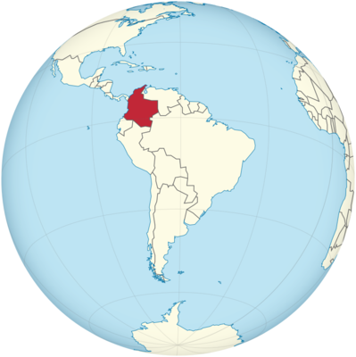
Colombia Location in World Map
Colombia is located in the northwest of South America.
Location Information of Colombia
Colombia is a country located in the northwestern region of South America. Known for its rich biodiversity, cultural diversity, and vibrant cities, Colombia is bordered by Venezuela to the east, Brazil to the southeast, Peru to the south, Ecuador and Panama to the northwest, and the Caribbean Sea to the north. The country also has coastlines on both the Pacific Ocean and the Caribbean Sea, contributing to its ecological variety and making it a major player in Latin America’s maritime economy.
Latitude and Longitude
Colombia is positioned at approximately 4.5° N latitude and 74° W longitude. This geographic location places Colombia within the tropical zone of the globe, contributing to its warm climate and lush natural environments. The country spans a vast area, with its territory stretching from the Caribbean Sea in the north to the Andes Mountains in the west and the Amazon rainforest in the south. Its location, just north of the equator, also means that Colombia experiences diverse climates depending on the elevation, ranging from tropical to temperate conditions.
Capital City and Major Cities
Capital City: Bogotá
The capital of Colombia is Bogotá, located in the Andean region of the country at an altitude of about 2,640 meters (8,660 feet) above sea level. With a population of over 7 million people, Bogotá is the largest city in Colombia and serves as the political, economic, and cultural center of the country. The city is a major hub for finance, industry, and government, and it boasts a variety of cultural institutions, including museums, theaters, and universities.
Bogotá is situated on the Altiplano Cundiboyacense, a high plateau in the Andes, and has a relatively cool climate due to its elevation. The city is also known for its historic center, La Candelaria, which features colonial-era buildings, cobblestone streets, and cultural landmarks such as the Gold Museum and the Botero Museum.
Major Cities
- Medellín Medellín is the second-largest city in Colombia, with a population of around 2.5 million people. Located in the Aburrá Valley in the Andes Mountains, Medellín is known as the “City of Eternal Spring” due to its temperate climate. Historically, Medellín was a major industrial center, and today it is a thriving metropolis with a strong technology sector. The city is also known for its transformation in recent decades, becoming a symbol of innovation and urban development. Medellín is famous for its annual Flower Festival, Parque Arví, and the Pueblito Paisa, a replica of a traditional Antioquian town.
- Cali Cali, located in the Valle del Cauca Department, is known as the salsa capital of Colombia due to its vibrant salsa music and dance scene. With a population of approximately 2.5 million people, Cali is the third-largest city in the country. The city’s economic base is diverse, with industries such as sugar production, textiles, and electronics contributing to its development. Cali is also known for its zoological parks, including the Zoológico de Cali, and the Santiago de Cali Fair, which is one of the largest in the region.
- Barranquilla Barranquilla is a port city on the Caribbean coast and is the fourth-largest city in Colombia, with a population of about 1.2 million people. It is an important center for commerce, industry, and culture in Colombia. Barranquilla is best known for hosting the Carnaval de Barranquilla, one of the largest and most vibrant carnivals in Latin America, attracting tourists from around the world. The city is also a key player in Colombia’s oil, petrochemicals, and shipping industries.
- Cartagena Cartagena, located on the Caribbean coast, is a historical and tourist hub known for its colonial architecture and beautiful beaches. The city is a UNESCO World Heritage site, with its walled city and historic buildings attracting millions of visitors each year. Cartagena’s economy is heavily influenced by tourism, oil exports, and manufacturing.
- Bucaramanga Bucaramanga, located in the northeastern part of Colombia, has a population of around 600,000 people. Known as the “City of Parks”, Bucaramanga is famous for its green spaces, such as Parque del Chicamocha and Parque Principal, making it one of the most pleasant cities in the country to visit and live in. It is an important center for commerce, and the surrounding region is a hub for mining and agriculture, particularly for the production of coffee and cocoa.
Time Zone
Colombia operates on Colombia Time (COT), which is UTC -5 hours. This time zone is the same year-round, as the country does not observe Daylight Saving Time. This means that Colombia’s time is consistent throughout the year, which is an advantage for international business and tourism, providing a stable time reference for scheduling and coordination with other parts of the world, particularly in North America.
Climate
Colombia’s climate is highly diverse, largely due to its geographic variation and elevation. The country is located near the equator, so the lower elevations tend to have tropical climates, while the higher altitudes enjoy temperate weather. Colombia can be divided into several climate zones:
Tropical Climate (Lowlands)
In the lowland regions, particularly near the Caribbean coast, the Pacific coast, and the Amazon rainforest, the climate is hot and humid, with average temperatures ranging between 24°C to 30°C (75°F to 86°F). These regions receive substantial rainfall, particularly in the rainy season, which lasts from April to November. Barranquilla and Cartagena, located on the Caribbean coast, are examples of cities with tropical climates.
Temperate Climate (Midlands)
At elevations between 1,000 and 2,000 meters (3,280 to 6,560 feet), cities such as Medellín and Cali experience a mild and temperate climate, with temperatures averaging around 20°C to 24°C (68°F to 75°F). The climate is often referred to as “eternal spring” due to its pleasant year-round weather, with moderate rainfall and cool evenings.
Cold Climate (Highlands)
The highland regions, particularly in the Andes mountains where cities like Bogotá are located, experience a cold climate due to the altitude. Bogotá, for instance, has an average temperature of around 14°C (57°F), with cooler temperatures at night. The climate varies by altitude, with some areas experiencing temperatures as low as 0°C (32°F) in the highest regions.
Rainfall
Rainfall in Colombia is varied, with the rainy season occurring from April to November in most parts of the country, while the dry season is typically from December to March. The Amazon Basin receives the most rainfall, often exceeding 3,000 mm (118 inches) annually, while the Caribbean coast experiences heavy showers during the wet season. The Andes Mountains also contribute to rainfall patterns, with the windward side receiving more precipitation.
Economic Status
Colombia has a diversified economy, with significant sectors in agriculture, oil and mining, manufacturing, and services. Despite facing challenges related to inequality, poverty, and internal conflict, the country has made remarkable progress in recent years, particularly in terms of economic growth, infrastructure development, and international trade.
Key Industries
- Oil and Mining Oil is one of the most important contributors to Colombia’s economy. The country is a major exporter of crude oil, and it has significant reserves of coal, gold, nickel, and emeralds. Mining and oil extraction are central to Colombia’s economy, and the sector attracts substantial foreign investment.
- Agriculture Colombia is one of the world’s leading producers of coffee, which is the country’s main agricultural export. Other important agricultural products include flowers (particularly roses and carnations), bananas, sugar, and cocoa. The country is also a significant exporter of tropical fruits like pineapples, avocados, and mangoes.
- Manufacturing Colombia has a strong manufacturing sector, producing goods such as textiles, chemicals, electronics, and food products. The country has worked to strengthen its manufacturing base and has attracted investment in areas such as automotive manufacturing and pharmaceuticals.
- Tourism Tourism is an increasingly important sector for Colombia, with growing numbers of international visitors traveling to the country for its rich cultural heritage, natural beauty, and vibrant cities. The industry is a major source of revenue and employment, contributing significantly to the country’s GDP.
- Services The services sector in Colombia is also expanding, with significant growth in banking, telecommunications, and technology. Major cities like Bogotá and Medellín are becoming important centers for technology startups and business process outsourcing (BPO), with a growing number of international companies setting up operations in the country.
Colombia Facts
| Size | 1,141,748 km² |
| Residents | 49.66 million |
| Language | Spanish |
| Capital | Bogotá |
| Longest river | Río Magdalena (1,540 km) |
| Highest mountain | Pico Cristóbal Colón and Pico Simón Bolívar (both 5,775 m) |
| Currency | peso |


