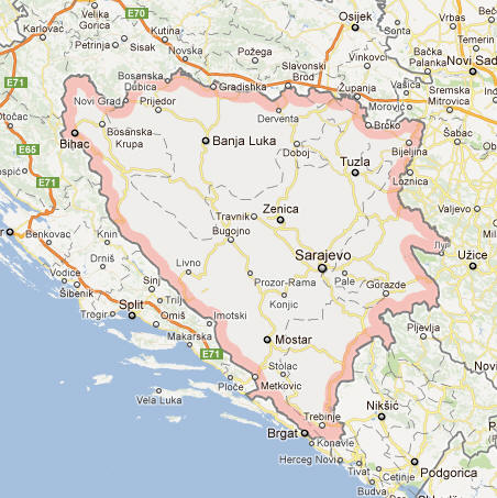
Bosnia and Herzegovina Facts
Bosnia and Herzegovina, often referred to as Bosnia only, the state of the Balkan Peninsula in southeastern Europe; 51 130 km², 3.3 million residents (2019).Bosnia and Herzegovina, which borders on Serbia in the east, in the southeast to Montenegro and in the west and north to Croatia, consists of the historical landscapes of Bosnia and Herzegovina. Bosnia and Herzegovina was declared an independent state in 1992, and in the same year civil war broke out in the country. The capital is Sarajevo (300 900 residents, 2012).
Bosnia and Herzegovina Flag

Country facts
- Republic of Bosnia in Herzegovina / Bosnia and Herzegovina
- Country abbreviation: BA
- Area: 51 130 km²
- Population (2019): 3.3 million residents
- Capital: Sarajevo
- Main language: Bosnian
- State: Republic
- Head of State: Rotating (Presidential Council President)
- Head of Government: Zoran Tegeltija
- Per capita GDP (2018): US $ 5,951
- GNI per capita (2018): US $ 5,690
- Currency unit: 1 convertible mark = 100 coins
- Currency code: BAM
- Country number (telephony): 387
- Internet domain name: ba
- Time difference compared to Sweden: 0
- National Day: November 25 (Constitution Day, 1943)
- Independence Day: March 1, 1992
Nature
- Land use: forest (43%), agricultural land (42%), other (15%)
- Highest mountain: Maglić (2,386 m asl)
Population
- Population density (2019): 64 residents per km²
- Natural population growth (2019): –0.2%; birth rate 9 ‰, death rate 11 ‰
- Age structure (2019): 0-14 years (14%), 15-64 (70%), 65- (16%)
- Life expectancy (2019): men 74 years, women 79 years
- Infant mortality (2019): 6 per 1,000 live births
- Population forecast 2050: 3 million residents
- HDI (2017): 0.768 (place 77 of 189)
- Urbanization rate (2019): 48%
- Most populous cities (2012): Sarajevo (300 900 residents), Banja Luka (238 400)
Business
- Industry’s contribution to GDP (2017): agriculture (7%), industry (29%), service (64%)
- Exports (2017): US $ 5,205 million
- Main export goods: metals, clothing, wood products
- Main exporting countries: Germany, Croatia, Italy
- Imports (2017): US $ 9,547 million
- Main import products: machinery, chemicals, fuel
- Main importing countries: Germany, Italy, Serbia
- Railway network (2014): 965 km
Geography
Topography
Bosnia and Herzegovina is situated in Southeast Europe on the Balkan Peninsula, bordered by Croatia to the north, west, and south, Serbia to the east, and Montenegro to the southeast. Covering an area of approximately 51,197 square kilometers, the country exhibits a diverse and rugged landscape. The terrain is predominantly mountainous, with the Dinaric Alps extending across much of the territory. These mountains are characterized by deep river canyons, dense forests, and karst formations, contributing to the country’s dramatic natural beauty. The highest peak is Maglić, standing at 2,386 meters in the southeast, near the border with Montenegro.
The country is bisected by numerous rivers, the most significant being the Sava, Drina, Bosna, and Neretva. These rivers play a crucial role in shaping the topography, supporting agriculture, and providing vital water resources. The central part of Bosnia is dominated by the central plateau, which gradually descends towards the Adriatic Sea in the southern region of Herzegovina. Herzegovina itself is marked by a milder climate and fertile valleys, such as the Livno Valley, which is conducive to agriculture and viticulture.
Bosnia and Herzegovina also boasts several notable natural landmarks, including the Una National Park, known for its pristine rivers and waterfalls, and the Sutjeska National Park, home to one of the last remaining primeval forests in Europe, Perućica. The country’s topography not only defines its natural heritage but also influences its economic activities, from mining in the mountainous regions to agriculture in the fertile valleys.
Regions
Bosnia and Herzegovina is traditionally divided into two main entities: the Federation of Bosnia and Herzegovina and the Republika Srpska, along with the Brčko District, a self-governing administrative unit. The Federation of Bosnia and Herzegovina is further subdivided into ten cantons, each with its own government, while Republika Srpska comprises municipalities with a more centralized administrative structure.
The Federation of Bosnia and Herzegovina is primarily inhabited by Bosniaks and Croats and features a landscape that includes fertile plains, river valleys, and moderate mountains. Major cities in this entity include Sarajevo, the capital, and Mostar, renowned for its historic Ottoman bridge, the Stari Most. Republika Srpska, predominantly inhabited by Serbs, encompasses a more rugged and mountainous terrain, with significant urban centers like Banja Luka, known for its vibrant cultural scene and economic activities.
The Brčko District, located at the crossroads of the two entities, serves as an important commercial and transportation hub, facilitating trade and movement between different parts of the country. This division into entities and districts reflects the complex ethnic and political landscape of Bosnia and Herzegovina, shaped significantly by its history and the aftermath of the Bosnian War in the 1990s.
Biodiversity
Bosnia and Herzegovina is rich in biodiversity, owing to its varied climate and topography. The country’s forests cover about 50% of its land area, consisting mainly of beech, oak, pine, and fir trees. These forests provide habitats for a wide range of wildlife, including large mammals such as brown bears, wolves, and lynxes. The mountainous regions and national parks are particularly important for biodiversity conservation, hosting numerous endemic and rare species.
The rivers and wetlands of Bosnia and Herzegovina are home to diverse aquatic life, including various fish species like trout and carp. Birdlife is abundant, with over 200 species recorded, including the endangered golden eagle and the peregrine falcon. The country’s flora is equally diverse, with over 3,800 plant species, many of which are unique to the Balkan region.
Efforts to preserve biodiversity are evident in the establishment of protected areas and national parks, which aim to safeguard critical habitats and promote sustainable tourism. However, challenges such as deforestation, habitat destruction, and pollution pose threats to the country’s natural ecosystems. Conservation initiatives and international cooperation are essential to maintaining Bosnia and Herzegovina’s rich biodiversity for future generations.
Climate
Climate Zones
Bosnia and Herzegovina experiences a diverse climate influenced by its varied topography. The country is predominantly characterized by a continental climate, with significant variations between regions. The central and eastern parts of Bosnia experience hot summers and cold winters, with substantial snowfall in the mountainous areas. These regions have a typical continental climate, marked by large temperature fluctuations between seasons.
In contrast, the western regions and areas near the Adriatic Sea in Herzegovina enjoy a more Mediterranean climate, with milder winters and warmer, drier summers. This climatic variation is particularly evident in regions like Mostar and Jablanica, where the influence of the Adriatic moderates the overall climate, making it suitable for agriculture, particularly the cultivation of olives and vineyards.
The highland areas, such as those in the Dinaric Alps, experience an alpine climate, characterized by cooler temperatures and higher precipitation levels. These areas receive significant snowfall during the winter months, supporting winter sports and contributing to the country’s hydrological systems through snowmelt-fed rivers.
Weather Patterns
Weather patterns in Bosnia and Herzegovina are influenced by both Atlantic and continental air masses. The country experiences four distinct seasons, each bringing different weather conditions. Spring is typically mild, with increasing rainfall and blooming vegetation, while summer can be hot and humid, especially in the lowland areas. Thunderstorms are common in the summer months, occasionally leading to severe weather events such as hailstorms and flash floods.
Autumn brings cooler temperatures and a decrease in rainfall, with vibrant fall foliage enhancing the natural beauty of the landscape. Winter is cold, particularly in the mountainous regions, where temperatures can drop significantly below freezing, and heavy snowfall is common. The variability in weather patterns poses both opportunities and challenges for agriculture, infrastructure, and daily life.
Climate change has begun to impact Bosnia and Herzegovina, leading to more unpredictable weather patterns, increased frequency of extreme weather events, and shifts in precipitation trends. These changes threaten water resources, agricultural productivity, and biodiversity, necessitating adaptive strategies and sustainable practices to mitigate adverse effects.
People
Demographics
Bosnia and Herzegovina has a population of approximately 3.3 million people, though this number has declined in recent years due to factors such as emigration, low birth rates, and the aftermath of the Bosnian War. The population is ethnically diverse, comprising mainly Bosniaks, Serbs, and Croats, each associated with different religious and cultural identities. The country is also home to smaller ethnic groups, including Roma, Jews, and other minorities, contributing to its multicultural tapestry.
The demographic distribution is uneven, with a significant portion of the population residing in urban areas. Sarajevo, the capital and largest city, is a major cultural and economic center, while other urban areas like Banja Luka, Tuzla, and Mostar also host substantial populations. Rural areas, particularly in the mountainous and eastern regions, are experiencing population decline as younger generations migrate to cities or abroad in search of better opportunities.
The population is relatively young, although aging is becoming more pronounced due to increased life expectancy and lower fertility rates. This demographic shift presents challenges for the country’s social services, healthcare system, and labor market, necessitating policies that address the needs of an aging population while fostering youth employment and education.
Ethnic Composition
Bosnia and Herzegovina is characterized by its complex ethnic composition, primarily divided among Bosniaks, Serbs, and Croats. Bosniaks, who are predominantly Muslim, constitute about 50% of the population and are primarily concentrated in the Federation of Bosnia and Herzegovina. Serbs, who are predominantly Orthodox Christians, make up approximately 30% of the population and are mainly found in Republika Srpska. Croats, who are mostly Roman Catholic, account for around 15% of the population and are largely situated in the western regions and parts of the Federation.
This ethnic diversity is a result of centuries of historical developments, including the Ottoman and Austro-Hungarian periods, which have shaped the cultural and social landscape of the country. The legacy of the Bosnian War (1992-1995) has left deep ethnic divisions and influenced the current political and social dynamics, with ongoing efforts to promote reconciliation and coexistence among the different ethnic groups.
Minority communities, such as the Roma, Jews, and others, add to the multicultural fabric of Bosnia and Herzegovina. These groups maintain their distinct cultural practices and contribute to the overall diversity of the society, despite facing challenges related to integration, discrimination, and economic marginalization.
Languages
The official languages of Bosnia and Herzegovina are Bosnian, Serbian, and Croatian, reflecting the country’s ethnic composition. These languages are mutually intelligible and belong to the South Slavic language group, differing primarily in dialects and scripts. Bosnian and Croatian are written in the Latin script, while Serbian can be written in both Cyrillic and Latin scripts.
English is widely taught in schools and used in business and tourism, serving as a lingua franca among the younger population and international communities. Additionally, minority languages such as Romani and various indigenous dialects are spoken by specific communities, although they have limited official status and recognition.
Language plays a significant role in the cultural identity of the different ethnic groups, and efforts to promote multilingualism and protect linguistic diversity are ongoing. The complex linguistic landscape is also a reflection of the broader social and political structures, with language policies often intertwined with ethnic and regional governance.
Religion
Religion is a central aspect of life in Bosnia and Herzegovina, deeply intertwined with the country’s ethnic identities. The three main religious groups are Islam, Eastern Orthodoxy, and Roman Catholicism, corresponding to the major ethnic groups of Bosniaks, Serbs, and Croats, respectively.
Islam, predominantly practiced by Bosniaks, is characterized by a rich tradition of Islamic scholarship, Sufi practices, and cultural expressions that blend with local customs. The presence of mosques, Islamic schools, and cultural institutions reflects the significant role of Islam in daily life and community activities.
Eastern Orthodoxy, practiced by Serbs, is centered around the Serbian Orthodox Church, which plays a crucial role in maintaining cultural and religious traditions. Orthodox monasteries, churches, and religious festivals are integral to the spiritual and cultural life of the Serbian community.
Roman Catholicism, practiced by Croats, is associated with the Roman Catholic Church and is marked by the celebration of Catholic sacraments, feasts, and rituals. Catholic churches, schools, and community organizations are pivotal in preserving the religious and cultural identity of the Croatian population.
In addition to these major religions, Bosnia and Herzegovina is home to smaller religious communities, including Jews, Protestants, and others. Interfaith dialogue and coexistence are important aspects of the country’s social fabric, promoting mutual respect and understanding among different religious groups. However, the legacy of the war has left religious tensions that continue to influence the social and political landscape.
Economy
Major Industries
Bosnia and Herzegovina has a diverse economy, though it faces challenges related to political instability, high unemployment rates, and a need for structural reforms. The country’s major industries include manufacturing, energy, mining, and tourism.
Manufacturing is a significant sector, encompassing the production of machinery, vehicles, textiles, and food processing. The automotive industry, in particular, has potential for growth, with existing facilities and a skilled labor force supporting production and assembly operations. The textile industry benefits from the availability of raw materials and the traditional expertise in garment manufacturing.
Energy production, primarily through hydropower and coal, is another critical industry. Bosnia and Herzegovina has substantial hydropower potential, with numerous rivers and waterfalls providing opportunities for renewable energy projects. The coal mining sector also contributes to energy production, though it faces environmental and sustainability challenges.
Mining remains an important industry, with Bosnia and Herzegovina being rich in mineral resources such as coal, iron ore, bauxite, and various industrial minerals. The extraction and processing of these resources are vital for the country’s economy, providing employment and export revenue.
Tourism is a growing sector, leveraging the country’s natural beauty, historical sites, and cultural heritage. Attractions such as the historic city of Mostar, the capital Sarajevo, and the natural landscapes of national parks draw both domestic and international tourists. Adventure tourism, including hiking, skiing, and rafting, has significant potential due to the country’s varied topography and climate.
Agriculture
Agriculture plays a crucial role in Bosnia and Herzegovina’s economy, employing a significant portion of the population, particularly in rural areas. The country’s agricultural sector is diverse, encompassing crop farming, livestock breeding, and horticulture.
Key crops include cereals such as wheat, corn, and barley, as well as fruits and vegetables like apples, plums, and potatoes. The fertile valleys and moderate climate in regions like Herzegovina are conducive to high-yield agriculture, supporting both domestic consumption and export markets. Viticulture and winemaking have a long tradition in Bosnia and Herzegovina, with several renowned wine-producing regions contributing to the country’s reputation for quality wines.
Livestock breeding is another important aspect of agriculture, with cattle, sheep, and poultry being the primary livestock raised. Dairy farming, meat production, and poultry farming provide essential products for the domestic market and contribute to export revenues. The country also produces honey, olives, and various other agricultural products that are integral to the local diet and economy.
Challenges in the agricultural sector include limited access to modern farming technologies, fragmented land ownership, and vulnerability to climate change. Efforts to modernize agriculture, improve productivity, and promote sustainable farming practices are ongoing, supported by government initiatives and international aid programs.
Trade
Trade is a vital component of Bosnia and Herzegovina’s economy, with the country engaging in both regional and international trade. The main exports include metals, textiles, machinery, and food products, while imports consist of machinery, chemicals, fuels, and consumer goods.
Bosnia and Herzegovina is a member of the Central European Free Trade Agreement (CEFTA), which facilitates trade with neighboring countries and the broader European market. The country’s strategic location in the Balkans makes it an important transit hub for goods moving between Eastern and Western Europe. Investments in infrastructure, such as roads, railways, and ports, are crucial for enhancing trade efficiency and connectivity.
The European Union is the largest trading partner, accounting for a significant portion of both exports and imports. Other major trading partners include neighboring countries like Croatia, Serbia, and Montenegro, as well as global markets such as Turkey, Russia, and China. The country is actively seeking to diversify its trade relations and expand into new markets to reduce dependence on a few key partners.
Challenges in the trade sector include bureaucratic inefficiencies, limited access to financing, and the need for regulatory reforms to align with international standards. Efforts to improve the business environment, streamline customs procedures, and promote export-oriented industries are essential for boosting trade performance and economic growth.
Economic Development
Economic development in Bosnia and Herzegovina has been gradual, influenced by the country’s complex political structure and the legacy of the Bosnian War. The economy has been transitioning from a centralized, socialist system to a market-oriented economy, with varying degrees of success across different sectors.
Structural reforms aimed at improving the business environment, attracting foreign investment, and enhancing competitiveness are ongoing. The privatization of state-owned enterprises, regulatory improvements, and initiatives to support small and medium-sized enterprises (SMEs) are critical for fostering economic growth and innovation.
Human capital development is another key aspect of economic development, with investments in education, vocational training, and healthcare contributing to a more skilled and healthy workforce. The country has a well-educated population, but there is a need to align educational outcomes with labor market demands to reduce unemployment and underemployment, particularly among the youth.
Infrastructure development, including transportation, energy, and telecommunications, is essential for supporting economic activities and enhancing connectivity. Projects aimed at modernizing infrastructure, improving energy efficiency, and expanding digital connectivity are pivotal for the country’s development trajectory.
However, challenges such as high unemployment rates, especially among young people, economic inequality, and the need for further political and institutional reforms hinder progress. Addressing these issues requires sustained efforts, international cooperation, and effective governance to create a conducive environment for economic development and prosperity.
Government
Political System
Bosnia and Herzegovina operates under a complex political system designed to accommodate its ethnic diversity and promote power-sharing among the major ethnic groups. The country is a federal parliamentary republic, structured by the Dayton Peace Agreement of 1995, which ended the Bosnian War. The political system consists of three main levels: the state level, the entity level (Federation of Bosnia and Herzegovina and Republika Srpska), and the cantonal or municipal level.
At the state level, the Presidency of Bosnia and Herzegovina serves as the collective head of state, comprising three members elected by popular vote: one Bosniak, one Serb, and one Croat. The presidency rotates its chairmanship among its members every eight months, ensuring equal representation of the three constituent peoples.
The legislative branch is bicameral, consisting of the House of Peoples and the House of Representatives. The House of Peoples includes representatives from each major ethnic group, ensuring that legislation reflects the interests of all constituent peoples. The House of Representatives is elected through a proportional representation system, allowing for a more diverse and inclusive legislative process.
The executive branch is led by the Council of Ministers, headed by the Chairman, who is nominated by the Presidency and approved by the House of Representatives. The Council of Ministers is responsible for implementing policies, managing the economy, and overseeing various government functions.
The judiciary is independent, with the Constitutional Court of Bosnia and Herzegovina overseeing the constitutionality of laws and ensuring the protection of fundamental rights. However, the judiciary faces challenges related to political interference, corruption, and inefficiency, impacting its effectiveness and public trust.
Administrative Divisions
Bosnia and Herzegovina is divided into two main entities: the Federation of Bosnia and Herzegovina and Republika Srpska, along with the Brčko District, a self-governing administrative unit. The Federation of Bosnia and Herzegovina is further subdivided into ten cantons, each with its own government and legislative body, reflecting the decentralized nature of governance. These cantons manage local affairs, including education, healthcare, and infrastructure, tailored to the specific needs of their regions.
Republika Srpska, the other main entity, has a more centralized administrative structure, with municipalities and cities managing local governance. This entity operates with a significant degree of autonomy, particularly in areas such as policing, education, and healthcare, allowing for policies that align with the preferences of the majority Serb population.
The Brčko District, situated at the intersection of the two entities, functions as a neutral administrative area governed by its own council and administration. It serves as an important commercial and transportation hub, facilitating economic activities and connectivity between different parts of the country.
This intricate division of administrative responsibilities aims to balance the interests of different ethnic groups, promote regional autonomy, and maintain national unity. However, it also leads to a complex and often cumbersome governance system, contributing to political gridlock and inefficiency.
Foreign Relations
Bosnia and Herzegovina maintains active foreign relations, striving to integrate more closely with European and international institutions while balancing the interests of its diverse domestic stakeholders. The country is a member of the United Nations, the Council of Europe, the Organization for Security and Co-operation in Europe (OSCE), and the World Trade Organization (WTO).
A primary goal of Bosnia and Herzegovina’s foreign policy is European Union (EU) integration. The country is recognized as a potential candidate for EU membership, having submitted its application for membership in February 2016. Progress towards EU accession involves implementing comprehensive reforms in areas such as the rule of law, human rights, economic development, and anti-corruption measures. However, the process is slow, hindered by internal political divisions and the need for substantial institutional improvements.
Bosnia and Herzegovina also seeks to strengthen its regional ties within the Balkans. It is an active participant in the Central European Free Trade Agreement (CEFTA) and the Stability Pact for South Eastern Europe, promoting economic cooperation and regional stability. The country works closely with neighboring states like Croatia, Serbia, and Montenegro to enhance trade, security, and infrastructure development.
Additionally, Bosnia and Herzegovina engages in bilateral relations with key global powers, including the United States, China, and Russia, balancing these relationships to maximize economic and political benefits. The country hosts various international peacekeeping missions and humanitarian efforts, reflecting its commitment to global security and development.
However, internal political complexities and ethnic divisions often complicate foreign policy decisions, limiting the country’s ability to present a unified stance on international issues. Continued efforts to foster political stability and institutional cohesion are essential for advancing its foreign policy objectives and achieving greater integration with the global community.
Culture
Arts
The cultural landscape of Bosnia and Herzegovina is a rich blend of indigenous, Ottoman, Austro-Hungarian, and modern influences, reflecting its complex history and diverse population. The country has a vibrant arts scene encompassing visual arts, literature, theater, and cinema.
Visual arts in Bosnia and Herzegovina are characterized by both traditional and contemporary expressions. Traditional crafts such as pottery, weaving, and wood carving are integral to the cultural heritage, with artisans producing intricate designs that reflect ethnic motifs and historical influences. Contemporary visual artists engage with a wide range of mediums, including painting, sculpture, and digital art, often addressing themes of identity, memory, and social issues.
Literature in Bosnia and Herzegovina has a distinguished history, with notable authors such as Ivo Andrić, who won the Nobel Prize in Literature in 1961 for his novel “The Bridge on the Drina,” which portrays the complex interactions between different ethnic groups in the region. Modern writers continue to explore themes related to the war, reconciliation, and the challenges of post-conflict society, contributing to the country’s literary heritage.
The theater scene is equally dynamic, with numerous theaters in major cities like Sarajevo, Banja Luka, and Mostar presenting a variety of performances ranging from classical plays to contemporary dramas and experimental productions. These theaters serve as important cultural hubs, fostering artistic innovation and providing platforms for both established and emerging talents.
Cinema in Bosnia and Herzegovina has gained international recognition, particularly through films that depict the country’s tumultuous history and cultural resilience. Directors like Danis Tanović and Jasmila Žbanić have received acclaim for their poignant portrayals of the Bosnian War and its aftermath, earning awards at prestigious film festivals and contributing to the global visibility of Bosnian cinema.
Music
Music plays a vital role in the cultural identity of Bosnia and Herzegovina, encompassing a diverse range of genres and styles influenced by its multicultural heritage. Traditional music includes sevdalinka, a genre characterized by its melancholic melodies and emotive lyrics, often reflecting themes of love, longing, and sorrow. Sevdalinka is performed with traditional instruments such as the saz, accordion, and violin, and remains a beloved and integral part of Bosnian cultural expression.
Folk music is another important aspect, with various regional styles reflecting the distinct cultural influences of different ethnic groups. Traditional dances, such as kolo, are performed during celebrations and social gatherings, accompanied by lively rhythms and energetic movements. These folk traditions are preserved and promoted through cultural events, music festivals, and community organizations.
Modern music in Bosnia and Herzegovina encompasses a wide array of genres, including pop, rock, hip-hop, and electronic music. Contemporary artists blend traditional elements with global influences, creating innovative sounds that resonate with both local and international audiences. Bands like Bijelo Dugme and artists like Dino Merlin have achieved widespread popularity, contributing to the country’s vibrant music scene.
Classical music also holds significance, with orchestras, choirs, and solo performers showcasing the works of both Bosnian and international composers. The Sarajevo Philharmonic Orchestra, for example, is a prominent institution that promotes classical music through performances, education, and community outreach.
Music festivals are a key feature of the cultural calendar, attracting audiences from across the region and beyond. Events such as the Sarajevo Film Festival, Jazz Fest Sarajevo, and the Mostar Summer Festival highlight the country’s musical diversity and cultural dynamism, providing platforms for artistic exchange and collaboration.
Festivals
Bosnia and Herzegovina hosts a variety of festivals that celebrate its rich cultural heritage, artistic expressions, and natural beauty. These festivals play a crucial role in promoting cultural tourism, fostering community spirit, and showcasing the country’s diverse traditions.
The Sarajevo Film Festival is one of the most prominent cultural events in the country, attracting filmmakers, actors, and cinema enthusiasts from around the world. Established in 1995 during the Siege of Sarajevo, the festival has grown into an internationally recognized event, known for its focus on promoting cinema from the Balkans and fostering dialogue through film.
Jazz Fest Sarajevo is another major event, celebrating the genre’s influence and bringing together local and international jazz musicians. The festival features a mix of performances, workshops, and masterclasses, contributing to the development of the local jazz scene and providing a platform for artistic exchange.
The Mostar Summer Festival is a key cultural event that showcases traditional music, dance, and theater performances against the backdrop of the iconic Stari Most bridge. The festival highlights the city’s multicultural heritage and fosters a sense of unity and reconciliation through artistic expression.
Other notable festivals include the SevdahArt Festival, which focuses on the sevdalinka music genre, and the Cacao Festival in Neum, celebrating the country’s natural resources and promoting sustainable tourism. These festivals attract both domestic and international visitors, enhancing the country’s cultural visibility and economic development.
Religious and ethnic festivals also play a significant role, reflecting the diverse cultural landscape of Bosnia and Herzegovina. Events such as Ramadan, Easter, and Christmas are celebrated with traditional ceremonies, community gatherings, and cultural performances, reinforcing the social and cultural bonds within and between different communities.
Cuisine
The cuisine of Bosnia and Herzegovina is a reflection of its diverse cultural influences, blending elements from Ottoman, Austro-Hungarian, Mediterranean, and Central European culinary traditions. This fusion has created a unique and flavorful gastronomic landscape characterized by hearty dishes, rich flavors, and a variety of ingredients.
Traditional dishes often feature meats such as lamb, beef, and pork, prepared in various ways including grilling, stewing, and baking. One of the most famous Bosnian dishes is ćevapi, small minced meat sausages typically served with somun (a type of flatbread), onions, and ajvar (a red pepper relish). Another popular dish is burek, a savory pastry filled with meat, cheese, or spinach, showcasing the influence of Ottoman culinary traditions.
Bosnian cuisine also includes a variety of stews and soups, such as begova čorba (a creamy chicken and okra soup) and japrak (stuffed grape leaves). These dishes are often accompanied by side dishes like potatoes, rice, and vegetables, emphasizing the use of fresh, locally sourced ingredients.
Dairy products play an important role in the diet, with products like kajmak (a creamy dairy spread) and various cheeses being widely consumed. Bread, particularly somun and pita, is a staple in Bosnian meals, reflecting the agrarian roots of the cuisine.
Desserts in Bosnia and Herzegovina are rich and varied, with sweets such as baklava, tufahija (stuffed apples), and tufahija (hollowed apples filled with walnuts and syrup) being popular choices. These desserts highlight the intricate pastry techniques and the use of nuts and sweeteners, common in Ottoman-influenced cuisines.
Beverages include traditional drinks like boza (a fermented grain drink) and various fruit juices, as well as alcoholic beverages such as rakija (a fruit brandy) and beer, which is widely enjoyed across the country. Coffee culture is also significant, with Bosnian coffee being a central social ritual, often served in traditional settings alongside sweet pastries.
Overall, Bosnian cuisine is characterized by its diversity, rich flavors, and the harmonious blending of different culinary traditions, making it a key aspect of the country’s cultural identity and social life.
History
Early History
The history of Bosnia and Herzegovina is marked by a series of migrations, invasions, and cultural transformations. The region has been inhabited since prehistoric times, with evidence of Neolithic settlements and Illyrian tribes dating back to antiquity. The Illyrians were among the earliest known inhabitants, forming a significant part of the region’s early cultural and social structures.
During the Roman Empire, Bosnia and Herzegovina was incorporated into the province of Illyricum, with cities such as Salona serving as important urban centers. The Roman influence left a lasting legacy, evident in archaeological sites, roads, and architectural remnants that testify to the region’s integration into the broader Roman world.
With the decline of the Roman Empire, the region experienced invasions by various barbarian tribes, including the Goths and the Huns. In the early Middle Ages, Slavic tribes migrated into the Balkans, gradually assimilating and establishing the foundations of the medieval Bosnian state. By the 10th century, the area was inhabited by South Slavic peoples who formed distinct ethnic and cultural identities.
Medieval Bosnia
The medieval period saw the rise of the Kingdom of Bosnia, which became a significant regional power. The Banate of Bosnia was established in the early 12th century, evolving into the Kingdom of Bosnia in the 14th century under King Tvrtko I Kotromanić. During this time, Bosnia developed its own distinct cultural and political identity, with the Bosnian Church emerging as a unique religious institution, separate from both Catholicism and Orthodoxy.
The Kingdom of Bosnia reached its zenith under King Tvrtko I, who expanded its territories and established diplomatic relations with neighboring states and the Papacy. The medieval period also saw the construction of numerous castles, fortresses, and religious buildings, many of which remain important historical landmarks today.
However, internal strife, external pressures from the Ottoman Empire, and dynastic conflicts eventually weakened the kingdom. By the late 15th century, Bosnia became a battleground for Ottoman expansion, leading to its eventual conquest and incorporation into the Ottoman Empire in 1463.
Ottoman Period
The Ottoman rule profoundly influenced the cultural, social, and economic landscape of Bosnia and Herzegovina. Under Ottoman administration, the region was integrated into the empire’s sophisticated administrative system, with the establishment of the Vilayet of Bosnia. The Ottoman period introduced Islam, which became a major religion in the region, significantly shaping the demographic and cultural composition.
Ottoman architecture left a lasting imprint, with the construction of mosques, bridges, and other infrastructure that are still prominent today. Cities like Sarajevo and Mostar flourished as important trade and cultural centers, benefiting from the empire’s extensive trade networks and relative religious tolerance.
The Ottoman period also saw the development of a diverse society, where Muslims, Orthodox Christians, Catholics, Jews, and other religious communities coexisted, contributing to a rich cultural mosaic. The millet system allowed for a degree of autonomy for different religious groups, fostering a unique multicultural environment.
However, the decline of the Ottoman Empire in the 19th century brought increased instability and foreign intervention. Nationalist movements emerged, seeking independence and the redefinition of national identities, setting the stage for the eventual dissolution of Ottoman rule in the region.
Austro-Hungarian Rule
Following the Congress of Berlin in 1878, Bosnia and Herzegovina came under Austro-Hungarian administration, officially annexed by the empire in 1908. The Austro-Hungarian period introduced significant modernization and development initiatives, including the expansion of infrastructure, education, and public services.
Under Austro-Hungarian rule, Sarajevo became a cosmopolitan city, experiencing architectural and cultural renaissance with the construction of new buildings, museums, and cultural institutions. The administration implemented administrative reforms, promoting economic growth and integrating Bosnia and Herzegovina more closely with Central Europe.
However, the period was also marked by ethnic tensions and nationalist aspirations, as different groups sought greater autonomy or unification with neighboring nations. The assassination of Archduke Franz Ferdinand in Sarajevo in 1914 by a Bosnian Serb nationalist was a pivotal event that triggered World War I, highlighting the region’s strategic and symbolic significance.
The Austro-Hungarian rule ended with the dissolution of the empire following World War I, leading to the formation of the Kingdom of Serbs, Croats, and Slovenes (later known as Yugoslavia), which fundamentally reshaped the political and social landscape of Bosnia and Herzegovina.
World War II and Socialist Yugoslavia
During World War II, Bosnia and Herzegovina was occupied by Axis forces, leading to significant destruction and loss of life. The region became a battleground for various factions, including the Yugoslav Partisans led by Josip Broz Tito, who fought against the occupying forces and local collaborators. The war left deep scars on the population and infrastructure, contributing to the desire for strong, unified governance in the post-war period.
After the war, Bosnia and Herzegovina became one of the six republics of the Socialist Federal Republic of Yugoslavia, under Tito’s leadership. The socialist period brought about industrialization, urbanization, and significant improvements in education and healthcare. The country experienced economic growth and became a key player in the Non-Aligned Movement, maintaining a degree of independence from both the Soviet Union and the Western bloc.
Socialist Yugoslavia promoted a sense of Yugoslav identity, encouraging cooperation among the different ethnic groups. However, underlying ethnic tensions persisted, and the rigid federal structure sometimes led to conflicts over autonomy and representation.
Independence and the Bosnian War
The late 1980s and early 1990s were marked by the rise of nationalist movements across Yugoslavia, leading to the disintegration of the federation. Bosnia and Herzegovina declared independence in March 1992 following a referendum, which was boycotted by the majority of the Serb population. The declaration of independence triggered the Bosnian War (1992-1995), a brutal conflict characterized by ethnic cleansing, genocide, and widespread atrocities, most notably the Srebrenica massacre.
The war resulted in significant loss of life, displacement of populations, and destruction of infrastructure. International intervention, including NATO airstrikes and the Dayton Peace Agreement, eventually brought an end to the conflict. The Dayton Agreement established the current political structure of Bosnia and Herzegovina, dividing the country into two entities and setting the framework for its post-war governance and reconstruction.
Post-War Era and Contemporary Developments
Since the end of the Bosnian War, Bosnia and Herzegovina has been focused on rebuilding and reconciling its divided society. The country has made progress in establishing democratic institutions, rebuilding infrastructure, and fostering economic development. However, challenges such as political fragmentation, corruption, high unemployment rates, and the return of refugees continue to impede progress.
Bosnia and Herzegovina has sought closer integration with European and international institutions, aspiring to join the European Union and NATO. Efforts to implement necessary reforms and align with EU standards are ongoing, though progress is slow due to the complex political landscape and entrenched ethnic divisions.
Socially, the country is working towards reconciliation and building a cohesive national identity, despite lingering ethnic tensions and memories of the war. Civil society organizations, international aid, and grassroots initiatives play crucial roles in promoting peace, human rights, and economic opportunities.
In recent years, Bosnia and Herzegovina has also focused on developing its tourism sector, leveraging its rich cultural heritage, natural beauty, and historical sites to attract visitors and stimulate economic growth. The country continues to navigate the challenges of post-conflict recovery while striving to build a stable, prosperous, and inclusive society.