Where is Belgium Located?
Where is Belgium located on the map? Belgium is an independent nation located in Western Europe. Check out the following images to see location of Belgium on maps.
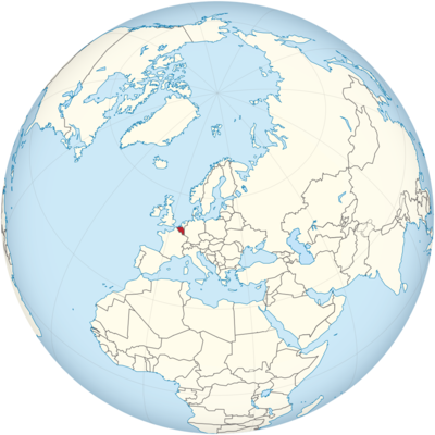
Belgium Location in World Map
Belgium is divided into a Flemish and a Walloon part. The Walloon part is marked in yellow, the Flemish part in red and the capital Brussels is marked in blue.
Location Information of Belgium
Latitude and Longitude
Belgium is a country located in Western Europe, bordered by France to the south, Germany to the east, the Netherlands to the north, and Luxembourg to the southeast. The country has a coastline along the North Sea to the northwest. The geographical coordinates of Belgium are:
- Latitude: 50.8503° N
- Longitude: 4.3517° E
These coordinates place Belgium in the heart of Europe, with its central location contributing to its significance as a hub for European politics, culture, and commerce. Belgium is an important member of both the European Union and NATO, hosting the EU’s capital, Brussels, and serving as a key player in European diplomacy and trade.
Capital City and Major Cities
- Capital City: BrusselsBrussels is the capital of both Belgium and the European Union (EU), making it a global center for politics and international cooperation. Located in the central part of the country, Brussels is known for its blend of medieval architecture and modern buildings. It is home to key EU institutions, including the European Parliament, European Commission, and Council of the European Union. The city’s famous landmarks include the Grand Place, the Atomium, and Manneken Pis. Brussels also serves as the cultural and economic heart of the country, with numerous museums, theaters, and restaurants.
- Major Cities:
- Antwerp – Located in the northern part of Belgium, Antwerp is the country’s second-largest city and a major port. Known as a global diamond-trading hub, Antwerp is also famous for its fashion industry, historic architecture, and vibrant art scene. The city is home to the Antwerp Central Station, one of the most beautiful railway stations in the world, and the Cathedral of Our Lady, a UNESCO World Heritage site.
- Ghent – Situated in the western part of the country, Ghent is a university city with a rich history that dates back to the medieval period. Known for its canals, medieval architecture, and vibrant cultural life, Ghent is a popular destination for tourists. Key attractions include the Gravensteen Castle, St. Bavo’s Cathedral, and the Museum of Fine Arts.
- Bruges – Located in the northwestern part of Belgium, Bruges is a well-preserved medieval city known for its canals, cobblestone streets, and historic buildings. The city is often referred to as the “Venice of the North.” Key sights include the Belfry of Bruges, Market Square, and Basilica of the Holy Blood. Bruges is also known for its chocolate, lace, and beer.
- Liège – Situated in the eastern part of Belgium, Liège is an industrial and cultural center with a strong historical legacy. The city is known for its steel industry, its vibrant nightlife, and its museums. Notable landmarks include the Liège-Guillemins railway station, Prince-Bishops’ Palace, and La Boverie Museum.
- Leuven – A university city located in the eastern part of Belgium, Leuven is known for being the home of KU Leuven, one of Europe’s oldest and most prestigious universities. The city boasts a lively student atmosphere, beautiful Gothic architecture, and the Old Market Square, which is considered one of the longest bars in the world.
Time Zone
Belgium operates in the Central European Time (CET) zone, which is UTC +1 during standard time. During the summer months, Belgium observes Central European Summer Time (CEST), which is UTC +2. This time zone is shared by several European countries, including France, Germany, and the Netherlands, making travel within the region convenient without the need for time adjustments.
Climate
Belgium has a temperate maritime climate, characterized by mild temperatures, moderate rainfall, and relatively high humidity year-round. The country’s weather is influenced by its proximity to the North Sea, which moderates the climate, preventing extreme temperatures.
- Summer: Summers in Belgium are generally mild and pleasant, with average temperatures ranging from 15°C (59°F) to 22°C (72°F). July is typically the warmest month, with temperatures occasionally reaching up to 30°C (86°F) during heatwaves. Summer is the ideal time for outdoor activities and festivals, as the weather is usually comfortable, with occasional thunderstorms and rain.
- Winter: Winters in Belgium are cold but not extreme. Temperatures typically range from 0°C (32°F) to 7°C (45°F), and snowfall is relatively rare. However, the country experiences periods of cloudy and rainy weather during the winter months, especially in January and February. The relatively mild winter makes Belgium a year-round destination for tourists.
- Rainfall: Belgium experiences rainfall throughout the year, with the wettest months typically occurring from July to August. The west of the country tends to be wetter than the east, as it is closer to the North Sea. Belgium averages between 700 mm (27.5 inches) to 900 mm (35 inches) of precipitation annually. Rain is usually spread across the year, and Belgium experiences cloudy days and drizzle frequently, which is characteristic of the maritime climate.
- Autumn and Spring: Spring and autumn in Belgium are transitional seasons with mild temperatures. Spring sees flowers blooming, while autumn brings beautiful fall colors. Both seasons are relatively short, with spring starting to warm up in March and April, and autumn bringing cooler temperatures in October and November.
Economic Status
Belgium has one of the most developed economies in the European Union, with a high GDP per capita and a well-balanced industrial, agricultural, and services sector. The country benefits from its central location in Europe, its access to the North Sea, and its highly educated workforce.
- Services Sector: The services sector is the largest contributor to Belgium’s GDP, with significant contributions from finance, trade, real estate, and tourism. Brussels is a major global financial center, housing the European Union’s political institutions, and many multinational companies have offices in the city. Belgium’s port of Antwerp is also a major trade hub for both European and global markets, particularly in the diamond industry, chemical products, and crude oil.
- Industry and Manufacturing: Belgium has a diverse industrial base, with strong sectors in chemicals, machinery, and food production. The country is home to many multinational corporations in the automotive, pharmaceuticals, and electronics sectors, including Solvay (chemicals) and Anheuser-Busch InBev (beverages). The steel and metalworking industries are also significant, with ArcelorMittal having major operations in the country.
- Agriculture: While agriculture’s contribution to Belgium’s GDP is relatively small, the sector is still important, especially in rural areas. Key agricultural products include cereals, vegetables, potatoes, and dairy products. Belgium is also known for its production of flowers, particularly cut flowers and ornamental plants. The country’s fertile soils and favorable climate support a strong agricultural industry.
- Tourism: Tourism is a significant part of the Belgian economy, with millions of visitors traveling to the country each year to explore its historic cities, cultural heritage, and beautiful landscapes. The tourism sector provides employment to thousands of people in hotels, restaurants, transportation, and other related services. Brussels, Bruges, and Antwerp are the top tourist destinations, while Belgium’s festivals, such as the Carnival of Binche and the Brussels Summer Festival, attract global audiences.
- Trade and Exports: Belgium is an export-oriented economy, with exports accounting for around 80% of its GDP. The country is a key player in the global market, particularly in sectors like chemicals, machinery, food, and beverages. Major export partners include Germany, the Netherlands, France, and the United States. The port of Antwerp serves as one of the largest ports in Europe, handling a wide range of commodities, including petroleum products, chemicals, and consumer goods.
- Challenges: Despite its strong economy, Belgium faces several challenges. The country’s public debt has been rising, and political fragmentation can sometimes slow down decision-making. The labor market has also struggled with issues such as income inequality and a relatively high unemployment rate in some regions. Additionally, Belgium’s economy is highly dependent on international trade, making it vulnerable to global economic fluctuations.
Tourist Attractions
Belgium is rich in history, culture, and natural beauty, making it a popular destination for tourists. The country offers a diverse range of attractions, from medieval cities to scenic countryside and coastlines. Some of the top tourist destinations in Belgium include:
- Brussels: As the capital of Belgium and the European Union, Brussels is home to iconic landmarks such as the Atomium, Grand Place, Manneken Pis, and the European Parliament. Visitors can explore the Royal Palace, Musées Royaux des Beaux-Arts, and sample delicious Belgian chocolates and waffles in the historic neighborhoods.
- Bruges: Known as the “Venice of the North,” Bruges is a medieval city famous for its canals, cobblestone streets, and beautiful architecture. Belfry Tower, Market Square, and Basilica of the Holy Blood are some of the top attractions, while visitors can also take a canal boat tour to admire the city’s charm.
- Antwerp: Antwerp is a vibrant city known for its fashion, art, and diamond trade. Key attractions include the Cathedral of Our Lady, the Museum aan de Stroom (MAS), and the Rubenshuis, the former home and studio of painter Peter Paul Rubens. Antwerp also has a lively fashion scene, with many designer boutiques and shopping districts.
- Ghent: Ghent is a historic city known for its medieval architecture and lively cultural scene. Visitors can explore the Gravensteen Castle, St. Bavo’s Cathedral, and Museum of Fine Arts, while also enjoying the city’s canals, cafes, and festivals.
- Leuven: Leuven is a university city that boasts stunning Gothic architecture, including the Town Hall, one of the most beautiful in Europe. The Old Market Square is known for its vibrant cafe culture, and visitors can also explore the M-Museum and University Library.
- Ardennes: The Ardennes is a picturesque region of forests, hills, and rivers in southern Belgium. The area is popular for hiking, cycling, and nature activities, with attractions such as the Caves of Han-sur-Lesse and La Roche-en-Ardenne. It is also known for its medieval castles and charming villages.
- Waterloo: Waterloo is famous for the historic Battle of Waterloo in 1815, where Napoleon Bonaparte was defeated. The Lion’s Mound and the Waterloo Battlefield are key sites for history enthusiasts.
Visa Requirements for U.S. Citizens
U.S. citizens visiting Belgium for tourism or business purposes do not need a visa for stays of up to 90 days within a 180-day period. However, they must meet the following requirements:
- Passport: U.S. citizens must have a valid passport with at least six months of validity beyond their planned departure date from Belgium.
- Proof of Sufficient Funds: Travelers may be asked to provide proof of sufficient funds for their stay in Belgium.
- Return or Onward Travel Ticket: U.S. travelers must show proof of a return or onward travel ticket upon entering the country.
- Schengen Area: Belgium is part of the Schengen Area, which allows for visa-free travel between many European countries. U.S. citizens can travel freely within the Schengen Area for up to 90 days.
For longer stays, such as for work, study, or residence, U.S. citizens will need to apply for a visa through the Belgian Embassy or Consulate.
Distance to Major U.S. Cities
The approximate air distances from Brussels, Belgium, to major U.S. cities are:
- Distance to New York City: The distance from Brussels to New York City is approximately 3,600 miles (5,800 kilometers). Flights typically take about 7 to 8 hours, depending on the specific route and any layovers.
- Distance to Los Angeles: The distance from Brussels to Los Angeles is approximately 5,500 miles (8,850 kilometers). Flights generally take about 10 to 11 hours, with one or more layovers in cities such as London, Frankfurt, or Amsterdam.
Belgium Facts
| Size | 30,520 km² |
| Residents | 11.5 million |
| Languages | French, Flemish (Dutch), German |
| Capital | Brussels (Bruxelles) |
| Longest river | Maas (183 km in Belgium) |
| Highest mountain | Botrange (694 m) |
| Currency | Euro |


